University of Minnesota
http://www.umn.edu/
612-625-5000
http://www.umn.edu/
612-625-5000
Minnesota Biodiversity Atlas
Dataset: MIN-Plants
Search Criteria: Costa Rica; excluding cultivated/captive occurrences
Bell Museum plants | |
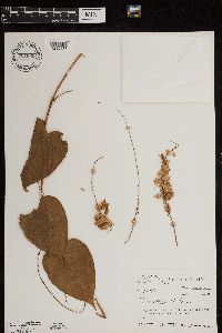
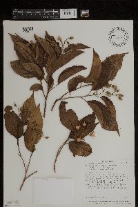
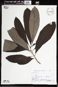
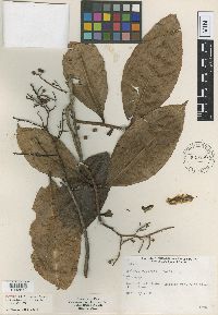
MIN:Plants | 701809[1299437]Taylor, John 179921974-12-31 Costa Rica, San Jose, hillside just above the Rio Hondura at Baja La Hondura, 1150m |
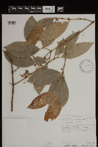
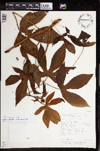
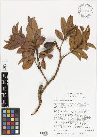
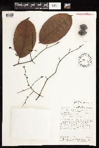
MIN:Plants | Garcinia madruno (Kunth) Hammel 498037[1299122]Aguilar, Reinaldo 8201992-01-15 Costa Rica, Puntarenas: Reserva Forestal Golfo Dulce Aguabuena. Sector sur.;;;;, 8.7055559 -83.5250015, 50 - 150m |
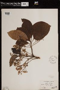
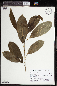
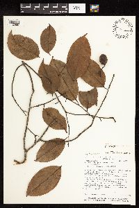
MIN:Plants | Persea americana P. Miller 580567[1299425]Hunnewell, F. 166181940-01-29 Costa Rica, Alajuela, El Rodeo, 975m |
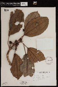
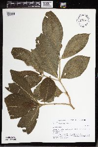
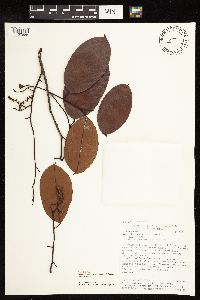
MIN:Plants | Blakea multiflora D.Don 535392[1299466]Stork, H. 13141928-04-01 Costa Rica, 2 mi. SW. of Agua Caliente;;;;, 10.329423 -85.087584, 1676m |
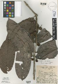
MIN:Plants | Macrohasseltia macroterantha (Standley & L.O.Williams) L.O.Williams 482236[1299117]Vargas, Orlando 2241989-10-10 Costa Rica, Heredia, Canton de Sarapiqui, Rara Avis, ca. 15 km al suroeste de Horquetas. Siguiendo los Caminos Real y Atajo, hasta la Catarata Grande, en su base.., 10.2833338 -84.0333328, 400m |
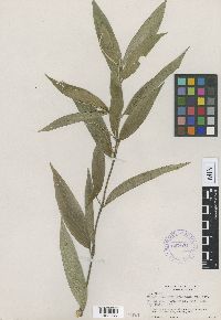
MIN:Plants | 480990[1353400]Robles, R. 22011988-12-02 Costa Rica, Linon: Lomas de Sierpe, 5 km Noreste de La Aurora, Guapiles. Limite Sure Parque Nacional Tortuguero, junto al Rio Sierpe;;;;, 10.3666668 -83.5166702, 30m |
MIN:Plants | Astronium graveolens NULL 939736[]P 12011-07-07 Costa Rica, Guanacaste, Liberia, , 10.84 -85.61, 320m |
MIN:Plants | 939712[]P 102011-07-07 Costa Rica, Guanacaste, Liberia, , 10.84 -85.61, 320m |
MIN:Plants | 939735[]P 112011-07-07 Costa Rica, Guanacaste, Liberia, , 10.84 -85.61, 320m |
MIN:Plants | Tabebuia ochracea NULL 939720[]P 122011-06-21 Costa Rica, Guanacaste, Liberia, , 10.84 -85.61, 320m |
MIN:Plants | Tabebuia rosea NULL 939721[]P 132011-07-07 Costa Rica, Guanacaste, Liberia, , 10.84 -85.61, 320m |
MIN:Plants | 939738[]P 142011-06-21 Costa Rica, Guanacaste, Liberia, , 10.84 -85.61, 320m |
MIN:Plants | Cordia alliodora NULL 939774[]P 162011-07-07 Costa Rica, Guanacaste, Liberia, , 10.84 -85.61, 320m |
MIN:Plants | Cordia panamensis NULL 939772[]P 182011-07-07 Costa Rica, Guanacaste, Liberia, , 10.84 -85.61, 320m |
MIN:Plants | Bursera simaruba (L.) Sargent 939713[]P 192011-07-07 Costa Rica, Guanacaste, Liberia, , 10.84 -85.61, 320m |
MIN:Plants | Spondias mombin NULL 939743[]P 22011-07-07 Costa Rica, Guanacaste, Liberia, , 10.84 -85.61, 320m |
MIN:Plants | Bursera tomentosa NULL 939737[]P 202011-07-07 Costa Rica, Guanacaste, Liberia, , 10.84 -85.61, 320m |
MIN:Plants | Capparis indica NULL 939752[]P 212011-07-07 Costa Rica, Guanacaste, Liberia, , 10.84 -85.61, 320m |
MIN:Plants | Licania arborea NULL 939756[]P 222011-07-07 Costa Rica, Guanacaste, Liberia, , 10.84 -85.61, 320m |
MIN:Plants | Curatella americana NULL 939739[]P 232011-06-21 Costa Rica, Guanacaste, Liberia, , 10.84 -85.61, 320m |
MIN:Plants | 939755[]P 242011-07-07 Costa Rica, Guanacaste, Liberia, , 10.84 -85.61, 320m |
MIN:Plants | Sloanea terniflora NULL 939754[]P 252011-07-07 Costa Rica, Guanacaste, Liberia, , 10.84 -85.61, 320m |
MIN:Plants | Sapium glandulosum NULL 939749[1352417]P 262011-07-07 Costa Rica, Guanacaste, Liberia,, 10.84 -85.61, 320m |
MIN:Plants | Acacia collinsii NULL 939748[]P 282011-07-07 Costa Rica, Guanacaste, Liberia, , 10.84 -85.61, 320m |
MIN:Plants | 939750[]P 292011-07-07 Costa Rica, Guanacaste, Liberia, , 10.84 -85.61, 320m |
MIN:Plants | Bauhinia ungulata NULL 939769[]P 302011-07-07 Costa Rica, Guanacaste, Liberia, , 10.84 -85.61, 320m |
MIN:Plants | 939718[]P 312011-07-07 Costa Rica, Guanacaste, Liberia, , 10.84 -85.61, 320m |
MIN:Plants | Enterolobium cyclocarpum (Jacquin) Grisebach 939742[]P 322011-07-07 Costa Rica, Guanacaste, Liberia, , 10.84 -85.61, 320m |
MIN:Plants | Gliricidia sepium NULL 939716[]P 332011-06-21 Costa Rica, Guanacaste, Liberia, , 10.84 -85.61, 320m |
MIN:Plants | Hymenaea courbaril NULL 939747[]P 342011-07-07 Costa Rica, Guanacaste, Liberia, , 10.84 -85.61, 320m |
MIN:Plants | Lonchocarpus felipei NULL 939751[]P 352011-07-07 Costa Rica, Guanacaste, Liberia, , 10.84 -85.61, 320m |
MIN:Plants | 939741[]P 362011-07-07 Costa Rica, Guanacaste, Liberia, , 10.84 -85.61, 320m |
MIN:Plants | Lysiloma divaricatum NULL 939740[]P 372011-07-07 Costa Rica, Guanacaste, Liberia, , 10.84 -85.61, 320m |
MIN:Plants | 939709[]P 382011-07-07 Costa Rica, Guanacaste, Liberia, , 10.84 -85.61, 320m |
MIN:Plants | Pithecellobium dulce NULL 939746[]P 392011-07-07 Costa Rica, Guanacaste, Liberia, , 10.84 -85.61, 320m |
MIN:Plants | Albizia saman NULL 939723[]P 412011-06-21 Costa Rica, Guanacaste, Liberia, , 10.84 -85.61, 320m |
MIN:Plants | Dalbergia retusa NULL 939764[]P 422011-07-07 Costa Rica, Guanacaste, Liberia, , 10.84 -85.61, 320m |
MIN:Plants | Quercus oleoides NULL 939725[]P 432011-06-21 Costa Rica, Guanacaste, Liberia, , 10.84 -85.61, 320m |
MIN:Plants | Casearia arguta NULL 939727[]P 442011-07-07 Costa Rica, Guanacaste, Liberia, , 10.84 -85.61, 320m |
MIN:Plants | Casearia corymbosa NULL 939728[]P 452011-07-07 Costa Rica, Guanacaste, Liberia, , 10.84 -85.61, 320m |
MIN:Plants | Zuelania guidonia NULL 939757[]P 472011-06-21 Costa Rica, Guanacaste, Liberia, , 10.84 -85.61, 320m |
MIN:Plants | Ocotea veraguensis NULL 939724[]P 492011-07-07 Costa Rica, Guanacaste, Liberia, , 10.84 -85.61, 320m |
MIN:Plants | Annona reticulata NULL 939759[]P 52011-07-07 Costa Rica, Guanacaste, Liberia, , 10.84 -85.61, 320m |
MIN:Plants | 939768[]P 502011-06-21 Costa Rica, Guanacaste, Liberia, , 10.84 -85.61, 320m |
MIN:Plants | Apeiba tibourbou NULL 939766[]P 512011-07-07 Costa Rica, Guanacaste, Liberia, , 10.84 -85.61, 320m |
MIN:Plants | Luehea speciosa NULL 939733[]P 522011-06-21 Costa Rica, Guanacaste, Liberia, , 10.84 -85.61, 320m |
MIN:Plants | Luehea candida NULL 939726[]P 532011-07-07 Costa Rica, Guanacaste, Liberia, , 10.84 -85.61, 320m |
MIN:Plants | Miconia argentea NULL 939745[]P 542011-07-07 Costa Rica, Guanacaste, Liberia, , 10.84 -85.61, 320m |
MIN:Plants | 939715[]P 552011-07-07 Costa Rica, Guanacaste, Liberia, , 10.84 -85.61, 320m |
MIN:Plants | 939717[]P 562011-07-07 Costa Rica, Guanacaste, Liberia, , 10.84 -85.61, 320m |
MIN:Plants | Trichilia americana NULL 939714[]P 572011-07-07 Costa Rica, Guanacaste, Liberia, , 10.84 -85.61, 320m |
MIN:Plants | Trichilia martiana NULL 939775[]P 592011-07-07 Costa Rica, Guanacaste, Liberia, , 10.84 -85.61, 320m |
MIN:Plants | Sapranthus palanga NULL 939771[]P 62011-06-21 Costa Rica, Guanacaste, Liberia, , 10.84 -85.61, 320m |
MIN:Plants | Brosimum alicastrum NULL 939758[]P 602011-07-07 Costa Rica, Guanacaste, Liberia, , 10.84 -85.61, 320m |
MIN:Plants | Castilla elastica NULL 939753[]P 612011-07-07 Costa Rica, Guanacaste, Liberia, , 10.84 -85.61, 320m |
MIN:Plants | Ficus crassinervia NULL 939762[]P 622011-07-07 Costa Rica, Guanacaste, Liberia, , 10.84 -85.61, 320m |
MIN:Plants | Maclura tinctoria NULL 939770[]P 632011-07-07 Costa Rica, Guanacaste, Liberia, , 10.84 -85.61, 320m |
MIN:Plants | Eugenia salamensis NULL 939744[]P 642011-07-07 Costa Rica, Guanacaste, Liberia, , 10.84 -85.61, 320m |
MIN:Plants | Pisonia aculeata NULL 939773[]P 652011-07-07 Costa Rica, Guanacaste, Liberia, , 10.84 -85.61, 320m |
MIN:Plants | Schoepfia schreberi NULL 939719[]P 662011-07-07 Costa Rica, Guanacaste, Liberia, , 10.84 -85.61, 320m |
MIN:Plants | 939763[]P 682011-07-07 Costa Rica, Guanacaste, Liberia, , 10.84 -85.61, 320m |
MIN:Plants | 939734[]P 692011-07-07 Costa Rica, Guanacaste, Liberia, , 10.84 -85.61, 320m |
MIN:Plants | 939708[1332712]Perez, D. 72011-07-07 Costa Rica, Guanacaste, Liberia,, 10.84 -85.61, 320m |
MIN:Plants | Chomelia spinosa NULL 939711[]P 702011-07-07 Costa Rica, Guanacaste, Liberia, , 10.84 -85.61, 320m |
MIN:Plants | Genipa americana NULL 939732[]P 722011-06-21 Costa Rica, Guanacaste, Liberia, , 10.84 -85.61, 320m |
MIN:Plants | Allophylus racemosus NULL 939760[]P 742011-07-07 Costa Rica, Guanacaste, Liberia, , 10.84 -85.61, 320m |
MIN:Plants | 939761[]P 752011-07-07 Costa Rica, Guanacaste, Liberia, , 10.84 -85.61, 320m |
MIN:Plants | Manilkara chicle (Pittier) Gilly 939731[]P 762011-06-21 Costa Rica, Guanacaste, Liberia, , 10.84 -85.61, 320m |
MIN:Plants | Sideroxylon capiri NULL 939707[]P 772011-07-07 Costa Rica, Guanacaste, Liberia, , 10.84 -85.61, 320m |
MIN:Plants | Simarouba amara NULL 939765[]P 782011-07-07 Costa Rica, Guanacaste, Liberia, , 10.84 -85.61, 320m |
MIN:Plants | Cecropia peltata NULL 939730[]Perez, D. 792011-07-07 Costa Rica, Guanacaste, Liberia, Area de Conservacion Guanacaste, Sector Santa Rosa, Sendero Indio Desnudo, 10.84 -85.61, 320m |
MIN:Plants | Cascabela ovata NULL 939767[1332818]P 82011-07-07 Costa Rica, Guanacaste, Liberia,, 10.84 -85.61, 320m |
MIN:Plants | Rehdera trinervis NULL 939722[]P 802011-07-07 Costa Rica, Guanacaste, Liberia, , 10.84 -85.61, 320m |
MIN:Plants | Crescentia alata NULL 939729[]P 92011-06-21 Costa Rica, Guanacaste, Liberia, , 10.84 -85.61, 320m |
MIN:Plants | Alfaroa guanocastensis Stone 459933[1000083]Stone, D.E. 21671966-04-21 Costa Rica, Guanacaste, southwestern slope of Volcan Tenorio; above upper pasture of Hacienda Tenorio, 1128m |
MIN:Plants | Mouriri osaensis Morley 518877[1001864]Poveda, L.T. s.n.1975-09-19 Costa Rica, Huesillo o Quiebracho. Llorona - Peninsula de Osa |
MIN:Plants | Piper goergeri Trelease 347071[1002086]Dodge, C.W. 94211936-07-27 Costa Rica, Limon, Limón; Along Rio Reventazón below farmhouse, 10.284 -83.41, 30m |
MIN:Plants | Ardisia copeyana Standley 535166[1002879]Stork, H.E. 15921928-04-19 Costa Rica, El Copey, 1676m |
MIN:Plants | Ruptiliocarpon caracolito Hammel & Zamora 506497[1127886]Hammel, B. 181661991-03-28 Costa Rica, Puntarenas, Reserva Forestal Golfo Dulce Cantón de Osa; Fila Ganado hasta Guerra. 08°44'00"N 83°36'00"W, 1 - 300m |
MIN:Plants | Ruptiliocarpon caracolito Hammel & Zamora 506466[1127887]Hammel, B. 179831990-11-28 Costa Rica, Puntarenas, Reserva Forestal Golfo Dulce Cantón de Osa; en la fila al N del antiguo campo de aterrizaje a lo largo de Quebrada Agua Buena; Estación Agua Buena de Boscosa. 08°42'40"N 83°31'00"W, 100 - 500m |
MIN:Plants | Ruptiliocarpon caracolito Hammel & Zamora 506467[1127888]Hammel, B. 181541991-03-20 Costa Rica, Puntarenas, Reserva Forestal Golfo Dulce Cantón de Osa; camino nuevo entre Rancho Quemado y Drake...08°43'00"N 83°36'00"W, 250m |
MIN:Plants | Ruptiliocarpon caracolito Hammel & Zamora 506491[1127889]Hammel, B. 179111990-10-20 Costa Rica, Puntarenas, Reserva Indîgena Guaimî Cantón de Osa; ca. 2 km noreste de donde se junta Río Pavón con Río Rincón
08°37'00"N 83°31'20"W, 50 - 200m |
MIN:Plants | Perebea angustifolia (Poeppig & Endl.) C. C. 439017[]Weiblen, G.D. GW14032001-09-12 Costa Rica, La Selva, 9.766667 -83.75, 972m |
MIN:Plants | Pourouma bicolor Mart. 493621[]Weiblen, G.D. GW14132001-09-12 Costa Rica, La Selva, 9.766667 -83.75, 972m |
MIN:Plants | Clarisia biflora Ruiz & PavÛn 489551[]Weiblen, G.D. GW14162001-09-13 Costa Rica, La Selva, 9.766667 -83.75, 972m |
MIN:Plants | Ficus cahuitensis C. C. Berg 493421[]Weiblen, G.D. GW14212001-09-13 Costa Rica, La Selva, 9.766667 -83.75, 972m |
MIN:Plants | Dorstenia choconiana S. Watson 431446[]Weiblen, G.D. GW14172001-09-13 Costa Rica, La Selva, 9.766667 -83.75, 972m |
MIN:Plants | Ficus colubrinae Standley 488324[]Weiblen, G.D. GW14262001-09-14 Costa Rica, La Selva, 9.766667 -83.75, 972m |
MIN:Plants | Ficus crassiuscula Standley 493413[]Weiblen, G.D. GW14222001-09-14 Costa Rica, La Selva, 9.766667 -83.75, 972m |
MIN:Plants | Castilla elastica subsp. costaricana (Liebm.) C.C. Berg 431444[]Weiblen, G.D. GW14062001-09-12 Costa Rica, La Selva, 9.766667 -83.75, 972m |
MIN:Plants | Castilla elastica subsp. costaricana (Liebm.) C.C. Berg 431443[]Weiblen, G.D. GW14152001-09-12 Costa Rica, La Selva, 9.766667 -83.75, 972m |
MIN:Plants | Ficus insipida Willd. 488325[]Weiblen, G.D. GW14232001-09-14 Costa Rica, La Selva, 9.766667 -83.75, 972m |
MIN:Plants | Trophis involucrata W.C. Burger 431397[]Weiblen, G.D. GW14052001-09-12 Costa Rica, La Selva, 9.766667 -83.75, 972m |
MIN:Plants | Brosimum lactescens (S. Moore) C.C. Berg 431440[]Weiblen, G.D. GW14112001-09-12 Costa Rica, La Selva, 9.766667 -83.75, 972m |
MIN:Plants | Ficus maxima P. Miller 493597[]Weiblen, G.D. GW14192001-09-13 Costa Rica, La Selva, 9.766667 -83.75, 972m |
MIN:Plants | Naucleopsis naga Pittier 431448[]Weiblen, G.D. GW14042001-09-12 Costa Rica, La Selva, 9.766667 -83.75, 972m |
MIN:Plants | Naucleopsis naga Pittier 431450[]Weiblen, G.D. GW14142001-09-12 Costa Rica, La Selva, 9.766667 -83.75, 972m |
MIN:Plants | Coussapoa nymphaeifolia Standley 488137[]Weiblen, G.D. GW14122001-09-12 Costa Rica, La Selva, 9.766667 -83.75, 972m |
MIN:Plants | Ficus pertusa L.f. 493703[]Weiblen, G.D. GW14202001-09-13 Costa Rica, La Selva, 9.766667 -83.75, 972m |
MIN:Plants | Ficus popenoei Standley 432568[]Weiblen, G.D. GW14102001-09-12 Costa Rica, La Selva, 9.766667 -83.75, 972m |
Google Map
Google Maps is a web mapping service provided by Google that features a map that users can pan (by dragging the mouse) and zoom (by using the mouse wheel). Collection points are displayed as colored markers that when clicked on, displays the full information for that collection. When multiple species are queried (separated by semi-colons), different colored markers denote each individual species.
