University of Minnesota
http://www.umn.edu/
612-625-5000
http://www.umn.edu/
612-625-5000
Minnesota Biodiversity Atlas
Bell Museum
Dataset: MIN-Plants
Search Criteria: Ecuador; Tungurahua; excluding cultivated/captive occurrences
1
Page 1, records 1-6 of 6
Bell Museum plants | |
 MIN:Plants | 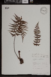 Asplenium aethiopicum (Burm.f.) Becherer 940651[1307314]Fay, Alice 34411992-06-27 Ecuador, Tungurahua, Baños Canton, East of Baños, 78.416667 -1.383333, 1770m |
MIN:Plants | 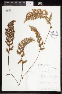 473626[1321023]Fay, Alice 34401992-06-27 Ecuador, Tungurahua, Banos, East of Baños, 78.416667 -1.383333, 1770m |
MIN:Plants | 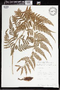 Dryopteris patula (Sw.) Underw. 942671[1326426] 35521992-07-07 Ecuador, Tungurahua, Banos canton, rio verde, 1550m |
MIN:Plants | 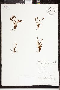 Elaphoglossum piloselloides T.Moore 940652[1326900]Fay, Alice 35191992-07-03 Ecuador, Tungurahua, West of Banos, up the valley S, west side of Rio Bascun, -1.4 -78.433333, 2200m |
MIN:Plants | 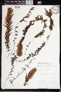 Hymenophyllum plumosum Kaulf. 942566[1338994]Fay, Alice 35151992-07-02 Ecuador, Tungurahua, Banos, 5 km east of Banos in the area of the Agoyan waterfall, -1.391667 -78.375, 1650m |
MIN:Plants | 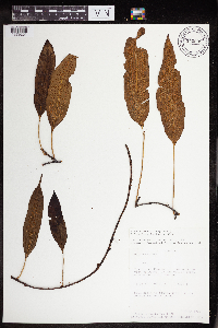 Polypodium levigatum Cav. 942695[1379231] Ecuador, Tungurahua |
1
Page 1, records 1-6 of 6
Google Map
Google Maps is a web mapping service provided by Google that features a map that users can pan (by dragging the mouse) and zoom (by using the mouse wheel). Collection points are displayed as colored markers that when clicked on, displays the full information for that collection. When multiple species are queried (separated by semi-colons), different colored markers denote each individual species.