University of Minnesota
http://www.umn.edu/
612-625-5000
http://www.umn.edu/
612-625-5000
Minnesota Biodiversity Atlas
Bell Museum
Dataset: MIN-Lichens
Search Criteria: United States OR USA OR U.S.A. OR United States of America; Colorado; Huerfano; excluding cultivated/captive occurrences
Bell Museum lichens | |
 MIN:Lichens | Lecanora novomexicana B. de Lesd. 928382[]Egan, R. 37851969-09-25 United States, Colorado, Huerfano, Trinchera Peak; San Isabel National Forest, 37.28944 -105.16444 |
MIN:Lichens | 928920[]Wetmore, C. 173191967-07-02 United States, Colorado, Huerfano, Spring Creek Picnic Ground, 0.5 Mi S of Cucharas |
MIN:Lichens | Rhizocarpon geographicum (L.) DC. 930806[]Egan, R. 37971969-09-25 United States, Colorado, Huerfano, Trinchera Peak, 7 Mi Sw of Cuchara; San Isabel National Forest |
MIN:Lichens | Rhizocarpon macrosporum Räsänen 930807[]Egan, R. 37911969-09-25 United States, Colorado, Huerfano, Trinchera Peak, 7 Mi Sw of Cuchara; San Isabel National Forest |
MIN:Lichens | Rhizocarpon geographicum (L.) DC. 930808[]Egan, R. 37791969-09-25 United States, Colorado, Huerfano, Trinchera Peak, 7 Mi Sw of Cuchara; San Isabel National Forest |
MIN:Lichens | Aspicilia caesiocinerea (Nyl. ex Malbr.) Arnold 935168[]Egan, R. 38011969-09-25 United States, Colorado, Huerfano, Trinchera Peak; San Isabel National Forest |
MIN:Lichens | Mycobilimbia berengeriana (A. Massal.) Hafellner & V. Wirth 940346[]Wetmore, C. 172961967-07-02 United States, Colorado, Huerfano, Spring Creek Picnic Ground 0.5 Mi S of Cucharas |
MIN:Lichens | Amandinea punctata (Hoffm.) Coppins & Scheid. 940981[]Wetmore, C. 172991967-07-02 United States, Colorado, Huerfano, Spring Creek Picnic Ground, 0.5 Mi S of Cucharas |
MIN:Lichens | Cladonia chlorophaea (Flörke ex Sommerf.) Spreng. 941176[]Egan, R. 38391969-09-25 United States, Colorado, Huerfano, Trinchera Peak, 7 Mi Sw of Cuchara, Culera Range; San Isabel National Forest |
MIN:Lichens | Cladonia pyxidata (L.) Hoffm. 941179[]Egan, R. 38381969-09-25 United States, Colorado, Huerfano, Trinchera Peak, 7 Mi Sw of Cuchara, Culebra Range; San Isabel National Forest |
MIN:Lichens | Lecanora rupicola (L.) Zahlbr. 941754[]Egan, R. 37901969-09-25 United States, Colorado, Huerfano, Trinchera Peak, 7 Mi Sw of Cuchara, Culebra Range; San Isabel National Forest |
MIN:Lichens | Lecidea atrobrunnea (DC.) Schaer. 943640[]Shushan, S. 58851955-08-17 United States, Colorado, Huerfano, E Spanish Peak, N Slope |
MIN:Lichens | 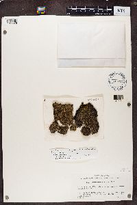 592874[1374376]Shushan, S. United States, Colorado, Huerfano |
MIN:Lichens | 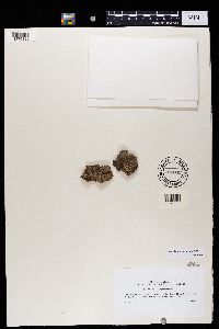 703842[1370336]Weber, W.A. United States, Colorado, Huerfano |
Google Map
Google Maps is a web mapping service provided by Google that features a map that users can pan (by dragging the mouse) and zoom (by using the mouse wheel). Collection points are displayed as colored markers that when clicked on, displays the full information for that collection. When multiple species are queried (separated by semi-colons), different colored markers denote each individual species.