University of Minnesota
http://www.umn.edu/
612-625-5000
http://www.umn.edu/
612-625-5000
Minnesota Biodiversity Atlas
Bell Museum
Dataset: MIN-Lichens
Search Criteria: United States OR USA OR U.S.A. OR United States of America; Mississippi; Adams; excluding cultivated/captive occurrences
1
Page 1, records 1-13 of 13
Bell Museum lichens | |
 MIN:Lichens | Teloschistes chrysophthalmus (L.) Th. Fr. 679754[]Shimek, B. s.n.1898-06-00 United States, Mississippi, Adams, Natchez |
MIN:Lichens | Astrothelium variolosum (Ach.) Müll. Arg. 757176[]Johnson, G. 24661939-06-12 United States, Mississippi, Adams, Natchez, 5 Mi S, 31.487873 -91.403171 |
MIN:Lichens | Trypethelium virens Tuck. 757308[]Johnson, G. 12091953-04-06 United States, Mississippi, Adams, Natchez, 15 Mi S, 31.3486 -91.3842 |
MIN:Lichens | 757363[]Johnson, G. 12191953-04-06 United States, Mississippi, Adams, Natchez, 15 Mi S, 31.34273 -91.403171 |
MIN:Lichens | Haematomma persoonii (Fée) A. Massal. 862970[]Shimek, B. s.n.1898-06-00 United States, Mississippi, Adams, Natchez |
MIN:Lichens | Caloplaca citrina (Hoffm.) Th. Fr. 875651[]Shimek, B. s.n.1898-06-00 United States, Mississippi, Adams, Natchez |
MIN:Lichens | Buellia curtisii (Tuck.) Imshaug 895972[]Shimek, B. s.n.1898-06-00 United States, Mississippi, Adams, Natchez |
MIN:Lichens | 895973[]Shimek, B. s.n.1898-06-00 United States, Mississippi, Adams, Natchez |
MIN:Lichens | Dirinaria aegialita (Afzel. ex Ach.) B.J. Moore 918866[]Shimek, B. s.n.1898-06-00 United States, Mississippi, Adams, Natchez |
MIN:Lichens | Dirinaria confluens (Fr.) D.D. Awasthi 918867[]Shimek, B. s.n.1898-06-00 United States, Mississippi, Adams, Natchez |
MIN:Lichens | Dirinaria picta (Sw.) Schaer. ex Clem. 918868[]Shimek, B. s.n.1898-06-00 United States, Mississippi, Adams, Natchez |
MIN:Lichens | Usnea rubicunda Stirt. 927225[]Shimek, B. s.n.1898-06-00 United States, Mississippi, Adams, Natchez |
MIN:Lichens | 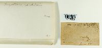 Chrysothrix candelaris (L.) J.R. Laundon 957239[1298559]Bohumil Shimek 1898-06-00 United States, Mississippi, Adams, Natchez |
1
Page 1, records 1-13 of 13
Google Map
Google Maps is a web mapping service provided by Google that features a map that users can pan (by dragging the mouse) and zoom (by using the mouse wheel). Collection points are displayed as colored markers that when clicked on, displays the full information for that collection. When multiple species are queried (separated by semi-colons), different colored markers denote each individual species.