University of Minnesota
http://www.umn.edu/
612-625-5000
http://www.umn.edu/
612-625-5000
Minnesota Biodiversity Atlas
Dataset: MIN-Lichens
Search Criteria: United States OR USA OR U.S.A. OR United States of America; Montana; Carbon; excluding cultivated/captive occurrences
1
Page 1, records 1-19 of 19
Bell Museum lichens | |
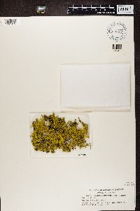
MIN:Lichens | 692010[]Nash, T. 151521977-08-15 United States, Montana, Carbon, Beartooth Plateau, 45.02356 -109.40843 |
MIN:Lichens | Dactylina madreporiformis (With.) Tuck. 692042[]Nash, T. 151601977-08-15 United States, Montana, Carbon, Beartooth Plateau, 45.02356 -109.40843 |
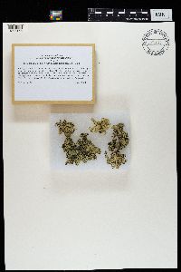
MIN:Lichens | Cetraria aculeata (Schreb.) Fr. 692044[]Nash, T. 151631977-08-15 United States, Montana, Carbon, Beartooth Plateau, 45.0166667 -109.9333333 |
MIN:Lichens | 692050[]Nash, T. 151651977-08-15 United States, Montana, Carbon, Beartooth Plateau, 45.0166667 -109.9333333 |
MIN:Lichens | Lecanora novomexicana B. de Lesd. 803532[]Ryan, B. 209781985-08-03 United States, Montana, Carbon, Highway 212, 45.05 -109.3333333 |
MIN:Lichens | Lecanora novomexicana B. de Lesd. 843498[]Ryan, B. 145041985-08-30 United States, Montana, Carbon, Beartooth Pass, Ne of, 45 -109.4166667 |
MIN:Lichens | Lecanora novomexicana B. de Lesd. 843506[]Ryan, B. 209831985-08-03 United States, Montana, Carbon, 6 Mi N of Wy Border, 45.05 -109.3333333 |
MIN:Lichens | Lecanora novomexicana B. de Lesd. 843507[]Ryan, B. 212281985-08-03 United States, Montana, Carbon, 6 Mi N of Wy Border, 45.05 -109.3333333 |
MIN:Lichens | Lecanora novomexicana B. de Lesd. 843508[]Ryan, B. 209781985-08-03 United States, Montana, Carbon, 6 Mi N of Wy Border, 45.05 -109.3333333 |
MIN:Lichens | Lecanora novomexicana B. de Lesd. 843509[]Ryan, B. 209791985-08-03 United States, Montana, Carbon, 6 Mi N of Wy Border, 45.05 -109.3333333 |
MIN:Lichens | Lecanora novomexicana B. de Lesd. 843510[]Ryan, B. 212231985-08-03 United States, Montana, Carbon, 6 Mi N of Wy Border, 45.05 -109.3333333 |
MIN:Lichens | Lecanora novomexicana B. de Lesd. 843511[]Ryan, B. 211481985-08-30 United States, Montana, Carbon, Beartooth Pass, Ne of, 45 -109.4166667 |
MIN:Lichens | Lecanora novomexicana B. de Lesd. 843512[]Ryan, B. 208991985-08-03 United States, Montana, Carbon, 15 Mi N of Wy Border, 45.03333333 -109.4166667 |
MIN:Lichens | Lecanora novomexicana B. de Lesd. 843513[]Ryan, B. 209071985-08-03 United States, Montana, Carbon, 15 Mi N of Wy Border, 45.03333333 -109.4166667 |
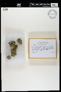
MIN:Lichens | Rhizoplaca haydenii (Tuck.) W.A. Weber 885369[]Nash, T. 151641977-08-15 United States, Montana, Carbon, Beartooth Plateau, 45.0166667 -109.9333333 |
MIN:Lichens | Caloplaca tiroliensis Zahlbr. 940182[]Eversman, S. 33191990-07-29 United States, Montana, Carbon, Hwy 212, 26 km Sw of Red Lodge; Custer National Forest, 45.03333333 -109.4227778 |
MIN:Lichens | Letharia columbiana (Nutt.) J.W. Thomson 626437[1361319]Wirth, W. United States, Montana, Carbon |
MIN:Lichens | 971678[1396156]Leavitt 20-0812020-09-05 United States, Montana, Carbon, Shoshone National Forest, Beartooth Plateau, alpine zone of the Middle Rockies, along Highway 212 (Beartooth Highway), ca. 0.7km north of Montana/Wyoming border, upslope along north side of highway, 45.0097 -109.4077, 3100m |
MIN:Lichens | Rhizoplaca arbuscula (Rosentr.) Rosentr., St. Clair & Leavitt 971688[1396166]S. Leavitt 20-0882020-09-05 United States, Montana, Carbon, Shoshone National Forest, Beartooth Plateau, alpine zone of the Middle Rockies, along Highway 212 (Beartooth Highway), ca. 0.7km north of Montana/Wyoming border, upslope long north side of Highway, 45.0097 -109.4077, 3100m |
1
Page 1, records 1-19 of 19
Google Map
Google Maps is a web mapping service provided by Google that features a map that users can pan (by dragging the mouse) and zoom (by using the mouse wheel). Collection points are displayed as colored markers that when clicked on, displays the full information for that collection. When multiple species are queried (separated by semi-colons), different colored markers denote each individual species.


