University of Minnesota
http://www.umn.edu/
612-625-5000
http://www.umn.edu/
612-625-5000
Minnesota Biodiversity Atlas
Dataset: MIN-Lichens
Search Criteria: United States OR USA OR U.S.A. OR United States of America; Mississippi; Jackson; excluding cultivated/captive occurrences
1
Page 1, records 1-27 of 27
Bell Museum lichens | |
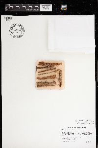
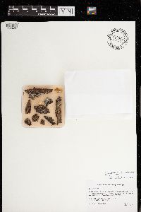
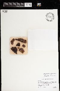
MIN:Lichens | Dirinaria aegialita (Afzel. ex Ach.) B.J. Moore 623809[]Tucker, S. 71721967-10-22 United States, Mississippi, Jackson, Gulfport; Magnolia State Park, 30.41989 -89.063829 |
MIN:Lichens | Dirinaria picta (Sw.) Schaer. ex Clem. 626347[]Demaree, D. 359801954-08-02 United States, Mississippi, Jackson, Ocean Springs, 30.41111 -88.82778 |
MIN:Lichens | Dirinaria picta (Sw.) Schaer. ex Clem. 626348[]Demaree, D. 359791954-08-02 United States, Mississippi, Jackson, Ocean Springs |
MIN:Lichens | Ramalina willeyi R. Howe 629099[]Demaree, D. 350091954-04-27 United States, Mississippi, Jackson, Ocean Springs |
MIN:Lichens | Usnea evansii Motyka 629555[]Demaree, D. 335671953-08-07 United States, Mississippi, Jackson, Fountainbleau, S |
MIN:Lichens | Usnea strigosa (Ach.) Eaton 629556[]Demaree, D. 363911955-01-26 United States, Mississippi, Jackson, Ocean Springs, 30.41111 -88.82778 |
MIN:Lichens | Usnea evansii Motyka 629557[]Demaree, D. 346411954-01-31 United States, Mississippi, Jackson, Gulf Coast Research Lab |
MIN:Lichens | Usnea evansii Motyka 629558[]Demaree, D. 349201954-04-24 United States, Mississippi, Jackson, Ocean Springs |
MIN:Lichens | Cladonia subtenuis (Abbayes) Mattick 652280[]Demaree, D. 324991952-08-03 United States, Mississippi, Jackson, Ocean Springs |
MIN:Lichens | Dirinaria aegialita (Afzel. ex Ach.) B.J. Moore 656709[]Tucker, S. 130891974-10-19 United States, Mississippi, Jackson, Ocean Springs, 30.3926 -88.7987 |
MIN:Lichens | Trypethelium ochroleucum (Eschw.) Nyl. 656734[]Tucker, S. 131091974-10-19 United States, Mississippi, Jackson, Ocean Springs, 30.393819 -88.797294 |
MIN:Lichens | Coenogonium luteum (Dicks.) Kalb & Lücking 656741[]Tucker, S. 130101974-10-19 United States, Mississippi, Jackson, Ocean Springs, 30.3926 -88.7987 |
MIN:Lichens | 656759[]Tucker, S. 130511974-10-19 United States, Mississippi, Jackson, Ocean Springs, 30.405078 -88.784082 |
MIN:Lichens | Parmotrema rigidum (Lynge) Hale 756522[]Tucker, S. 253221982-11-11 United States, Mississippi, Jackson, Horn Island, Chimney Point, 30.233022 -88.665694 |
MIN:Lichens | Cladonia prostrata A. Evans 756524[]Tucker, S. 253101982-11-11 United States, Mississippi, Jackson, Horn Island, Chimney Point, 30.233972 -88.6672 |
MIN:Lichens | 756527[]Tucker, S. 253091982-11-11 United States, Mississippi, Jackson, Horn Island, Chimney Point, 30.233022 -88.665694 |
MIN:Lichens | Ramalina willeyi R. Howe 805185[]Tucker, S. 253311982-11-11 United States, Mississippi, Jackson, Horn Island, Chimney Point, 30.233022 -88.665694 |
MIN:Lichens | 805240[]Barbour, P. 13036A1974-10-19 United States, Mississippi, Jackson, Ocean Springs |
MIN:Lichens | Graphis afzelii Ach. 805251[]Tucker, S. 130261974-10-19 United States, Mississippi, Jackson, Ocean Springs, 30.393819 -88.797294 |
MIN:Lichens | Dirinaria confusa D.D. Awasthi 805264[]Tucker, S. 130921974-10-19 United States, Mississippi, Jackson, Ocean Springs, 30.393819 -88.797294 |
MIN:Lichens | Pertusaria tetrathalamia (Fée) Nyl. 805290[]Tucker, S. 130791974-10-19 United States, Mississippi, Jackson, Ocean Springs, 30.393819 -88.797294 |
MIN:Lichens | Parmotrema praesorediosum (Nyl.) Hale 891440[]Tucker, S. 130681974-10-19 United States, Mississippi, Jackson, Ocean Springs, Gulf Coast Research Lab, 30.405078 -88.784082 |
MIN:Lichens | Calicium abietinum Pers. 964856[1408473]Otto Gockman 54572017-07-12 United States, Mississippi, Jackson, De Soto National Forest. 2.7 km north-northwest of Latimer and 8 km south-southwest of Larue., 30.551 -88.861818 |
MIN:Lichens | Chaenotheca floridana R.C. Harris 964853[1408476]Otto Gockman 54562017-07-14 United States, Mississippi, Jackson, De Soto National Forest. Approximately 2.7 km north-northwest of Latimer and 8 km south-southwest of Larue., 30.553586 -88.860287 |
MIN:Lichens | 964859[1408482]Otto Gockman 54542017-07-13 United States, Mississippi, Jackson, De Soto National Forest. Approximately 5.9 km south-southwest of Larue and 4.8 km north-northeast of Latimer,, 30.571686 -88.858295 |
MIN:Lichens | 964854[1408483]Otto Gockman 54512017-07-13 United States, Mississippi, Jackson, De Soto National Forest. Approximately 5.9 km south-southwest of Larue and 4.8 km north-northeast of Latimer., 30.571686 -88.858295 |
MIN:Lichens | Phaeocalicium polyporaeum (Nyl.) Tibell 964846[1408500]Otto Gockman 54552017-07-08 United States, Mississippi, Jackson, De Soto National Forest. Approximately 3.8 km south of Larue and 7 km north-northeast of Latimer., 30.586596 -88.847842 |
1
Page 1, records 1-27 of 27
Google Map
Google Maps is a web mapping service provided by Google that features a map that users can pan (by dragging the mouse) and zoom (by using the mouse wheel). Collection points are displayed as colored markers that when clicked on, displays the full information for that collection. When multiple species are queried (separated by semi-colons), different colored markers denote each individual species.


