University of Minnesota
http://www.umn.edu/
612-625-5000
http://www.umn.edu/
612-625-5000
Minnesota Biodiversity Atlas
Dataset: MIN-Lichens
Search Criteria: United States OR USA OR U.S.A. OR United States of America; Oregon; Malheur; excluding cultivated/captive occurrences
1
Page 1, records 1-14 of 14
Bell Museum lichens | |
 MIN:Lichens | 809942[]Rosentreter, R. 67101990-10-27 United States, Oregon, Malheur, N of Wolf Creek Overpass, 44.099999 -116.900002 |
MIN:Lichens | Caloplaca biatorina (Trevis.) J. Steiner 858336[]McCune, B. 188901991-03-00 United States, Oregon, Malheur, On Us Route 20, 43.9 -117.4666667 |
MIN:Lichens | Amandinea punctata (Hoffm.) Coppins & Scheid. 891629[]Wetmore, C. 950942006-07-19 United States, Oregon, Malheur, Malheur River 13 Mi W of Harper, 43.79 -117.8525 |
MIN:Lichens | Psora globifera (Ach.) A. Massal. 891630[]Wetmore, C. 950922006-07-19 United States, Oregon, Malheur, Malheur River 13 Mi W of Harper, 43.79 -117.8525 |
MIN:Lichens | Diploschistes muscorum (Scop.) R. Sant. 891631[]Wetmore, C. 950902006-07-19 United States, Oregon, Malheur, Malheur River 13 Mi W of Harper, 43.79 -117.8525 |
MIN:Lichens | Melanelia elegantula (Zahlbr.) Essl. 892047[]Wetmore, C. 951072006-07-19 United States, Oregon, Malheur, Malheur River 13 Mi W of Harper, 43.79 -117.8525 |
MIN:Lichens | Candelaria concolor (Dicks.) Arnold 892048[]Wetmore, C. 951062006-07-19 United States, Oregon, Malheur, Malheur River 13 Mi W of Harper, 43.79 -117.8525 |
MIN:Lichens | Xanthomendoza galericulata L. Lindblom 892049[]Wetmore, C. 951042006-07-19 United States, Oregon, Malheur, Malheur River 13 Mi W of Harper, 43.79 -117.8525 |
MIN:Lichens | Melanelia disjuncta (Erichsen) Essl. 892050[]Wetmore, C. 950962006-07-19 United States, Oregon, Malheur, Malheur River 13 Mi W of Harper, 43.79 -117.8525 |
MIN:Lichens | Lecidella stigmatea (Ach.) Hertel & Leuckert 909309[]Wetmore, C. 950972006-07-19 United States, Oregon, Malheur, Malheur River 13 Mi W of Harper, 43.79 -117.8525 |
MIN:Lichens | Lecidea plana Kremp. 909310[]Wetmore, C. 950882006-07-19 United States, Oregon, Malheur, Malheur River 13 Mi W of Harper, 43.79 -117.8525 |
MIN:Lichens | Rhizoplaca phaedrophthalma (Poelt) Leavitt, Zhao Xin & Lumbsch 928378[]Wetmore, C. 951012006-07-19 United States, Oregon, Malheur, Malheur River 13 Mi Sw of Harper, 43.79 -117.8525 |
MIN:Lichens | Aspicilia contorta (Hoffm.) Körb. 935068[]Wetmore, C. 950992006-07-19 United States, Oregon, Malheur, Malheur River, Above, 43.79 -117.8525 |
MIN:Lichens | 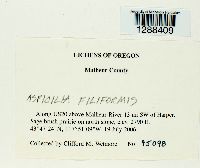 Aspicilia filiformis Rosentr. 956595[1288409]Wetmore, Clifford M. 950982006-07-19 United States, Oregon, Malheur, Along US20 above Malheur River 13 mi SW of Harper., 43.79 -117.8525, 850m |
1
Page 1, records 1-14 of 14
Google Map
Google Maps is a web mapping service provided by Google that features a map that users can pan (by dragging the mouse) and zoom (by using the mouse wheel). Collection points are displayed as colored markers that when clicked on, displays the full information for that collection. When multiple species are queried (separated by semi-colons), different colored markers denote each individual species.