University of Minnesota
http://www.umn.edu/
612-625-5000
http://www.umn.edu/
612-625-5000
Minnesota Biodiversity Atlas
Dataset: MIN-Lichens
Search Criteria: United States OR USA OR U.S.A. OR United States of America; South Dakota; McPherson; excluding cultivated/captive occurrences
1
Page 1, records 1-12 of 12
Bell Museum lichens | |
 MIN:Lichens | Caloplaca grimmiae (Nyl.) H. Olivier 902218[]Advaita, M. 54752007-05-01 United States, South Dakota, McPherson, S of Leola; Ordway Preserve, 45.7113 -99.1245 |
MIN:Lichens | Caloplaca soralifera Vondrák & Hrouzek 902685[]Advaita, M. 54022007-04-28 United States, South Dakota, McPherson, Ordway Prairie Preserve, 45.714833 -99.1315 |
MIN:Lichens | Caloplaca soralifera Vondrák & Hrouzek 906760[]Advaita, M.K. 55002007-05-03 United States, South Dakota, McPherson, Adjacent To Ordway Preserve, 11 Mi And 2 Mi S of Leola, 45.70861111 -99.157778 |
MIN:Lichens | Caloplaca soralifera Vondrák & Hrouzek 906761[]Advaita, M.K. 53462007-04-26 United States, South Dakota, McPherson, 11 Mi And 2 Mi S of Leola; Ordway Preserve, 45.71472222 -99.13138889 |
MIN:Lichens | Caloplaca lignicola Wetmore 940177[]Advaita, M. 54352007-04-29 United States, South Dakota, McPherson, Adjacent To Ordway Prairie, 45.70861111 -99.15777778 |
MIN:Lichens | 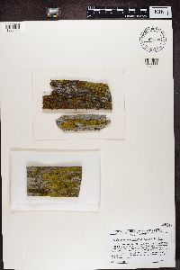 Candelariella vitellina (Ehrh.) Müll. Arg. 906734[1366090]Advaita, M.K. United States, South Dakota, McPherson |
MIN:Lichens | 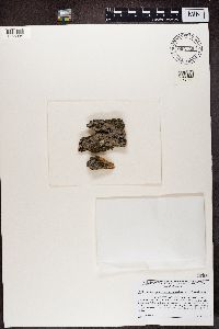 Strangospora microhaema (Norman) R. A. Anderson 906730[1366094]Advaita, M.K. United States, South Dakota, McPherson |
MIN:Lichens | 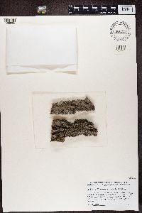 906729[1366095]Advaita, M.K. United States, South Dakota, McPherson |
MIN:Lichens | 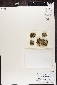 Xanthoria tenax L. Lindblom 917877[1366174]Advaita, M.K. United States, South Dakota, McPherson |
MIN:Lichens |  Caloplaca soralifera Vondrák & Hrouzek 906673[1370811]Advaita, M.K. United States, South Dakota, McPherson |
MIN:Lichens |  Caloplaca soralifera Vondrák & Hrouzek 906671[1370813]Advaita, M.K. United States, South Dakota, McPherson |
MIN:Lichens |  Caloplaca lignicola Wetmore 940085[1370830]Advaita, M.K. United States, South Dakota, McPherson |
1
Page 1, records 1-12 of 12
Google Map
Google Maps is a web mapping service provided by Google that features a map that users can pan (by dragging the mouse) and zoom (by using the mouse wheel). Collection points are displayed as colored markers that when clicked on, displays the full information for that collection. When multiple species are queried (separated by semi-colons), different colored markers denote each individual species.