University of Minnesota
http://www.umn.edu/
612-625-5000
http://www.umn.edu/
612-625-5000
Minnesota Biodiversity Atlas
Dataset: MIN-Lichens
Search Criteria: United States OR USA OR U.S.A. OR United States of America; Michigan; Midland; excluding cultivated/captive occurrences
1
Page 1, records 1-4 of 4
Bell Museum lichens | |
 MIN:Lichens | Cyphelium tigillare (Ach.) Ach. 780728[]Erbisch, F. 9701959-11-27 United States, Michigan, Midland, Midland, 5 Mi N of, 43.676448 -84.246869 |
MIN:Lichens | Phaeocalicium curtisii (Tuck.) Tibell 780847[]Imshaug, H. 216531958-05-24 United States, Michigan, Midland, Black Creek Near Sanford, 43.740543 -84.4339 |
MIN:Lichens | Caloplaca ahtii Søchting 889607[]Erbisch, F. 10381961-07-03 United States, Michigan, Midland, Midland, 5 Mi N of |
MIN:Lichens | 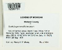 Scoliciosporum chlorococcum (Stenh.) Vezda 957992[1298751]Henry A Imshaug 216581958-05-24 United States, Michigan, Midland, NW of Sanford along Black Creek (10 mi NW of Midland), 43.710556 -84.395, 198m |
1
Page 1, records 1-4 of 4
Google Map
Google Maps is a web mapping service provided by Google that features a map that users can pan (by dragging the mouse) and zoom (by using the mouse wheel). Collection points are displayed as colored markers that when clicked on, displays the full information for that collection. When multiple species are queried (separated by semi-colons), different colored markers denote each individual species.