University of Minnesota
http://www.umn.edu/
612-625-5000
http://www.umn.edu/
612-625-5000
Minnesota Biodiversity Atlas
Bell Museum
Dataset: MIN-Plants
Taxa: Equisetaceae
Search Criteria: excluding cultivated/captive occurrences
Bell Museum plants | |
 MIN:Plants | 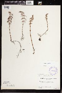 374030[1333529]Linnaean Club, U of M, 1921940-05-19 United States, Minnesota, Rice, Nerstrand Woods. Rice Co.;Nerstrand Woods State Park;110N;19W;, 44.342155 -93.105067 |
MIN:Plants | 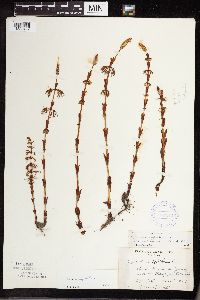 387842[1333402]Dahl, A. 61945-06-15 United States, Minnesota, Cook, Cook Co. Near Poplar Lake, T64N R2W 1;Superior National Forest;064N;02W;1, 48.046734 -90.508674 |
MIN:Plants | 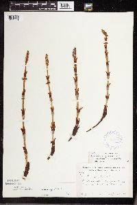 387843[1333501]Moore, John 170591945-06-05 United States, Minnesota, Todd, Todd Co.; 1 mi NE of Philbrook;;N;;, 46.294486 -94.679914 |
MIN:Plants | 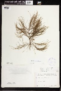 387844[1333387]Carlander, K. 1939-07-16 United States, Minnesota, Lake of the Woods, Lake of the Woods Co. Wheeler's Point.;;N;;, 48.837173 -94.689373 |
MIN:Plants | 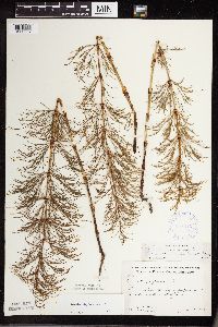 387845[1333557]Moore, John 174421945-06-28 United States, Minnesota, Kanabec, Kanabec Co. 2 mi SE of Mora;;;;, 45.856423 -93.264424 |
MIN:Plants | 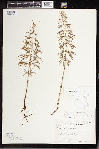 387846[1333573]Moore, John 195091947-06-11 United States, Minnesota, Itasca, Itasca Co. 12 1/2 mi S of Grand Rapids.;;N;;, 47.056221 -93.530214 |
MIN:Plants | 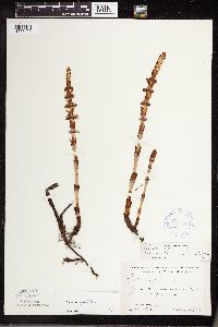 387847[1333499]Moore, John 194091947-05-28 United States, Minnesota, Pine, Pine Co. 3 mi SE of Hinckley;;N;;, 45.980618 -92.900147 |
MIN:Plants | 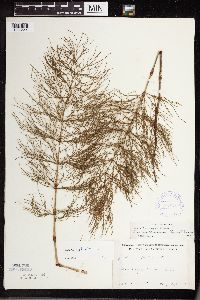 387848[1333544]Schuster, R. s.n.1947-07-00 United States, Minnesota, Lake, Lake Co. Gooseberry Falls State Park;Gooseberry Falls State Park / North Shore;054N;09W;00, 47.146872 -91.463229 |
MIN:Plants | 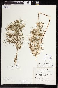 387849[1333426]Emanuel, J. 1321946-09-03 United States, Minnesota, Itasca, County: Itasca. Locality: Nashwauk Township - Stevenson Rd. [this connects Nashwauk & Hibbing];;057N;22W;00, 47.413912 -93.13289 |
MIN:Plants | 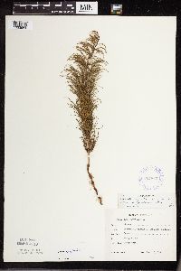 387863[1333561]Emanuel, J. 261946-06-13 United States, Minnesota, Itasca, County: Itasca. Locality: Nashwauk Township - 3 mi N Nashwauk;;057N;22W;00, 47.413912 -93.13289 |
MIN:Plants | 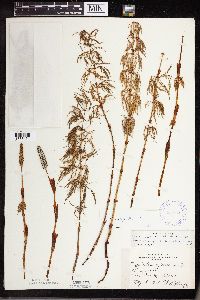 387864[1333461]Huff, N. s.n.1941-05-16 United States, Minnesota, Saint Louis, Fond du Lac;;N;;, 46.659664 -92.273248 |
MIN:Plants |  392922[1333531]Lakela, Olga 68611947-06-21 United States, Minnesota, Saint Louis, Island Lake; S shore, 19 mi N Duluth;;N;;, 47.040057 -92.110562 |
MIN:Plants | 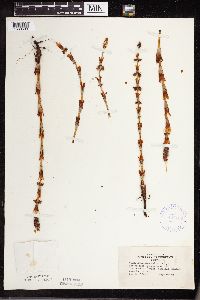 407783[1333503]Lakela, Olga 79821949-05-14 United States, Minnesota, Lake, Basswood Lake, The Hubachek Estate, Canadian boundary, Lake Co. [this was on Back Bay];Boundary Waters Canoe Area Wilderness / Superior National Forest;064N;10W;00, 48.096528 -91.623738 |
MIN:Plants | 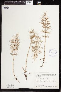 411971[1333565]Moore, John 110351939-07-21 United States, Minnesota, Lake of the Woods, Lake of the Woods Co.; 1 mi up from the mouth of Pine Creek. Angle Inlet, 3/4 of a mile W of the creek.;Northwest Angle;168N;34W;29, 49.333453 -95.073556 |
MIN:Plants | 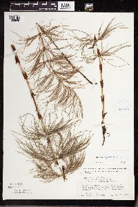 413072[1333545]Moore, John 117701939-08-15 United States, Minnesota, Koochiching, Koochiching Co.; E of Black Bay Landing, T71, R22W, Rainy Lake;Voyageurs National Park;071N;22W;, 48.607149 -93.198812 |
MIN:Plants | 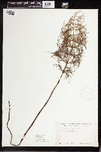 418861[1333383]Ahlgren, Clifford 1341949-06-22 United States, Minnesota, Lake, Quetico-Superior Wilderness Research Center...T64N R10W Sec. 9. Lake Co.;Boundary Waters Canoe Area Wilderness / Superior National Forest;064N;10W;09, 47.868332 -91.307881 |
MIN:Plants | 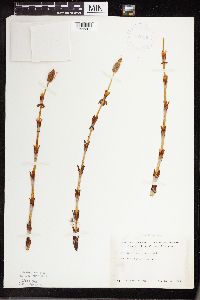 419126[1333361]Ahlgren, Clifford 511949-05-14 United States, Minnesota, Lake, Quetico-Superior Wilderness Research Center...Lake Co. Sec. 9 T64N R10W.;Boundary Waters Canoe Area Wilderness / Superior National Forest;064N;10W;09, 47.868332 -91.307881 |
MIN:Plants | 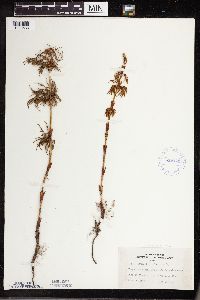 419441[1333533]Lakela, Olga 103321950-06-11 United States, Minnesota, Saint Louis, Herseth's Vacation Camp, Lake Kabetogama, St. Louis Co.;Voyageurs National Park;N;;, 48.483546 -92.838098 |
MIN:Plants | 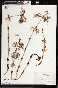 419754[1333532]Lakela, Olga 102321950-06-10 United States, Minnesota, Saint Louis, Herseth's Vacation Camp, Lake Kabetogama, St. Louis Co.;Voyageurs National Park;N;;, 48.483546 -92.838098 |
MIN:Plants | 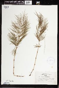 420809[1333559]Lakela, Olga 116111950-08-22 United States, Minnesota, Saint Louis, Between Iron and Crooked Lakes, St. Louis Co. (Curtain Falls);Boundary Waters Canoe Area Wilderness / Superior National Forest;N;;, 48.203274 -91.857461 |
MIN:Plants | 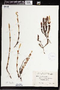 421311[1333458]Lakela, Olga 101181950-05-27 United States, Minnesota, Saint Louis, St. Louis Co.; at Prairie Lake, SW St. Louis Co.;;050N;20W;, 46.780017 -92.943614 |
MIN:Plants | 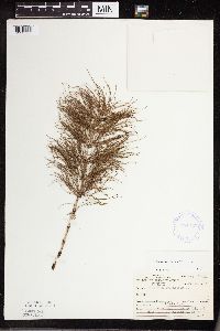 421723[1333566]Ahlgren, Clifford 10881950-08-22 United States, Minnesota, Saint Louis, Approx. 1/4 mi SW of Curtain Falls Crooked Lake, Lake Co. [this actually in St. Louis Co.];Boundary Waters Canoe Area Wilderness / Superior National Forest;066N;12W;06, 48.202438 -91.871974 |
MIN:Plants | 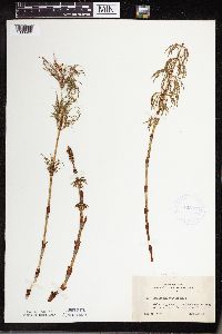 422573[1333460]Lakela, Olga 74471948-05-31 United States, Minnesota, Saint Louis, On Grand Rapids Rd, 8 mi N of Duluth;;N;;, 46.899087 -92.106579 |
MIN:Plants | 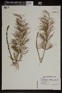 430644[1311022]Smith, Welby 194301991-07-10 United States, Minnesota, Koochiching, Koochiching State Forest. Koochiching Co.; On the north side of Moose Lake, about 6 miles east of Little Fork; T68N R24W SE1/4 of SE1/4 of Sec 9 Koochiching Co.; On the north side of Moose Lake, about 6 miles east of Little Fork; T 68N R 24W SE1/4 of SE1/4 of Sec 9. 068N 24W 9, 48.3922234 -93.4236145 |
MIN:Plants | 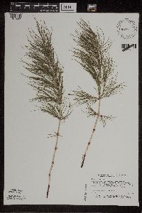 439806[1311017]Dana, R. 921081992-08-11 United States, Minnesota, Kittson, Kittson Co.; T163N R47W NE1/4 of SE1/4 of Sec 25;;163N;47W;25, 48.911976 -96.678848 |
MIN:Plants | 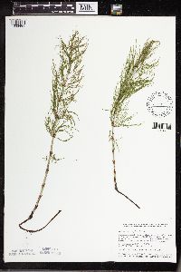 441228[1333481]Smith, Welby 114461986-05-16 United States, Minnesota, Sherburne, Sherburne National Wildlife Refuge. Sherburne County...Sherburne National Wildlife Refuge, about 4 mi N-NW of Orrock, along the Blue Hill Trail. SW1/4 NW1/4 sec 28, T35N R27W. 035N 27W 28, 45.4972222 -93.7180556 |
MIN:Plants | 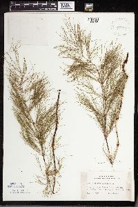 442586[1333450]Lakela, Olga 129991951-06-10 United States, Minnesota, Saint Louis, Namakan Lake; Kettle Falls, St. Louis Co.;Voyageurs National Park;070N;18W;, 48.49944 -92.63889 |
MIN:Plants | 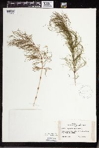 442667[1333457]Lakela, Olga 124621951-06-19 United States, Minnesota, Saint Louis, Iron Lake at Curtain Falls, St. Louis Co.;Boundary Waters Canoe Area Wilderness / Superior National Forest;066N;12W;06, 48.227062 -91.938222 |
MIN:Plants | 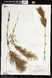 442777[1333409]Lakela, Olga 131151951-07-11 United States, Minnesota, Saint Louis, Near the end of the trail to Rainy Lake from Namakan, 1 mi from Kettle Falls, St. Louis Co.;Voyageurs National Park;070N;18W;, 48.50217 -92.671849 |
MIN:Plants | 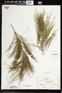 442825[1333408]Lakela, Olga 131171951-07-11 United States, Minnesota, Saint Louis, Trail to Rainy Lake from Namakan Lake, 1 mi from Kettle Falls, St. Louis Co.;Voyageurs National Park;070N;18W;, 48.49853 -92.685582 |
MIN:Plants | 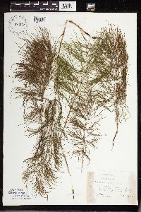 451225[1333569]Cotter, Shirley 19161951-06-24 United States, Minnesota, Anoka, Anoka Co. On nursery road in Carlos Avery game refuge;Carlos Avery Wildlife Management Area;N;;, 45.313817 -93.080299 |
MIN:Plants | 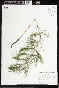 453207[1333380]Smith, Welby 131171987-06-24 United States, Minnesota, Pine, Saint Croix State Park. Pine County...St. Croix State Park; perched about 70 feet above the floodplain of the st. Croix River NE1/4 SW1/4 section 31, T 41N R 17W. 041N 17W 31, 45.9897222 -92.5436111 |
MIN:Plants | 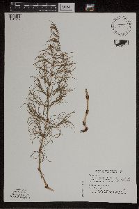 461544[1311019]Myhre, K. 55501995-06-13 United States, Minnesota, Aitkin, Aitkin Co. Located 3 mi SE of Big Sandy Lake; Camp Lake; T49N R23W SW1/4 of NW1/4 of sec 13;Savanna State Forest;049N;23W;13, 46.733622 -93.206593 |
MIN:Plants | 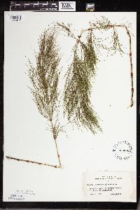 463450[1333451]Lakela, Olga 141701952-06-17 United States, Minnesota, Saint Louis, At Namakan Narrows, St. Louis Co.;Voyageurs National Park;069N;17W;, 48.487203 -92.816997 |
MIN:Plants | 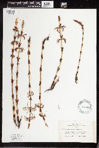 463511[1333554]Lakela, Olga 139781952-05-17 United States, Minnesota, Lake, Marshall trail; QSWRC [Quetico-Superior Wilderness Research Center] Basswood Lake, Lake Co.;Boundary Waters Canoe Area Wilderness / Superior National Forest;N;;, 48.087126 -91.633008 |
MIN:Plants | 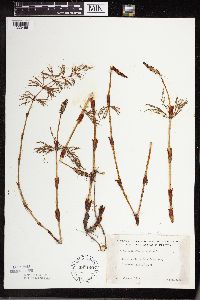 481149[1333466]Lakela, Olga 159801953-06-08 United States, Minnesota, Saint Louis, St. Louis Co.; on Lake Vermilion, Treasure Island Resort;;N;;, 47.860994 -92.309031 |
MIN:Plants | 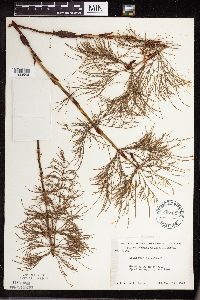 497431[1333546]Moore, John 201481949-06-14 United States, Minnesota, Itasca, Itasca Co.; 6 1/2 mi E of Bigfork;Chippewa National Forest;N;;, 47.744302 -93.514172 |
MIN:Plants | 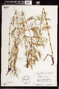 507452[1333570]Moore, John 209831951-06-07 United States, Minnesota, Itasca, Itasca County...at Coon Lake, Scenic State Park;Scenic State Park;060N;25W;, 47.723007 -93.563738 |
MIN:Plants | 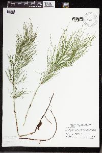 514818[1333482]Smith, Welby 191251991-07-08 United States, Minnesota, Koochiching, Koochiching County...about 6 mi S of Birchdale...T159N R27W NE1/4 of SE1/4 of Sec 34;;159N;27W;34, 48.5475006 -94.082222 |
MIN:Plants | 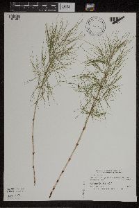 525266[1311021]Smith, Welby 195201991-07-16 United States, Minnesota, Koochiching, Koochiching Co.; on the W side of Silverdale; T64N R22W SW1/4 of NE1/4 of Sec 35;Koochiching State Forest;064N;22W;35, 47.9866676 -93.1188889 |
MIN:Plants | 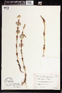 527169[1333464]Lakela, Olga 173281954-06-07 United States, Minnesota, Saint Louis, St. Louis Co.; Vermilion Lke above Vermilion River dam;Kabetogama State Forest;N;;, 47.86401 -92.318691 |
MIN:Plants | 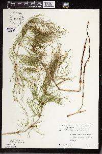 532389[1333470]Lakela, Olga 201711956-07-01 United States, Minnesota, Saint Louis, St. Louis Co.; Hwy.#5 between Greeney and Celina;;N;;, 47.921309 -93.035502 |
MIN:Plants | 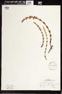 542983[1333362]Lakela, Olga 212571957-05-19 United States, Minnesota, Lake, Lake County...NE Encampment River, Hwy.#61, Lake Co.;North Shore;053N;10W;11, 47.169839 -91.645476 |
MIN:Plants |  543083[1333384]Lakela, Olga 223211957-09-05 United States, Minnesota, Lake, White Iron Lake at Silver Rapids, Lake Co.;Superior National Forest;063N;11W;32, 47.903789 -91.755417 |
MIN:Plants | 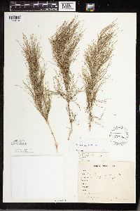 54912[1333414]Bergman, H. 31011914-08-26 United States, Minnesota, Hubbard, Quadrat 14, Benedict;;143N;32W;35, 47.157195 -94.695017 |
MIN:Plants | 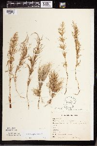 54913[1333415]Bergman, H. 30211914-08-11 United States, Minnesota, Hubbard, Quadrat 12, Benedict;;143N;32W;35, 47.157195 -94.695017 |
MIN:Plants | 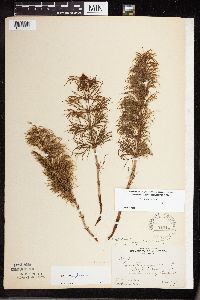 54914[1333560]Butters, F.K. 30091915-06-21 United States, Minnesota, Fillmore, 3 mi W of Rushford;;104N;08W;, 43.748669 -91.898062 |
MIN:Plants | 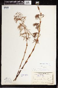 54916[1333517]Sheldon, Edmund s.n.1892-07-00 United States, Minnesota, Crow Wing, Bay Lake, Crow Wing Co.;;N;;, 46.390261 -93.855381 |
MIN:Plants | 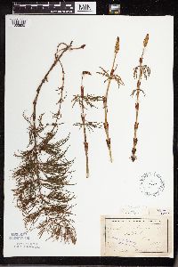 54917[1333520]Tilden, Josephine Tn211893-06-00 United States, Minnesota, Cass, Gull Lake, Cass Co.;;N;;, 46.446379 -94.35099 |
MIN:Plants | 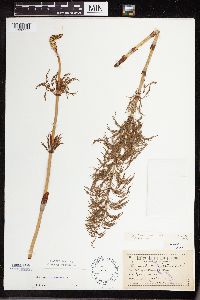 54918[1333555]Aiton, G. s.n.1892-06-00 United States, Minnesota, Hennepin, Vicinity of Minneapolis;;N;;, 44.979965 -93.263836 |
MIN:Plants |  54919[1333549]Ballard, C. B14581893-07-00 United States, Minnesota, Cass, Lake Kilpatrick, Cass Co.;;135N;29W;, 46.495108 -94.365032 |
MIN:Plants |  54920[1333388]MacMillan, C. s.n.1894-07-00 United States, Minnesota, Lake of the Woods, Lake of the Woods;;;;, 48.568903 -94.78825 |
MIN:Plants |  54921[1333518]Sandberg, John s.n.1891-06-00 United States, Minnesota, Carlton, Thomson;;N;;, 46.663811 -92.397824 |
MIN:Plants |  54922[1333515]Anderson, A. A3831893-06-00 United States, Minnesota, Cass, Gull Lake, Cass Co.;;N;;, 46.446379 -94.35099 |
MIN:Plants | 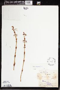 54923[1333411]Sandberg, John s.n.1881-06-00 United States, Minnesota, Saint Louis, Vermilion Lake;;N;;, 47.891581 -92.366824 |
MIN:Plants | 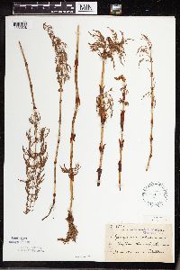 54924[1333528]Sheldon, Edmund S21481892-06-00 United States, Minnesota, Crow Wing, Bay Lake, Crow Wing Co.;;045N;28W;, 46.390261 -93.855381 |
MIN:Plants | 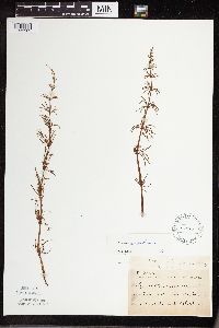 54925[1333562]Sheldon, Edmund S28261892-07-00 United States, Minnesota, Kanabec, Mora, Kanabec Co.;;039N;24W;, 45.874517 -93.282147 |
MIN:Plants | 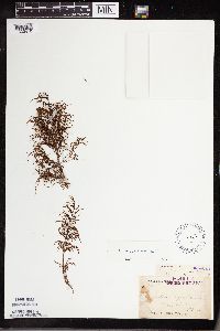 54926[1333410]Arthur, J. B2611886-07-23 United States, Minnesota, Saint Louis, Vermilion Lake;;;;, 47.891581 -92.366824 |
MIN:Plants |  54927[1333550]Arthur, J. B281886-07-18 United States, Minnesota, Saint Louis, Vermilion Lake;;;;, 47.891581 -92.366824 |
MIN:Plants |  54928[1333459]Winchell, N. s.n.1875-09-00 United States, Minnesota, Saint Louis, French River (L.S.);;N;;, 46.942992 -91.949958 |
MIN:Plants |  54929[1333405]Campbell, Jennie C1e1895-06-00 United States, Minnesota, Stearns, St. Cloud;;N;;, 45.557453 -94.160643 |
MIN:Plants |  54930[1333567]Butters, F.K. 40871921-06-19 United States, Minnesota, Otter Tail, N of Deer Creek, Otter Tail Co.;;;;, 46.401218 -95.322081 |
MIN:Plants |  552522[1333386]Partch, M. s.n.1958-08-03 United States, Minnesota, Mahnomen, Mahnomen Co. N of Tulaby Lake.;White Earth Indian Reservation / White Earth State Forest;143N;39W;, 47.197923 -95.62147 |
MIN:Plants | 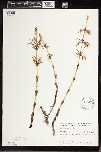 561082[1333583]Ownbey, Gerald B. 26991959-06-21 United States, Minnesota, Clearwater, Clearwater Co. NW1/4 sec.23, T143N, R37W, 1.9 mi W of W boundary of Itasca Park, along forest access road;White Earth Indian Reservation;143N;37W;23, 47.187615 -95.329026 |
MIN:Plants | 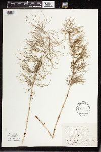 565143[1333497]Cotter, Shirley 8361948-08-20 United States, Minnesota, Clearwater, Rd. to LaSalle Springs, Itasca Pk. Clearwater Co.;Itasca State Park;143N;36W;, 47.195125 -95.225997 |
MIN:Plants | 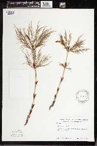 583397[1333488]Kellner, H. 1491956-06-19 United States, Minnesota, Lake, Lake Co. ... Lake Superior, Encampment Forest.;North Shore;053N;10W;11, 47.523171 -91.408849 |
MIN:Plants | 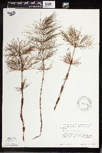 586558[1333395]Moore, John 264191963-07-18 United States, Minnesota, Anoka, Anoka Co.; SE of Cedar Bog Lake, Bethel Twp, Cedar Creek Natural History Area;Cedar Creek National History Area;034N;23W;, 45.40217 -93.199397 |
MIN:Plants | 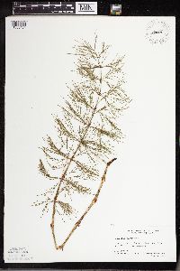 588059[1333454]Marion, J. s.n.1982-00-00 United States, Minnesota, Cook, Cook Co, North Shore of Lake Superior, ca. 200 ft. from lakeshore.;North Shore;N;;, 47.46396 -91.02551 |
MIN:Plants | 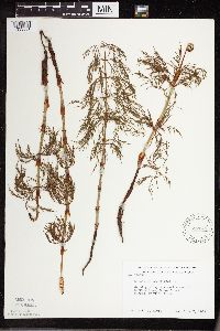 592048[1333551]Moore, John 267291965-06-07 United States, Minnesota, Isanti, Isanti Co. W shore of Beckman Lake, Cedar Creek Natural History Area;Cedar Creek National History Area;034N;23W;, 45.42379 -93.186946 |
MIN:Plants | 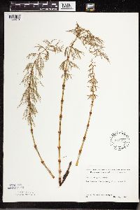 592368[1333510]Westkaemper, Remberta s.n.1965-05-00 United States, Minnesota, Stearns, Stearns Co. St. Wendel;;125N;29W;, 45.663595 -94.378865 |
MIN:Plants | 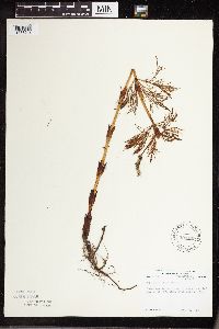 594199[1333547]Thorne, Robert 303421962-06-13 United States, Minnesota, Hubbard, Hubbard Co.; 1/3 mi SE of Mary Lake, Itasca State Park.;Itasca State Park;143N;35W;, 47.19592 -95.107697 |
MIN:Plants | 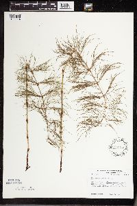 594432[1333514]Thorne, Robert 308471962-07-04 United States, Minnesota, Clearwater, Clearwater Co.; N margin Floating Bog Bay, bet. N and E arms, Lake Itasca, Itasca State Park;Itasca State Park;143N;36W;, 47.197458 -95.201964 |
MIN:Plants | 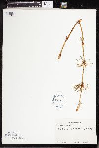 607261[1333467]Grafstrom, M. 1451968-06-13 United States, Minnesota, Pine, Pine Co. T41N, R17W, NE1/4 sec.29;Saint Croix State Park;041N;17W;29, 46.039288 -92.585213 |
MIN:Plants | 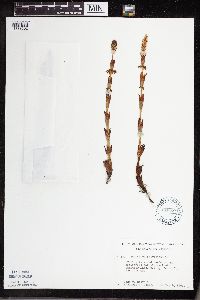 616587[1333502]Moore, John 171969-05-09 United States, Minnesota, Crow Wing, Crow Wing Natural History Area. Crow Wing Co.; E of Chandler Lake, SW1/4, Sec.22, Garrison Twp.;Crow Wing Natural Area;044N;28W;22, 46.278961 -93.86289 |
MIN:Plants | 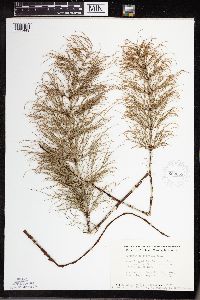 663659[1333449]Noble, Mark 6461975-07-05 United States, Minnesota, Saint Louis, Located on Moose Loop 28 mi NW of Ely.;Superior National Forest;065N;14W;, 48.189007 -92.294556 |
MIN:Plants |  672674[1333442]Wheeler, Gerald s.n.1974-06-22 United States, Minnesota, Aitkin, Aitkin Co. 2 mi S of Aitkin on Hwy.169.;;;;, 46.504442 -93.709949 |
MIN:Plants |  681658[1333542]Peck, J. 770910101977-09-10 United States, Minnesota, Rice, Rice Co. Nerstrand Woods St. Park along ravine; T110 R-19W sec.9;Nerstrand Woods State Park;110N;19W;9, 44.344444 -93.112658 |
MIN:Plants |  681659[1333453]Peck, J. 770910101977-09-10 United States, Minnesota, Rice, Rice Co, Nerstrand State Pk.; T110N R-19W sec.9;Nerstrand Woods State Park;110N;19W;9, 44.344444 -93.112658 |
MIN:Plants |  684854[1333391]Meyer, Rob 451977-08-08 United States, Minnesota, Cook, Superior National Forest. Cook Co. Superior National Forest; E side of the Gunflint Trail (Co.12). Site 4.0 mi S of Gunflint Trail of Trails End N Cook Co. Superior National Forest; E side of the Gunflint Trail (Co.12). Site 4.0 mi S of Gunflint Trail of Trails End National Forest Campgroudn; NE1/4 sec.8 T65N R4W. 065N 04W 8, 48.127957 -90.868849 |
MIN:Plants | 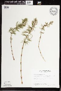 686875[1333563]Wheeler, Gerald 13011977-05-15 United States, Minnesota, Itasca, Itasca Co. Coll. Site#7. NW1/4 SW1/4 Sec.32 T55N R26W, approx. 6 mi SW of Grand Rapids.;;055N;26W;32, 47.201562 -93.679551 |
MIN:Plants | 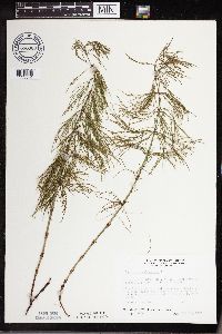 686980[1333574]Wheeler, Gerald 14041977-05-22 United States, Minnesota, Itasca, Itasca Co. Coll. Site#19. S1/2 NE1/4 Sec.8 T56N R26W, approx. 9.5 mi NW of Grand Rapids.;;056N;26W;8, 47.350953 -93.666968 |
MIN:Plants | 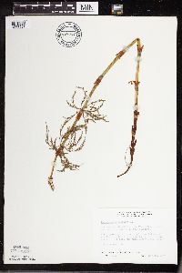 687037[1333527]Wheeler, Gerald 14631977-05-28 United States, Minnesota, Itasca, Itasca Co. Coll. Site#30. SE1/4 NE1/4 Sec.36 T56N R27W, approx. 8.5 mi NW of Grand Rapids;;056N;27W;36, 47.291036 -93.705657 |
MIN:Plants | 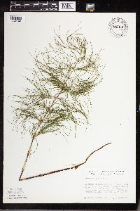 688436[1333420]Meyer, Rob 511977-08-08 United States, Minnesota, Cook, Superior National Forest. Cook Co. Beginning of Kekekabaic Trail (Fernberg Rd.). Superior National Forest. 2.5 mi S of Gunflint Trail of Seagull L Cook Co. Beginning of Kekekabaic Trail (Fernberg Rd.). Superior National Forest. 2.5 mi S of Gunflint Trail of Seagull Lake Ranger Station; SW1/4 NE1/4 sec.27 T65N R4W. 065N 04W 27, 48.019817 -90.524269 |
MIN:Plants | 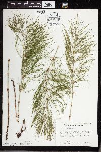 691399[1333543]Ownbey, Gerald 59241978-06-18 United States, Minnesota, Cass, Cass Co. Sucker Bay Rd, 6.1 mi S of its jnc. with U.S. Rt.2, T144N, R29W NW1/4, Sec.20, Bowstring Twp.;Chippewa National Forest / Leech Lake Indian Reservation;144N;29W;20, 47.277584 -94.386208 |
MIN:Plants | 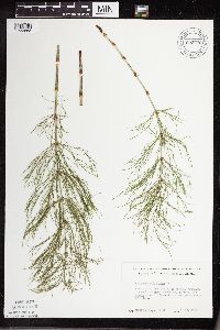 692729[1333568]Meyer, Rob 1941978-06-09 United States, Minnesota, Chisago, Chisago Co. Goose Creek. 3 mi NE of Harris; Central part of the W1/2 sec.12 T36N R21W;;036N;21W;12, 45.62264 -92.913104 |
MIN:Plants | 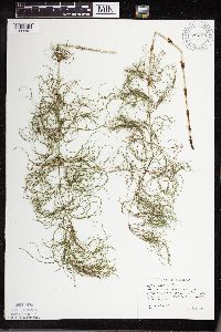 692795[1333491]Wagner, W. 731461973-08-03 United States, Minnesota, Beltrami, Beltrami Co.: Red Lakes Area, Indian Service R18, 0.4 mi N of Minn. Rt.1, R33W, T151N, sec.25;Red Lake Indian Reservation;151N;33W;25, 47.868166 -94.818547 |
MIN:Plants | 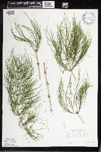 692798[1333490]Wagner, W. 732091973-08-11 United States, Minnesota, Becker, Becker Co.: Rt.44, Savannah Twp, 3 mi W of Rt.71, T142N, R36W, sec.27;Two Inlets State Forest;142N;36W;27, 47.087082 -95.223499 |
MIN:Plants | 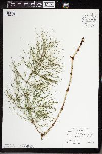 692804[1333421]Wagner, W. 754621975-08-00 United States, Minnesota, Roseau, Roseau Co.: Roseau Wildlife Area, 4.1 mi NW from jnc. of interior loop & Dice Rd.;Roseau River Wildlife Management Area;;;, 48.903539 -95.835317 |
MIN:Plants | 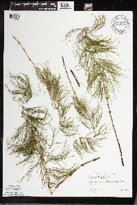 692824[1333498]Wagner, W. 732311973-08-14 United States, Minnesota, Koochiching, Koochiching Co.: Maragie;Pine Island State Forest;153N;26W;, 48.025406 -93.9333 |
MIN:Plants | 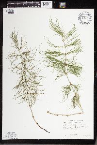 692830[1333422]Wagner, W. 756161975-08-09 United States, Minnesota, Cass, Cass Co.: Ottertail Peninsula N side of Leech Lake, betw. Sucker Bay & Waboose Bay, 0.6 mi N of turnoff to Springborn's;Chippewa National Forest / Leech Lake Indian Reservation;;;, 47.221477 -94.412916 |
MIN:Plants | 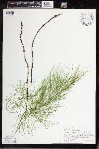 692831[1333495]Wagner, W. 1181973-08-05 United States, Minnesota, Mahnomen, Mahnomen Co.: dirt road, 0.4 mi N of Minn. 200, just W of White Earth State Forest, T145N, R39W, sec.34;White Earth Indian Reservation;145N;39N;34, 47.331905 -95.605071 |
MIN:Plants | 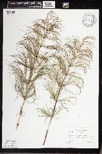 692833[1333493]Peck, J. 75412P1975-08-03 United States, Minnesota, Lake of the Woods, Lake of Woods Co.: 3 mi W of Williams on Minn.11;;;;, 48.768296 -95.02109 |
MIN:Plants | 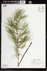 692838[1333423]Wagner, W. 732981973-08-22 United States, Minnesota, Hubbard, Hubbard Co.: Itasca State Park; just S of the smaller of the Twin Lakes, W of Lake Drive, T143N, R35W, sec.31;Itasca State Park;143N;35W;31, 46.902804 -94.905571 |
MIN:Plants | 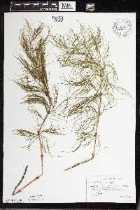 692844[1333494]Wagner, W. 753191975-07-24 United States, Minnesota, Beltrami, Beltrami Co.: 4.1-4.3 mi N of Becida, along sand rd, R35W, T146N, sec.36;;146N;35W;36, 48.373818 -94.678884 |
MIN:Plants | 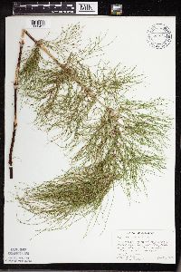 692846[1333492]Wagner, W. 754781975-08-00 United States, Minnesota, Roseau, Roseau Co.: closed rd. to S at sighn marking Hayes Lake State Park, 3/4 mi on Rt.4;Hayes Lake State Park;;;, 48.636924 -95.544833 |
MIN:Plants | 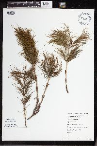 699140[1333509]Sather, Nancy 991976-06-16 United States, Minnesota, Saint Louis, St. Louis Co. ...plot #2, E1/2, NE1/4, S7, T57N, R14W;Superior National Forest;T057N R14W S07, 47.436796 -92.16565 |
MIN:Plants | 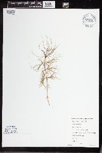 699141[1333508]Sather, Nancy 3081976-07-15 United States, Minnesota, Saint Louis, St. Louis Co....by St. Louis River, NW1/4 SW1/4 T58N, R14W [sic]. Map 17;Superior National Forest;058N;14W;00, 47.215428 -92.049316 |
MIN:Plants | 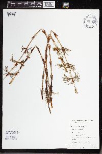 699145[1333584]Sather, Nancy 3611977-05-27 United States, Minnesota, Saint Louis, St. Louis Co....ordering Hwy 16, SE1/4, SE1/4, SW1/4, S32, T57N, R14W;Superior National Forest;T057N R14W S32, 47.379077 -92.143285 |
MIN:Plants | 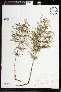 700945[1333496]Dorio, J. 6521977-07-26 United States, Minnesota, Morrison, Morrison Co. Lake Alexander, about 7 mi N of Randall on co.rd.6; T131N, R30W, Sec.6;;131N;30W;6, 46.187068 -94.506234 |
MIN:Plants | 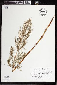 717194[1333455]Peck, J. 80-781980-05-25 United States, Minnesota, Winona, Winona Co, La Moille, mouth of Trout Creek, at Hwy.61;Upper Mississippi National Wildlife Refuge;106N;05W;, 44.193017 -91.936542 |
Google Map
Google Maps is a web mapping service provided by Google that features a map that users can pan (by dragging the mouse) and zoom (by using the mouse wheel). Collection points are displayed as colored markers that when clicked on, displays the full information for that collection. When multiple species are queried (separated by semi-colons), different colored markers denote each individual species.