University of Minnesota
http://www.umn.edu/
612-625-5000
http://www.umn.edu/
612-625-5000
Minnesota Biodiversity Atlas
Bell Museum
Dataset: MIN-Plants
Taxa: Lycopodiaceae
Search Criteria: excluding cultivated/captive occurrences
Bell Museum plants | |
 MIN:Plants | 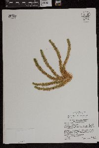 Huperzia selago (L.) Bernhardi ex Schrank & Martius 959016[1305243]Gerdes, Lynden B. 64552011-11-02 United States, Minnesota, Lake, Superior National Forest. Approximately 9.68 miles north of Isabella, MN and 0.40 miles ENE of the Tomahawk Road (FR377) and Northwest Road (FR 373) intersection., 47.75527778 -91.38333333 |
MIN:Plants | 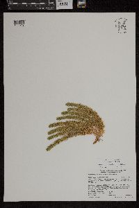 Huperzia selago (L.) Bernhardi ex Schrank & Martius 959015[1305242]Gerdes, Lynden B. 64562011-11-02 United States, Minnesota, Lake, Superior National Forest. Approximately 9.68 miles north of Isabella, MN and 0.40 miles ENE of the Tomahawk Road (FR377) and Northwest Road (FR 373) intersection., 47.75527778 -91.38333333 |
MIN:Plants | 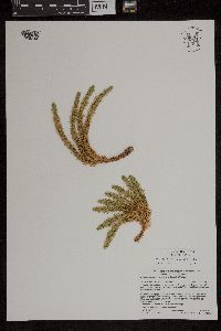 Huperzia selago (L.) Bernhardi ex Schrank & Martius 959017[1305244]Gerdes, Lynden B. 64572011-11-02 United States, Minnesota, Lake, Superior National Forest. Approximately 9.68 miles north of Isabella, MN and 0.40 miles ENE of the Tomahawk Road (FR377) and Northwest Road (FR 373) intersection., 47.75527778 -91.38333333 |
MIN:Plants | 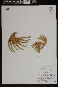 Huperzia selago (L.) Bernhardi ex Schrank & Martius 959007[1305234]Gerdes, Lynden B. 64582011-11-02 United States, Minnesota, Lake, Superior National Forest. Approximately 9.68 miles north of Isabella, MN and 0.40 miles ENE of the Tomahawk Road (FR377) and Northwest Road (FR 373) intersection., 47.75527778 -91.38333333 |
MIN:Plants | 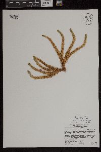 Huperzia selago (L.) Bernhardi ex Schrank & Martius 959005[1305232]Gerdes, Lynden B. 64592011-11-02 United States, Minnesota, Lake, Superior National Forest. Approximately 9.68 miles north of Isabella, MN and 0.40 miles ENE of the Tomahawk Road (FR377) and Northwest Road (FR 373) intersection., 47.75527778 -91.38333333 |
MIN:Plants | 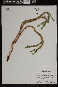 Huperzia selago (L.) Bernhardi ex Schrank & Martius 959001[1305228]Gerdes, Lynden B. 64612011-11-02 United States, Minnesota, Lake, Superior National Forest. Approximately 9.68 miles north of Isabella, MN and 0.46 miles east of the Tomahawk Road (FR377) and Northwest Road (FR 373) intersection., 47.755 -91.38222222 |
MIN:Plants | 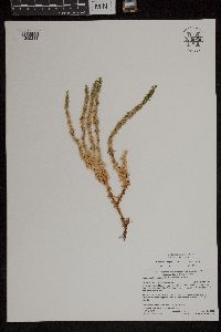 Huperzia selago (L.) Bernhardi ex Schrank & Martius 959004[1305231]Gerdes, Lynden B. 64622011-11-02 United States, Minnesota, Lake, Superior National Forest. Approximately 9.65 miles north of Isabella, MN and 0.58 miles east of the Tomahawk Road (FR377) and Northwest Road (FR 373) intersection., 47.755 -91.38194444 |
MIN:Plants | 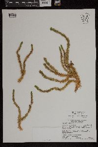 Huperzia selago (L.) Bernhardi ex Schrank & Martius 959003[1305230]Gerdes, Lynden B. 64632011-11-02 United States, Minnesota, Lake, Superior National Forest. Approximately 9.65 miles north of Isabella, MN and 0.58 miles east of the Tomahawk Road (FR377) and Northwest Road (FR 373) intersection., 47.755 -91.38194444 |
MIN:Plants | 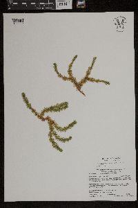 Huperzia selago (L.) Bernhardi ex Schrank & Martius 959002[1305229]Gerdes, Lynden B. 64642011-11-02 United States, Minnesota, Lake, Superior National Forest. Approximately 9.65 miles north of Isabella, MN and 0.58 miles east of the Tomahawk Road (FR377) and Northwest Road (FR 373) intersection., 47.755 -91.38194444 |
MIN:Plants | 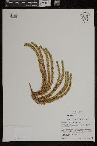 Huperzia selago (L.) Bernhardi ex Schrank & Martius 958998[1305225]Gerdes, Lynden B. 68852013-08-02 United States, Minnesota, Lake, Superior National Forest. Approximately 9.38 miles ENE of Babbitt, MN and 0.39 miles west of Sue Lake., 47.72916667 -91.73027778 |
MIN:Plants | 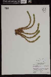 Huperzia selago (L.) Bernhardi ex Schrank & Martius 958996[1305223]Gerdes, Lynden B. 68862013-08-02 United States, Minnesota, Lake, Superior National Forest. Approximately 9.38 miles ENE of Babbitt, MN and 0.39 miles west of Sue Lake., 47.72916667 -91.73027778 |
MIN:Plants | 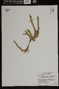 Huperzia selago (L.) Bernhardi ex Schrank & Martius 959000[1305227]Gerdes, Lynden B. 69382013-08-18 United States, Minnesota, Saint Louis, Superior National Forest. BWCAW. Steep Lake, approximately 12.36 miles ENE of Crane Lake, MN. Drainage at the northeast end of lake., 48.30888889 -92.22888889 |
MIN:Plants | 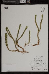 Huperzia selago (L.) Bernhardi ex Schrank & Martius 958999[1305226]Gerdes, Lynden B. 69392013-08-18 United States, Minnesota, Saint Louis, Superior National Forest. BWCAW. Steep Lake, approximately 12.36 miles ENE of Crane Lake, MN. Drainage at the northeast end of lake., 48.30888889 -92.22888889 |
MIN:Plants | 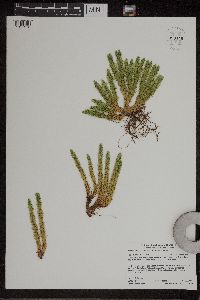 Huperzia selago (L.) Bernhardi ex Schrank & Martius 959446[1311513]Gerdes, Lynden B. 72782015-07-01 United States, Minnesota, Saint Louis, Superior National Forest. Approximately 15.49 miles east of Ray, MN and 0.02 miles south of the Ash River Trail (County Road 129)., 48.39388889 -92.8675 |
MIN:Plants | 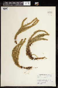 Huperzia selago (L.) Bernhardi ex Schrank & Martius 960344[1318831]Eyerdam W.J. 74371949-10-02 United States, Alaska, Kuiu Island, Washington Bay, 56.540556 -134.051111 |
MIN:Plants | 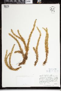 Huperzia selago (L.) Bernhardi ex Schrank & Martius 960604[1329206]Lee, Michael MDL33322002-09-18 United States, Minnesota, Carlton, Rugged bedrock terrain along the St. Louis River, 1/2-mile east of the town of Carlton. Along the lower reaches of Otter Creek ~1/4 mile upstream from the St. Louis River. NW1/4 of NE1/4 of NE1/4 Sec. 7, Jay Cooke State Park, 46.659252 -92.418536 |
MIN:Plants | 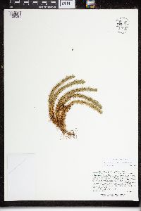 Huperzia selago (L.) Bernhardi ex Schrank & Martius 960610[1329213]Lee, Michael MDL32792002-09-04 United States, Minnesota, Cook, On the north side of Moose Mountain in rugged bedrock terrain of the Lutsen Mountains Ski Area three miles west-northwest of Lutsen; above the Poplar River. N1/2 of SE1/4 of NE1/4 Sec. 29, Lutsen Mountains Ski Area, 47.650103 -90.719184 |
MIN:Plants | 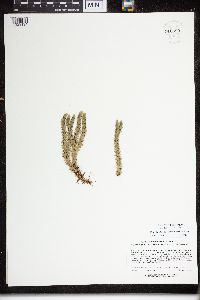 Huperzia selago (L.) Bernhardi ex Schrank & Martius 960593[1329194]Lee, Michael MDL33042002-09-11 United States, Minnesota, Cook, Rugged bedrock terrain just northeast of the Lutsen Mountains Ski Area, 1.5 miles northwest of Lutsen; on the north side of Eagle Mountain. SW1/4 of SW1/4 of NW1/4 Sec. 22, SE1/4 of SE1/4 of NE1/4 Sec. 21, Lutsen State Scientific & Natural Area, 47.666178 -90.691973 |
MIN:Plants | 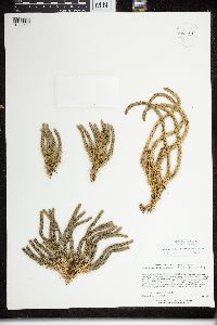 Huperzia selago (L.) Bernhardi ex Schrank & Martius 960591[1329192]Lee, Michael MDL31592002-06-14 United States, Minnesota, Lake, Rugged bedrock terrain 2.5 miles west of Silver Bay, atop an extremely steep, 250-foot, west-facing slope overlooking the Mile Post 7 tailings ponds, NE1/4 of NW1/4 Sec. 34, 47.293125 -91.336068 |
MIN:Plants | 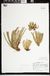 Huperzia selago (L.) Bernhardi ex Schrank & Martius 960603[1329204]Lee, Michael MDL31962002-07-29 United States, Minnesota, Lake, Rugged bedrock terrain between Hwy 61 and the Lake Superior shoreline, 2.5 miles north of Little Marais, on the inland side of a ridge rising 300 feet above Lake Superior. E1/2 of NE1/4 of SW1/4 Sec. 10, NW1/4 of NW1/4 of SE1/4 Sec. 10, 47.410745 -91.110162 |
MIN:Plants | 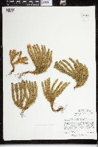 Huperzia selago (L.) Bernhardi ex Schrank & Martius 960596[1329197]Lee, Michael MDL32842002-09-05 United States, Minnesota, Lake, Rugged bedrock terrain south of the East Branch Baptism River 4.5 miles east-northeast of Finland. S1/2 of SE1/4 of SE1/4 Sec. 12, 47.374099 -91.228628 |
MIN:Plants | 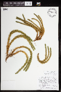 Huperzia selago (L.) Bernhardi ex Schrank & Martius 965259[1375928]Lee, Michael MDL51442009-09-16 United States, Minnesota, Cook, Boundary Waters Canoe Area Wilderness, Rugged bedrock terrain northeast of Brule Lake, 18 miles northwest of Grand Marais. T63N R2W NW1/4 of NW1/4 of SW1/4 Sec. 10, 47.95458988 -90.57504396 |
MIN:Plants | 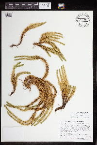 Huperzia selago (L.) Bernhardi ex Schrank & Martius 965260[1375929]Lee, Michael MDL51452009-09-16 United States, Minnesota, Cook, Boundary Waters Canoe Area Wilderness, Rugged bedrock terrain northeast of Brule Lake, 18 miles northwest of Grand Marais. T63N R2W NW1/4 of NW1/4 of SW1/4 Sec. 10, 47.95458988 -90.57504396 |
MIN:Plants | 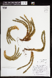 Huperzia selago (L.) Bernhardi ex Schrank & Martius 964694[1375638]Lee, Michael MDL49192009-06-18 United States, Minnesota, Cook, Rugged bedrock terrain along the Border Route Hiking Trail, above the lower reaches of the Swamp River 11 miles north of Hovland. T64N R4E NW1/4 of NE1/4 of NE1/4 Sec. 28, NE1/4 of NW1/4 of NE1/4 Sec. 28, 47.99959334 -89.93413815 |
MIN:Plants | 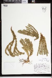 Huperzia selago (L.) Bernhardi ex Schrank & Martius 960616[1329220]Lee, Michael MDL32932002-09-11 United States, Minnesota, Cook, Rugged terrain along the Poplar River three miles northwest of Lutsen. S1/2 of NE1/4 of NE1/4 Sec. 20, N1/2 of SE1/4 of NE1/4 Sec. 20, 47.671003 -90.729172 |
MIN:Plants | 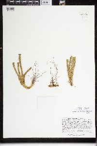 Huperzia selago (L.) Bernhardi ex Schrank & Martius 960598[1329199]Lee, Michael MDL32942002-09-11 United States, Minnesota, Cook, Rugged terrain along the Poplar River three miles northwest of Lutsen. S1/2 of NE1/4 of NE1/4 Sec. 20, N1/2 of SE1/4 of NE1/4 Sec. 20, 47.671003 -90.729172 |
MIN:Plants | 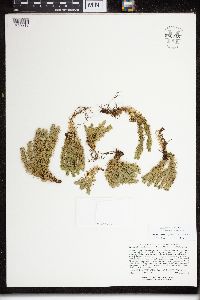 Huperzia selago (L.) Bernhardi ex Schrank & Martius 960615[1329219]Lee, Michael MDL33182002-09-13 United States, Minnesota, Carlton, Along the St. Louis River immediately below the Thomson dam, between the towns of Carlton and Thomson; between the dam and Highway 210. E1/2 of SE1/4 of SE1/4 Sec. 6, W1/2 of SW1/4 of SW1/4 Sec. 5, 46.670606 -92.417497 |
MIN:Plants | 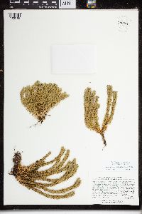 Huperzia selago (L.) Bernhardi ex Schrank & Martius 960594[1329195]Lee, Michael MDL33192002-09-13 United States, Minnesota, Carlton, Along the St. Louis River immediately below the Thomson dam, between the towns of Carlton and Thomson; between the dam and Highway 210. E1/2 of SE1/4 of SE1/4 Sec. 6, W1/2 of SW1/4 of SW1/4 Sec. 5, 46.670606 -92.417497 |
MIN:Plants | 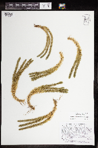 Huperzia selago (L.) Bernhardi ex Schrank & Martius 964676[1375619]Lee, Michael MDL4901A2009-06-14 United States, Minnesota, Cook, Boundary Waters Canoe Area Wilderness, Rugged bedrock terrain between Moose and Mountain Lakes, 20 miles north-northwest of Hovland. T65N R2E NW1/4 of SW1/4 of SW1/4 Sec. 13, NE1/4 of SE1/4 of SE1/4 Sec. 14, 48.11052243 -90.14405188 |
MIN:Plants | 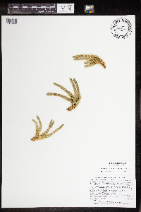 Huperzia selago (L.) Bernhardi ex Schrank & Martius 965107[1375620]Lee, Michael MDL4901B2009-06-14 United States, Minnesota, Cook, Boundary Waters Canoe Area Wilderness, Rugged bedrock terrain between Moose and Mountain Lakes, 20 miles north-northwest of Hovland. T65N R2E NW1/4 of SW1/4 of SW1/4 Sec. 13, NE1/4 of SE1/4 of SE1/4 Sec. 14, 48.11052243 -90.14405188 |
MIN:Plants | 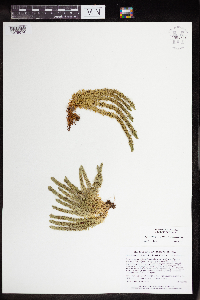 Huperzia selago (L.) Bernhardi ex Schrank & Martius 964728[1375674]Lee, Michael MDL4953A2009-06-25 United States, Minnesota, Cook, On the north slope of Oberg Mountain, in rugged bedrock terrain five miles northeast of Tofte. T59N R4W NE1/4 of NW1/4 of NE1/4 Sec. 1, NW1/4 of NE1/4 of NE1/4 Sec. 1, 47.62975729 -90.77224805 |
MIN:Plants | 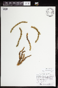 Huperzia selago (L.) Bernhardi ex Schrank & Martius 965208[1375875]Lee, Michael MDL51902010-06-16 United States, Minnesota, Cook, 47.98094584 -90.10379419, 640m |
MIN:Plants |  Huperzia selago (L.) Bernhardi ex Schrank & Martius 965275[1375944]Lee, Michael MDL52112010-06-23 United States, Minnesota, Cook, Boundary Waters Canoe Area Wilderness, Rolling bedrock terrain northeast of Eagle Mountain, 15 miles northwest of Grand Marais.T63N R2W NW1/4 of NW1/4 of NE1/4 Sec. 26, 47.91833555 -90.54243189, 584m |
MIN:Plants |  Huperzia selago (L.) Bernhardi ex Schrank & Martius 965136[1375806]Lee, Michael MDL5076B2009-08-19 United States, Minnesota, Cook, Boundary Waters Canoe Area Wilderness, Rugged bedrock terrain northwest of Brule Lake, 24 miles northwest of Grand Marais. T63N R3W N1/2 of NW1/4 of NW1/4 Sec. 5, 47.97359354 -90.74269834 |
MIN:Plants |  Huperzia selago (L.) Bernhardi ex Schrank & Martius 964653[1375606]Lee, Michael MDL48882009-06-03 United States, Minnesota, Cook, On the south side of South Fowl Lake, 14 miles north-northwest of Hovland. T64N R3E N1/2 of NW1/4 of SW1/4 Sec. 12 (irregular Section), 48.04293702 -90.00633386 |
MIN:Plants |  Huperzia selago (L.) Bernhardi ex Schrank & Martius 964704[1375649]Lee, Michael MDL49292009-06-22 United States, Minnesota, Cook, Along the Border Route Hiking Trail in rugged bedrock terrain 11 miles north of Hovland. T64N R4E NW1/4 of NE1/4 of NE1/4 Sec. 29, 48.00212277 -89.95784125 |
MIN:Plants | 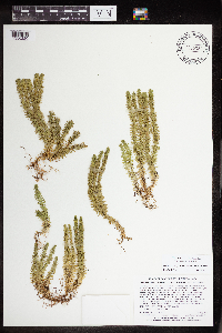 Huperzia selago (L.) Bernhardi ex Schrank & Martius 965359[1356220]Lee, Michael MDL52992010-07-24 United States, Minnesota, Cook, Boundary Waters Canoe Area Wilderness, Moderately rugged bedrock terrain east of Davis Lake, 23 miles north of Lutsen, 23 miles northwest of Grand Marais. T64N R3W NE1/4 of SE1/4 of NE1/4 Sec. 34, 47.98576692 -90.67992354, 585m |
MIN:Plants | 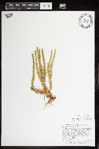 Huperzia selago (L.) Bernhardi ex Schrank & Martius 965163[1356221]Lee, Michael MDL5299A2010-07-24 United States, Minnesota, Cook, Boundary Waters Canoe Area Wilderness, Moderately rugged bedrock terrain east of Davis Lake, 23 miles north of Lutsen, 23 miles northwest of Grand Marais. T64N R3W NE1/4 of SE1/4 of NE1/4 Sec. 34, 47.98576692 -90.67992354, 585m |
MIN:Plants | 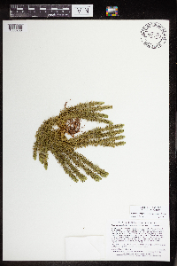 Huperzia selago (L.) Bernhardi ex Schrank & Martius 965370[1356233]Lee, Michael MDL53102010-07-25 United States, Minnesota, Cook, Boundary Waters Canoe Area Wilderness, Rolling to moderately rugged bedrock terrain 24 miles northwest of Grand Marais, 26 miles north of Lutsen. T64N R3W S1/2 of SW1/4 of NE1/4 Sec. 13, NW1/4 of NE1/4 of SE1/4 Sec. 13, 48.02508567 -90.64665079, 588m |
MIN:Plants | 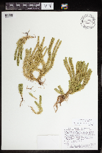 Huperzia selago (L.) Bernhardi ex Schrank & Martius 965420[1356283]Lee, Michael MDL53622010-08-07 United States, Minnesota, Cook, Boundary Waters Canoe Area Wilderness, Strongly rolling bedrock terrain south of Swan Lake, 16 miles northwest of Grand Marais. T63N R2W N1/2 of SE1/4 of NE1/4 Sec. 14, 47.94321007 -90.53798467 |
MIN:Plants | 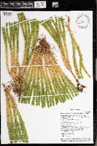 Huperzia selago (L.) Bernhardi ex Schrank & Martius 976705[1402313]Timothy J. S. Whitfeld 30312021-07-21 United States, Minnesota, St. Louis, Voyageurs National Park, 1.15 miles west of Grassy Bay, Sand Point Lake, 48.392437 -92.567608, 361m |
MIN:Plants | 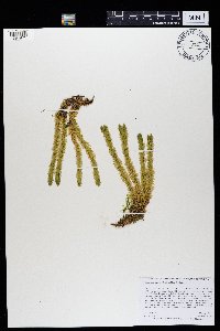 Huperzia selago (L.) Bernhardi ex Schrank & Martius 969348[1384971]Rowe, Erika R. ERR8122012-08-30 United States, Minnesota, Lake of the Woods, Beltrami Island State Forest. 0.60 miles north of Faunce-Butterfield Forest Rd; 2.75 miles northeast of Norris Camp Wildlife Headquarters., 48.97 -94.99 |
MIN:Plants | 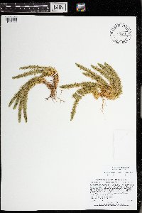 Huperzia selago (L.) Bernhardi ex Schrank & Martius 973461[1397015]Lee, Michael MDL56122011-06-28 United States, Minnesota, Lake, Superior National Forest; Rugged bedrock terrain south of the Fernberg Road, along the upper reaches of Madden Creek, 12 miles east-northeast of Ely., 47.95184451 -91.59150033, 457m |
MIN:Plants | 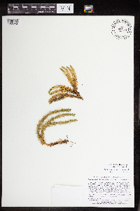 Huperzia selago (L.) Bernhardi ex Schrank & Martius 965371[1356234]Lee, Michael MDL53112010-07-25 United States, Minnesota, Cook, Boundary Waters Canoe Area Wilderness, Rolling to moderately rugged bedrock terrain 24 miles northwest of Grand Marais, 26 miles north of Lutsen. T64N R3W S1/2 of SW1/4 of NE1/4 Sec. 13, NW1/4 of NE1/4 of SE1/4 Sec. 13, 48.02508567 -90.64665079, 588m |
MIN:Plants | 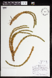 Huperzia selago (L.) Bernhardi ex Schrank & Martius 965393[1356256]Lee, Michael MDL53342010-07-27 United States, Minnesota, Cook, Boundary Waters Canoe Area Wilderness, Rolling bedrock terrain 24 miles northwest of Grand Marais, 26 miles north of Lutsen. T64N R3W NE1/4 of SW1/4 Sec. 14, 48.02308768 -90.67001298, 590m |
MIN:Plants | 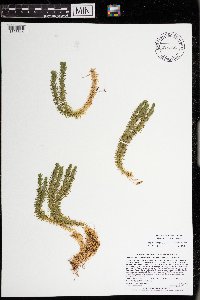 Huperzia selago (L.) Bernhardi ex Schrank & Martius 973261[1398814]Lee, Michael MDL60202012-07-20 United States, Minnesota, Lake, Boundary Waters Canoe Area Wilderness; Rolling bedrock terrain on the northeast side of Wind Lake, 17 miles northeast of Ely., 48.0175981087 -91.5066901567, 411m |
MIN:Plants | 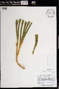 Huperzia selago (L.) Bernhardi ex Schrank & Martius 977165[1402746]Lee, Michael MDL63132013-07-26 United States, Minnesota, Lake, Boundary Waters Canoe Area Wilderness. Fairly rugged bedrock terrain on the north side of Jackfish Bay, Basswood Lake, 12 miles north-northeast of Ely., 48.05886599 -91.73908148, 399m |
MIN:Plants | 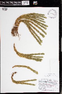 Huperzia selago (L.) Bernhardi ex Schrank & Martius 977300[1402884]Lee, Michael MDL67152014-08-30 United States, Minnesota, Lake, Boundary Waters Canoe Area Wilderness. Along the flowage between Moosecamp and Fourtown Lakes, in rugged bedrock terrain 13 miles north-northeast of Ely., 48.10919578014 -91.78832344255, 107m |
MIN:Plants | 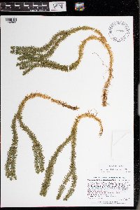 Huperzia selago (L.) Bernhardi ex Schrank & Martius 977316[1402900]Lee, Michael MDL66222014-07-29 United States, Minnesota, St. Louis, Strongly rolling bedrock terrain east of Eagles Nest Lake #3, west of Purvis Lake, south of Meadow Lake, nine miles southwest of Ely, along the Purvis Lake Forest Road, just east of the Beaver River., 47.82134489214 -92.03131953285, 149m |
MIN:Plants | 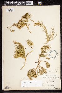 Diphasiastrum sitchense (Ruprecht) Holub 55422[1327181]Elmer, A.D.E. 25271900-08-00 United States, Washington, Clallam, Olympic Mts. [Olympic National Park] |
MIN:Plants | 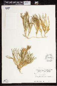 Diphasiastrum sitchense (Ruprecht) Holub 599845[1327183]Cooper, William 3211929-07-24 United States, Alaska, Glacier Bay, Station 27.;Glacier Bay National Park;;;, 58.797428 -136.838127 |
MIN:Plants |  Diphasiastrum sitchense (Ruprecht) Holub 55029[1327201]Sandberg, John s.n.1893-08-00 United States, Washington, Eastern Washington ... Stevens Pass, 914m |
MIN:Plants | 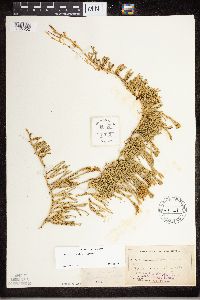 Diphasiastrum sitchense (Ruprecht) Holub 55421[1327202]Sandberg, John s.n.1893-08-00 United States, Washington, Eastern Washington ... Stevens Pass, 1829m |
MIN:Plants | 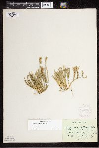 Diphasiastrum sitchense (Ruprecht) Holub 284721[1327182]Thompson, J. 54451930-07-27 United States, Washington, Pierce, Spray Park...Mt. Rainier, Pierce County;Mount Rainier National Park, 1829m |
MIN:Plants | 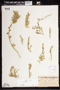 Diphasiastrum sitchense (Ruprecht) Holub 361959[1327179]Thompson, J. 126591935-08-23 United States, Washington, Skamania, Washington ... Skamania Co. ... Mt. St. Helens;Mount Saint Helens National Volanic Monument |
MIN:Plants | 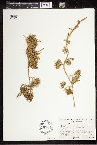 Diphasiastrum sitchense (Ruprecht) Holub 479541[1327180]Abbe, E.C. 1939-07-21 Canada, Quebec, Richmond Gulf, East Coast of Hudson Bay. near fall of river, Wiachewn Bay |
MIN:Plants | 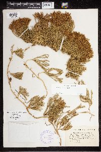 Diphasiastrum sitchense (Ruprecht) Holub 388087[1327184]Williams, E.F. 1901-08-11 United States, Maine, Fort KEnt |
MIN:Plants | 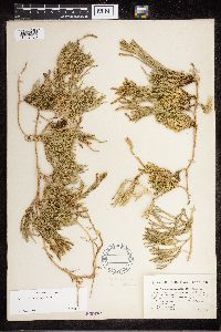 Diphasiastrum sitchense (Ruprecht) Holub 260876[1327185]Williams, E.F. 1901-08-11 United States, Maine, Fort Kent |
MIN:Plants | 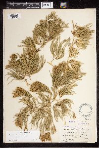 Diphasiastrum sitchense (Ruprecht) Holub 55423[1327186]Williams, E.F. 1901-08-11 United States, Maine, Fort Kent |
MIN:Plants | 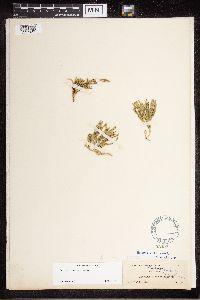 Diphasiastrum sitchense (Ruprecht) Holub 55425[1327187]Eggleston, W.W. 1901-08-17 United States, New Hampshire, Mt. Washington |
MIN:Plants | 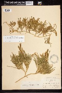 Diphasiastrum sitchense (Ruprecht) Holub 55390[1327188]Fernald, M.L. 1906-08-07 Canada, Quebec, Gaspe, Table-top mountain, 950 - 1150m |
MIN:Plants | 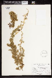 Diphasiastrum sitchense (Ruprecht) Holub 534052[1327189]Abbe, E.C. 1939-07-21 Canada, Quebec, Richmond Gulf, East Coast of Hudson Bay. near fall of river, Wiachewn Bay |
MIN:Plants | 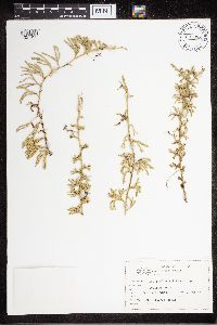 Diphasiastrum sitchense (Ruprecht) Holub 637888[1327190]Abair, Christopher 1967-07-01 United States, Washington, Twin Lakes |
MIN:Plants | 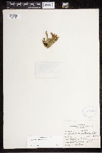 Diphasiastrum sitchense (Ruprecht) Holub 360069[1327191]Eartham, J.W. s.n.1938-00-00 Canada, British Columbia, west Vancouver; Hollybrum Plateau, 914 - 1066m |
MIN:Plants | 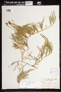 Diphasiastrum sitchense (Ruprecht) Holub 352011[1327192]Muenscher, W.C. 75281937-08-03 United States, Washington, Whatcom, Mount Baker National Forest, Mazama Park |
MIN:Plants | 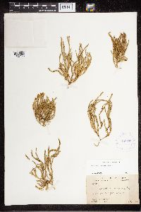 Diphasiastrum sitchense (Ruprecht) Holub 420421[1327193]Potter, David 1934-07-01 Canada, Newfoundland and Labrador, Assizes Harbor |
MIN:Plants | 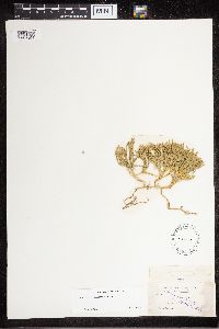 Diphasiastrum sitchense (Ruprecht) Holub 55426[1327194]Fernald, M.L. 1893-08-07 United States, Maine, Aroostook, ALong the St. John River, St. Francis |
MIN:Plants | 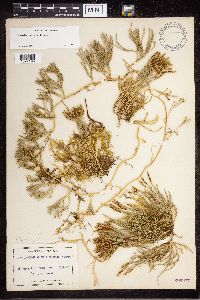 Diphasiastrum sitchense (Ruprecht) Holub 260877[1327195]Knight, O.W. 1905-08-10 United States, Maine, Fort Kent |
MIN:Plants | 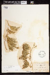 Diphasiastrum sitchense (Ruprecht) Holub 502737[1327196]Collins, J.F. 141905-08-09 Canada, Quebec, Gaspe, tableland of Mt. Albert, 1000m |
MIN:Plants |  Diphasiastrum sitchense (Ruprecht) Holub 55009[1327197]Gorman, M.W. 1894-08-11 United States, Alaska, Short Bay |
MIN:Plants |  Diphasiastrum sitchense (Ruprecht) Holub 618657[1327198]Abbe, E.C. 1951-06-30 Canada, Ontario, Thunder Bay, 0.5 miles E of Jackfish, 48.799999 -86.955682 |
MIN:Plants |  Diphasiastrum sitchense (Ruprecht) Holub 716845[1327199]Abair, Christopher 1979-07-19 United States, Washington, Thurston, Capital Peak |
MIN:Plants |  Diphasiastrum sitchense (Ruprecht) Holub 663625[1327200]Jacobson, G.L. 571974-08-16 Canada, Newfoundland and Labrador, Labrador; Sebaskachu River, 53.833333 -60.583333 |
MIN:Plants | 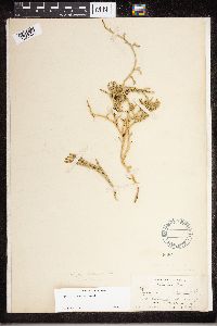 Diphasiastrum sitchense (Ruprecht) Holub 86858[1327203]Rosendahl, C.O. 1902-08-21 Canada, British Columbia, Mt. Avalanche, 1219m |
MIN:Plants | 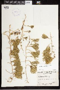 Diphasiastrum sitchense (Ruprecht) Holub 424755[1327204]Marie-Victorin 1940-08-18 Canada, Quebec, Gaspe, Claude River |
MIN:Plants | 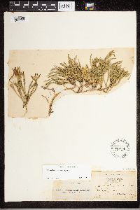 Diphasiastrum sitchense (Ruprecht) Holub 55424[1327205]Collins, J.F. s.n.1904-07-19 Canada, Quebec, Bonaventure, St. Jean l'Evangeliste, Nouvelle |
MIN:Plants | 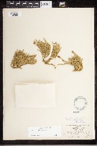 Diphasiastrum sitchense (Ruprecht) Holub 86847[1327206]Underwood, L.M. 1905-07-26 Canada, Manitoba, Selkirk, Big Bend District, 1828m |
MIN:Plants |  Diphasiastrum sitchense (Ruprecht) Holub 559668[1327207]Hosie, R.C. 1938-07-08 Canada, Ontario, Algoma District, Trail to Upper Magpie Falls. Vicinity of Michipicoten Harbour |
MIN:Plants |  Diphasiastrum sitchense (Ruprecht) Holub 556351[1327208]Moir, D.R. 1953-07-01 Canada, Ontario, Vicinity of Pickle Lake |
MIN:Plants |  Diphasiastrum sitchense (Ruprecht) Holub 827500[1327209]Grether, David F. 1980-08-11 United States, Alaska, Prince William Sound, Nellie Juan Overlook |
MIN:Plants |  Diphasiastrum sitchense (Ruprecht) Holub 55026[1327210]Howell 1895-08-21 United States, Alaska, Howell's Pacific Coast, summit of high mts near Yes Bay, 55.909722 -131.8 |
MIN:Plants | 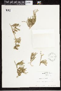 Diphasiastrum sitchense (Ruprecht) Holub 579170[1327211]Kaul, R.B. 1960-07-18 United States, Montana, Flathead, top of Mt. Aeneas in Swan Mts. |
MIN:Plants | 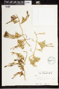 Diphasiastrum sitchense (Ruprecht) Holub 599871[1327212]Cooper, William S. 1935-09-05 United States, Alaska, Prince William Sound, Station 28 |
MIN:Plants | 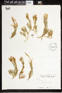 Diphasiastrum sitchense (Ruprecht) Holub 599870[1327213]Cooper, William S. 1935-08-19 Canada, Alaska, Prince William Sound, Station 2 |
MIN:Plants | 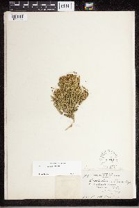 Diphasiastrum sitchense (Ruprecht) Holub 86848[1327214]Butters, F.K. 9661917-09-08 Canada, British Columbia, Avalanche basin, Glacier, 2133m |
MIN:Plants |  Diphasiastrum sitchense (Ruprecht) Holub 86849[1327215]Butters, F.K. 1909-09-07 Canada, British Columbia, Selkirk Mts. Avalanche Mt. Glacier, 1981m |
MIN:Plants |  Diphasiastrum sitchense (Ruprecht) Holub 86851[1327216]Butters, F.K. 1906-08-00 Canada, British Columbia, Selkirk Mts, 1828m |
MIN:Plants |  Diphasiastrum sitchense (Ruprecht) Holub 86853[1327217]Holway, E.W.D. 1907-08-03 Canada, British Columbia, Rogers Pass, 1371m |
MIN:Plants |  Diphasiastrum sitchense (Ruprecht) Holub 86852[1327218]Butters, F.K. 1913-07-22 Canada, British Columbia, Donald Trail, Glacier, 1676m |
MIN:Plants |  Diphasiastrum sitchense (Ruprecht) Holub 86850[1327219]Butters, F.K. 1910-07-20 Canada, British Columbia, Surrey, Sandford Region, 1828m |
MIN:Plants |  595423[1341589]Stimson, William R. 1965-07-07 Puerto Rico, Reserva Forestal de Toro Negro. Summit of Cerro Maravilla Mountain, 18.158991 -66.564987, 3700m |
MIN:Plants |  55128[1341590] 1885-10-13 Puerto Rico, Cayey, Mount Torito, 18.110111 -66.170166 |
MIN:Plants |  55124[1341591]Clute, Willard N. 1900-02-06 Jamaica, Cinchona, 18.162361 -77.348755, 1524m |
MIN:Plants | 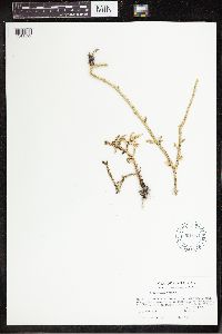 601934[1341592]Lent, Roy W. 1965-08-15 Costa Rica, Cartago, Turrialba Volcano, 9.906384 -83.680715, 3150m |
MIN:Plants | 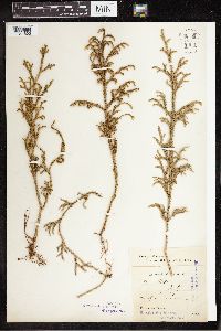 55125[1341593]Schmitz Mexico, 23 -102 |
MIN:Plants | 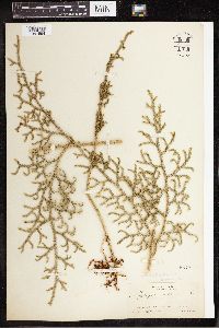 55127[1341594]Pollard, Charles L. 1902-01-30 Cuba, Santiago, Slopes and summit of El Yunque, near Baracoa, 23.033333 -82.583333, 304 - 609m |
MIN:Plants | 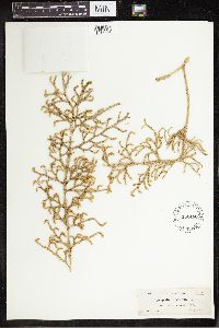 452468[1341595]Curtiss, A.H. 1904-01-28 Cuba, Isla de la Juventud, Near Nueva Gerona, Isla de Pinos, W.I., 21.886667 -82.805556 |
MIN:Plants | 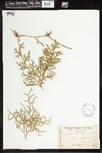 55130[1341596]Butler, Eloise 1894-00-00 Jamaica, Blue Mountains, 18.089408 -76.63609 |
MIN:Plants | 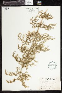 521423[1341597]J.S. 1906-02-13 Jamaica, Cinchona, 18.072907 -76.666916 |
MIN:Plants | 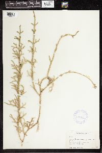 358397[1341598]Muensher, W.C. 1937-05-05 Guatemala, Near Finca Adelside, 15.644998 -90.224731 |
Google Map
Google Maps is a web mapping service provided by Google that features a map that users can pan (by dragging the mouse) and zoom (by using the mouse wheel). Collection points are displayed as colored markers that when clicked on, displays the full information for that collection. When multiple species are queried (separated by semi-colons), different colored markers denote each individual species.