University of Minnesota
http://www.umn.edu/
612-625-5000
http://www.umn.edu/
612-625-5000
Minnesota Biodiversity Atlas
Bell Museum
Dataset: MIN-Plants
Taxa: Brassicaceae
Search Criteria: excluding cultivated/captive occurrences
Bell Museum plants | |
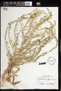
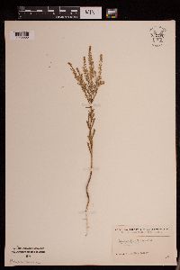
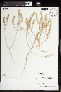
MIN:Plants | Lepidium densiflorum Schrader 803065[]Smith, Welby 117511986-06-12 United States, Minnesota, Lac Qui Parle, Antelope Hills, ca. 7.5 mi. due W of Providence. SW1/4 NE1/4 Sec. 27, T116N, R45W.;;116N;45W;27, 44.830555 -96.2616653 |
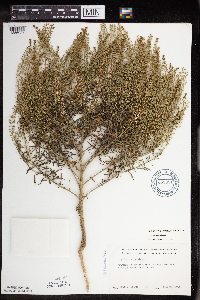
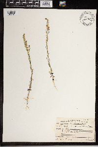
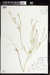
MIN:Plants | Lepidium densiflorum Schrader 807605[]Dorio, J. 3401977-06-23 United States, Minnesota, Benton, Benton Co. Englund Ecotone.;Englund Ecotone, The Nature Conservancy;037N;31W;, 45.695467 -94.172414 |
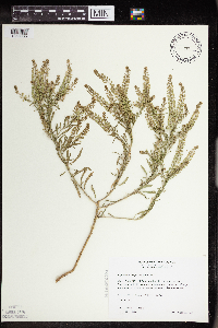
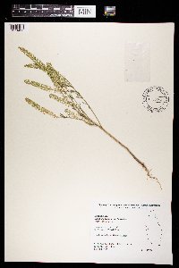
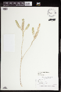
MIN:Plants | Lepidium densiflorum Schrader 807656[]Dorio, J. 491977-05-26 United States, Minnesota, Morrison, Ripley Esker.;Ripley Esker Scientific Natural Area;042N;31W;, 46.113633 -94.250885 |
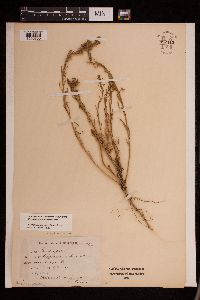
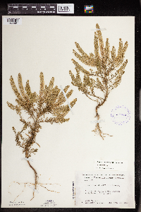
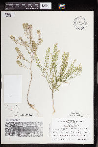
MIN:Plants | Lepidium densiflorum Schrader 813546[]Wheeler, Gerald 114081988-07-25 United States, Minnesota, Lac Qui Parle, Lac Qui Parle State Park. Ca. 15 mi. E of Madison; Lac Qui Parle State Park, NE of Rte. 33. Near the parking lot. N1/2 E1/2 Sec. 15, T118N, R42W Ca. 15 mi. E of Madison; Lac Qui Parle State Park, NE of Rte. 33. Near the parking lot. N1/2 E1/2 Sec. 15, T118N, R42W (Lac Qui Parle Twp.). 118N 42W 15, 45.029904 -95.909318 |
MIN:Plants | Lepidium densiflorum Schrader 815801[]Wheeler, Gerald 114591988-07-26 United States, Minnesota, Big Stone, Ca. 14 mi. NW of Ortonville; N of Rte. 7. N of morainic hill overlooking Big Stone Lake. NW1/4 SW1/4 Sec. 35, T123N, R Ca. 14 mi. NW of Ortonville; N of Rte. 7. N of morainic hill overlooking Big Stone Lake. NW1/4 SW1/4 Sec. 35, T123N, R48W (Foster Twp). 123N 48W 35, 45.421214 -96.646948 |
MIN:Plants | Lepidium densiflorum Schrader 825710[]Marion, J. 1001982-00-00 United States, Minnesota, Cook, Cook Co, North Shore of Lake Superior, ca. 200 ft. from lakeshore.;North Shore;N;;, 47.46396 -91.02551 |
MIN:Plants | Lepidium densiflorum Schrader 830199[1356030]Myhre, K. 20271992-06-01 United States, Minnesota, Cass, Cass Co. Located 1.5 mi NE of the town of Pillager; T133N R30W NE1/4 of NE1/4 of Sec.9;;133N;30W;9, 46.347718 -94.464151 |
MIN:Plants | Lepidium densiflorum Schrader 832076[]Robertson, Steve s.n.1981-06-22 United States, Minnesota, Saint Louis, St. Louis County...R-12W T-63N SW 1/4 2;Superior National Forest;063N;12W;02, 47.969196 -91.831648, 415m |
MIN:Plants | Lepidium densiflorum Schrader 832359[]Benson, Robert 511941-07-31 United States, Minnesota, Anoka, Anoka Co. Carlos Avery Refuge. T33 R22 S32;Carlos Avery Wildlife Management Area;033N;22W;32, 45.304324 -93.111756 |
MIN:Plants | Lepidium densiflorum Schrader 833524[]Juhnke, C. 0921991-06-07 United States, Minnesota, Fillmore, Forestville State Park. Fillmore Co. T102N R12W Sec.20 NE NE SE; along road into Mystery Cave II;Forestville State Park;102N;12W;20, 43.623656 -92.298604 |
MIN:Plants | Lepidium densiflorum Schrader 833866[]Smith, Welby 141341988-05-31 United States, Minnesota, Lac Qui Parle, Lac Qui Parle Co.; about 13 mi W-SW of Dawson. SW1/4 NW1/4 Sec 16, T116N R45W.;;116N;45W;16, 44.856112 -96.286297 |
MIN:Plants | Lepidium densiflorum Schrader 837197[]Smith, Welby 172731990-07-17 United States, Minnesota, Morrison, Camp Ripley Military Reservation. Camp Ripley Military Reservation. Morrison Co. Along East Boundary Road, about 2.5 km N of the airfield. UTM: 394700E 51 Camp Ripley Military Reservation. Morrison Co. Along East Boundary Road, about 2.5 km N of the airfield. UTM: 394700E 5107700N T131N R30W SE1/4 of NW1/4 of Sec 32. 131N 30W 32, 46.114584 -94.484628 |
MIN:Plants | Lepidium densiflorum Schrader 838294[]Smith, Welby 177751990-08-07 United States, Minnesota, Red Lake, Marcoux Wildlife Management Area. Red Lake Co. In Marcoux State Wildlife Management Area, about 5 mi W-SW of Terrebonne. Red Lake Co. In Marcoux State Wildlife Management Area, about 5 mi W-SW of Terrebonne. T150N R44W SE1/4 of NE1/4 of Sec 24. 150N 44W 24, 47.793335 -96.2258301 |
MIN:Plants | Lepidium densiflorum Schrader 263939[]Holzinger, John s.n.1901-07-00 United States, Minnesota, Winona, [no further locality];;;;, 43.926613 -91.67387 |
MIN:Plants | Lepidium densiflorum Schrader 567746[]Bender, J. s.n.1986-06-30 United States, Minnesota, Washington, Washington Co, Belwin Outdoor Education Laboratory, T48N R20W, Afton twp.;Belwin Outdoor Education Laboratory;048N;20W;, 44.92523 -92.79982 |
MIN:Plants | Lepidium densiflorum Schrader 574918[]Wertman, Freida 1531960-07-20 United States, Minnesota, Anoka, Anoka County...Cedar Creek Natural History Area...Section 27 s.w, County Road 24, Northside... Athens Twp. Section 27;Cedar Creek National History Area;034N;23W;27, 45.406779 -93.193727 |
MIN:Plants | Lepidium densiflorum Schrader 586439[]Moore, John 264161963-07-18 United States, Minnesota, Anoka, Anoka County...Growing at the gate on the road into Norris Cabin, Bethel Twp. Cedar Creek Natural History Area.;Cedar Creek National History Area;034N;23W;, 45.428063 -93.203997 |
MIN:Plants | Lepidium densiflorum Schrader 669981[1356027]Grimm, Eric 481974-07-22 United States, Minnesota, Hennepin, Hennepin County...YMCA Camp Iduhapi, Lorretto.;;118N;24W;12, 45.043836 -93.655981 |
MIN:Plants | Lepidium densiflorum Schrader 225455[]Abrams, Le Roy 43821911-06-19 United States, California, Mariposa, Yosemite National Park...Yosemite Valley;Yosemite National Park;;;, 37.92687 -119.50378, 1372m |
MIN:Plants | Lepidium densiflorum Schrader 438308[]Juhnke, C. 331 CMJ FRO1999-06-09 United States, Minnesota, Goodhue, Frontenac State Park. Frontenac State Park Goodhue County ... Along Cty. Rd. 2 between Well's Creek bridge and Hwy. 61 wayside ... T112N R13W SW SE NW 13. 112N 13W 13, 44.505359 -92.319092 |
MIN:Plants | Lepidium densiflorum Schrader 250274[]Mearns, E. 37471902-09-05 United States, Wyoming, Park, Yellowstone National Park...Mammoth Hot Springs;Yellowstone National Park |
MIN:Plants | Lepidium densiflorum Schrader 461198[1356035]Wheeler, Gerald 171961997-08-13 United States, Minnesota, Swift, Swift Co.; Ca. 11.5 mi. NNE of Appleton, E of Rte. 7; NE1/4 SW1/4 Sec. 21 T122N R42W (Fairfield 21);;122N;42W;21, 45.362273 -95.942429 |
MIN:Plants | Lepidium densiflorum Schrader 907542[]Lee, Michael MDL43862007-06-16 United States, Minnesota, Yellow Medicine, Big Rock Wildlife Management Area. Yellow Medicine County ... Big Rock Wildlife Management Area ... Three miles north of St. Leo, 12 miles south of Dawson ... T115N R43W SE1/4 of SW1/4 of SE1/4 Sec. 17 ... UTM: 4961014N 257985E. 115N 43W 17, 44.768174 -96.061682 |
MIN:Plants | Lepidium densiflorum Schrader 914604[]Smith, Welby 225791993-06-22 United States, Minnesota, Stevens, Hornings Pit Wildlife Management Area. Stevens County...Horning's Pit State Wildlife Management Area, about 10 miles west-northwest of Donnelly...T 126N R 44W SW1/4 of NE1/4 of Sec 18. 126N 44W 18, 45.7244444 -96.2433333 |
MIN:Plants | Lepidium densiflorum Schrader 234177[]Congdon, J. s.n.1888-05-28 United States, California, Mariposa, Wawona;Yosemite National Park;;;, 37.53694 -119.65528 |
MIN:Plants | Lepidium densiflorum Schrader 392039[]Duncan, W. s.n.1940-06-19 United States, South Dakota, Minnehaha, Sand Hills ... Minnehaha Co. |
MIN:Plants | Lepidium densiflorum Schrader 681377[]Swanson, Steven 17201975-07-23 United States, Wisconsin, Vernon, Mississippi River (Navigation Pool #8)...Vernon Co, Site 64;Upper Mississippi National Wildlife Refuge |
MIN:Plants | Lepidium densiflorum Schrader 800702[]Garton, C. 237421987-06-30 Canada, Ontario, Thunder Bay, Thunder Bay Distr. ...Parking lot of Mt. McKay Ski Club, Fort William Indian Reserve #52 at S edge of Thunder Bay City |
MIN:Plants | Lepidium densiflorum Schrader 924641[]Cholewa, A. 28002011-06-16 United States, Minnesota, Anoka, City of Blaine, Airport Park on 105th Avenue NE, adjacent to Victory Links city golf course. Approx. center of section.;;031N;23W;21, 45.1577778 -93.2175 |
MIN:Plants | Lepidium densiflorum Schrader 924654[]Cholewa, A. 28202011-07-08 United States, Minnesota, Anoka, Linwood Lake, boat launch.;Martin-Island-Linwood Lakes County Park;033N;22W;09, 45.3575 -93.0972222 |
MIN:Plants | Lepidium densiflorum Schrader 921204[]Smith, Welby 249371994-07-26 United States, Minnesota, Aitkin, Rabbit Lake Wildlife Management Area. Rabbit Lake State Wildlife Management Area; about 2.5 miles northwest of the town of Glen...T 46N R 25W NW1/4 of NW1/4 of Sec 30. 046N 25W 30, 46.4452778 -93.5555556 |
MIN:Plants | Lepidium densiflorum Schrader 922958[]Smith, Welby 234291993-08-10 United States, Minnesota, Brown, Cottonwood River Prairie Scientific Natural Area. Cottonwood River Prairie State Scientific and Natural Area, about 5 miles south of Springfield... T 109N R 35W NW1/4 of SW1/4 of Sec 33. 109N 35W 33, 44.2005556 -95.0647222 |
MIN:Plants | Lepidium densiflorum Schrader 921208[]Smith, Welby 235961993-08-11 United States, Minnesota, Isanti, About 8 miles northwest of Cambridge. SW1/4 of NW1/4 of section;;037N;24W;26, 45.6658333 -93.3072222 |
MIN:Plants | Lepidium densiflorum Schrader 930174[]Smith, Welby 159401989-07-30 United States, Minnesota, Ramsey, At the corner of Hoyt and Snelling in St. Paul. NE1/4 of NE1/4 of section.;;029N;23W;21, 44.984523 -93.177092 |
MIN:Plants | Lepidium densiflorum Schrader 933520[]Smith, Welby R. 205091992-06-20 United States, Minnesota, Wadena, About 4 miles east of Nimrod SE of SE of section;;137N;33W;36, 46.6313889 -94.7847222 |
MIN:Plants | Lepidium densiflorum Schrader 933902[]Smith, Welby R. 213831992-08-11 United States, Minnesota, Marshall, On the south side of County Road 108, about 7.5 miles east of Strathcona NE of NW of section;;158N;42W;01, 48.5433333 -96.0097222 |
MIN:Plants | Lepidium densiflorum Schrader 129237[]Nash, A.; Nash, V. 33161965-07-08 United States, Wyoming, Park, Mammoth Terraces;Yellowstone National Park |
MIN:Plants | Lepidium densiflorum Schrader 129146[]Nash, A.; Nash, V. 33151965-07-08 United States, Wyoming, Park, Mammoth Terraces;Yellowstone National Park |
MIN:Plants | Lepidium densiflorum Schrader 937662[]Gerdes, Lynden B.; Gerdes, D. Lawson 66212012-07-13 United States, Minnesota, Lake, Isabella River. Campsite on east side of river, approximately 0.41 miles north of the junction of Snake Creek and the Isabella River.;Boundary Waters Canoe Area Wilderness / Superior National Forest;062N;09W;31, 47.804722 -91.530556 |
MIN:Plants | Lepidium densiflorum Schrader 952413[1290756]Jenkins, F. E. s.n.1898-06-00 United States, Minnesota, Jackson |
MIN:Plants | Lepidium densiflorum Schrader 952411[1292223]Kramer, Leona s.n.1927-00-00 United States, Minnesota, Mower, [no further data], 43.67147 -92.752514 |
MIN:Plants | Lepidium densiflorum Schrader 952412[1292222]KenKnight, Glenn s.n.1932-00-00 United States, Minnesota, Clearwater, [no further data], 47.577653 -95.379024 |
MIN:Plants | Lepidium densiflorum Schrader 967921[1368414]Drew, L.A. s.n.1971-06-15 United States, Minnesota, Polk, 1.5 miles S Fertile; Agassiz Dunes, 47.503117 -96.30016 |
MIN:Plants | Lepidium densiflorum Schrader 969845[1371433]S. Blood 04-25 B2004-08-05 United States, Minnesota, Ramsey, Drainage Area: KOHL-01E, 45.024579 -93.035528 |
MIN:Plants | 699727[]Ziegler, S.; et al. 14661975-06-30 United States, Wisconsin, Vernon, Verson [sic] Co.; Island 6; Mississippi River-mile #687.2; T14N R7W Sec 19...W side of main channel;Upper Mississippi National Wildlife Refuge;014N;07W;19, 193m |
MIN:Plants | 681479[]Swanson, Steven; et al. 5701975-06-16 United States, Wisconsin, La Crosse, Mississippi River (NAvigation Pool#8)...La Crosse Co, Site 12;Upper Mississippi National Wildlife Refuge |
MIN:Plants | 412474[1356045]Moore, John; Moore, Marjorie 119311939-08-19 United States, Minnesota, Koochiching, Koochiching County...west of City [assuming Island View] Beach, Rainy Lake.;;071N;22W;00, 48.609164 -93.157413 |
MIN:Plants | 428198[1356046]Nation, R. 94-4191994-07-05 United States, Minnesota, Mower, Lake Louise State Park. Mower County ...Tract 4B. T101N R14W SW1/4 of NW1/4 of sec.28;Lake Louise State Park;101N;14W;28, 43.522099 -92.518958 |
MIN:Plants | 453179[1356044]Smith, Welby 211091992-07-28 United States, Minnesota, Fillmore, Root River Valley, about 0.5 mile south of Peterson (about 3/8 mile west of mile post 23 on the Root River Trail). Gravel pit;Dorer Memorial Hardwood State Forest;104N;08W;30, 43.7791672 -91.8386078 |
MIN:Plants | 504853[1356042]Nation, R. 94-1291994-06-21 United States, Minnesota, Mower, Lake Louis State Park. Mower County ... Tract #22A. T101N R14W NE1/4 of Sec.21;Lake Louise State Park;101N;14W;21, 43.536578 -92.519043 |
MIN:Plants | 120030[]Butters, F. s.n.1918-10-10 United States, Minnesota, Hennepin, Campus, University of Minnesota, Minneapolis;;N;;, 44.97441 -93.233002 |
MIN:Plants | 265465[]Goldsmith, G. G1101912-00-00 United States, Minnesota, Rice, Northfield;;N;;, 44.458298 -93.161604 |
MIN:Plants | 265466[]Goldsmith, G. G1101912-00-00 United States, Minnesota, Rice, Northfield;;N;;, 44.458298 -93.161604 |
MIN:Plants | 348614[]Seim, A. 251937-06-18 United States, Minnesota, Hennepin, Barge terminal, Mississippi River flats, S of Washington Bridge, Minneapolis.;;N;;, 44.969959 -93.237021 |
MIN:Plants | 350187[]McCartney, James 371938-06-28 United States, Minnesota, Scott, Minnesota River between s.t.h. [highway] #50 and Savage.;;;;, 44.78852 -93.35306 |
MIN:Plants | 350194[]McCartney, James 121938-06-21 United States, Minnesota, Scott, Minnesota River between s.t.h. [highway] #50 and Savage.;;;;, 44.78852 -93.35306 |
MIN:Plants | 553687[]Mielke, Walter 1091958-06-18 United States, Minnesota, Itasca, Ca. 8 mi. N of Nashwauk. About 8 mi N of Nashwauk.. , 47.496015 -93.168252 |
MIN:Plants | 699732[1356041]Ziegler, S. 5331974-08-18 United States, Minnesota, Houston, Houston Co.; Island 13; Mississippi River Mile #691; T103N, R4W, Sec. 13...Large island W side of main channel...S end;Upper Mississippi National Wildlife Refuge;103N;04W;13, 43.725044 -91.265964, 192m |
MIN:Plants | 738506[1356043]Galatowitsch, S. 3831982-07-02 United States, Minnesota, Wabasha, SE1/4 and E1/2 NE1/4 of Sec. 7; NW1/4 and W1/2 NE1/4 of Sec. 8.;Kellogg-Weaver Dunes Scientific Natural Area / Kellogg-Weaver Dunes, The Nature Conservancy;109N;09W;, 44.2331079 -91.9172451 |
MIN:Plants | 690699[]Shane, L. 77-71977-06-30 United States, Ohio, Erie, Erie County ... bluff above the west bank of Old Woman Creek estuary ca. 1-1/2 miles south of Lake Erie. In area of Anderson Site excavation. |
MIN:Plants | 906897[1356047]Schimpf, D. DJS4712008-06-03 United States, Minnesota, Saint Louis, St. Louis County, Duluth. T50N R14W NW1/4 Sec 14 ... University of Minnesota Duluth campus.;;050N;14W;14, 46.8208333 -92.0872222 |
MIN:Plants | 120027[]MacMillan, C.; et al. 9641894-07-07 Canada, Ontario, Kenora, Rat Portage ... L. of W. Col. |
MIN:Plants | 966498[1359290] 0000-00-00 United States, District of Columbia, Harewood Road |
MIN:Plants | 0967740[1368280] s.n.1938-04-18 united states, Texas |
MIN:Plants | Armoracia rusticana P. Gaertner, B. Meyer & Scherbius 568676[]Moore, John 249741960-06-14 United States, Minnesota, Kittson, Kittson County...rail road right of way 1 mile east of Noyes;;;;, 48.997485 -97.18245 |
MIN:Plants | Armoracia rusticana P. Gaertner, B. Meyer & Scherbius 622058[]Stevens, O. 32861971-06-06 United States, North Dakota, Cass, Cass County...Fargo |
MIN:Plants | Armoracia rusticana P. Gaertner, B. Meyer & Scherbius 120351[]Hollinshead, C. 652000-05-00 United States, Minnesota, [no further data];;;;, 46 -94 |
MIN:Plants | Armoracia rusticana P. Gaertner, B. Meyer & Scherbius 120357[]Taylor, B. T1601891-06-00 United States, Minnesota, Waseca, Janesville;;N;;, 44.116078 -93.708004 |
MIN:Plants | Armoracia rusticana P. Gaertner, B. Meyer & Scherbius 120359[]Sandberg, John s.n.1884-06-00 United States, Minnesota, Goodhue, Red Wing.;;113N;14W;, 44.555216 -92.495543 |
MIN:Plants | Armoracia rusticana P. Gaertner, B. Meyer & Scherbius 270846[]Budde, C. s.n.1896-05-23 United States, Minnesota, Blue Earth, Vic. of Minnesota St, Mankato.;;N;;, 44.163578 -93.9994 |
MIN:Plants | Armoracia rusticana P. Gaertner, B. Meyer & Scherbius 288520[]Aiton, G. s.n.1891-00-00 United States, Minnesota, Hennepin, Near Minneapolis.;;N;;, 44.979965 -93.263836 |
MIN:Plants | Armoracia rusticana P. Gaertner, B. Meyer & Scherbius 352707[]Seim, A. 361937-06-19 United States, Minnesota, Ramsey, S of University Ave, opposite the Y.C.M.A, Midway district, St. Paul.;;029N;23W;, 44.992077 -93.166387 |
MIN:Plants | Armoracia rusticana P. Gaertner, B. Meyer & Scherbius 367078[]Carlander, K. s.n.1940-06-25 United States, Minnesota, Lake of the Woods, Near Zippel.;;N;;, 48.87254 -94.87398 |
MIN:Plants | Armoracia rusticana P. Gaertner, B. Meyer & Scherbius 514946[1351628]Schimpf, D. 901982-06-18 United States, Minnesota, Saint Louis, St. Louis Co. T50N, R14W, NE1/4S15; vacant lot above alley between 1125 Brainerd Ave. & Mississippi Ave.;;050N;14W;15, 46.814831 -92.100333 |
MIN:Plants | Armoracia rusticana P. Gaertner, B. Meyer & Scherbius 554464[]Moore, John 232121957-06-15 United States, Minnesota, Pipestone, Pipestone Co.; 1 mi. south of Trosky.;;105N;45W;, 43.892269 -96.245863 |
MIN:Plants | Armoracia rusticana P. Gaertner, B. Meyer & Scherbius 578647[]Ownbey, Gerald 31731962-06-21 United States, Minnesota, Clearwater, Itasca State Park. T143N, R36W, NE1/4 Sec. 2.;Itasca State Park;143N;36W;2, 47.231973 -95.201528 |
MIN:Plants | Armoracia rusticana P. Gaertner, B. Meyer & Scherbius 580359[]Stevens, O. 21831960-06-02 United States, Minnesota, Clay, Kragnes;;141N;48W;, 47.020558 -96.75325 |
MIN:Plants | Armoracia rusticana P. Gaertner, B. Meyer & Scherbius 592147[1351630]Moore, John 266471964-05-28 United States, Minnesota, Blue Earth, Along the roadside, 1/2 mi. S of Eagle Lake.;;N;;, 44.170846 -93.885759 |
MIN:Plants | Armoracia rusticana P. Gaertner, B. Meyer & Scherbius 592402[1351629]Westkaemper, Remberta s.n.1965-06-00 United States, Minnesota, Stearns, Stearns Co. St. Cloud.;;N;;, 45.55 -94.166667 |
MIN:Plants | Armoracia rusticana P. Gaertner, B. Meyer & Scherbius 603720[1351631]Moore, John; et al. 268211966-05-28 United States, Minnesota, Blue Earth, Blue Earth County...At the N end of Long Lake.;;;;, 44.221533 -93.85229 |
MIN:Plants | Armoracia rusticana P. Gaertner, B. Meyer & Scherbius 616827[]Moore, John; et al. 4571969-08-27 United States, Minnesota, Crow Wing, Crow Wing Natural History Area, Crow Wing County...N of old barn, SW1/4 Sec. 6, Garrison Twp.;Crow Wing Natural Area;044N;28W;06, 46.323097 -93.926287 |
MIN:Plants | Armoracia rusticana P. Gaertner, B. Meyer & Scherbius 663849[1351632]Grether, David 88011978-06-01 United States, Minnesota, Sherburne, Becker. Northern States Power plant.;;N;;, 45.393299 -93.87692 |
MIN:Plants | Armoracia rusticana P. Gaertner, B. Meyer & Scherbius 763918[]Lakela, Olga s.n.1992-06-20 United States, Minnesota, Hennepin, Lake Minnetonka;;N;;, 44.924687 -93.603582 |
MIN:Plants | Armoracia rusticana P. Gaertner, B. Meyer & Scherbius 968847[1391530]Gammon, Inaz 1903-07-15 United States, Minnesota, Hennepin, 44.903296 -93.566346 |
MIN:Plants | Armoracia rusticana P. Gaertner, B. Meyer & Scherbius 972686[1398239]Verbelen, E. 1481974-05-18 Belgium, Kiel |
MIN:Plants | Arabidopsis lyrata (L.) O 599383[]Tryon, R. 25131936-04-25 United States, Indiana, Porter, Indiana Dunes State Park;Indiana Dunes National Lakeshore;;;, 41.66306 -87.03694 |
MIN:Plants | Arabidopsis lyrata (L.) O 599729[]Cooper, William 1381929-07-10 United States, Alaska, Glacier Bay, Station 27.;Glacier Bay National Park;;;, 58.797428 -136.838127 |
MIN:Plants | Arabidopsis lyrata (L.) O []Timothy J. S. Whitfeld 34052022-07-18 United States, Minnesota, Washington, Crystal Spring Scientific and Natural Area, 0.4 miles northeast of the intersection of Scandia Trail North and Hwy 95, 45.257051 -92.765088, 280m |
MIN:Plants | Arabidopsis lyrata (L.) O 973681[1397236]Dunevitz, Hannah L. 6861992-05-29 United States, Minnesota, Winona, Whitewater WMA. Just south of the Trout Valley parking area., 44.185784 -91.950139 |
MIN:Plants | Arabidopsis lyrata (L.) O'Kane & Al-Shehbaz []Timothy J. S. Whitfeld 35522023-06-12 United States, Minnesota, Washington, Along back channel of the Mississippi River on the east side of Upper Grey Cloud Island, 44.79926 -92.97785, 233m |
MIN:Plants | Arabidopsis lyrata (L.) O'Kane & Al-Shehbaz []Dunevitz, Hannah L. 7301992-06-30 United States, Minnesota, Winona, In King's and Queen's Bluffs Scientific and Natural Area, which is within Great River Bluffs State Park. Cliff at the base of Queen's Bluff just above Highway 61., 43.96 -91.4 |
MIN:Plants | Arabidopsis lyrata (L.) O'Kane & Al-Shehbaz 978084[1401492]Don Henson 311971-05-16 United States, Michigan, Schoolcraft, along Lake Michigan shore. NE 1/4 SE 1/4 NE 1/4 Sec 9 T41N-R14W, 45.961489 -86.064892 |
MIN:Plants | 358970[]Moyer, Lycurgus 711911-05-14 United States, Florida, Everglades;Everglades National Park |
MIN:Plants | 914250[1352536]Schimpf, D. DJS5412009-07-08 United States, Minnesota, Saint Louis, St. Louis County, Duluth. T50N R14W NE1/4 Sec 14;;050N;14W;14, 46.8202778 -92.0727778 |
MIN:Plants | 454587[1352537]Schimpf, D. DJS3262002-07-21 United States, Minnesota, Pennington, Pennington County, Thief River Falls. T154N R43W Sec 28.;;154N;43W;28, 48.1166667 -96.1833333 |
MIN:Plants | 811152[1181108]Vixie, D. 231975-03-20 United States, Tennessee, Hamilton, MacDonald. |
MIN:Plants | 946487[1289933]Gerdes, Lynden B. 41542000-07-26 United States, Minnesota, Lake, Vicinity of Wolf Ridge Environmental Learning Center, Finland, MN. Approximately 0.5 mile SW of Johnson Lake. NWNW of section; T056N R07W sec02, 47.364853 -91.187095 |
MIN:Plants | 794888[]Schaaf, J. 1141982-07-08 United States, Nevada, Carson City, Carson City Co. ... Eagle Valley bottom, 1402m |
MIN:Plants | 552127[1356038]Stevens, O. 17151958-05-28 United States, Minnesota, Clay, Moorhead;;N;;, 46.845648 -96.728846 |
MIN:Plants | []Cosand, D. GW24922005-06-29 United States, Colorado, Delta, Adobe Hills, 38.761528 -107.6515, 2070m |
Google Map
Google Maps is a web mapping service provided by Google that features a map that users can pan (by dragging the mouse) and zoom (by using the mouse wheel). Collection points are displayed as colored markers that when clicked on, displays the full information for that collection. When multiple species are queried (separated by semi-colons), different colored markers denote each individual species.
