University of Minnesota
http://www.umn.edu/
612-625-5000
http://www.umn.edu/
612-625-5000
Minnesota Biodiversity Atlas
Bell Museum
Dataset: MIN-Plants
Taxa: Lycopodiaceae
Search Criteria: excluding cultivated/captive occurrences
Bell Museum plants | |
 MIN:Plants | 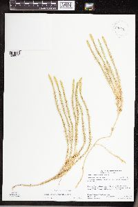 Lycopodium canadense NULL 930616[1339819]Gerdes, Lynden B. 61422010-08-03 United States, Minnesota, Lake, Approximately 0.26 miles west of Rabbit Lake. SWSESENE of section;Superior National Forest;066N;06W;33, 48.1577778 -91.0988889 |
MIN:Plants | 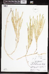 Lycopodium canadense NULL 930682[1339814]Gerdes, Lynden B. 60372010-06-25 United States, Minnesota, Cook, Banadad Lake area. Unnamed bog lake approximately 0.13 miles north of the western end of Banadad Lake. SENESWNE of section;Superior National Forest;064N;03W;10, 48.0413889 -90.6788889 |
MIN:Plants | 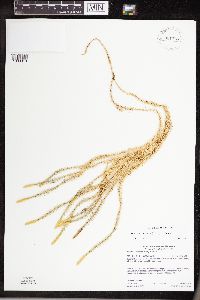 Lycopodium canadense NULL 931153[1339813]Gerdes, Lynden B. 62172010-09-14 United States, Minnesota, Cook, Approximately 6.70 miles NNW of Grand Marais, MN and 0.24 miles west of Binagami Lake. NWSWNWNE of section;Superior National Forest;062N;01E;19, 47.8463889 -90.3708333 |
MIN:Plants | 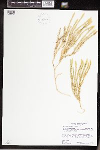 Lycopodium canadense NULL 931548[1339815]Gerdes, Lynden B. 63222011-07-30 United States, Minnesota, Lake, Approximately 10.85 miles north of Isabella, MN and 0.14 miles south of Brush Lake. NESESESE of section;Superior National Forest;061N;08W;08, 47.7736111 -91.3638889 |
MIN:Plants | 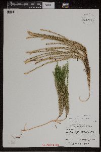 Lycopodium canadense NULL 938072[1311300]Perry, Ethan 110052011-09-08 United States, Minnesota, Saint Louis, loop of St Louis River about 4.4 miles SSE of Hoyt Lakes. NW, 47.4591667 -92.1113889 |
MIN:Plants | 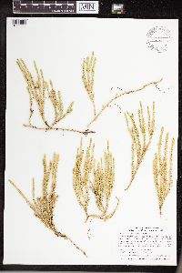 Lycopodium canadense NULL 74405[1339820]Smith, Welby R. 320512010-08-09 United States, Minnesota, Cook, About 1/2 mile north of the Brule River, between Vernon Lake and Swan Lake. NW1/4 of NW1/4 of section;Boundary Waters Canoe Area Wilderness / Superior National Forest;063N;02W;11, 47.9588889 -90.5516667 |
MIN:Plants | 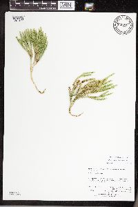 Lycopodium canadense Nessel 943291[1291417]Perry, Ethan F. 130152013-07-29 United States, Minnesota, Saint Louis, 3.8 miles west of Melrude., 47.23784 -92.49595 |
MIN:Plants | 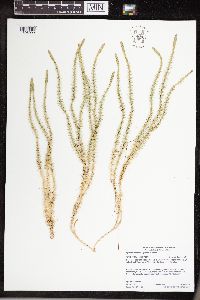 Lycopodium canadense Nessel 958862[1305099]Gerdes, Lynden B. 70712014-06-26 United States, Minnesota, Saint Louis, Superior National Forest, Knute Lake area, BWCAW. Approximately 2.84 miles SE of Crane Lake, MN and 0.10 miles west of the lake., 48.24944444 -92.43222222 |
MIN:Plants | 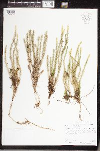 Lycopodium canadense Nessel 960870[1329780]Perry, Ethan F. 170602017-08-20 United States, Minnesota, Koochiching, 9.0 miles southeast of Margie., 48.02 -93.78 |
MIN:Plants | 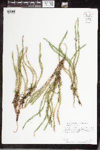 Lycopodium canadense Nessel 960832[1329732]Perry, Ethan F. 180262018-08-09 United States, Minnesota, Koochiching, 17.5 miles southeast of Big Falls, 0.75 miles southwest of Little Fork River., 48.12 -93.45 |
MIN:Plants | 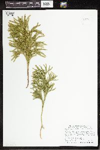 936106[1341149]Smith, Welby R. 324982011-06-09 United States, Minnesota, Sherburne, on the west side of Zimmerman. SE of SE of section;Fremont State Wildlife Management Area;034N;26W;18, 45.43 -93.6166106 |
MIN:Plants | 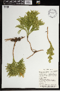 Dendrolycopodium hickeyi (W.H. Wagner, Beitel & R.C. Moran) A. Haines 0967466[1368041]T. J. S. Whitfeld 21242019-06-16 United States, Minnesota, Lake, Boundary Waters Canoe Area Wilderness, 50 m from south shore of Insula Lake, in area burned in 2011 Pagami Creek Fire, 47.89895 -91.281958, 460m |
MIN:Plants | 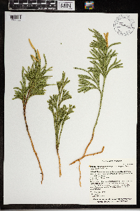 Dendrolycopodium hickeyi (W.H. Wagner, Beitel & R.C. Moran) A. Haines 968023[1368586]T. J. S. Whitfeld 2207b2019-06-19 United States, Minnesota, Lake, Boundary Waters Canoe Area Wilderness, along north shoreline of Fish Dance Lake, 47.915667 -91.199361, 474m |
MIN:Plants | 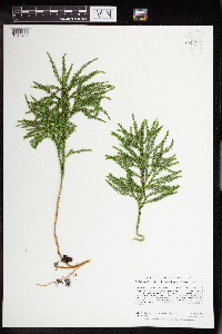 Dendrolycopodium hickeyi (W.H. Wagner, Beitel & R.C. Moran) A. Haines 962777[1346402]Dahlberg, Nathan B. NBD882018-08-01 United States, Minnesota, Cass, 0.81mi south of hwy 2; 169m west of National Forest rd 206; 1.36mi southeast of Ryan Village., 47.34 -94.25 |
MIN:Plants | 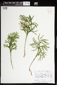 Dendrolycopodium hickeyi (W.H. Wagner, Beitel & R.C. Moran) A. Haines 962773[1346398]Dahlberg, Nathan B. NBD802018-06-26 United States, Minnesota, Saint Louis, County tax forfeit, 0.82mi east of Elliot Lake Rd, 1.36mi southeast of Elliot Lake; 1.60mi south of Water Hen Creek., 47.3 -92.41 |
MIN:Plants | 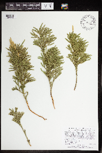 Dendrolycopodium hickeyi (W.H. Wagner, Beitel & R.C. Moran) A. Haines 965524[1356391]Lee, Michael MDL54712010-09-10 United States, Minnesota, Cook, 48.0113017 -90.26690541, 631m |
MIN:Plants | 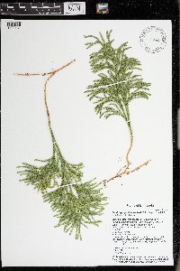 Dendrolycopodium hickeyi (W.H. Wagner, Beitel & R.C. Moran) A. Haines 976541[1402131]Timothy J. S. Whitfeld 29002021-07-15 United States, Minnesota, St. Louis, Voyageurs National Park, 0.5 miles east of O’Leary Lake, 1/10th mile south of Hammer Bay, 48.415765 -92.516725, 362m |
MIN:Plants | 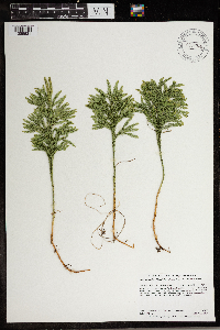 Dendrolycopodium hickeyi (W.H. Wagner, Beitel & R.C. Moran) A. Haines 966940[1359631]Dahlberg, Nathan B. NBD1682019-07-30 United States, Minnesota, St. Louis, Superior National Forest. 221m E of Sherwood Anderson Rd, 240m E of Dark Lake Rd, 7.11 miles from Kinney;, 47.62 -92.73 |
MIN:Plants | 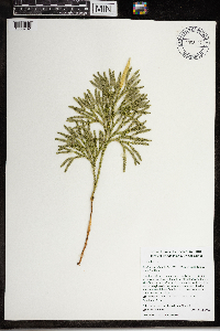 Dendrolycopodium hickeyi (W.H. Wagner, Beitel & R.C. Moran) A. Haines 968128[1368732]Jane Jacoby 22016-09-16 United States, Rhode Island, Providence, 177 Tower Hill Road, 1 mile east of West Wrentham Road., 41.9964917 -71.4444528 |
MIN:Plants | 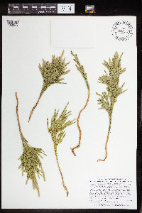 Dendrolycopodium hickeyi (W.H. Wagner, Beitel & R.C. Moran) A. Haines 965377[1356240]Lee, Michael MDL53182010-07-26 United States, Minnesota, Cook, Boundary Waters Canoe Area Wilderness, Rolling bedrock terrain east of Long Island Lake, 24 miles northwest of Grand Marais. T64N R3W NW1/4 of SW1/4 Sec. 22, N1/2 of NE1/4 of SW1/4 Sec. 22, 48.00936645 -90.70084235, 579m |
MIN:Plants | 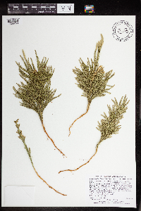 Dendrolycopodium hickeyi (W.H. Wagner, Beitel & R.C. Moran) A. Haines 965396[1356259]Lee, Michael MDL53382010-07-28 United States, Minnesota, Cook, Boundary Waters Canoe Area Wilderness, Rolling bedrock terrain south of the Banadad ski trail, west of Moon Lake, 23 miles north-northwest of Grand Marais. T64N R2W E1/2 of SE1/4 of NE1/4 Sec. 18, 48.02711746 -90.61820134, 588m |
MIN:Plants | 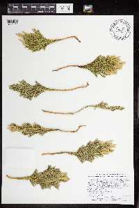 Dendrolycopodium hickeyi (W.H. Wagner, Beitel & R.C. Moran) A. Haines 965399[1356262]Lee, Michael MDL53412010-08-05 United States, Minnesota, Cook, Boundary Waters Canoe Area Wilderness, Strongly rolling to moderately rugged bedrock terrain southeast of Swan Lake, 15 miles north-northwest of Grand Marais. Local on the north side of Skidway Lake. T63N R1W W1/2 of NE1/4 of NE1/4 Sec. 18, 47.9445605 -90.49476964, 511m |
MIN:Plants | 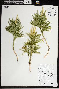 Dendrolycopodium hickeyi (W.H. Wagner, Beitel & R.C. Moran) A. Haines 968082[1368671]Timothy J. S. Whitfeld 14202016-08-17 United States, Rhode Island, Providence, 177 Tower Hill Road, 0.6 miles east of West Wrentham Road., 41.99632 -71.44208 |
MIN:Plants | 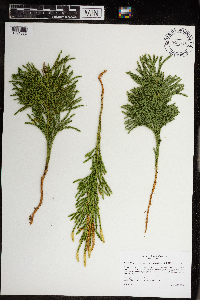 Dendrolycopodium hickeyi (W.H. Wagner, Beitel & R.C. Moran) A. Haines 968918[1391582]Milburn, Scott 212020-08-28 United States, Minnesota, Lake, Located 2.02km due east of Birch Lake., 47.769024 -91.724884 |
MIN:Plants |  Dendrolycopodium hickeyi (W.H. Wagner, Beitel & R.C. Moran) A. Haines 971155[1394624]Smith, Welby R WRS361232018-10-19 United States, Minnesota, Pine, St. Croix State Park, about 30 km (19 miles) east of Hinckley at a heading of 97 degrees., 45.98205 -92.5572167 |
MIN:Plants |  Dendrolycopodium hickeyi (W.H. Wagner, Beitel & R.C. Moran) A. Haines 973467[1397021]Lee, Michael MDL57552011-09-10 United States, Minnesota, Lake, Boundary Waters Canoe Area Wilderness; Rugged bedrock terrain along the Jackfish River southeast of Thursday Bay, Crooked Lake, 18 miles north-northeast of Ely., 48.15991437 -91.74079701, 424m |
MIN:Plants |  Dendrolycopodium hickeyi (W.H. Wagner, Beitel & R.C. Moran) A. Haines 973466[1397020]Lee, Michael MDL56182011-06-28 United States, Minnesota, Lake, Rugged bedrock terrain south of the Fernberg Road, along the upper reaches of Madden Creek, 12 miles east-northeast of Ely., 47.95204007 -91.59497736, 463m |
MIN:Plants |  Dendrolycopodium hickeyi (W.H. Wagner, Beitel & R.C. Moran) A. Haines 973465[1397019]Lee, Michael MDL56322011-06-29 United States, Minnesota, Lake, Rugged bedrock terrain south of the Fernberg Road, along Madden Creek 10 miles east-northeast of Ely., 47.93949012 -91.64071089, 431m |
MIN:Plants | 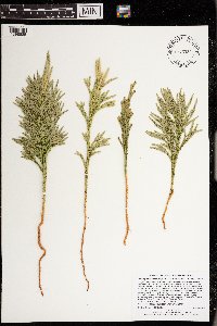 Dendrolycopodium hickeyi (W.H. Wagner, Beitel & R.C. Moran) A. Haines 973332[1398885]Lee, Michael MDL56792011-08-10 United States, Minnesota, Lake, Rugged bedrock terrain in the White Hills, seven miles north-northeast of Ely. Uncommon and local near the eastern shore of Hawks Nest Lake., 47.99273998 -91.79060487, 425m |
MIN:Plants | 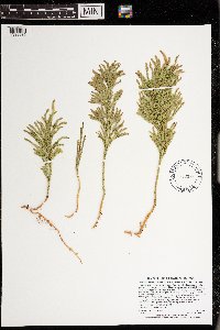 Dendrolycopodium hickeyi (W.H. Wagner, Beitel & R.C. Moran) A. Haines 973382[1398935]Lee, Michael MDL59342012-07-01 United States, Minnesota, Lake, Boundary Waters Canoe Area Wilderness; Fairly rugged bedrock terrain 11 miles northeast of Ely; on a ridge south of Ella Hall Lake., 47.9788841992 -91.6454848407, 436m |
MIN:Plants | 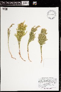 Dendrolycopodium hickeyi (W.H. Wagner, Beitel & R.C. Moran) A. Haines 973383[1398936]Lee, Michael MDL60172012-07-20 United States, Minnesota, Lake, Boundary Waters Canoe Area Wilderness; Rolling bedrock terrain on the northeast side of Wind Lake, 17 miles northeast of Ely., 48.0175981087 -91.5066901567, 411m |
MIN:Plants | 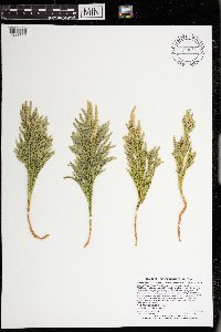 Dendrolycopodium hickeyi (W.H. Wagner, Beitel & R.C. Moran) A. Haines 973056[1398609]Lee, Michael MDL60502012-07-23 United States, Minnesota, Lake, Boundary Waters Canoe Area Wilderness; Rolling bedrock terrain northeast of Wind Lake, 18 miles northeast of Ely; along a small drainage ~1/3-mile from the lake., 48.0269497995 -91.5117986295, 413m |
MIN:Plants |  Dendrolycopodium hickeyi (W.H. Wagner, Beitel & R.C. Moran) A. Haines 973061[1398614]Lee, Michael MDL61122012-08-18 United States, Minnesota, Lake, Boundary Waters Canoe Area Wilderness; On the shores of Basswood Lake in fairly rugged bedrock terrain 14 miles northeast of Ely; between Pipestone and Jackfish Bays, 1/2-mile north of Lewis Narrows., 48.0632329432 -91.6629771449, 398m |
MIN:Plants |  Dendrolycopodium hickeyi (W.H. Wagner, Beitel & R.C. Moran) A. Haines 973350[1398903]Lee, Michael MDL61842012-09-12 United States, Minnesota, Lake, Boundary Waters Canoe Area Wilderness; Along the shores of Fall Lake in rolling bedrock terrain seven miles northeast of Ely; on the eastern portion of Mile Island, near campsite #2., 47.9641078983 -91.7109390762, 402m |
MIN:Plants |  Dendrolycopodium hickeyi (W.H. Wagner, Beitel & R.C. Moran) A. Haines 973064[1398617]Lee, Michael MDL61702012-08-30 United States, Minnesota, Morrison, Crane Meadows State Wildlife Management Area within Crane Meadows National Wildlife Refuge; Along the lower reaches of Buckman Creek on gently rolling sandy outwash five miles west of Buckman, eight miles southeast of Little Falls., 45.9094111467 -94.2029127605, 337m |
MIN:Plants |  Dendrolycopodium hickeyi (W.H. Wagner, Beitel & R.C. Moran) A. Haines 973062[1398615]Lee, Michael MDL58962012-06-14 United States, Minnesota, Lake, Rugged bedrock terrain north of the Fernberg Road, 15 miles east-southeast of Ely., 47.9744753767 -91.5312895271, 460m |
MIN:Plants | 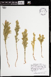 Dendrolycopodium hickeyi (W.H. Wagner, Beitel & R.C. Moran) A. Haines 973059[1398612]Lee, Michael MDL59272012-06-21 United States, Minnesota, Lake, Strongly rolling bedrock terrain north of the Fernberg Road, east of the Moose Lake Road, 16 miles east-northeast of Ely., 47.97119 -91.7086621576, 431m |
MIN:Plants | 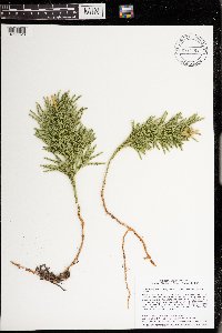 Dendrolycopodium hickeyi (W.H. Wagner, Beitel & R.C. Moran) A. Haines 974264[1396628]Smith, Welby R WRS366042019-10-25 United States, Minnesota, Sherburne, Sand Dune State Forest, about 7.5 km (4.6 miles) southwest of the approximate center of Zimmerman., 45.38955 -93.64756 |
MIN:Plants | 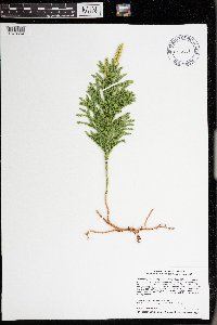 Dendrolycopodium hickeyi (W.H. Wagner, Beitel & R.C. Moran) A. Haines 976111[1373664]Smith, Welby R WRS368072020-08-12 United States, Minnesota, St. Louis, About 3.3 km (2 miles) west of the edge of Hibbing. In an abandoned iron ore mine site. Habitat left to natural recovery for perhaps 50+ years., 47.41787 -92.99126 |
MIN:Plants | 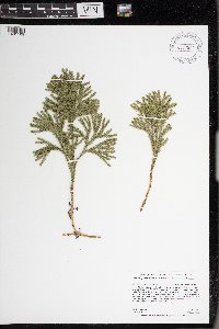 Dendrolycopodium hickeyi (W.H. Wagner, Beitel & R.C. Moran) A. Haines 977523[1401109]Anderson, Derek S. 34742021-04-05 United States, Minnesota, Washington, Washington County Parks. About 8.5 km southwest of Scandia. About 1.6 km southeast of the intersection of Cty. Rd. 4 and Cty. Rd. 15 (Manning Ave.)., 45.18911 -92.86401 |
MIN:Plants |  Dendrolycopodium hickeyi (W.H. Wagner, Beitel & R.C. Moran) A. Haines 977631[1401219]Anderson, Derek S. 37542021-10-05 United States, Minnesota, Aitkin, Solana State Forest. About 5.3 km northeast of Dads Corner (intersection of State Hwy. 65 and Cty. Rd. 2). Approximately 500 m west of the end of East White Pine Forest Road., 46.36389 -93.20925 |
MIN:Plants |  Dendrolycopodium hickeyi (W.H. Wagner, Beitel & R.C. Moran) A. Haines 977599[1401187]Anderson, Derek S. 34552020-11-06 United States, Minnesota, Pine, Nemadji State Forest. About 12.2 km northwest of Cloverton. On the Park Truck Trail, about 8 km west of the intersection with the Gandy Dancer Trail., 46.26004 -92.40136 |
MIN:Plants |  Dendrolycopodium hickeyi (W.H. Wagner, Beitel & R.C. Moran) A. Haines 977602[1401190]Anderson, Derek S. 34582020-11-06 United States, Minnesota, Pine, Nemadji State Forest. About 14.5 km northwest of Cloverton. On the Park Truck Trail, about 11 km west of the intersection with the Gandy Dancer Trail., 46.28236 -92.40294 |
MIN:Plants |  Dendrolycopodium hickeyi (W.H. Wagner, Beitel & R.C. Moran) A. Haines 977525[1401111]Anderson, Derek S. 34722021-03-28 United States, Minnesota, Pine, Chengwatana State Forest. About 14 km east of Pine City. About 1.2 km north-northwest of the intersection of St. Croix Rd. (Cty. Rd. 118) and the state forest campground road. North of the Snake River., 45.82761 -92.78094 |
MIN:Plants | 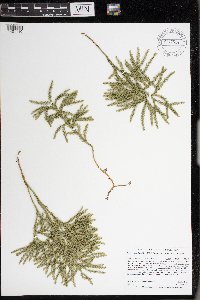 Dendrolycopodium hickeyi (W.H. Wagner, Beitel & R.C. Moran) A. Haines 977524[1401110]Anderson, Derek S. 34732021-03-28 United States, Minnesota, Pine, Chengwatana State Forest. About 14 km east of Pine City. About 1.6 km northwest of the intersection of St. Croix Rd. (Cty. Rd. 118) and the state forest campground road. North of the Snake River., 45.83069 -92.78393 |
MIN:Plants | 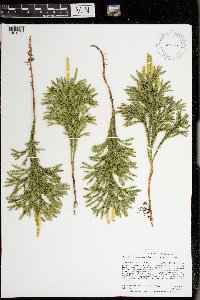 Dendrolycopodium hickeyi (W.H. Wagner, Beitel & R.C. Moran) A. Haines 977668[1401256]Anderson, Derek S. 37742021-10-29 United States, Minnesota, Carlton, Carlton County Forest. About 16 km southwest of Cromwell. On Sauvolz Rd, about 1.7 km west of the intersection with Erickson Rd., 46.57909 -93.0366 |
MIN:Plants | 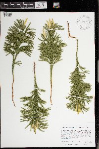 Dendrolycopodium hickeyi (W.H. Wagner, Beitel & R.C. Moran) A. Haines 977663[1401251]Anderson, Derek S. 37782021-10-29 United States, Minnesota, Carlton, Carlton County Forest. About 12.7 km southwest of Cromwell. Along trail, about 400 m northeast of Cty. Rd. 22. About 2 km southeast of intersection of Cty. Rd. 22 and Schoolhouse Rd., 46.62131 -93.0303 |
MIN:Plants | 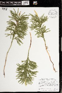 Dendrolycopodium hickeyi (W.H. Wagner, Beitel & R.C. Moran) A. Haines 977549[1401136]Anderson, Derek S. 34292020-10-08 United States, Minnesota, Chisago, Carlos Avery WMA. About 4 km east-northeast of Stacy. About 570 m southwest of the Cty. Rd. 19 bridge over the Sunrise River., 45.40398 -92.93521 |
MIN:Plants | 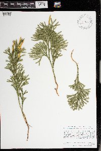 Dendrolycopodium hickeyi (W.H. Wagner, Beitel & R.C. Moran) A. Haines 977627[1401215]Anderson, Derek S. 34372020-10-15 United States, Minnesota, Chisago, Carlos Avery WMA. About 3.6 km northeast of Stacy. About 890 meters northeast of the intersection of Hemmingway Ave. and 320th St., 45.41742 -92.95123 |
MIN:Plants | 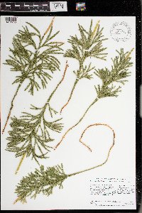 Dendrolycopodium hickeyi (W.H. Wagner, Beitel & R.C. Moran) A. Haines 977617[1401205]Anderson, Derek S. 34452020-10-15 United States, Minnesota, Chisago, Carlos Avery WMA. About 3 km north-northeast of Wyoming. About 980 meters southeast of the intersection of Foxhill Ave. and 287th St., 45.36132 -92.97679 |
MIN:Plants | 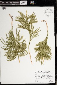 Dendrolycopodium hickeyi (W.H. Wagner, Beitel & R.C. Moran) A. Haines 977535[1401122]Anderson, Derek S. 34632021-03-13 United States, Minnesota, Chisago, Carlos Avery Wildlife Management Area: Sunrise Unit. About 4.6 km northeast of Stacy. About 180 m south-southeast of the parking lot on County Road 18 (870 m east of the intersection of Hemingway Ave. and Cty. Rd. 18)., 45.42844 -92.94654 |
MIN:Plants | 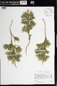 Dendrolycopodium hickeyi (W.H. Wagner, Beitel & R.C. Moran) A. Haines 977530[1401117]Anderson, Derek S. 34682021-03-13 United States, Minnesota, Chisago, Carlos Avery Wildlife Management Area: Sunrise Unit. About 4.3 km northeast of Stacy. About 660 m south of the parking lot on County Road 18 (870 m east of the intersection of Hemingway Ave. and Cty. Rd. 18)., 45.42405 -92.94716 |
MIN:Plants | 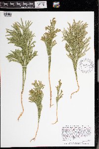 Dendrolycopodium hickeyi (W.H. Wagner, Beitel & R.C. Moran) A. Haines 977315[1402899]Lee, Michael MDL66642014-08-07 United States, Minnesota, Lake of the Woods, Red Lake Reservation. Extensive peatland complex between the North Branch of the Rapid River and Gustafson's Camp, 20 miles southwest of Baudette., 48.49696460234 -94.88664176309, 58m |
MIN:Plants | 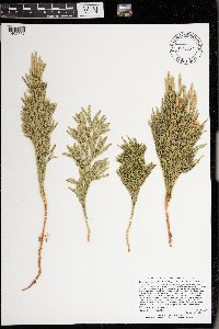 Dendrolycopodium hickeyi (W.H. Wagner, Beitel & R.C. Moran) A. Haines 976957[1402537]Lee, Michael MDL63152013-07-26 United States, Minnesota, Lake, Boundary Waters Canoe Area Wilderness. Fairly rugged bedrock terrain on the north side of Jackfish Bay, Basswood Lake, 12 miles north-northeast of Ely., 48.05808357 -91.7399327, 399m |
MIN:Plants | 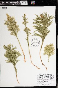 Dendrolycopodium hickeyi (W.H. Wagner, Beitel & R.C. Moran) A. Haines 976958[1402538]Lee, Michael MDL63782013-08-22 United States, Minnesota, Lake, Boundary Waters Canoe Area Wilderness. Rugged bedrock terrain on the large peninsula in Basswood Lake known as United States Point, 17 miles northeast of Ely., 48.0833151 -91.60176363, 418m |
MIN:Plants | 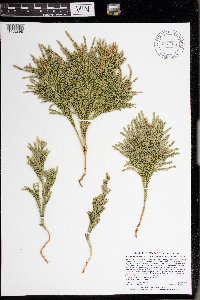 Dendrolycopodium hickeyi (W.H. Wagner, Beitel & R.C. Moran) A. Haines 977314[1402898]Lee, Michael MDL66892014-08-23 United States, Minnesota, St. Louis, Boundary Waters Canoe Area Wilderness. Strongly rolling bedrock terrain north of Fourtown Lake, 15 miles north of Ely, just inland from the south shore of Bullet Lake., 48.12750372193 -91.80537707677, 107m |
MIN:Plants | 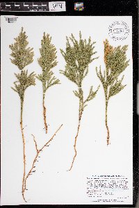 Dendrolycopodium hickeyi (W.H. Wagner, Beitel & R.C. Moran) A. Haines 977304[1402888]Lee, Michael MDL65842014-07-24 United States, Minnesota, St. Louis, Purvis-Ober Scientific and Natural Area. Rolling to fairly rugged morainal terrain north of the Beaver River, between Highway 169 and Bear Island Lake, eight miles southwest of Ely, on the eastern shore of Purvis Lake., 47.82455617107 -92.00388393646, 152m |
MIN:Plants | 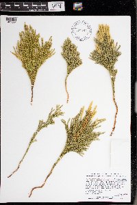 Dendrolycopodium hickeyi (W.H. Wagner, Beitel & R.C. Moran) A. Haines 977313[1402897]Lee, Michael MDL67482014-09-23 United States, Minnesota, St. Louis, Strongly rolling forested terrain west of Ash Lake, eight miles north-northeast of the town of Nett Lake, 14 miles northwest of Orr., 48.21693075397 -93.02751667229, 104m |
MIN:Plants | 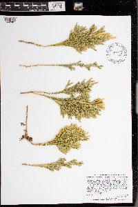 Dendrolycopodium hickeyi (W.H. Wagner, Beitel & R.C. Moran) A. Haines 977303[1402887]Lee, Michael MDL67612014-09-24 United States, Minnesota, St. Louis, Strongly rolling forested terrain west of Ash Lake, eight miles north-northeast of the town of Nett Lake, 14 miles northwest of Orr., 48.20416306122 -93.05559839622, 116m |
MIN:Plants |  Spinulum annotinum NULL 936343[1339780]Smith, Welby R. 329382011-06-27 United States, Minnesota, Koochiching, about 22 miles west of Big Falls. SE of SE of section;Pine Island State Forest;154N;28W;07, 48.1655833 -94.2751333 |
MIN:Plants | 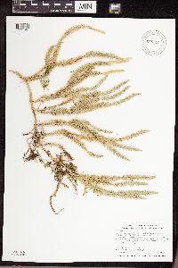 Spinulum annotinum (L.) A. Haines 948370[1292546]Smith, Welby R. 341432012-08-09 United States, Minnesota, Koochiching, Lake Agassiz Peatland National Natural Landmark, about 20 miles (32 km) southeast of Big Falls.; T064N R25W sec24, 48.0193833 -93.4730167 |
MIN:Plants | 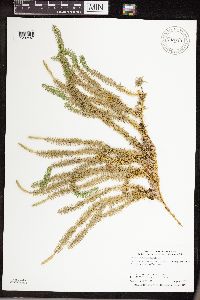 Spinulum annotinum (L.) A. Haines 948329[1292487]Smith, Welby R. WRS341032012-08-06 United States, Minnesota, Koochiching, Pine Island State Forest, about 24 miles (38.6 km) northeast of Waskish.; T157N R27W sec28, 48.38855 -94.1208 |
MIN:Plants | Spinulum annotinum (L.) A. Haines 962039[1322894]Smith, Welby 310422008-07-24 United States, Minnesota, Saint louis, Boundary Waters Canoe Area Wilderness / Superior National Forest. St. Louis County...About 0.75 miles west of Fourtown Lake in the Boundary Waters Canoe Area Wilderness, Superior National Forest...T 65N R 12W SW1/4 of SW1/4 of Sec 36. 065N 12W 36, 48.0669444 -91.8177778 |
MIN:Plants | 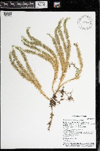 Spinulum annotinum (L.) A. Haines 976528[1402118]Timothy J. S. Whitfeld 28552021-07-14 United States, Minnesota, St. Louis, Voyageurs National Park, Sand Point Lake, area around campsite S7 Granite Cliffs South, 48.399796 -92.478801, 350m |
MIN:Plants | 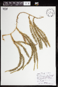 Spinulum annotinum (L.) A. Haines 965402[1356265]Lee, Michael MDL53452010-08-05 United States, Minnesota, Cook, Boundary Waters Canoe Area Wilderness, Rolling to fairly rugged bedrock terrain between Swan and Bower Trout lakes, 15 miles north-northwest of Grand Marais. T63N R1W SE1/4 of SW1/4 of SW1/4 Sec. 8, NE1/4 of NW1/4 of NW1/4 Sec. 17, 47.94684858 -90.48460071, 512m |
MIN:Plants | 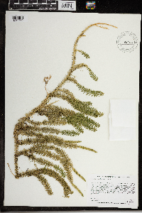 Spinulum annotinum (L.) A. Haines 967203[1359862]Rowe, Erika R. ERR6742010-07-14 United States, Minnesota, Beltrami, Island in the middle of Puposky Lake; 1.8 miles west-northwest of Puposky., 47.69 -94.94 |
MIN:Plants | 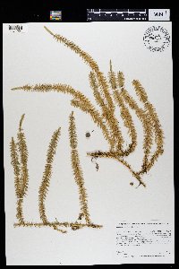 Spinulum annotinum (L.) A. Haines 969385[1371004]Rowe, Erika R. ERR8302012-06-25 United States, Minnesota, Lake of the Woods, 48.54 -94.96 |
MIN:Plants | Spinulum annotinum (L.) A. Haines []Timothy J. S. Whitfeld 34212022-07-20 United States, Minnesota, Saint louis, Sax-Zim Bog area, Winterberry Bog, 0.15 miles northwest of intersection of Hwy 52 (Arkola Road) and Hwy 221, 47.169848 -92.539005, 387m |
MIN:Plants | 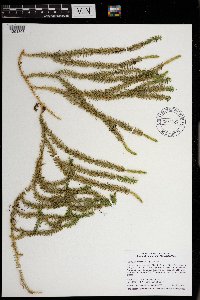 Spinulum annotinum (L.) A. Haines 970825[1394306]Smith, Welby R WRS357722017-07-26 United States, Minnesota, Pine, On the west side of Kettle River in Banning State Park, about 1 km (0.6 mile) NE of the approximate center of Sandstone., 46.1382222 -92.8597222 |
MIN:Plants | 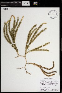 Spinulum annotinum (L.) A. Haines 970909[1394377]Smith, Welby R WRS358552017-11-16 United States, Minnesota, Anoka, Boot Lake State Scientific and Natural Area, about 6.8 km (4.2 miles) E-NE of East Bethel at a heading of 70 degrees., 45.3395667 -93.1204167 |
MIN:Plants | 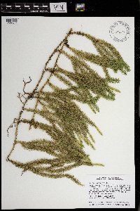 Spinulum annotinum (L.) A. Haines 971148[1394617]Smith, Welby R WRS361142018-09-17 United States, Minnesota, Lake, Superior National Forest, about 22.3 km (13.9 miles) NE of Isabella at a heading of 45 degrees. Just a few meters south of Lake 29 Road., 47.7596167 -91.1441167 |
MIN:Plants | 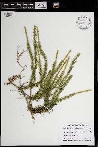 Spinulum annotinum (L.) A. Haines 971159[1394628]Smith, Welby R WRS361272018-10-23 United States, Minnesota, Carlton, Cloquet Forest Experiment Center, about 7 km (4.4 miles) west of the approximate center of the town of Cloquet., 46.70485 -92.5356667 |
MIN:Plants | 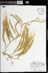 Spinulum annotinum (L.) A. Haines 973458[1397012]Lee, Michael MDL57802011-09-13 United States, Minnesota, Lake, Boundary Waters Canoe Area Wilderness; Strongly rolling bedrock terrain northeast of Jackfish Lake, 18 miles north-northeast of Ely, on the granitic ridge between Circle and Wabosons Lakes., 48.14845191 -91.7188132, 411m |
MIN:Plants | 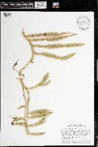 Spinulum annotinum (L.) A. Haines 974414[1396778]Smith, Welby R WRS361932019-06-16 United States, Minnesota, Lake, In the Boundary Waters Canoe Area Wilderness, Superior National Forest. About 42 km (26 miles) nearly due east of the approximate center of Ely. On an island in Insula Lake (unburned by the Pagami Creek Fire of 2011)., 47.91084 -91.28675 |
MIN:Plants | 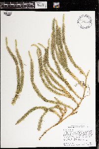 Spinulum annotinum (L.) A. Haines 974263[1396627]Smith, Welby R WRS365812019-09-24 United States, Minnesota, Carlton, University of Minnesota Cloquet Forestry Experiment Station, about 7 km (4.3 miles) west of the approximate center of Cloquet., 46.707169 -92.53564 |
MIN:Plants | 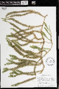 Spinulum annotinum (L.) A. Haines 976071[1373624]Smith, Welby R WRS367652020-07-13 United States, Minnesota, Itasca, Chippewa National Forest, about 21 km (13 miles) northwest of the town of Deer River., 47.469724 -93.982933 |
MIN:Plants | 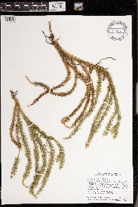 Spinulum annotinum (L.) A. Haines 976190[1373742]Smith, Welby R WRS369352020-08-27 United States, Minnesota, Pine, At the southwest corner of Dago Lake; about 3.7 km (2.3 miles) southeast of the town of Sturgeon Lake., 46.3533 -92.79713 |
MIN:Plants | 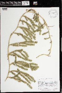 Spinulum annotinum (L.) A. Haines 977632[1401220]Anderson, Derek S. 37532021-10-05 United States, Minnesota, Aitkin, Solana State Forest. About 5.3 km northeast of Dads Corner (intersection of State Hwy. 65 and Cty. Rd. 2). Approximately 500 m west of the end of East White Pine Forest Road., 46.36389 -93.20925 |
MIN:Plants | 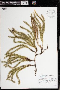 Spinulum annotinum (L.) A. Haines 977611[1401199]Anderson, Derek S. 34532020-11-06 United States, Minnesota, Pine, Nemadji State Forest. About 10.7 km northwest of Cloverton. On the Park Truck Trail, about 6.3 km west of the intersection with the Gandy Dancer Trail., 46.25129 -92.38888 |
MIN:Plants | 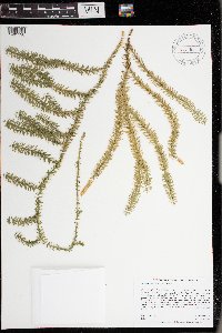 Spinulum annotinum (L.) A. Haines 977610[1401198]Anderson, Derek S. 34592020-11-06 United States, Minnesota, Pine, Nemadji State Forest. About 14.5 km northwest of Cloverton. On the Park Truck Trail, about 11 km west of the intersection with the Gandy Dancer Trail., 46.28244 -92.40231 |
MIN:Plants | 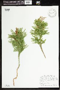 Dendrolycopodium dendroideum (Michx.) A. Haines 948371[1292545]Smith, Welby R. 341442012-08-09 United States, Minnesota, Koochiching, Lake Agassiz Peatland National Natural Landmark, about 20 miles (32 km) southeast of Big Falls.; T064N R25W sec24, 48.0193833 -93.4730167 |
MIN:Plants | 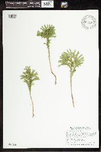 Dendrolycopodium dendroideum (Michx.) A. Haines 941710[1296886]Smith, Welby R. 303762007-07-17 United States, Minnesota, Aitkin |
MIN:Plants | 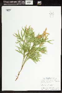 Dendrolycopodium dendroideum (Michx.) A. Haines 952122[1297221]Smith, Welby R. 349892014-06-25 United States, Minnesota, Saint Louis |
MIN:Plants | 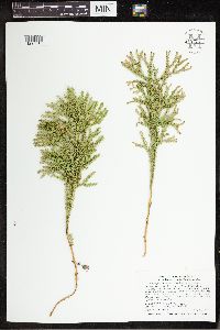 Dendrolycopodium dendroideum (Michx.) A. Haines 949721[1297318]Smith, Welby R. 33584 United States, Minnesota, Dakota |
MIN:Plants | 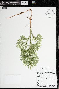 Dendrolycopodium dendroideum (Michx.) A. Haines 976527[1402117]Timothy J. S. Whitfeld 28562021-07-14 United States, Minnesota, St. Louis, Voyageurs National Park, Sand Point Lake, area around campsite S7 Granite Cliffs South, 48.399796 -92.478801, 350m |
MIN:Plants | 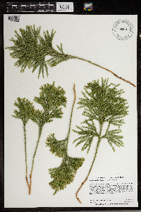 Dendrolycopodium dendroideum (Michx.) A. Haines 966814[1359503]Anderson, Derek S. 27892018-06-21 United States, Minnesota, Chisago, Lawrence Creek SNA. About 4 km southwest of Taylors Falls. Parking lot located off Unity Ave. approximately 200 meters south of U.S. Hwy. 8, 45.38 -92.69 |
MIN:Plants |  Dendrolycopodium dendroideum (Michx.) A. Haines 967009[1359705]Bosacker, Laura E. LEB182017-09-06 United States, Minnesota, St. Louis, 48.23 -92.98, 450m |
MIN:Plants |  Dendrolycopodium dendroideum (Michx.) A. Haines 967196[1359855]Rowe, Erika R. ERR6672010-06-23 United States, Minnesota, Beltrami, 400 meters east of County Hwy 5; 2 miles south of Pinewood., 47.57 -95.12 |
MIN:Plants |  Dendrolycopodium dendroideum (Michx.) A. Haines 968968[1391602]Milburn, Scott 262020-09-01 United States, Minnesota, Lake, Located 2.26km due east of Birch Lake., 47.777284 -91.7317 |
MIN:Plants |  Dendrolycopodium dendroideum (Michx.) A. Haines 969389[1371008]Rowe, Erika R. ERR8272012-06-30 United States, Minnesota, Lake of the Woods, Beltrami Island State Forest. 2 miles north of Faunce-Butterfield Forest Rd.; 6.65 miles east-northeast of Norris Camp Wildlife Headquarters., 48.62 -95.04 |
MIN:Plants | 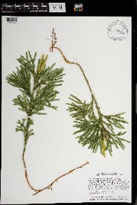 Dendrolycopodium dendroideum (Michx.) A. Haines 970899[1394367]Smith, Welby R WRS358452017-10-04 United States, Minnesota, Isanti, Twin Lakes State Scientific and Natural Area, about 7.7 km (4.8 miles) SW of North Branch at a heading of 215 degrees., 45.4529667 -93.0486833 |
MIN:Plants | 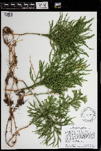 Dendrolycopodium dendroideum (Michx.) A. Haines 971152[1394621]Smith, Welby R WRS361182018-09-28 United States, Minnesota, Isanti, Twin Lakes State Scientific and Natural Area, about 7.7 km (4.8 miles) SW of North Branch at a heading of 215 degrees., 45.4529667 -93.0486833 |
MIN:Plants | 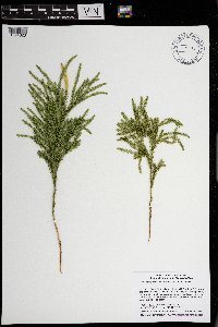 Dendrolycopodium dendroideum (Michx.) A. Haines 971154[1394623]Smith, Welby R WRS361202018-10-19 United States, Minnesota, Pine, St. Croix State Park, about 20 km (12.5 miles) SE of the approximate center of Hinkley at a heading of 110 degrees., 45.9505333 -92.6956 |
MIN:Plants | 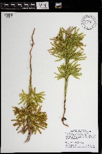 Dendrolycopodium dendroideum (Michx.) A. Haines 971160[1394629]Smith, Welby R WRS361282018-10-23 United States, Minnesota, Carlton, Cloquet Forest Experiment Center, about 7 km (4.4 miles) west of the approximate center of the town of Cloquet., 46.70485 -92.5356667 |
MIN:Plants | 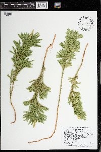 Dendrolycopodium dendroideum (Michx.) A. Haines 973468[1397022]Lee, Michael MDL57812011-09-13 United States, Minnesota, Lake, Boundary Waters Canoe Area Wilderness; Strongly rolling bedrock terrain northeast of Jackfish Lake, 18 miles north-northeast of Ely, on the granitic ridge between Circle and Wabosons Lakes., 48.14845191 -91.7188132, 411m |
MIN:Plants | 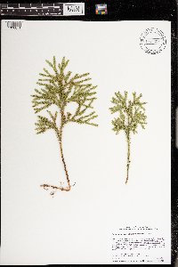 Dendrolycopodium dendroideum (Michx.) A. Haines 974307[1396671]Smith, Welby R WRS361642019-05-30 United States, Minnesota, Olmsted, Gorden Yeager State Wildlife Management Area, about 4 km (2.5 miles) east of the approximate center of downtown Rochester at 78 degrees., 44.02843 -92.41725 |
MIN:Plants | 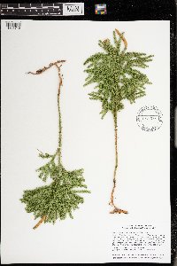 Dendrolycopodium dendroideum (Michx.) A. Haines 974376[1396740]Smith, Welby R WRS362022019-06-16 United States, Minnesota, Lake, In the Boundary Waters Canoe Area Wilderness, Superior National Forest. About 44 km (27 miles) east of the approximate center of Ely at 85 degrees. Upland habitat at the north end of Insula Lake., 47.93541 -91.26816 |
MIN:Plants | 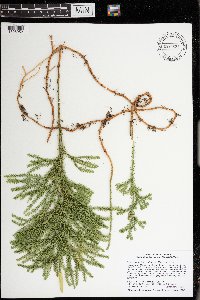 Dendrolycopodium dendroideum (Michx.) A. Haines 974623[1396952]Smith, Welby R WRS365802019-09-24 United States, Minnesota, Carlton, University of Minnesota Cloquet Forestry Experiment Station, about 7 km (4.3 miles) west of the approximate center of Cloquet., 46.707169 -92.53564 |
MIN:Plants | 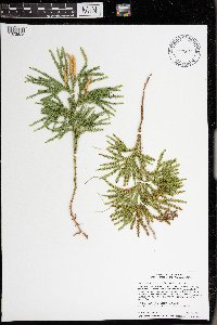 Dendrolycopodium dendroideum (Michx.) A. Haines 976072[1373625]Smith, Welby R WRS367642020-07-13 United States, Minnesota, Itasca, Chippewa National Forest, about 21 km (13 miles) northwest of the town of Deer River., 47.469724 -93.982933 |
MIN:Plants | 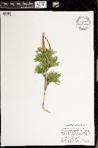 Dendrolycopodium dendroideum (Michx.) A. Haines 976191[1373743]Smith, Welby R WRS369362020-08-27 United States, Minnesota, Pine, At the southwest corner of Dago Lake; about 3.7 km (2.3 miles) southeast of the town of Sturgeon Lake., 46.3533 -92.79713 |
Google Map
Google Maps is a web mapping service provided by Google that features a map that users can pan (by dragging the mouse) and zoom (by using the mouse wheel). Collection points are displayed as colored markers that when clicked on, displays the full information for that collection. When multiple species are queried (separated by semi-colons), different colored markers denote each individual species.