University of Minnesota
http://www.umn.edu/
612-625-5000
http://www.umn.edu/
612-625-5000
Minnesota Biodiversity Atlas
Bell Museum
Dataset: MIN-Plants
Taxa: Brassicaceae
Search Criteria: excluding cultivated/captive occurrences
Bell Museum plants | |
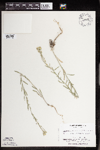
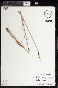
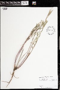
MIN:Plants | Erysimum inconspicuum (S. Watson) MacMillan 550710[]Cotter, Shirley 18921951-06-10 United States, Minnesota, Yellow Medicine, W Granite Falls;;N;;, 44.809958 -95.545575 |
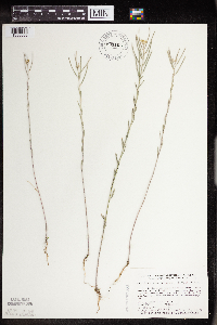
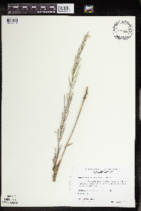
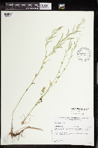
MIN:Plants | Erysimum inconspicuum (S. Watson) MacMillan 550711[]Cotter Tucker, Shirley 41751957-06-30 United States, Minnesota, Polk, 4 mi W, 1 mi S of Fertile;;N;;, 47.52157 -96.366093 |
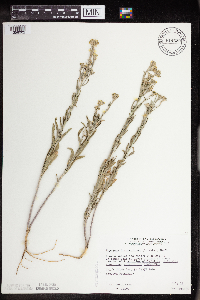
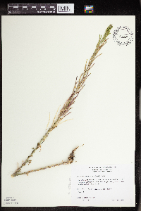
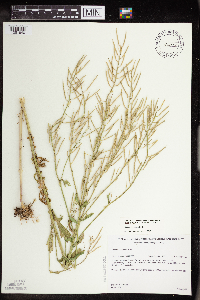
MIN:Plants | Erysimum inconspicuum (S. Watson) MacMillan 550712[]Cotter Tucker, Shirley 41471957-06-23 United States, Minnesota, Clearwater, W end of Long Lake, ca. 4 mi W of Itasca Park;;;;, 47.276488 -95.298664 |
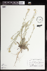
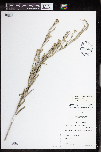
MIN:Plants | Erysimum inconspicuum (S. Watson) MacMillan 553874[]Moore, John 228141956-06-11 United States, Minnesota, Clay, Clay County...Along the S side of the rail road 2 mi S of Glyndon;;139N;46W;07, 46.869992 -96.536757 |
MIN:Plants | Erysimum inconspicuum (S. Watson) MacMillan 565256[]Cotter Tucker, Shirley 41751957-06-30 United States, Minnesota, Polk, 4 mi W of Fertile, 1 mi S;;N;;, 47.52157 -96.366093 |
MIN:Plants | Erysimum inconspicuum (S. Watson) MacMillan 568523[]Moore, John 250641960-06-20 United States, Minnesota, Kittson, Near the river, 10 mi E of Hallock;;N;;, 48.775123 -96.749514 |
MIN:Plants | Erysimum inconspicuum (S. Watson) MacMillan 584537[]Ownbey, Gerald 35111963-06-27 United States, Minnesota, Clearwater, 0.3 mi N of Lake Itasca Post Office, at edge of gravel pit; T144N R36W SE1/4 Sec. 27;;144N;36W;27, 47.26071 -95.222871 |
MIN:Plants | Erysimum inconspicuum (S. Watson) MacMillan 585696[]Moore, John 260981962-06-29 United States, Minnesota, Kittson, 4 mi N of Halma;;N;;, 48.718977 -96.600321 |
MIN:Plants | Erysimum inconspicuum (S. Watson) MacMillan 592235[]Westkaemper, Remberta s.n.1962-07-00 United States, Minnesota, Stearns, Stearns Co. St. Joseph, rr tracks;;124N;29W;, 45.543642 -94.322053 |
MIN:Plants | Erysimum inconspicuum (S. Watson) MacMillan 594132[]Thorne, Robert 309001962-07-06 United States, Minnesota, Norman, Near gravel pit, Frenchman's Bluff, 4 mi ENE of Syre; S1/2 Sec. 18 T143N R13W;Frenchmans Bluff Scientific Natural Area;143N;13W;18, 47.201968 -96.183893 |
MIN:Plants | Erysimum inconspicuum (S. Watson) MacMillan 603353[]Morley, T. 12051967-07-16 United States, Minnesota, Redwood, Redwood County...Springdale Twp. T109N R39W NE1/4 NE1/4 Sec. 22;;109N;39W;22, 44.231809 -95.522873 |
MIN:Plants | Erysimum inconspicuum (S. Watson) MacMillan 607554[]Westkaemper, Remberta s.n.1965-07-05 United States, Minnesota, Stearns, Stearns Co. St. Joseph;;124N;29W;, 45.543642 -94.322053 |
MIN:Plants | Erysimum inconspicuum (S. Watson) MacMillan 614610[]Westkaemper, Remberta s.n.1969-06-00 United States, Minnesota, Stearns, Stearns Co. Melrose;;N;;, 45.674687 -94.807515 |
MIN:Plants | Erysimum inconspicuum (S. Watson) MacMillan 622322[]Westkaemper, Remberta s.n.1971-06-00 United States, Minnesota, Stearns, Stearns Co. St. Joseph;;124N;29W;, 45.543642 -94.322053 |
MIN:Plants | Erysimum inconspicuum (S. Watson) MacMillan 670134[]Westkaemper, Remberta s.n.1973-06-00 United States, Minnesota, Stearns, Stearns Co. SBC [St. Benedict's College] Woods, St. Joseph;;124N;29W;, 45.543642 -94.322053 |
MIN:Plants | Erysimum inconspicuum (S. Watson) MacMillan 670153[]Westkaemper, Remberta s.n.1973-06-00 United States, Minnesota, Stearns, Stearns Co. SBC [St. Benedict's College] Woods, St. Joseph;;124N;29W;, 45.543642 -94.322053 |
MIN:Plants | Erysimum inconspicuum (S. Watson) MacMillan 689906[]Ownbey, Gerald 57051977-07-27 United States, Minnesota, Norman, Minn. rte 113, 5 mi E of Syre; T143N R43W Sec. 29 NE1/4 NE1/4;;143N;43W;29, 47.173088 -96.162801 |
MIN:Plants | Erysimum inconspicuum (S. Watson) MacMillan 696594[]Smith, Welby 7561978-07-02 United States, Minnesota, Wright, Wright Co.; between Burlington tracks and co. hwy 75, ca. 3 mi NW of Monticello; T122N R25W N1/2 Sec. 32;;122N;25W;32, 45.331907 -93.860001 |
MIN:Plants | Erysimum inconspicuum (S. Watson) MacMillan 701556[]Ownbey, Gerald 62281979-06-13 United States, Minnesota, Washington, Washington Co.; Bluffs of the Mississippi River; T 26N R 20W W1/2 Sec. 7;;026N;20W;7, 44.754529 -92.851477 |
MIN:Plants | Erysimum inconspicuum (S. Watson) MacMillan 715477[]Ottoson, S. 481979-06-27 United States, Minnesota, Clay, Blazing Star Prairie, 4 mi SE of Felton; NE1/4 Sec. 5 T141N R45W;Felton Prairie-Blazing Star Prairie Scientific Natural Area;141N;45W;5, 47.056714 -96.417356 |
MIN:Plants | Erysimum inconspicuum (S. Watson) MacMillan 717760[]Farrell, P. 841979-07-09 United States, Minnesota, Norman, Frenchman's Bluff, 2.5 mi N of Flom; frac. of Sec. 18 T143N R43W;Frenchmans Bluff Scientific Natural Area;143N;43W;18, 47.201968 -96.183893 |
MIN:Plants | Erysimum inconspicuum (S. Watson) MacMillan 720195[]Ottoson, S. 611979-06-25 United States, Minnesota, 2 miles southwest of Fertile.;Agassiz Dunes Scientific Natural Area;;;, 47.51564 -96.31032 |
MIN:Plants | Erysimum inconspicuum (S. Watson) MacMillan 721278[]Lustig, K. 5301979-06-25 United States, Minnesota, Sherburne, Clear Lake-Mississippi Scenic and Recreational River SNA, 12 mi SE of St. Cloud; SEc. 14, 22, 23, T34N R30W;Clear Lake Scientific Natural Area;034N;30W;, 45.446339 -94.043783 |
MIN:Plants | Erysimum inconspicuum (S. Watson) MacMillan 727417[]Ottoson, S. 901979-07-25 United States, Minnesota, Clay, Clay County Bicentennial Prairie, 4 mi SE of Felton; SW1/4 Sec. 5 T141N R45W;Felton Prairie-Bicentennial Prairie Scientific Natural Area;141N;45W;5, 47.056714 -96.417356 |
MIN:Plants | Erysimum inconspicuum (S. Watson) MacMillan 727427[]Ottoson, S. 431979-06-27 United States, Minnesota, Clay, Clay County Bicentennial Prairie, 4 mi SE of Felton; SW1/4 Sec. 5 T141N R45W;Felton Prairie-Bicentennial Prairie Scientific Natural Area;141N;45W;5, 47.056714 -96.417356 |
MIN:Plants | Erysimum inconspicuum (S. Watson) MacMillan 734479[]Severson, M. 2601980-06-03 United States, Minnesota, Clay, Bluestem Prairie, 13 mi E of Moorhead; SW1/4 NE1/4 Sec. 15 T139N R46W;Bluestem Prairie Scientific Natural Area;139N;46W;15, 46.854948 -96.473403 |
MIN:Plants | Erysimum inconspicuum (S. Watson) MacMillan 734717[]Petron, T. 1101980-06-23 United States, Minnesota, Clay, Bluestem Prairie, 13 mi E of Moorhead; NW1/4 NE1/4 Sec. 22 T139N R46W;Bluestem Prairie Scientific Natural Area;139N;46W;22, 46.840462 -96.473451 |
MIN:Plants | Erysimum inconspicuum (S. Watson) MacMillan 743538[]Nietering, E. 1211982-06-22 United States, Minnesota, Yellow Medicine, Blue Devil Valley Scientific Natural Area. Yellow Medicine County ... On Granite outcrop, south of hwy 39 and about 3/8 mi west of intersection of hwy 23 and 67, Granite Falls; SW1/4 NE1/4 Sec. 4 T115N R39W. 115N 39W 4, 44.796844 -95.554369 |
MIN:Plants | Erysimum inconspicuum (S. Watson) MacMillan 753101[1356004]Boe, J. 19441983-07-01 United States, Minnesota, Kittson, Norway Dunes; SW1/4 SE1/4 Sec. 10 T160N R46W;Norway Dunes, The Nature Conservancy;160N;46W;10, 48.695736 -96.57277 |
MIN:Plants | Erysimum inconspicuum (S. Watson) MacMillan 758294[]Delaney, B. s.n.1982-06-17 United States, Minnesota, Anoka, Cedar Creek Natural History Area, near intersection of East Bethel Blvd. and co. rd 26, NW corner; SE1/4 SE1/4 Sec. 34;Cedar Creek National History Area;034N;23W;34, 45.392319 -93.193505 |
MIN:Plants | Erysimum inconspicuum (S. Watson) MacMillan 759134[]Smith, Welby 68531982-07-22 United States, Minnesota, Polk, Polk County...On the N side of co. hwy 45, about 12 mi ESE of Crookston...NW1/4 NW1/4 Sec. 19 T149N R44W;Pembina Trail Preserve Scientific Natural Area;149N;44W;19, 47.709227 -96.341088 |
MIN:Plants | Erysimum inconspicuum (S. Watson) MacMillan 764986[]Lugger, O. s.n.1890-06-01 United States, Minnesota, Nobles, Worthington;;N;;, 43.619964 -95.596398 |
MIN:Plants | Erysimum inconspicuum (S. Watson) MacMillan 795967[]Smith, Welby 114831986-05-24 United States, Minnesota, Scott, Minnesota Valley National Wildlife Refuge. Scott County...The Louisville Swamp area, in the Minnesota Valley National Wildlife Refuge, about 6 mi S of Shakopee; NW1/4 SW1/4 Sec. 28 T115N R23W. 115N 23W 28, 44.7355556 -93.5988889 |
MIN:Plants | Erysimum inconspicuum (S. Watson) MacMillan 795989[]Smith, Welby 117391986-06-12 United States, Minnesota, Lac Qui Parle, Antelope Hills, ca. 7.5 mi due W of Prividence; SW1/4 NE1/4 Sec. 27 T116N R45W;;116N;45W;27, 44.830555 -96.2616653 |
MIN:Plants | Erysimum inconspicuum (S. Watson) MacMillan 801155[1356005]Smith, Welby 105591985-06-29 United States, Minnesota, Dodge, Iron Horse Prairie Scientific Natural Area. Dodge County ... Iron Horse Prairie State Scientific and Natural Area, about 1.5 mi S of Hayfield ... NW1/4 SE1/4 Sec. 27 T105N R17W. 105N 17W 27, 43.8675003 -92.8486099 |
MIN:Plants | Erysimum inconspicuum (S. Watson) MacMillan 814620[1356002]Wheeler, Gerald 111301988-07-16 United States, Minnesota, Traverse, Browns Valley (NE side), W of rte 2; NW1/4 NW1/4 Sec. 34 T125N R49W (Folsom Twp.);;125N;49W;34, 45.593308 -96.813211 |
MIN:Plants | Erysimum inconspicuum (S. Watson) MacMillan 831850[]Sandberg, John s.n.1891-06-00 United States, Minnesota, Hennepin, Hennepin Co.;;N;;, 45.012622 -93.46588 |
MIN:Plants | Erysimum inconspicuum (S. Watson) MacMillan 837428[1356008]Smith, Welby 174901990-07-27 United States, Minnesota, Morrison, Camp Ripley Military Reservation. Camp Ripley Military Reservation Morrison Co. At the old Fort Ripley ruins. UTM: 393900E 5114300N T131N R29W SW1/4 of NE Camp Ripley Military Reservation Morrison Co. At the old Fort Ripley ruins. UTM: 393900E 5114300N T131N R29W SW1/4 of NE1/4 of Sec 7. 131N 29W 7, 46.172775 -94.381859 |
MIN:Plants | Erysimum inconspicuum (S. Watson) MacMillan 840527[1356003]Smith, Welby 136281987-07-30 United States, Minnesota, Washington, Grey Cloud Dunes Scientific Natural Area. Washington County...About 2 mi south of St. Paul Park...SW-facing terrace of the Mississippi River SW1/4 SW1/4 sec. 29, T 27N R 21W. 027N 21W 29, 44.7933333 -92.9625 |
MIN:Plants | Erysimum inconspicuum (S. Watson) MacMillan 477234[]Wheeler, Gerald 192441998-06-16 United States, Minnesota, Le Sueur, Le Sueur County ... Ca. 1.2 mi. S of Ottawa on Rte. 23; Ottawa Bluffs ... W1/2 NE1/4 Sec. 3 T110N R26W;Ottawa Bluffs, The Nature Conservancy;110n;26W;3, 44.362618 -93.939379 |
MIN:Plants | Erysimum inconspicuum (S. Watson) MacMillan 575257[]Garton, C. 89201961-07-24 Canada, Ontario, Rainy River, Rainy River District...The Ridge, 8 mi. N. of Rainy R. Town, H. 600, Wildland Reserve |
MIN:Plants | Erysimum inconspicuum (S. Watson) MacMillan 509734[1356010]Wheeler, Gerald 172801997-08-16 United States, Minnesota, Yellow Medicine, Yellow Medicine County ... Ca. 1.5 mi. NW of Granite Falls; E of Rte. 212 ... NE1/4 SW1/4 SE1/4 Sec. 29 T116N R39W;;116N;39W;29, 44.826175 -95.575365 |
MIN:Plants | Erysimum inconspicuum (S. Watson) MacMillan 273832[]Moore, John 1011921-06-00 United States, South Dakota, Brookings, Brookings;;;;, 44.31139 -96.79806 |
MIN:Plants | Erysimum inconspicuum (S. Watson) MacMillan 438110[]Cully, Anne; et al. sn1998-08-10 United States, Minnesota, Pipestone, Pipestone County, Pipestone National Monument UTM 0714399N 4876297E;Pipestone National Monument;106N;46W;01, 44.015848 -96.317669 |
MIN:Plants | Erysimum inconspicuum (S. Watson) MacMillan 914993[]Smith, Welby 226461993-07-01 United States, Minnesota, Otter Tail, Inspiration Peak Scenic Wayside Park. Otter Tail County ... Inspiration Peak State Wayside Park, about 12 miles west of Parkers Prairie ... T131N R39W SE1/4 of SW1/4 of Sec 22. 131N 39W 22, 46.1383333 -95.5736111 |
MIN:Plants | Erysimum inconspicuum (S. Watson) MacMillan 435335[1356009]Wheeler, Gerald 162471997-06-26 United States, Minnesota, Renville, Renville Co.; Ca. 10 mi. S of Renville; SE1/4 NE1/4 NW1/4 Sec. 30 T114N R36W (Flora 30);Town & Country County Park;114N;36W;30, 44.65436 -95.22432 |
MIN:Plants | Erysimum inconspicuum (S. Watson) MacMillan 436462[1356006]Cully, Anne; et al. s.n.1997-06-28 United States, Minnesota, Pipestone, UTM 071456N 4876879E;Pipestone National Monument;106N;46W;01, 44.013519 -96.324841 |
MIN:Plants | Erysimum inconspicuum (S. Watson) MacMillan []K.E. GW24912005-06-29 United States, Colorado, Gunnison, Bracken Creek, Kebler Pass Road, 38.851333 -107.106667, 3024m |
MIN:Plants | Erysimum inconspicuum (S. Watson) MacMillan 974689[1397456]Dunevitz, Hannah L. 4541991-08-08 United States, Minnesota, Goodhue, About 8 miles southeast of Hastings on Prairie Island. In pasture just east of floodplain forest on the east side of Upper Clear Lake., 44.66 -92.72 |
MIN:Plants | Boechera davidsonii (Greene) N.H. Holmgren 569513[]Mason, Herbert 120071938-07-25 United States, California, Tuolumne, Yosemtie National Park...Slopes of Mahan Peak...Tuolumne County;Yosemite National Park, 2591m |
MIN:Plants | Boechera microphylla (Nuttall) Dorn 117540[]Nelson, Aven; et al. 57261899-07-09 United States, Wyoming, Park, Yellowstone National Park...Yellowstone River near Junction Butte;Yellowstone National Park |
MIN:Plants | Cardamine microphylla M.F. Adams 403481[]Spetzman, L. 567 A1948-07-08 United States, Alaska, Arctic North Slope ... Lake Schrader;Arctic National Wildlife Refuge;;;, 69.4166667 -145, 914m |
MIN:Plants | Cardamine microphylla M.F. Adams 403479[]Spetzman, L. 8451948-07-26 United States, Alaska, Arctic North Slope...Sadlerochit River;Arctic National Wildlife Refuge;;;, 69.4166667 -149.1666667, 762m |
MIN:Plants | Cardamine microphylla M.F. Adams 403346[]Spetzman, L. 571 A1948-07-08 United States, Alaska, Arctic North Slope ... Lake Schrader;Arctic National Wildlife Refuge;;;, 69.4166667 -145, 914m |
MIN:Plants | Cardamine microphylla M.F. Adams 403573[]Spetzman, L. 8791948-07-28 United States, Alaska, Arctic North Slope...Sadlerochit River;Arctic National Wildlife Refuge;;;, 69.4166667 -149.1666667, 762m |
MIN:Plants | Parrya nudicaulis (L.) Regel 403741[]Spetzman, L. 7111948-07-14 United States, Alaska, Arctic North Slope ... Lake Peters;Arctic National Wildlife Refuge;;;, 69.3333333 -145, 1067m |
MIN:Plants | Parrya nudicaulis (L.) Regel 403801[]Spetzman, L. 8471948-07-26 United States, Alaska, Arctic North Slope...Sadlerochit River;Arctic National Wildlife Refuge;;;, 69.4166667 -149.1666667, 762m |
MIN:Plants | Parrya nudicaulis (L.) Regel 417231[]Kover, A.; et al. s.n.1950-07-28 United States, Alaska, Arctic North Slope...west side of eastern outlet of Canning River Estuary;Arctic National Wildlife Refuge;;;, 70.05 -145.5833333, 3m |
MIN:Plants | Parrya nudicaulis (L.) Regel 601164[]Munns, C. 4591966-06-23 United States, Alaska, Wonder Lake, McKinley National Park;Denali National Park;;;, 63.45884 -150.86412 |
MIN:Plants | Parrya nudicaulis (L.) Regel 548598[]Spetzman, L. 38911951-07-15 United States, Alaska, Arctic North Slope...Canning R. & Ignek Cr.;Arctic National Wildlife Refuge;;;, 69.5833333 -146.25, 305m |
MIN:Plants | Parrya nudicaulis (L.) Regel 417227[]Spetzman, L. 42371950-07-17 United States, Alaska, Arctic North Slope...Noatak & Kugururok R.;Noatak National Preserve;;;, 67.9666667 -161.9166667, 152m |
MIN:Plants | Parrya nudicaulis (L.) Regel 700236[]Glaser, Paul 353 b1972-08-02 United States, Alaska, Mt. McKinley National Park...SE1/4NW1/4Sec.16 T17S R16W, Mile 76, lateral moraine of Muldrow Glacier;Denali National Park;017S;16W;16 |
MIN:Plants | Parrya nudicaulis (L.) Regel 416996[]Spetzman, L. 37971950-07-04 United States, Alaska, Arctic North Slope...Kurupa Lake;Gates of the Arctic National Park;;;, 68.3666667 -154.6666667, 945m |
MIN:Plants | Parrya nudicaulis (L.) Regel 601163[]Munns, C. 4601966-06-27 United States, Alaska, Mile 56 - Park road. Mckinley National Park;Denali National Park |
MIN:Plants | Parrya nudicaulis (L.) Regel 409387[]Spetzman, L. 17271949-07-07 United States, Alaska, Arctic North Slope ... Anaktuvuk Pass;Gates of the Arctic National Park;;;, 68.2833333 -151.4166667, 914m |
MIN:Plants | Parrya nudicaulis (L.) Regel 403742[]Spetzman, L. 11971948-08-29 United States, Alaska, Arctic North Slope...Sadlerochit River;Arctic National Wildlife Refuge;;;, 69.6666667 -144.4166667, 305m |
MIN:Plants | Parrya nudicaulis (L.) Regel 700241[]Glaser, Paul 11972-06-28 United States, Alaska, Mt. McKinley National Park...Nw1/4NW1/4Sec.32 T16S R13W, Highway Pass;Denali National Park;016S;13W;32, 1158m |
MIN:Plants | Parrya nudicaulis (L.) Regel 403743[]Spetzman, L. 5061948-07-08 United States, Alaska, Arctic North Slope ... Lake Schrader;Arctic National Wildlife Refuge;;;, 69.4166667 -145, 914m |
MIN:Plants | Parrya nudicaulis (L.) Regel 700246[]Glaser, Paul 353 a1972-08-02 United States, Alaska, Mt. McKinley National Park...SE1/4NW1/4Sec.16 T17S R16W, Mile 76, lateral moraine of Muldrow Glacier;Denali National Park;017S;16W;16 |
MIN:Plants | Parrya nudicaulis (L.) Regel 409388[]Spetzman, L. 20181949-07-17 United States, Alaska, Arctic North Slope...Kanayut Lake;Gates of the Arctic National Park;;;, 68.3333333 -151, 914m |
MIN:Plants | Parrya nudicaulis (L.) Regel 456361[]Sills, Cynthia 005z1988-07-02 United States, Alaska, Kongakut River Delta. ;Arctic National Wildlife Refuge;005N;41E;16, 69.787124 -141.89777 |
MIN:Plants | Barbarea vulgaris W.T. Aiton 250338[]Waldron, Clarence 5221910-05-26 United States, North Dakota, Cass, Fargo. |
MIN:Plants | Barbarea vulgaris W.T. Aiton 432696[1351643]Gerdes, Lynden 35551999-07-10 United States, Minnesota, Cook, Superior National Forest. T65N R04W S26. Cook County...Superior National Forest. Old gravel pit/slash burning area; approximately .25 mile north of the Gunflint Trail (Cty. 12) & FR1347 junction; east off FR1347.. 065N 04W 26, 48.084497 -90.803753 |
MIN:Plants | Barbarea vulgaris W.T. Aiton 432860[]Cholewa, A. 25852006-06-10 United States, Minnesota, Anoka, Anoka County, City of Blaine, Baseball Complex on Paul Parkway. T31N R23W Sec 17 NW1/4;;031N;23W;17, 45.1754 -93.234994 |
MIN:Plants | Barbarea vulgaris W.T. Aiton 699737[]Ziegler, S.; et al. 12681975-06-17 United States, Wisconsin, La Crosse, LaCrosse Co.; Island 18; Mississippi River-mile #693.3; T15N R7W Sec 29...Island on E side of main channel;Upper Mississippi National Wildlife Refuge;015N;07W;29, 194m |
MIN:Plants | Barbarea vulgaris W.T. Aiton 920507[]Smith, Welby 186011991-05-23 United States, Minnesota, Morrison, Camp Ripley Military Reservation. Camp Ripley Military Reservation. Morrison County...penninsula on the east side of Goose Lake (Goose Pond)... UTM: 389800E 5108900N. T 131N R 30W SE1/4 of SW1/4 of Sec 26. 131N 30W 26, 46.1266667 -94.4263889 |
MIN:Plants | Barbarea vulgaris W.T. Aiton 919438[]Smith, Welby 220741993-05-11 United States, Minnesota, Swift, Monson Lake State Park. Swift County...Monson Lake State Park, about 17 miles northwest of Wilmar [sic]...Monson Lake...T121N R37W SW1/4 of NW1/4 of Sec 1. 121N 37W 1, 45.3236111 -95.2688889 |
MIN:Plants | Barbarea vulgaris W.T. Aiton 431713[]Smith, Welby 166381990-05-21 United States, Minnesota, Steele, Steele County ... Kaplan Woods City Park, on the south side of Owatonna ... On the north side of the Straight River T107N R20W NE1/4 of NW1/4 of Sec 21. 107N 20W 21, 44.0644455 -93.2350006 |
MIN:Plants | Barbarea vulgaris W.T. Aiton 477341[]Whitfeld, T.J.S.; Harris, Fred 1872001-05-16 United States, Minnesota, Kandiyohi, Sibley State Park. Kandiyohi County ... Sibley State Park. 1/4 mile east of Mount Tom Road, 1/2 mile north of park ranger station ... T 121N R 35W SW1/4 of NE1/4 of NE1/4 of Section 2. 121N 35W 2, 45.318485 -95.03982 |
MIN:Plants | Barbarea vulgaris W.T. Aiton 631377[]George, Lou 1011973-05-09 United States, Wisconsin, La Crosse, Co.: La Crosse...Bluebird campsite at end of Smith Valley road off county trunk B. T.16N, R7W, sec 36;;016N;07W;36 |
MIN:Plants | Barbarea vulgaris W.T. Aiton 899964[]Scott, P. 18722004-08-27 United States, Minnesota, Cook, COOK CO. ... Gunflint Tr. roadside approx. 0.4 miles E of W end of CR92. T65N R2W sec.31 NE;Superior National Forest;065N;02W;31, 48.070013 -90.631259 |
MIN:Plants | Barbarea vulgaris W.T. Aiton 432225[1351640]Gerdes, Lynden 37011999-08-03 United States, Minnesota, Cook, Superior National Forest. T65N R04W S27NWSE. Cook County...Superior National Forest, Round Lake area. Roadside/wetland ditch approximately 0.2 miles southwest of the Gunflint Trail (Cty. 12) and Round Lake Rd (Cty. 47) intersection.. 065N 04W 27, 48.084242 -90.825443 |
MIN:Plants | Barbarea vulgaris W.T. Aiton 493811[]Mason, Harriet; et al. NSP98-011998-05-13 United States, Minnesota, Rice, SW corner of sec. 16 in Nerstrand Big Woods State Park. In central area along the west boundary in open old field.;Nerstrand Woods State Park;110N;19W;16, 44.334371 -93.111203 |
MIN:Plants | Barbarea vulgaris W.T. Aiton 461212[]Gerdes, Lynden 25681998-06-01 United States, Minnesota, Cook, Superior National Forest. T65N R04W S27NWSE. Cook County; Superior National Forest, approx. .25 miles north of the Gunflint Trail (Cty. 12) and FR 1347 junction, roadside.. 065N 04W 26, 48.084497 -90.803753 |
MIN:Plants | Barbarea vulgaris W.T. Aiton 234468[]Congdon, J. s.n.1883-04-00 United States, California, Mariposa, Aqua Fria;Yosemite National Park |
MIN:Plants | Barbarea vulgaris W.T. Aiton 454312[]Juhnke, C. 165 CMJ FRO1999-05-04 United States, Minnesota, Goodhue, Frontenac State Park. Frontenac State Park. Goodhue County ... along trail SSE and across Cty. Rd. 2 from contact station ... T 112N R 13W SW SE NW 11. 112N 13W 11, 44.51999 -92.339224 |
MIN:Plants | Barbarea vulgaris W.T. Aiton 456948[]Myhre, K. 18651992-05-19 United States, Minnesota, Cass, Cass County...Plants located on Ottertail Peninsula in Leech Lake...T 144N R 29W NW1/4 of NE1/4 of Sec 30;Chippewa National Forest / Leech Lake Indian Reservation;144N;29W;30, 47.25962 -94.399224 |
MIN:Plants | Barbarea vulgaris W.T. Aiton 117655[]Lang, H. s.n.1890-05-26 United States, Minnesota, Hennepin, [no further data];;;;, 45 -93.47 |
MIN:Plants | Barbarea vulgaris W.T. Aiton 117692[]Sheldon, Edmund S49851893-06-00 United States, Minnesota, Lake, Marmata;;N;;, 47.658426 -91.379797 |
MIN:Plants | Barbarea vulgaris W.T. Aiton 120467[]Holzinger, John s.n.1886-06-01 United States, Minnesota, Winona, Winona Co.;;N;;, 43.926613 -91.67387 |
MIN:Plants | Barbarea vulgaris W.T. Aiton 277778[]Roberts, Thomas s.n.1877-06-02 United States, Minnesota, Hennepin, Minneapolis;;N;;, 44.979965 -93.263836 |
MIN:Plants | Barbarea vulgaris W.T. Aiton 349414[]Rosendahl, C.; et al. 29771935-05-19 United States, Minnesota, Blue Earth, Lake Crystal.;;;;, 44.109435 -94.202968 |
MIN:Plants | Barbarea vulgaris W.T. Aiton 351765[]Lakela, Olga 20591937-07-11 United States, Minnesota, Saint Louis, Bank of the Lester River ca. 1 mi. upland from London Road, Duluth.;;N;;, 46.849672 -92.005653 |
MIN:Plants | Barbarea vulgaris W.T. Aiton 353593[]Lakela, Olga 24331938-06-06 United States, Minnesota, Saint Louis, Anna Kilpela's farm, Palo.;;057N;15W;, 47.415324 -92.239713 |
MIN:Plants | Barbarea vulgaris W.T. Aiton 369711[]Moore, John; et al. 138161941-05-09 United States, Minnesota, Olmsted, Olmsted Co. Beside Hwy. 14, 1 mi W of the jct. of Hwy. 14 and 52, near Rochester.;;;;, 44.03052 -92.476566 |
MIN:Plants | Barbarea vulgaris W.T. Aiton 369849[]Moore, John; et al. 139681941-05-23 United States, Minnesota, Anoka, 2 mi. N of Soderville on Hwy. 65.;;033N;23W;, 45.341289 -93.204126 |
MIN:Plants | Barbarea vulgaris W.T. Aiton 370111[]Moore, John; et al. 141451941-05-25 United States, Minnesota, Carlton, Beside Hwy. 23, 5 mi. SW of Blackhoof.;;;;, 46.48161 -92.42695 |
MIN:Plants | Barbarea vulgaris W.T. Aiton 370468[]Moore, John; et al. 139001941-05-11 United States, Minnesota, Fillmore, Along Hwy. 16, 4 mi. E of Spring Valley.;;;;, 43.68688 -92.308936 |
MIN:Plants | Barbarea vulgaris W.T. Aiton 381533[]Moore, John; et al. 142841942-05-02 United States, Minnesota, Winona, Winona Co. 1 mi. NE of Stockton, on roadside of Hwy. 14.;Dorer Memorial Hardwood State Forest;107N;08W;, 44.063412 -91.779624 |
MIN:Plants | Barbarea vulgaris W.T. Aiton 394141[]Butters, F.; Abbe, E. 10231944-08-12 United States, Minnesota, Cook, Roadside near McLean house, Grand Portage. T63N, R6E. Cook Co.;Grand Portage Indian Reservation / North Shore;063N;06E;, 47.958468 -89.703576 |
Google Map
Google Maps is a web mapping service provided by Google that features a map that users can pan (by dragging the mouse) and zoom (by using the mouse wheel). Collection points are displayed as colored markers that when clicked on, displays the full information for that collection. When multiple species are queried (separated by semi-colons), different colored markers denote each individual species.
