University of Minnesota
http://www.umn.edu/
612-625-5000
http://www.umn.edu/
612-625-5000
Minnesota Biodiversity Atlas
Bell Museum
Dataset: MIN-Plants
Taxa: Brassicaceae
Search Criteria: excluding cultivated/captive occurrences
Bell Museum plants | |
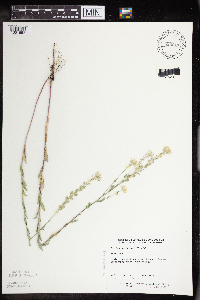
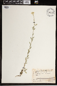
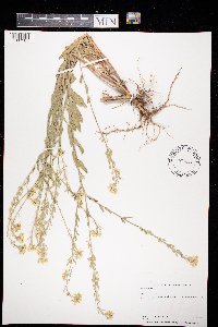
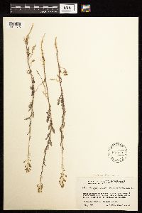
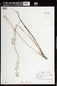
MIN:Plants | Berteroa incana (L.) de Candolle 801214[]Smith, Welby 119331986-06-28 United States, Minnesota, Anoka, Lamprey Pass Wildlife Management Area. Anoka County...Lamprey Pass State Wildlife Management Area, about 2 mi SW of Forest Lake (town); SW1/4 NE1/4 Sec. 13 T32N R22W. 032N 22W 13, 45.262588 -93.027648 |
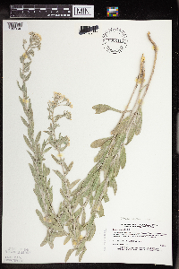
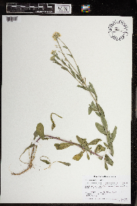
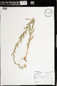
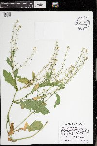
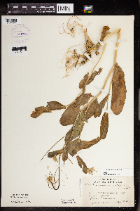
MIN:Plants | Berteroa incana (L.) de Candolle 807654[]Dorio, J. 511977-05-26 United States, Minnesota, Morrison, Ripley Esker, on esker;Ripley Esker Scientific Natural Area;042N;31W;, 46.113633 -94.250885 |
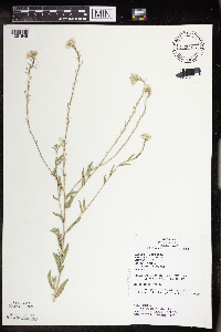
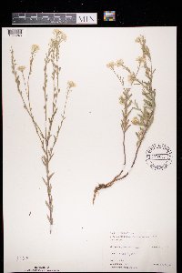
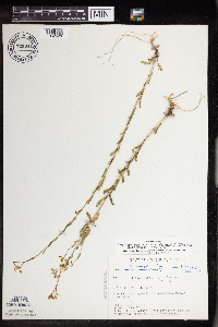
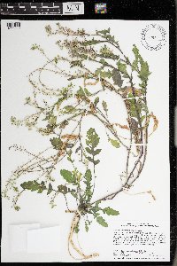
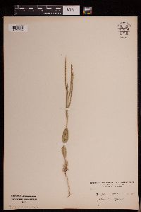
MIN:Plants | Berteroa incana (L.) de Candolle 812573[]Wheeler, Gerald 124261988-09-27 United States, Minnesota, Big Stone, Ca. 3.5 mi NNE of Ortonville, E of rte 7, bordering a small creek; W1/2 Sec. 29 T122N R46W (Big Stone Twp.);;122N;46W;29, 45.34761 -96.461599 |
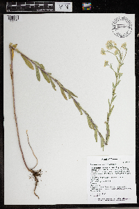
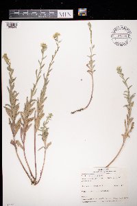
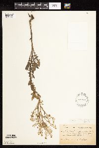
MIN:Plants | Berteroa incana (L.) de Candolle 813031[]Wheeler, Gerald 105821988-06-01 United States, Minnesota, Norman, Ca. 4 mi NE of Twin Valley, S of rte 29, near road; N1/2 NE1/4 NE1/4 Sec. 19 T144N R43W (Fossum Twp.);;144N;43W;19, 47.274201 -96.183827 |
MIN:Plants | Berteroa incana (L.) de Candolle 816109[]Wheeler, Gerald 122541988-07-13 United States, Minnesota, Traverse, Traverse Co.; Ca. 1.2 mi N of jnc of rte 27 and rte 28, W of rte 27, between Lake Traverse and road; W1/2 NE1/4 Sec. 36 T125N R48W (Arthur Twp.) [note: this junction is in T125 R49 Sec 21]. 125N 49W 21, 45.622235 -96.833764 |
MIN:Plants | Berteroa incana (L.) de Candolle 816195[]Bender, J. s.n.1986-06-13 United States, Minnesota, Washington, Belwin Outdoor Education Laboratory, along roadsides and trails; T28N R20W;Belwin Outdoor Education Laboratory;028N;20W;, 44.907173 -92.81202 |
MIN:Plants | Berteroa incana (L.) de Candolle 822315[]Vixie, D. 5301980-07-18 United States, Minnesota, Hubbard, Hubbard County ... Clancy Lake, Lake Alice Twp, T143N R35W S1.;;143N;35W;1, 47.231869 -95.056789, 434m |
MIN:Plants | Berteroa incana (L.) de Candolle 830017[1351652]Townsend, D.; et al. 91-1221991-06-25 United States, Minnesota, Polk, Polk County...Trail WMA...W1/2 Sec 13 T148N R44W [prob. meant R45; wildlife area doesn't extend into R44 at this time]];Trail Wildlife Management Area;148N;45W;13, 47.637276 -96.334236 |
MIN:Plants | Berteroa incana (L.) de Candolle 830211[1351646]Myhre, K. 23571992-06-22 United States, Minnesota, Cass, Cass Co. Located 1/2 mi W of Mile Lake; T133N R29W SW1/4 of SW1/4 of Sec.9;;133N;29W;9, 46.347481 -94.338084 |
MIN:Plants | Berteroa incana (L.) de Candolle 833466[1351648]Juhnke, C. 1721991-07-15 United States, Minnesota, Fillmore, Forestville State Park. Fillmore Co. T102N R12W Sec.13 NE SW NE;Forestville State Park;102N;12W;13, 43.637724 -92.219269 |
MIN:Plants | Berteroa incana (L.) de Candolle 833835[]Smith, Welby 141471988-05-31 United States, Minnesota, Lac Qui Parle, Lac Qui Parle Co. About 9 mi SW of Madison. N side of the West Branch Lac Qui Parle River. SW1/4 NE1/4 sec 13, T117N R46 Lac Qui Parle Co. About 9 mi SW of Madison. N side of the West Branch Lac Qui Parle River. SW1/4 NE1/4 sec 13, T117N R46W. 117N 46W 13, 44.942972 -96.363858 |
MIN:Plants | Berteroa incana (L.) de Candolle 837295[]Smith, Welby 172741990-07-17 United States, Minnesota, Morrison, Camp Ripley Military Reservation. Camp Ripley Military Reservation Morrison Co. Along East Boundary Road, about 2.5 km N of the airfield. UTM: 394700E 510 Camp Ripley Military Reservation Morrison Co. Along East Boundary Road, about 2.5 km N of the airfield. UTM: 394700E 5107700N T131N R30W SE1/4 of NW1/4 of Sec 32. 131N 30W 32, 46.114584 -94.484628 |
MIN:Plants | Berteroa incana (L.) de Candolle 915899[]Smith, Welby 251681994-08-18 United States, Minnesota, Beltrami, Lake Bemidji State Park. Beltrami County...On the northeast side of Lake Bemidji, in Lake Bemidji State Park...T147 N R 33W SW1/4 of NE1/4 of Sec 23. 147N 33W 23, 47.5347222 -94.8311111 |
MIN:Plants | Berteroa incana (L.) de Candolle 575611[]Garton, C. 90411961-07-27 Canada, Ontario, Rainy River, Rainy River District...2-1/2 mi. NE. of Gameland, Sutherland Twp. |
MIN:Plants | Berteroa incana (L.) de Candolle 431637[]Gerdes, Lynden 38141999-08-13 United States, Minnesota, Cook, Superior National Forest. T65N R04W S26NESE. Cook County...Superior National Forest. Gravel/sand pit approximately .25 mile south east of the Gunflint Trail (Cty. 12) and Cross River intersection. Pit is on the south side of the Gunflint Trail.. 065N 04W 26, 48.084497 -90.803753 |
MIN:Plants | Berteroa incana (L.) de Candolle 474187[]Stark, Dan 12841999-08-02 United States, Minnesota, Sherburne, Sherburne National Wildlife Refuge; SENE 16-35-27;Sherburne National Wildlife Refuge;035N;27W;16, 45.52313 -93.70595 |
MIN:Plants | Berteroa incana (L.) de Candolle 489749[]Stevens, O. 3981938-07-07 United States, North Dakota, Pembina, Walhalla (Pembina Co.) |
MIN:Plants | Berteroa incana (L.) de Candolle 474394[]U.S. Fish & Wildlife personnel 7091994-06-09 United States, Minnesota, Sherburne, Sherburne National Wildlife Refuge;Sherburne National Wildlife Refuge;;;, 45.515 -93.71028 |
MIN:Plants | Berteroa incana (L.) de Candolle 923854[]Smith, Welby 216651992-08-26 United States, Minnesota, Nicollet, About 7 miles north of Mankato; bank of Seven Mile Creek. NW1/4 of NE1/4 of section.;Seven Mile Creek County Park;109N;27W;11, 44.2680556 -94.0344444 |
MIN:Plants | Berteroa incana (L.) de Candolle 922583[]Smith, Welby 233691993-08-04 United States, Minnesota, Olmsted, Chester Woods County Park. Chester Woods County Park. About 3.5 miles northeast of Marion, along Bear Creek...T106N R13W SE1/4 of NE1/4 of Sec 13. 106N 13W 13, 43.9875 -92.3194444 |
MIN:Plants | Berteroa incana (L.) de Candolle 931765[]Smith, Welby R. 203941992-06-12 United States, Minnesota, Le Sueur, about 4 miles south- southwest of Le Sueur in the Minnesota Valley SW of SW of section;Chamberlain Woods Scientific Natural Area;111N;26W;22, 44.4005556 -93.9477778 |
MIN:Plants | Berteroa incana (L.) de Candolle 933522[]Smith, Welby R. 205071992-06-20 United States, Minnesota, Wadena, About 4 miles east of Nimrod SE of SE of section;;137N;33W;36, 46.6313889 -94.7847222 |
MIN:Plants | Berteroa incana (L.) de Candolle 933481[]Smith, Welby R. 213621992-08-11 United States, Minnesota, Marshall, On the south side of County Road 108, about 7.5 miles east of Strathcona NE of NW of section;;158N;42W;01, 48.5433333 -96.0097222 |
MIN:Plants | Berteroa incana (L.) de Candolle 933927[]Smith, Welby R. 215721992-08-18 United States, Minnesota, Pine, About one mile south-southwest of Willow River (town). Willard Munger State Trail. SW1/4 of SE1/4 of section;;044N;20W;10, 46.3030556 -92.9758333 |
MIN:Plants | Berteroa incana (L.) de Candolle 934774[]Whitfeld, T. J. S.; et al. 9322012-06-11 United States, Minnesota, Sherburne, Sherburne County;Sand Dunes State Forest;;;, 45.45 -93.76667 |
MIN:Plants | Berteroa incana (L.) de Candolle 966150[1356913]T. J. S. Whitfeld 26082020-06-22 United States, Minnesota, Washington, Lost Valley Prairie Scientific and Natural Area, 2 miles east north east of intersection of State Highway 95 and 110th Street, at dead-end of Nyberg Avenue South., 44.798895 -92.820892, 269m |
MIN:Plants | Berteroa incana (L.) de Candolle 967918[1368417]Drew, L.A. s.n.1971-06-23 United States, Minnesota, 0.25 miles N Itasca State Park, 47.213205 -95.201964 |
MIN:Plants | Berteroa incana (L.) de Candolle 968886[1391550]Lueth, Dylan G. DGL170262017-09-02 United States, Minnesota, Aitkin, Approximately 16.88km N of Palisade, MN and 19.39km E of Swatara, MN., 46.858808 -93.42533 |
MIN:Plants | Berteroa incana (L.) de Candolle 972695[1398248]Janssens, J. 75/1871975-07-21 Belgium, Kiel, 15m |
MIN:Plants | Berteroa incana (L.) de Candolle 972696[1398249]Janssens, J. 1571974-06-09 Belgium, Kiel |
MIN:Plants | Berteroa incana (L.) de Candolle 973607[1397161]Bezanson, Char A. 1031991-06-21 United States, Minnesota, Rice, Service road near Skoglund Athletic Center, St. Olaf College, Northfield., 44.463613 -93.189396 |
MIN:Plants | Berteroa incana (L.) de Candolle []Kerstin Griffin 541964-05-29 United States, Minnesota, Scott, 4 miles southwest Shakopee along Highway 169. Old pasture. Found in patches all over, 44.750704 -93.585996 |
MIN:Plants | Berteroa incana (L.) de Candolle 978083[1401491]Don Henson 4211972-06-29 United States, Michigan, Delta, SW1/4 NE1/4 SE1/4 Sec 16 T40N R18W, 45.860424 -86.532179 |
MIN:Plants | Cardamine umbellata Greene 656978[]Noble, Mark; et al. 3761974-08-05 United States, Alaska, Muir Point; from site deglaciated ca. 1880.;Glacier Bay National Park;;;, 58.82694 -136.07722 |
MIN:Plants | Cardamine umbellata Greene 539712[]Viereck, Les 15541956-07-26 United States, Alaska, Mt. McKinley Nat. Park...N.W. slope to summit of Mt. Eielson (Copper Mt.);Denali National Park;;;, 63.4166667 -150.3333333, 1676m |
MIN:Plants | Cardamine umbellata Greene 382594[]Morse, Marius s.n.1944-06-11 United States, Alaska, Aleutian Islands ... Adak Island;Aleutian Islands Wilderness;;;, 51.88 -176.65806 |
MIN:Plants | Cardamine umbellata Greene 382595[]Morse, Marius s.n.1944-06-17 United States, Alaska, Aleutian Islands ... Adak Island;Aleutian Islands Wilderness;;;, 51.88 -176.65806 |
MIN:Plants | Cardamine umbellata Greene 663800[]Noble, Mark; et al. 5821974-08-05 United States, Alaska, on the shoulder of Mt. Wright;Glacier Bay National Park;;;, 58.809784 -136.05167, 780m |
MIN:Plants | Boechera howellii (S. Watson) Windham & Al-Shehbaz 233270[]Congdon, J. s.n.1890-08-23 United States, California, Mariposa, Summit, Cloud's Rest, Mariposa County;Yosemite National Park |
MIN:Plants | Boechera howellii (S. Watson) Windham & Al-Shehbaz 533269[]Congdon, J. s.n.1890-08-20 United States, California, Mariposa, Mt. Hoffman, Mariposa County;Yosemite National Park;;;, 37.84691 -119.51054 |
MIN:Plants | Draba oligosperma Hooker 607884[]Seim, A. s.n.1946-07-13 United States, Wyoming, Park, Mt. Washburn, Yellowstone National Park;Yellowstone National Park |
MIN:Plants | Draba oligosperma Hooker 119066[]Nelson, Aven; et al. 55311899-06-28 United States, Wyoming, Park, Yellowstone National Park...Golden Gate;Yellowstone National Park;;;, 44.935 -110.72222 |
MIN:Plants | Draba oligosperma Hooker 119070[]Burglehaus, F. s.n.1893-06-00 United States, Wyoming, Park, Near Mammoth Hot Springs;Yellowstone National Park;;;, 44.96694 -110.71139, 1890m |
MIN:Plants | Draba oligosperma Hooker 119067[]Burglehaus, F. s.n.1893-06-00 United States, Wyoming, Park, Near Mammoth Hot Springs;Yellowstone National Park;;;, 44.96694 -110.71139, 1890m |
MIN:Plants | Draba oligosperma Hooker 119071[]Burglehaus, F. s.n.1893-06-00 United States, Wyoming, Park, Near Mammoth Hot Springs;Yellowstone National Park;;;, 44.96694 -110.71139, 1890m |
MIN:Plants | Draba oligosperma Hooker 234089[]Congdon, J. s.n.1898-08-11 United States, California, Tuolumne, Mt. Dana, Tuolumne County;Yosemite National Park;;;, 37.8999 -119.2211 |
MIN:Plants | Draba oligosperma Hooker 119069[]Burglehaus, F. s.n.1893-07-00 United States, Wyoming, Park, Yellowstone National Park...near Mammoth Hot Springs;Yellowstone National Park, 2134m |
MIN:Plants | Draba oligosperma Hooker 234090[]Congdon, J. s.n.1894-08-21 United States, California, Tuolumne, Mt. Warren Trail, Tuolumne County;Yosemite National Park |
MIN:Plants | Draba oligosperma Hooker 119082[]Burglehaus, F. s.n.1893-07-00 United States, Wyoming, Park, Yellowstone National Park...near Mammoth Hot Springs;Yellowstone National Park, 2134m |
MIN:Plants | Boechera missouriensis (Greene) Al-Shehbaz 729341[1352526]Cutler, S. 141980-06-09 United States, Minnesota, Pine, Pine County...St. Croix Natural Area, 21 mi E of Hinckley...SW1/4 Sec. 34 T41N R17W;Saint Croix State Park;041N;17W;34, 45.990628 -92.4775 |
MIN:Plants | Rorippa barbareifolia (de Candolle) Kitagawa 120400[1134447]Taylor, B. T6521891-07-00 United States, Minnesota, Faribault, Minnesota Lake;;N;;, 43.804422 -93.827689 |
MIN:Plants | Rorippa barbareifolia (de Candolle) Kitagawa 539770[1181818]Weber, W.A. 1642 United States, Alaska |
MIN:Plants | Rorippa barbareifolia (de Candolle) Kitagawa 975879[1373432]Smith, Welby R WRS368632020-08-19 United States, Minnesota, Ramsey, Snail Lake Regional Park in Shoreview. Along the shore of a shallow marshy bay of Grass Lake (west side)., 45.05717 -93.12055 |
MIN:Plants | Rorippa barbareifolia (de Candolle) Kitagawa 976259[1373812]Smith, Welby R WRS370692020-10-16 United States, Minnesota, Ramsey, In herbaceous lakeshore vegetation at the northwest end of Grass Lake in Snail Lake Regional Park, within the municipality of Shoreview., 45.05894 -93.12165 |
MIN:Plants | Boechera subpinnatifida (S. Watson) Al-Shehbaz 234317[]Congdon, J. s.n.1896-07-07 United States, California, Tuolumne, Sides Hetch-Hetchy Valley, Tuolomne County;Yosemite National Park |
MIN:Plants | Lepidium oblongum Small 119730[]Elmer, A.D.E. 47751903-07-00 United States, California, Marin, Point Reyes. County: Marin;Point Reyes National Seashore |
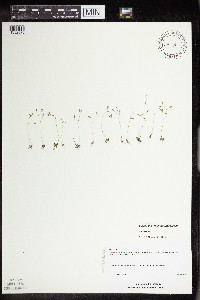
MIN:Plants | Draba verna L. 234377[]Congdon, J. s.n.1903-04-05 United States, California, Mariposa, Pea Ridge Road, Mariposa County;Yosemite National Park;;;, 37.55 -119.9 |
MIN:Plants | Draba verna L. 453020[]Davis, Owen s.n.1978-08-29 United States, Idaho, Bingham, [no further data] |
MIN:Plants | Draba verna L. 459881[1352976]Schimpf, D. DJS3012001-05-16 United States, Minnesota, Saint Louis, St. Louis Co, Duluth. T49N R15W SW1/4 of SE1/4 Sec 13. Indian Point Campground.;;049N;14W;00, 46.7291667 -92.1833333 |
MIN:Plants | Draba verna L. 234219[]Congdon, J. s.n.1901-03-22 United States, California, Mariposa, Below Mormon Bar, Mariposa County;Yosemite National Park |
MIN:Plants | Draba verna L. 963523[1348907]Nee, M. H. 641962018-05-10 United States, Wisconsin, Richland, 3 miles SE of center of Richland Center, 43.307083 -90.333056, 222m |
MIN:Plants | Draba praelta Greene 118904[]Burglehaus, F. s.n.1893-07-00 United States, Wyoming, Park, Near Mammoth Hot Springs;Yellowstone National Park;;;, 44.96694 -110.71139, 1890m |
MIN:Plants | Draba praelta Greene 118903[]Burglehaus, F. s.n.1893-07-00 United States, Wyoming, Park, Near Mammoth Hot Springs;Yellowstone National Park;;;, 44.96694 -110.71139, 1829m |
MIN:Plants | Draba praelta Greene 118905[]Burglehaus, F. s.n.1893-07-00 United States, Wyoming, Park, Near Mammoth Hot Springs;Yellowstone National Park;;;, 44.96694 -110.71139, 1829m |
MIN:Plants | Camelina microcarpa de Candolle 265156[]Moore, John 5661923-06-00 United States, South Dakota, Brookings, Brookings;;;;, 44.31139 -96.79806 |
MIN:Plants | Camelina microcarpa de Candolle 920572[]Smith, Welby 214881992-08-12 United States, Minnesota, Pennington, Pembina Wildlife Management Area. Pennington County ... Pembina State Wildlife Management Area, about 16 miles southwest of Thief River Falls ...T152N R45W SE1/4 of NE1/4 of Sec 18. 152N 45W 18, 47.9880556 -96.4638889 |
MIN:Plants | Camelina microcarpa de Candolle 756036[]Davis, Owen ID77-3681977-07-30 United States, Idaho, Cassia, Cassia Co. ... SW1/4, sec. 31, T 12 S, R 24 E;;012S;24E;31, 1951m |
MIN:Plants | Camelina microcarpa de Candolle 117993[]Herrick, C. s.n.1878-05-00 United States, Minnesota, Hennepin, Minneapolis;;N;;, 44.979965 -93.263836 |
MIN:Plants | Camelina microcarpa de Candolle 117994[]Juni, B. s.n.1878-00-00 United States, Minnesota, Hennepin, Minneapolis;;N;;, 44.979965 -93.263836 |
MIN:Plants | Camelina microcarpa de Candolle 117995[]Moyer, Lycurgus s.n.1891-06-22 United States, Minnesota, Chippewa, Montevideo, near R.R. station.;;117N;40W;, 44.934626 -95.675774 |
MIN:Plants | Camelina microcarpa de Candolle 117999[]Ballard, C. 25361900-08-09 United States, Minnesota, Otter Tail, Mineral Lake.;;N;;, 46.178408 -96.004877 |
MIN:Plants | Camelina microcarpa de Candolle 350188[]McCartney, James 351938-06-28 United States, Minnesota, Scott, Minnesota River between s.t.h. [highway] #50 and Savage.;;;;, 44.78852 -93.35306 |
MIN:Plants | Camelina microcarpa de Candolle 351857[]Rosendahl, C.; et al. 29801935-05-19 United States, Minnesota, Blue Earth, Roadside. Crystal Lake.;;;;, 44.109435 -94.202968 |
MIN:Plants | Camelina microcarpa de Candolle 370215[]Moore, John; et al. 142091941-06-13 United States, Minnesota, Clay, R.R. embankment at Keagnes.;;;;, 47.020558 -96.75325 |
MIN:Plants | Camelina microcarpa de Candolle 437309[]Moore, John; Hall, Robert 165451944-06-13 United States, Minnesota, Redwood, R.R. right-of-way, 1 mi. E of Walnut Grove on Hwy. 14. Redwood Co.;;109N;38W;, 44.239355 -95.41137 |
MIN:Plants | Camelina microcarpa de Candolle 449337[]Moore, John; et al. 174251945-06-28 United States, Minnesota, Kanabec, Kanabec Co. Along r.r, 1 1/2 mi. ENE of Mora.;;039N;23W;, 45.860965 -93.204163 |
MIN:Plants | Camelina microcarpa de Candolle 500812[]Moore, John 204161949-07-06 United States, Minnesota, Otter Tail, Along the N shore of Wall Lake.;;N;;, 46.273189 -95.964071 |
MIN:Plants | Camelina microcarpa de Candolle 507261[]Moore, John 206801950-06-21 United States, Minnesota, Martin, Along the r.r, 1/2 mi. N of Farimont.;;N;;, 43.652178 -94.461083 |
MIN:Plants | Camelina microcarpa de Candolle 553923[]Moore, John 225581955-06-03 United States, Minnesota, Sibley, On the r.r. grade, 1/2 mi. S of Green Isle.;;114N;27W;, 44.673805 -94.071323 |
MIN:Plants | Camelina microcarpa de Candolle 554653[1352556]Moore, John 231571957-06-12 United States, Minnesota, Pipestone, Pipestone Co.; Along the r.r. at Ihlen.;;105N;46W;, 43.892618 -96.367453 |
MIN:Plants | Camelina microcarpa de Candolle 572736[]Moore, John 253801961-06-06 United States, Minnesota, Houston, Along the r.r. at Reno.;Dorer Memorial Hardwood State Forest;102N;04W;35, 43.594236 -91.282816 |
MIN:Plants | Camelina microcarpa de Candolle 573918[]Stevens, O. 24201961-07-03 United States, Minnesota, Clay, Along r.r, N of Moorhead.;;N;;, 46.873852 -96.767581 |
MIN:Plants | Camelina microcarpa de Candolle 584492[1352558]Ownbey, Gerald 35431963-07-09 United States, Minnesota, Clearwater, 6.8 mi. N of Clearbrook, T150N, R37W, SE1/4 Sec. 19.;;150N;37W;19, 47.79709 -95.441153 |
MIN:Plants | Camelina microcarpa de Candolle 812589[1352557]Wheeler, Gerald 107561988-06-17 United States, Minnesota, Norman, Ca. 3.5 mi. NE of Syre; N side of Rte. 37. SW1/4 SE1/4 Sec. 12, T143N, R44W (Home Lake Twp.);;143N;44W;12, 47.216388 -96.205242 |
MIN:Plants | Camelina microcarpa de Candolle 923914[]Allen, Kathy; Allen, Adina s.n.2011-06-11 United States, Minnesota, Dakota, Inver Grove Heights, Macalester College's Katherine Ordway Natural History Study Area.;;027N;22W;22, 44.81187 -93.03436 |
MIN:Plants | Camelina microcarpa de Candolle 934332[1352555]Smith, Welby R. 214881992-08-12 United States, Minnesota, Pennington, About 16 miles southwest of Thief River Falls SE of NE of section;Pembina Wildlife Management Area;152N;45W;18, 47.9880556 -96.4638889 |
MIN:Plants | Conringia orientalis (L.) Dumortier 118544[]Moyer, Lycurgus s.n.1894-06-10 United States, Minnesota, Chippewa, Mandt, Chippewa Co.;;119N;40W;, 45.108142 -95.674782 |
MIN:Plants | Conringia orientalis (L.) Dumortier 118545[]Moyer, Lycurgus s.n.1894-06-00 United States, Minnesota, Chippewa, Chippewa Co.;;N;;, 45.063959 -95.620425 |
MIN:Plants | Conringia orientalis (L.) Dumortier 118546[]Moyer, Lycurgus s.n.1894-06-00 United States, Minnesota, Chippewa, Mandt, Chippewa Co.;;119N;40W;, 45.108142 -95.674782 |
MIN:Plants | Conringia orientalis (L.) Dumortier 118547[]Willard, s.n.1917-06-00 United States, Minnesota, Goodhue, Red Wing;;113N;14W;, 44.555216 -92.495543 |
MIN:Plants | Conringia orientalis (L.) Dumortier 118548[]Sheldon, Edmund S18421890-05-00 United States, Minnesota, Hennepin, Minneapolis;;N;;, 44.979965 -93.263836 |
MIN:Plants | Conringia orientalis (L.) Dumortier 263933[]Holzinger, John s.n.1905-06-00 United States, Minnesota, Winona, Winona Co.;;N;;, 43.926613 -91.67387 |
MIN:Plants | Conringia orientalis (L.) Dumortier 364137[]Dillman, John s.n.1917-06-00 United States, Minnesota, Hennepin, R.R. tracks back of Northrup field, University Campus, Minneapolis.;;N;;, 44.97441 -93.233002 |
MIN:Plants | Conringia orientalis (L.) Dumortier 391791[1352924]Lakela, Olga 59971945-06-30 United States, Minnesota, Saint Louis, Ed Kilpela's farm, Palo.;;057N;15W;, 47.415324 -92.239713 |
MIN:Plants | Conringia orientalis (L.) Dumortier 952394[1292220]Kramer, Leona s.n. United States, Minnesota, Mower |
MIN:Plants | Smelowskia media (W.H. Drury & Rollins) Velichkin 548408[]Spetzman, L. 37351951-07-20 United States, Alaska, Arctic North Slope...Katakturuk River, Igenk [sic] Valley;Arctic National Wildlife Refuge;;;, 69.5833333 -145.5833333, 610m |
MIN:Plants | Smelowskia media (W.H. Drury & Rollins) Velichkin 403684[]Spetzman, L. 13181948-08-03 United States, Alaska, Arctic North Slope...Ignek Valley;Arctic National Wildlife Refuge;;;, 69.5833333 -145.1666667, 914m |
MIN:Plants | Draba borealis de Candolle 530001[]Hardy, Robert 1351945-06-22 United States, Alaska, Aleutians...on Attu Is. ...Engineer Canyon;Aleutian Islands Wilderness;;;, 52.9 172.9, 91m |
MIN:Plants | Draba borealis de Candolle 382574[]Morse, Marius s.n.1944-06-11 United States, Alaska, Aleutian Islands ... Adak Island;Aleutian Islands Wilderness;;;, 51.88 -176.65806 |
MIN:Plants | Draba borealis de Candolle 530491[]Hardy, Robert 1541945-07-08 United States, Alaska, Aleutians...on Attu Is. ...west side of Chichagof Harbor;Aleutian Islands Wilderness;;;, 52.928602 173.243336 |
Google Map
Google Maps is a web mapping service provided by Google that features a map that users can pan (by dragging the mouse) and zoom (by using the mouse wheel). Collection points are displayed as colored markers that when clicked on, displays the full information for that collection. When multiple species are queried (separated by semi-colons), different colored markers denote each individual species.
