University of Minnesota
http://www.umn.edu/
612-625-5000
http://www.umn.edu/
612-625-5000
Minnesota Biodiversity Atlas
Bell Museum
Dataset: MIN-Plants
Taxa: Brassicaceae
Search Criteria: excluding cultivated/captive occurrences
Bell Museum plants | |
 MIN:Plants | Boechera grahamii (Lehmann) Windham & Al-Shehbaz 355979[]Stevens, O. 159a1936-06-14 United States, Minnesota, Clay, Muskoda [historic RR station near Hawley];;139N;45W;17, 46.854548 -96.396768 |
MIN:Plants | Boechera grahamii (Lehmann) Windham & Al-Shehbaz 367797[]Moore, John; et al. 125481940-05-25 United States, Minnesota, Wright, Ramsey Lake; Maple Lake Twp. [actually in Chatham Twp.] Wright Co.;;120N;26W;, 45.194895 -93.951207 |
MIN:Plants | Boechera grahamii (Lehmann) Windham & Al-Shehbaz 368039[]Moore, John; et al. 126791940-05-25 United States, Minnesota, Pope, North shore of Lake Leven; SW1/4 Sec. 12. Pope Co.;;126N;37W;12, 45.73732 -95.273292 |
MIN:Plants | Boechera grahamii (Lehmann) Windham & Al-Shehbaz 369971[]Moore, John 140611941-05-24 United States, Minnesota, Pine, Beside the railroad, along Hwy. 61; SE1/4 Sec. 33, Rock Creek Twp, Pine Co.;;038N;21W;33, 45.737637 -92.970581 |
MIN:Plants | Boechera grahamii (Lehmann) Windham & Al-Shehbaz 370240[]Moore, John; et al. 140111941-05-24 United States, Minnesota, Pine, Snake River, near dam at the outlet of Cross Lake, SE1/4, Sec. 26, Pine City Twp, Pine Co.;;039N;21W;26, 45.839139 -92.929089 |
MIN:Plants | Boechera grahamii (Lehmann) Windham & Al-Shehbaz 372847[]Moore, John; et al. 143791949-06-14 United States, Minnesota, Polk, Polk County...2 mi. SW of Fertile.;Agassiz Dunes Scientific Natural Area;147N;44W;, 47.543099 -96.259086 |
MIN:Plants | Boechera grahamii (Lehmann) Windham & Al-Shehbaz 378173[]Thatcher, E. 221942-05-23 United States, Minnesota, Crow Wing, Roadside, Sec. 25, NW1/4 Mission Twp.;;136N;27W;25, 46.56777 -94.025801 |
MIN:Plants | Boechera grahamii (Lehmann) Windham & Al-Shehbaz 381476[]Moore, John; et al. 153661942-06-20 United States, Minnesota, Olmsted, 1 mi N of Rochester on hwy 63. Olmsted Co.;;;;, 44.03615 -92.46972 |
MIN:Plants | Boechera grahamii (Lehmann) Windham & Al-Shehbaz 381617[]Moore, John; et al. 151621942-05-22 United States, Minnesota, Todd, 1/2 mi W of Motley;;;;, 46.33666 -94.68777 |
MIN:Plants | Boechera grahamii (Lehmann) Windham & Al-Shehbaz 381738[]Moore, John; et al. 153071942-06-18 United States, Minnesota, Hennepin, Hennepin County...South shore of Independence Lake, Mpls.;;;;, 45.0294 -93.64875 |
MIN:Plants | Boechera grahamii (Lehmann) Windham & Al-Shehbaz 394146[]Butters, F.; et al. 7051940-07-01 United States, Minnesota, Cook, Near the top of cliff on the W side of North Fowl Lake.;Superior National Forest;065N;03E;, 48.081607 -90.076407 |
MIN:Plants | Boechera grahamii (Lehmann) Windham & Al-Shehbaz 394147[]Butters, F.; Abbe, E. 9241944-08-04 United States, Minnesota, Cook, near the Cross River; T65N R4W.;Superior National Forest;065N;04W;, 48.104919 -90.838094 |
MIN:Plants | Boechera grahamii (Lehmann) Windham & Al-Shehbaz 394148[]Butters, F.; Abbe, E. 9551944-08-06 United States, Minnesota, Cook, W face of cliff 213, Clearwater Lake, T65N R1E.;Boundary Waters Canoe Area Wilderness / Superior National Forest;065N;01E;, 48.081055 -90.315189 |
MIN:Plants | Boechera grahamii (Lehmann) Windham & Al-Shehbaz 394149[]Butters, F.; Abbe, E. 1821936-06-29 United States, Minnesota, Cook, Top of Mt. Josephine near Grand Portage. T63N, R6E [actually in T64];Grand Portage Indian Reservation / North Shore;064N;06E;34, 47.983098 -89.66244 |
MIN:Plants | Boechera grahamii (Lehmann) Windham & Al-Shehbaz 394150[]Butters, F.; Abbe, E. 761936-06-21 United States, Minnesota, Cook, S side of Clearwater Lake. Cook Co.;Boundary Waters Canoe Area Wilderness / Superior National Forest;065N;01E;, 48.081055 -90.315189 |
MIN:Plants | Boechera grahamii (Lehmann) Windham & Al-Shehbaz 394151[]Butters, F.; Abbe, E. 1591936-06-28 United States, Minnesota, Cook, Below slate cliffs near Grand Portage. T63N, R6E.;Grand Portage Indian Reservation / North Shore;063N;06E;, 47.958468 -89.703576 |
MIN:Plants | Boechera grahamii (Lehmann) Windham & Al-Shehbaz 394152[]Butters, F.; Abbe, E.; Abbe, L. 4091937-07-13 United States, Minnesota, Cook, W of Little Portage Bay, Pigeon Point. T64N, R7E.;Grand Portage Indian Reservation / North Shore;064N;07E;, 47.994009 -89.575112 |
MIN:Plants | Boechera grahamii (Lehmann) Windham & Al-Shehbaz 394453[]Burns, G.; Hendrickson, M. 2261938-07-22 United States, Minnesota, Cook, Cliff, N of center of East Pike Lake.;Boundary Waters Canoe Area Wilderness / Superior National Forest;065N;03E;, 48.081607 -90.076407 |
MIN:Plants | Boechera grahamii (Lehmann) Windham & Al-Shehbaz 394454[]Breckenridge, Walter; et al. 3235a1935-06-09 United States, Minnesota, Cook, Clark's Bay, near Grand Portage. Cook Co.;Grand Portage Indian Reservation / North Shore;064N;07E;, 47.994009 -89.575112 |
MIN:Plants | Boechera grahamii (Lehmann) Windham & Al-Shehbaz 394455[]Nielsen, E. 16901932-09-12 United States, Minnesota, Cook, S side of Clearwater Lake. T65N, R01E. Cook Co.;Boundary Waters Canoe Area Wilderness / Superior National Forest;065N;01E;, 48.081055 -90.315189 |
MIN:Plants | Boechera grahamii (Lehmann) Windham & Al-Shehbaz 394456[]Butters, F.; et al. s.n.1935-06-29 United States, Minnesota, Cook, Clearwater Lake. T65N, R01E. Cook Co.;Boundary Waters Canoe Area Wilderness / Superior National Forest;065N;01E;, 48.081055 -90.315189 |
MIN:Plants | Boechera grahamii (Lehmann) Windham & Al-Shehbaz 394457[]Burns, G.; Hendrickson, M. 3391938-07-29 United States, Minnesota, Cook, 3/8 mi E of source of Royal River. T64N R3E.;Superior National Forest;064N;03E;, 48.018792 -90.055527 |
MIN:Plants | Boechera grahamii (Lehmann) Windham & Al-Shehbaz 394458[]Burns, G.; Hendrickson, M. 2531938-07-25 United States, Minnesota, Cook, Directly S of Royal Lake. T64N, R03E. Cook Co.;Superior National Forest;064N;03E;11, 48.043396 -90.022127 |
MIN:Plants | Boechera grahamii (Lehmann) Windham & Al-Shehbaz 394459[]Butters, F.; Abbe, E. 114a1936-06-24 United States, Minnesota, Cook, Above the S side of Watab Lake. T65N, R1E. Cook Co.;Boundary Waters Canoe Area Wilderness / Superior National Forest;065N;01E;, 48.081055 -90.315189 |
MIN:Plants | Boechera grahamii (Lehmann) Windham & Al-Shehbaz 394460[]Dahl, A. 125A1945-06-19 United States, Minnesota, Cook, Base sheer wall (above talus) of cliff 2B, S shore of Clearwater Lake. T65N, R1E, Sec. 28.;Boundary Waters Canoe Area Wilderness / Superior National Forest;065N;01E;28, 48.084859 -90.335202 |
MIN:Plants | Boechera grahamii (Lehmann) Windham & Al-Shehbaz 394461[]Butters, F.; et al. 108281939-07-02 United States, Minnesota, Cook, Cliff above Pigeon River, at the outlet of South Fowl Lake. T64N, R03E. Cook Co.;Pigeon River Cliffs, The Nature Conservancy / Superior National Forest;064N;03E;12, 48.044201 -90.003254 |
MIN:Plants | Boechera grahamii (Lehmann) Windham & Al-Shehbaz 394477[]Butters, F.; et al. 108861939-07-05 United States, Minnesota, Cook, 1 mi. E of Grand Portage. T63N, R6E. Cook Co.;Grand Portage Indian Reservation / North Shore;063N;06E;, 47.958468 -89.703576 |
MIN:Plants | Boechera grahamii (Lehmann) Windham & Al-Shehbaz 394478[]Burns, G.; Hendrickson, M. 2051938-07-19 United States, Minnesota, Cook, top of low cliff, 1/2 mi SW of W end of West Pike Lake. T65N R2E.;Boundary Waters Canoe Area Wilderness / Superior National Forest;065N;02E;, 48.086124 -90.186483 |
MIN:Plants | Boechera grahamii (Lehmann) Windham & Al-Shehbaz 394479[]Burns, G.; Hendrickson, M. 2791938-07-27 United States, Minnesota, Cook, South Fowl Lake. T64N, R3E.;Superior National Forest;064N;03E;, 48.018792 -90.055527 |
MIN:Plants | Boechera grahamii (Lehmann) Windham & Al-Shehbaz 396926[]Stevens, O. s.n.1947-05-31 United States, Minnesota, Clay, Just S of Buffalo State Park.;Buffalo River State Park;139N;46W;15, 46.854948 -96.473403 |
MIN:Plants | Boechera grahamii (Lehmann) Windham & Al-Shehbaz 396933[]Stevens, O. s.n.1947-06-27 United States, Minnesota, Clay, Buffalo State Park.;Buffalo River State Park;139N;46W;00, 46.847731 -96.483798 |
MIN:Plants | Boechera grahamii (Lehmann) Windham & Al-Shehbaz 401279[]Wilson, Palma; et al. s.n.1945-06-07 United States, Minnesota, Chisago, 4 mi. N of Stacy.;;N;;, 45.39755 -92.98742 |
MIN:Plants | Boechera grahamii (Lehmann) Windham & Al-Shehbaz 412981[]Moore, John; et al. 116581939-08-12 United States, Minnesota, Koochiching, Koochiching County...in the vic. of the Island View Hotel, T71N, R22W, Sec. 25.;Voyageurs National Park;071N;22W;25, 48.609275 -93.099933 |
MIN:Plants | Boechera grahamii (Lehmann) Windham & Al-Shehbaz 415496[]Moyle, J. s.n.1950-08-07 United States, Minnesota, Crow Wing, East Rabbit Lake, near Crosby.;;N;;, 46.530365 -93.924032 |
MIN:Plants | Boechera grahamii (Lehmann) Windham & Al-Shehbaz 427237[]Boe, J. 930722091993-07-22 United States, Minnesota, Cass, Cass Co.; highway 210 right-of-way west of Brainerd; T 133N R 29W SW1/4 of SE1/4 of SEc 9;;133N;29W;9, 46.347481 -94.338084 |
MIN:Plants | Boechera grahamii (Lehmann) Windham & Al-Shehbaz 430428[]Myhre, K. 20171992-06-01 United States, Minnesota, Cass, Cass Co.; Located 2 miles northeast of the town of Pillager; T 133N R 30W SW1/4 of NW1/4 of sec 10;;113N;30W;10, 46.347893 -94.443084 |
MIN:Plants |  Boechera grahamii (Lehmann) Windham & Al-Shehbaz 435053[1352511]Swanson, Gary 15481999-05-06 United States, Minnesota, Sherburne, Sherburne National Wildlife Refuge; SWNE 3-34-27;Sherburne National Wildlife Refuge;034N;27W;3, 45.465422 -93.684687 |
MIN:Plants | Boechera grahamii (Lehmann) Windham & Al-Shehbaz 439658[]Myhre, K. 41441993-07-12 United States, Minnesota, Pine, Pine Co. Located 3.5 mi NE of the town of Sandstone; escarpment of the Kettle River; T43N R20W NE1/4 of SE1/4 of SEc 23;Banning State Park;043N;20W;23, 46.194129 -92.834987 |
MIN:Plants | Boechera grahamii (Lehmann) Windham & Al-Shehbaz 442786[]Lakela, Olga 129521951-06-10 United States, Minnesota, Saint Louis, Above the dam at Kettle Falls;Voyageurs National Park;070N;18W;, 48.521444 -92.665357 |
MIN:Plants | Boechera grahamii (Lehmann) Windham & Al-Shehbaz 443996[]Gerdes, Lynden; et al. 25231998-05-25 United States, Minnesota, Cook, Superior National Forest. T64N R03E S11SENW. Cook Co.; Superior National Forest. Along the Border Route hiking trail between John Lake and South F T64N R03E S11SENW. Cook Co.; Superior National Forest. Along the Border Route hiking trail between John Lake and South Fowl Lake. Rock outcrop/cliff overlooking Royal Lake.. 064N 03E 11, 48.043396 -90.022127 |
MIN:Plants | Boechera grahamii (Lehmann) Windham & Al-Shehbaz 446490[]Moore, John; Huff, N. 186141946-06-13 United States, Minnesota, Roseau, 2 mi W of Warroad;;N;;, 48.905257 -95.358436 |
MIN:Plants | Boechera grahamii (Lehmann) Windham & Al-Shehbaz 446592[]Moore, John; Huff, N. 186011946-06-13 United States, Minnesota, Koochiching, Koochiching Co.; along the Rainy River bank at Ranier;;071N;24W;, 48.598866 -93.388503 |
MIN:Plants | Boechera grahamii (Lehmann) Windham & Al-Shehbaz 446774[]Moore, John; et al. 174621945-06-28 United States, Minnesota, Kanabec, Kanabec Co.; along banks of the Snake River, 1/2 mi S of Mora;;039N;24W;, 45.860683 -93.327529 |
MIN:Plants | Boechera grahamii (Lehmann) Windham & Al-Shehbaz 449156[]Moore, John 170081945-06-01 United States, Minnesota, Blue Earth, 1 mi E of Lake Crystal;;N;;, 44.105796 -94.198679 |
MIN:Plants | Boechera grahamii (Lehmann) Windham & Al-Shehbaz 452076[]Lakela, Olga 148301952-07-10 United States, Minnesota, Saint Louis, Rocks of an island off Dryweed Island in Rainy Lake, NW corner of the county;Voyageurs National Park;N;;, 48.616664 -93.070888 |
MIN:Plants |  Boechera grahamii (Lehmann) Windham & Al-Shehbaz 458997[1352508]Cholewa, A. s.n.1997-05-27 United States, Minnesota, Sherburne, Sherburne National Wildlife Refuge; S of Durgin along road. S1 T34N R28W &/or S6 T34N R27W;Sherburne National Wildlife Refuge;034N;28W;1, 45.46559 -93.768682 |
MIN:Plants | Boechera grahamii (Lehmann) Windham & Al-Shehbaz 460451[]Myhre, K. 23771992-06-02 United States, Minnesota, Cass, Cass County...Located 1 mile west of the Gull River in a narrow, flat strip between the railroad tracks and highway 210; T 133N R 29W NE1/4 of NW1/4 of Sec 18. 133N 29W 18, 46.333217 -94.380017 |
MIN:Plants | Boechera grahamii (Lehmann) Windham & Al-Shehbaz 462706[]Lakela, Olga 148301952-07-10 United States, Minnesota, Saint Louis, An island off Dryweed Island in Rainy Lake, NW corner of the county;Voyageurs National Park;N;;, 48.61394 -93.070888 |
MIN:Plants | Boechera grahamii (Lehmann) Windham & Al-Shehbaz 462707[]Lakela, Olga 151601952-07-16 United States, Minnesota, Saint Louis, N shore of Kabetogama Lake, 3 mi. W of Pine Island.;Voyageurs National Park;N;;, 48.4664 -92.92597 |
MIN:Plants | Boechera grahamii (Lehmann) Windham & Al-Shehbaz 462739[]Lakela, Olga 150181952-07-14 United States, Minnesota, Saint Louis, Terrace of Kabetogama Lake, N shore opposite Pine Island.;Voyageurs National Park;N;;, 48.47004 -92.92751 |
MIN:Plants | Boechera grahamii (Lehmann) Windham & Al-Shehbaz 462760[]Lakela, Olga 148571952-07-10 United States, Minnesota, Saint Louis, Island in Cranberry Bay of Rainy Lake;Voyageurs National Park;071N;21W;, 48.606257 -93.024038 |
MIN:Plants | Boechera grahamii (Lehmann) Windham & Al-Shehbaz 463217[]Lakela, Olga 145801952-07-08 United States, Minnesota, Saint Louis, Fox Island in Rainy Lake, the most northern part of the county;Voyageurs National Park;071N;21W;, 48.625169 -92.962016 |
MIN:Plants | Boechera grahamii (Lehmann) Windham & Al-Shehbaz 463448[]Lakela, Olga 141241952-06-16 United States, Minnesota, Saint Louis, Woods at Namakan Narrows;Voyageurs National Park;069N;17W;, 48.43053 -92.49014 |
MIN:Plants |  Boechera grahamii (Lehmann) Windham & Al-Shehbaz 463639[1352510]Lee, Michael MDL16951997-06-05 United States, Minnesota, Stearns, Stearns Co.; Along the Sauk River at the Hwy 23 bridge in Cold Spring; T123N R30W NW1/4 of NW1/4 Sec. 23;;123N;30W;23, 45.449438 -94.414531 |
MIN:Plants |  Boechera grahamii (Lehmann) Windham & Al-Shehbaz 473820[1352514]Smith, Welby 208511992-07-15 United States, Minnesota, Marshall, Marshall County ... About 9 miles south-southwest of Strandquist ... T 156N R 46W SW1/4 of SE1/4 of Sec 1;;156N;46W;1, 48.3572235 -96.5080566 |
MIN:Plants | 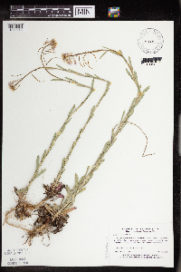 Boechera grahamii (Lehmann) Windham & Al-Shehbaz 475885[1352512]Myhre, K. 17891992-05-12 United States, Minnesota, Cass, Cass Co.; located one half mile east of the town of Bena; T 145N R 26W NE1/4 of SW1/4 of Sec 26;Chippewa National Forest / Leech Lake Indian Reservation;145N;26W;26, 47.335613 -94.092564 |
MIN:Plants | 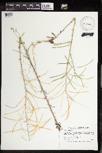 Boechera grahamii (Lehmann) Windham & Al-Shehbaz 476386[1352506]Smith, Welby 196351991-07-17 United States, Minnesota, Itasca, Itasca County ... Scenic State Park, abut 3 miles southeast of Big Fork ... T 60N R 26W NE1/4 of NE1/4 of Sec 1;Scenic State Park;060N;26W;1, 47.7213898 -93.5805588 |
MIN:Plants | Boechera grahamii (Lehmann) Windham & Al-Shehbaz 476462[]Aiton, G. s.n.1890-07-00 United States, Minnesota, Hennepin, [no further data];;;;, 45 -93.47 |
MIN:Plants | Boechera grahamii (Lehmann) Windham & Al-Shehbaz 488455[]Moore, John 200491949-06-01 United States, Minnesota, Otter Tail, On E shore of Otter Tail Lake;;N;;, 46.399132 -95.661637 |
MIN:Plants | Boechera grahamii (Lehmann) Windham & Al-Shehbaz 489741[]Stevens, O. 159a1936-06-14 United States, Minnesota, Clay, Muskoda [historic RR station near Hawley];;139N;45W;17, 46.854548 -96.396768 |
MIN:Plants | Boechera grahamii (Lehmann) Windham & Al-Shehbaz 497489[]Moore, John 202781949-06-23 United States, Minnesota, Cass, E shore of Woman Lake;;140N;28W;, 46.934801 -94.216123 |
MIN:Plants | Boechera grahamii (Lehmann) Windham & Al-Shehbaz 500761[]Moore, John 205151950-05-26 United States, Minnesota, Freeborn, along the n shore of Freeborn Lake at Freeborn;;N;;, 43.76579 -93.564108 |
MIN:Plants | Boechera grahamii (Lehmann) Windham & Al-Shehbaz 503033[]Moore, John 205681950-06-06 United States, Minnesota, Stevens, Along the shore of Long Lake, E of Morris.;;N;;, 45.5893 -95.79276 |
MIN:Plants | Boechera grahamii (Lehmann) Windham & Al-Shehbaz 519901[]Myhre, K. 43641993-08-07 United States, Minnesota, Pine, Pine Co.; located in the campground on the Willow River near the town of Willow River; T44N R20W SE1/4 of NE1/4 of Sec 2;General C C Andrews State Forest;044N;20W;2, 46.324306 -92.834766 |
MIN:Plants | Boechera grahamii (Lehmann) Windham & Al-Shehbaz 526173[]Moore, John 210921951-06-26 United States, Minnesota, Todd, 3 1/2 mi. SE of Staples;;N;;, 46.319676 -94.740326 |
MIN:Plants | Boechera grahamii (Lehmann) Windham & Al-Shehbaz 526212[]Moore, John 210381951-06-25 United States, Minnesota, Todd, 1 1/2 mi SE of Staples;;N;;, 46.340161 -94.769991 |
MIN:Plants | Boechera grahamii (Lehmann) Windham & Al-Shehbaz 532955[]Lakela, Olga 187401955-06-27 United States, Minnesota, Lake, Palisade Head on Lake Superior, 65 mi NE of Duluth;North Shore / Palisade Head;056N;07W;22, 47.32413 -91.213641 |
MIN:Plants | Boechera grahamii (Lehmann) Windham & Al-Shehbaz 538856[]Butters, F.; Abbe, E. s.n.1944-08-04 United States, Minnesota, Cook, near the Cross River, T65N R4W. Cook Co.;Superior National Forest;065N;04W;, 48.104919 -90.838094 |
MIN:Plants | Boechera grahamii (Lehmann) Windham & Al-Shehbaz 543115[]Lakela, Olga 213581957-06-08 United States, Minnesota, Saint Louis, s of Tomahawk Rd. jnc. with hwy 1.;Superior National Forest;N;;, 47.589862 -92.461466 |
MIN:Plants | Boechera grahamii (Lehmann) Windham & Al-Shehbaz 550326[]Cotter Tucker, Shirley 41481957-06-23 United States, Minnesota, Clearwater, At W end of Long Lake, (ca. 4 mi W of U, Itasca Park);;N;;, 47.276488 -95.298664 |
MIN:Plants | Boechera grahamii (Lehmann) Windham & Al-Shehbaz 560931[]Ownbey, Gerald; Anderson, Henry 27591959-07-01 United States, Minnesota, Clearwater, SE 1/4 Sec. 31, T147N, R38W, 0.4 mi. due N of Ebro, Co. Rd. 7.;;147N;38W;31, 47.506595 -95.542178 |
MIN:Plants | Boechera grahamii (Lehmann) Windham & Al-Shehbaz 568579[]Moore, John 250611961-06-20 United States, Minnesota, Kittson, 10 mi. E of Hallock.;;N;;, 48.775123 -96.749514 |
MIN:Plants | Boechera grahamii (Lehmann) Windham & Al-Shehbaz 568619[]Moore, John 249861960-06-15 United States, Minnesota, Kittson, 1 1/2 mi. SE of Lake Bronson;;N;;, 48.720182 -96.639548 |
MIN:Plants | Boechera grahamii (Lehmann) Windham & Al-Shehbaz 572785[]Moore, John; et al. 256281961-07-18 United States, Minnesota, Isanti, Field E of co. roadway 1/2 mi E of the Lungren Farmstead, Cedar Creek Natural History Area;Cedar Creek National History Area;034N;23W;, 45.428063 -93.203997 |
MIN:Plants | Boechera grahamii (Lehmann) Windham & Al-Shehbaz 574607[]Moore, John 247071959-07-29 United States, Minnesota, Kittson, 1/2 mi E of Karlstad;;N;;, 48.577476 -96.50966 |
MIN:Plants | Boechera grahamii (Lehmann) Windham & Al-Shehbaz 578682[]Ownbey, Gerald 31271962-06-18 United States, Minnesota, Hubbard, 2 mi by the road NW of the village of Lake George, at edge of road; T143N R34W NE1/4 Sec. 8;;143N;34W;8, 47.217772 -95.015485 |
MIN:Plants | Boechera grahamii (Lehmann) Windham & Al-Shehbaz 583308[]Kellner, H. 3841956-06-14 United States, Minnesota, Cook, Cook Co.; Slope of Rose Mt, Grand Portage;Grand Portage National Monument / North Shore;063N;06E;, 47.958468 -89.703576 |
MIN:Plants | Boechera grahamii (Lehmann) Windham & Al-Shehbaz 583901[]Gunderson, R. 721961-07-03 United States, Minnesota, Washington, St. Croix River, 3 mi N of Stillwater.;Saint Croix National Riverway;030N;20W;, 45.08498 -92.81735 |
MIN:Plants | Boechera grahamii (Lehmann) Windham & Al-Shehbaz 594161[]Thorne, Robert 305421962-06-18 United States, Minnesota, Hubbard, ca. 2 mi NW of Lake George;Paul Bunyan State Forest;N;;, 47.22098 -95.023756 |
MIN:Plants | Boechera grahamii (Lehmann) Windham & Al-Shehbaz 603721[]Moore, John; et al. 268201966-05-28 United States, Minnesota, Blue Earth, Blue Earth County...At the N end of Long Lake;;;;, 44.221533 -93.85229 |
MIN:Plants | Boechera grahamii (Lehmann) Windham & Al-Shehbaz 622299[]Westkaemper, Remberta s.n.1971-07-00 United States, Minnesota, Stearns, Stearns Co. Cold Spring;;123N;30W;, 45.456498 -94.4449 |
MIN:Plants | Boechera grahamii (Lehmann) Windham & Al-Shehbaz 645946[]Westkaemper, Remberta s.n.1973-06-09 United States, Minnesota, Stearns, Stearns Co. Byers 7 mi NW of St. Joseph;;124N;29W;, 45.543642 -94.322053 |
MIN:Plants | Boechera grahamii (Lehmann) Windham & Al-Shehbaz 678935[]Ownbey, Gerald 49211975-06-17 United States, Minnesota, Hubbard, 3 mi S of Park Rapids, U.S. rte 71, then 0.6 mi W of co. rte 14; T139N R35W NE1/4 Sec. 15;;139N;35W;15, 46.856006 -95.089605 |
MIN:Plants | Boechera grahamii (Lehmann) Windham & Al-Shehbaz 678936[]Ownbey, Gerald 50401975-07-25 United States, Minnesota, Cook, Cook County...Grand Portage, summit of Mt. Josephine;Grand Portage Indian Reservation / North Shore;064N;06E;34, 47.983098 -89.66244 |
MIN:Plants | Boechera grahamii (Lehmann) Windham & Al-Shehbaz 686965[]Wheeler, Gerald; Glaser, Paul 13901977-05-22 United States, Minnesota, Itasca, Site 17. NE1/4 Sec. 7, T56N, R26W; ca. 10.5 mi. NW of Grand Rapids.;;056N;26W;7, 47.3476 -93.692122 |
MIN:Plants | Boechera grahamii (Lehmann) Windham & Al-Shehbaz 691511[]Clemants, Steven 6801977-05-21 United States, Minnesota, Chisago, Goose Creek, ca. 3 mi NE of Harris, in the middle of the road; T36N R21W, intersection of Sec. 13, 14, 23, 24;Wild River State Park;036N;21W;, 45.600632 -92.960367 |
MIN:Plants | Boechera grahamii (Lehmann) Windham & Al-Shehbaz 695840[]Clemants, Steven 12851978-06-20 United States, Minnesota, Crow Wing, 1/2 mi. N of the town of Crow Wing. T144N, R31W, intersection of sections 16, 17, 19, 20.;;144N;31W;, 46.287206 -94.2925 |
MIN:Plants | Boechera grahamii (Lehmann) Windham & Al-Shehbaz 696547[]Smith, Welby 7661978-05-28 United States, Minnesota, Wright, Wright Co. Between Burlington Northern tracks and co. rd 75; T122N R25W N1/2 Sec. 32;;122N;25W;32, 45.331907 -93.860001 |
MIN:Plants | Boechera grahamii (Lehmann) Windham & Al-Shehbaz 698054[]Wheeler, Gerald; Glaser, Paul 28541978-05-23 United States, Minnesota, Beltrami, Ca. 2.5 mi. N of the Waskish Airport on Rte. 72, just NE of the road. Ditch which parallels Route 72.;Red Lake Peatland Scientific Natural Area;155N;30W;32, 48.20025 -94.521005 |
MIN:Plants | Boechera grahamii (Lehmann) Windham & Al-Shehbaz 709688[]Wheeler, Gerald 46951979-08-02 United States, Minnesota, Redwood, Redwood Co. Approx. 5.5 mi N of Belview on rte 7; T114N R37W Sec. 7;;114N;37W;7, 44.691689 -95.350531 |
MIN:Plants | Boechera grahamii (Lehmann) Windham & Al-Shehbaz 711520[]Smith, Welby 11551979-07-17 United States, Minnesota, Cook, Grand Portage Indian Reservation / North Shore. Cook County...T64N, R6E, SE1/4 SE1/4 Sec. 34. 1.5 mi. NW of Grand Portage. On Mt. Josephine toward Hat Point, 3/8 mi. S of Hwy. 61.. 064N 06E 34, 47.983098 -89.66244 |
MIN:Plants | Boechera grahamii (Lehmann) Windham & Al-Shehbaz 715172[]Severson, M. 351979-06-25 United States, Minnesota, Polk, 4.5 mi S of Fischer; W1/2 NW1/4 Sec.;Malmberg Prairie Scientific Natural Area;149N;48W;16, 47.72417 -96.813965 |
MIN:Plants | Boechera grahamii (Lehmann) Windham & Al-Shehbaz 717510[]Mathisen, Ron 121979-06-01 United States, Minnesota, Hubbard, Spearhead Lake;Spearhead Lake Preserve (Audubon);145N;34W;, 47.368099 -94.990966 |
MIN:Plants | Boechera grahamii (Lehmann) Windham & Al-Shehbaz 717869[]Lustig, K. 1181978-06-25 United States, Minnesota, Cook, Devil's Tract River; T62N R1E Sec. 12 and 13;Superior National Forest;062N;01E;, 47.845382 -90.317957 |
MIN:Plants | Boechera grahamii (Lehmann) Windham & Al-Shehbaz 720131[]Keller, C. 21979-04-30 United States, Minnesota, 2 miles southwest of Fertile.;Agassiz Dunes Scientific Natural Area;;;, 47.51564 -96.31032 |
MIN:Plants | Boechera grahamii (Lehmann) Windham & Al-Shehbaz 720285[]Ottoson, S. 161979-06-04 United States, Minnesota, 2 miles southwest of Fertile.;Agassiz Dunes Scientific Natural Area;;;, 47.51564 -96.31032 |
MIN:Plants | Boechera grahamii (Lehmann) Windham & Al-Shehbaz 721265[]Tornes, A. 3541979-05-31 United States, Minnesota, Sherburne, Clear Lake-Mississippi Scenic and Recreational River SNA, 12 mi SE of St. Cloud; Sec. 14, 22, 23 T34N R30W;Clear Lake Scientific Natural Area;034N;30W;, 45.446339 -94.043783 |
MIN:Plants | Boechera grahamii (Lehmann) Windham & Al-Shehbaz 722938[]Lustig, K. 3631979-06-01 United States, Minnesota, Anoka, Anoka Co. Helen Allison Savanna: 14 mi. SE of Cambridge, N1/2 of NE1/4 of Sec. 2, T33N, R23W.;Helen Allison Savanna Scientific Natural Area;033N;23W;2, 45.377702 -93.173879 |
MIN:Plants | Boechera grahamii (Lehmann) Windham & Al-Shehbaz 728546[]Sperling, C. 47801979-06-16 United States, Minnesota, Polk, Polk County...Agassiz Dunes.;Agassiz Dunes Scientific Natural Area;147N;44W;, 47.543099 -96.259086 |
MIN:Plants | Boechera grahamii (Lehmann) Windham & Al-Shehbaz 729777[]Converse, C. 2321980-06-09 United States, Minnesota, Pine, Pine Co. Kettle River Natural Area: 5.5 mi E of Hinckley. SW1/4 Sec. 23, T41N, R20W.;Kettle River Scientific Natural Area / Sandstone National Wildlife Refuge;041N;20W;23, 46.01861 -92.8358 |
Google Map
Google Maps is a web mapping service provided by Google that features a map that users can pan (by dragging the mouse) and zoom (by using the mouse wheel). Collection points are displayed as colored markers that when clicked on, displays the full information for that collection. When multiple species are queried (separated by semi-colons), different colored markers denote each individual species.