University of Minnesota
http://www.umn.edu/
612-625-5000
http://www.umn.edu/
612-625-5000
Minnesota Biodiversity Atlas
Bell Museum
Dataset: MIN-Plants
Search Criteria: Australia; Queensland; excluding cultivated/captive occurrences
1
Page 1, records 1-36 of 36
Bell Museum plants | |
 MIN:Plants | 499443[]Weiblen, G.D. GW6921996-06-10 Australia, Queensland, Mt. Whitfield Environmental Park, -16.88333 145.73333, 150m |
MIN:Plants | 499438[]Weiblen, G.D. GW9401997-07-04 Australia, Queensland, Ellis Beach, north of Cairns, -16.733333 145.65, 5m |
MIN:Plants | 936012[] GW27242006-09-13 Australia, Queensland, Mareeba Botanic Garden, Atherton Tablelands, -16.917444 145.389444, 331m |
MIN:Plants | 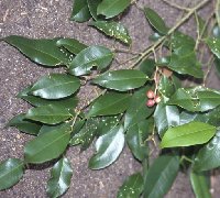 432564[]Weiblen, G.D. GW11002000-05-17 Australia, Queensland, Flecker Botanic Gardens, -16.916667 145.766667 |
MIN:Plants | 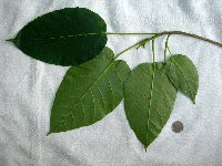 Ficus variegata Bl. 903455[] GW27462006-10-31 Australia, Queensland, Cape Tribulation, -16.25 145.316667 |
MIN:Plants | 903458[] GW27452006-10-30 Australia, Queensland, CSIRO Atheron Arboretum tree #44 ex Hyland 2927 (Pin Pin, Cape York Peninsula, Australia), -13.2 143.25 |
MIN:Plants | Artocarpus altilis (Parkinson) Fosberg 489552[]Weiblen, G.D. GW11042000-05-15 Australia, Queensland, Cape Tribulation, -16.25 145.316667, 59m |
MIN:Plants | Ficus destruens F. v. M. ex C. 431582[]Weiblen, G.D. GW9431997-07-05 Australia, Queensland, Adjacent to refuse dump, Cow Bay, -16.230338 145.455811 |
MIN:Plants | Ficus fraseri Miq. 903144[]Weiblen, G.D. GW27232006-09-13 Australia, Queensland, Hunter's Creek, -16.631694 145.316667, 385m |
MIN:Plants | 493333[]Weiblen, G.D. GW11052000-05-15 Australia, Queensland, Cape Tribulation, -16.25 145.316667, 59m |
MIN:Plants | Ficus hispida L.f. 462151[]Weiblen, G.D. GW9451997-07-05 Australia, Queensland, Cooper Creek near Thornton Beach between Cape Tribulation and Cow Bay, -16.176227 145.436641 |
MIN:Plants | 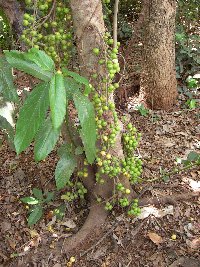 Ficus hispida L.f. 903453[] GW27472006-11-01 Australia, Queensland, Mount Webb National Park, -15.066667 145.116667, 60m |
MIN:Plants | Ficus leptoclada Benth. 499415[]Weiblen, G.D. GW9461997-07-05 Australia, Queensland, Cooper Creek between Cape Tribulation and Cow Bay, -16.166 145.415 |
MIN:Plants | 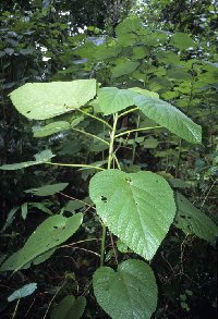 Dendrocnide moroides (Wedd.) Chew 489558[]Weiblen, G.D. GW11062000-05-15 Australia, Queensland, Cape Tribulation, -16.25 145.316667, 59m |
MIN:Plants | Ficus opposita Miq. 431310[]Weiblen, G.D. GW11022000-05-17 Australia, Queensland, Flecker Botanic Gardens, -16.916667 145.766667 |
MIN:Plants | Ficus pantoniana King 499439[]Weiblen, G.D. GW9471997-07-05 Australia, Queensland, Cooper Creek between Cape Tribulation and Cow Bay, -16.166 145.415 |
MIN:Plants |  Ficus pleurocarpa F. Muell. 499440[1340288]Weiblen, G.D. GW9441997-07-05 Australia, Queensland, Palm Road, between Cape Tribulation and Cow Bay, -16.203937 145.414211 |
MIN:Plants | Ficus L. 431309[]Weiblen, G.D. GW11072000-05-15 Australia, Queensland, Cape Tribulation, -16.25 145.316667, 59m |
MIN:Plants |  Dorstenia bahiensis Klotzsch ex von Fischer & von Meyer 949704[1297826]Weiblen, G.D. GW11012000-05-17 Australia, Queensland, Flecker Botanic Gardens, -16.916667 145.766667 |
MIN:Plants | Ficus destruens F. v. M. ex C. 462152[]George Weiblen GW9431997-05-07 Australia, Queensland, Adjacent to refuse dump, Cow Bay, -29.11403 167.94684 |
MIN:Plants | Trema orientalis (L.) Bl 489547[]G.D. Weiblen GW11032000-05-17 Australia, Queensland, Flecker Botanic Gardens, 16.916667 -145.766667 |
MIN:Plants | Caladenia carnea R.Br. 92047[1304084] Australia, Queensland, Peel Island, Detailed locality information protected. This is typically done to protect rare or threatened species localities. |
MIN:Plants | Caleana major R.Br. 92058[1304108] Australia, Queensland, Detailed locality information protected. This is typically done to protect rare or threatened species localities. |
MIN:Plants | Chiloglottis diphylla R.Br. 92138[1304494] Australia, Queensland, Brisbane, Detailed locality information protected. This is typically done to protect rare or threatened species localities. |
MIN:Plants |  Adiantum hispidulum Swartz 50703[1303518]unknown s.n. Australia, Queensland, near Herberton, -17.3333 145.9167 |
MIN:Plants | Dipodium punctatum R.Br. 92567[1310201]RBS Australia, Queensland, Gold Coast, Detailed locality information protected. This is typically done to protect rare or threatened species localities. |
MIN:Plants |  Carissa ovata R.Br. 173358[1330955] s.n. Australia, Queensland, Tallegalla, -27.594712 152.56557 |
MIN:Plants |  Chilocarpus australis F.Muell. 173360[1330994] s.n. Australia, Queensland, Mount Perry, -25.18024 151.64545 |
MIN:Plants |  Parsonsia eucalyptifolia Benth. 173386[1332500] s.n. Australia, Queensland |
MIN:Plants |  173465[1332795] s.n. Australia, Queensland, Tooloombah, Queensland, -22.705653 149.567754 |
MIN:Plants |  52811[1339601] s.n. Australia, Queensland, Brisbane |
MIN:Plants | 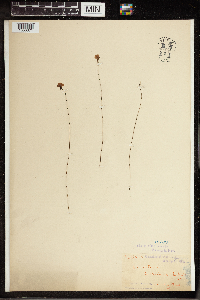 Utricularia dichotoma Labill. 191399[1350071] s.n. Australia, Queensland, Humpybong, -27.229936 153.111284 |
MIN:Plants | 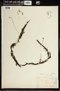 Utricularia flexuosa Vahl 191407[1350072]unknown s.n. Australia, Queensland, Sandgate, -27.320808 153.070174 |
MIN:Plants | 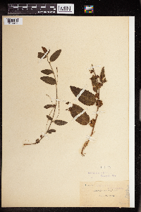 Acalypha nemorum Müll.Arg. 147405[1351196] s.n. Australia, Queensland, Taylor's Range. [Taylor Range, Brisbane], -27.474508 152.944845 |
MIN:Plants | 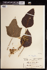 Aleurites moluccana (L.) Willd. 147498[1351251] s.n.1901-03-00 Australia, Queensland, Queensland, -20.373084 145.527344 |
MIN:Plants |  Mallotus philippensis (Lam.) Müll. Arg. 149167[1353649]J.L. Boorman s.n.1908-02-15 Australia, Queensland |
1
Page 1, records 1-36 of 36
Google Map
Google Maps is a web mapping service provided by Google that features a map that users can pan (by dragging the mouse) and zoom (by using the mouse wheel). Collection points are displayed as colored markers that when clicked on, displays the full information for that collection. When multiple species are queried (separated by semi-colons), different colored markers denote each individual species.