University of Minnesota
http://www.umn.edu/
612-625-5000
http://www.umn.edu/
612-625-5000
Minnesota Biodiversity Atlas
Bell Museum
Dataset: MIN-Plants
Search Criteria: Belize; excluding cultivated/captive occurrences
1
Page 1, records 1-26 of 26
Bell Museum plants | |
 MIN:Plants | 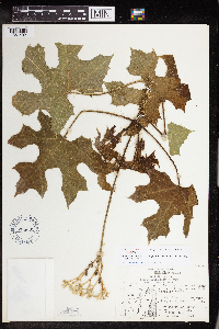 Cnidoscolus souzae McVaugh 704331[1351492]Leino, P. 76721976-12-07 Belize, Orange Walk, By quarry at cenote 1 km W. of San Antonio.;;;;, 18.131124 -88.683683 |
MIN:Plants | 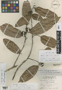 Brosimum belizense Lundell 929540[1002876]Gentle, P.H. 17371935-09-06 Belize, Belize ["British honduras']; Yucatan Peninsula; Gracie Rock, Sibun River |
MIN:Plants | 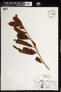 704342[1303002]Leino, Philip W. S76581976-12-01 Belize, Orange Walk, S. of San Antio village |
MIN:Plants | 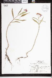 670864[1330858]Leino, Philip W. 3131974-07-01 Belize, Orange Walk, at NE corner of San Antonio village, 18.081304 -88.563475 |
MIN:Plants |  704369[1330861]Clevidence, Jennifer P. 75171975-02-00 Belize, Orange Walk, 100m. south of San Antonio village., 17.077708 -89.023611 |
MIN:Plants |  832244[1330862]Clevidence, Jennifer P. 75171975-02-00 Belize, Orange Walk, 100m south of San ANtonio village, 17.077708 -89.023611 |
MIN:Plants |  832245[1330863]Clevidence, Jennifer P. 75171975-02-00 Belize, 100 meters south of San Antonio village., 17.077708 -89.023611 |
MIN:Plants |  832246[1330864]Clevidence, Jennifer P. 15171975-02-00 Belize, Orange Walk, 100m south of San Antonio Village, 17.077708 -89.023611 |
MIN:Plants |  Gonolobus fraternus Schltdl. 670858[1332232]Leino, Philip W. 3061974-06-29 Belize, District Orange Walk, 1/2 mi north of San Antonio village, 16.107272 -88.933333 |
MIN:Plants | 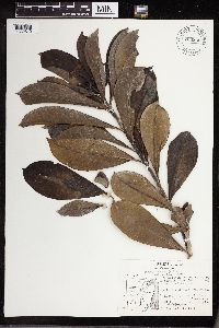 Thevetia ahouai A.DC. 704340[1332812]Leino, Phillip W. 76601976-12-01 Belize, Orange Walk; "Chacletin, Huevo de Perro. Corni Vargas. Roadside, 2 1/4 mi. from San Antonia on Yo Creek road Milky juice used for glue., 18.081304 -88.563475 |
MIN:Plants | 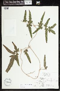 704336[1341978]Leino, Philip W. 76641976-12-02 Belize, Orange Walk District, San Anotnio village, 17.8333 -88.8333 |
MIN:Plants | 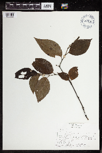 704335[1350229]Leino, Phillip W. 76651976-12-01 Belize, Orange Walk, Behind San Antonio cemetery at NW crnr of vill., 18.131124 -88.674182 |
MIN:Plants | 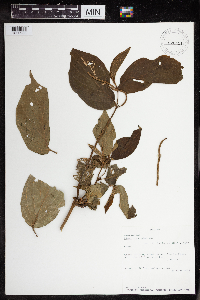 Piper hispidum Sw. 920451[1350285]D., John 108821973-06-02 Belize, Cayo, Grano de Oro, road toward Rio La Flor, vicinity of lumber mill. Cayo District, 16.8333 -88.9167, 518m |
MIN:Plants | 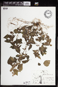 Acalypha alopecuroidea Jacq. 704371[1351079]Clevidence, Jennifer P. 75141975-02-00 Belize, Orange Walk, 100 m. south of San Antonio village., 16.099097 -88.933333 |
MIN:Plants | 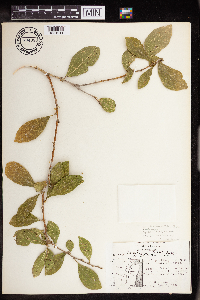 Adelia barbinervis Cham. & Schltdl. 704333[1351211]Leino, Phillip W. 76681976-12-02 Belize, District: Orange Walk., 16.099097 -88.933333 |
MIN:Plants |  Croton pyramidalis Donn.Sm. 670498[1353297] Belize |
MIN:Plants |  Sebastiania longicuspis Standl. 0963636[1353742] Belize |
MIN:Plants |  704411[1376360] Belize |
MIN:Plants |  670876[1376376] Belize |
MIN:Plants |  704372[1376377] Belize |
MIN:Plants |  704405[1376378] Belize |
MIN:Plants |  704406[1376379] Belize |
MIN:Plants |  Pteridium aquilinum (L.) Kuhn 832231[1383390] Belize |
MIN:Plants |  Pteridium aquilinum (L.) Kuhn 704394[1383391] Belize |
MIN:Plants |  Pteridium caudatum (L.) Maxon 535524[1383400] Belize |
MIN:Plants |  704343[1393291] Belize |
1
Page 1, records 1-26 of 26
Google Map
Google Maps is a web mapping service provided by Google that features a map that users can pan (by dragging the mouse) and zoom (by using the mouse wheel). Collection points are displayed as colored markers that when clicked on, displays the full information for that collection. When multiple species are queried (separated by semi-colons), different colored markers denote each individual species.