University of Minnesota
http://www.umn.edu/
612-625-5000
http://www.umn.edu/
612-625-5000
Minnesota Biodiversity Atlas
Bell Museum
Dataset: MIN-Plants
Search Criteria: Chile; excluding cultivated/captive occurrences
1
Page 1, records 1-19 of 19
Bell Museum plants | |
 MIN:Plants | Larrea tridentata var. tridentata (de Candolle) Coville 499402[]Went, F. s.n.1970-08-00 Chile, Amaicha [?] |
MIN:Plants |  Uncinia andina G.A. Wheeler 655367 939970[1127706]Zollner, O. 153641989-01-22 Chile, Araucania, Malleco, Region de la Araucania. Termas de Tolhuaca, 900m |
MIN:Plants |  Uncinia araucana G.A. Wheeler 939967[1127707]Zollner, O. 76811974-01-08 Chile, Araucania, Malleco, Region de la Araucania. Malalcahuello (near Curacautin) |
MIN:Plants |  Uncinia chilensis G.A. Wheeler 939963[1127708]Zollner, O. 152031989-01-22 Chile, Araucania, Malleco, Region de la Araucania. WSW of Longuimay. Cordillera de Las Raices, 1000m |
MIN:Plants |  Uncinia chilensis G.A. Wheeler 939965[1127709]Zollner, O. 188121992-02-14 Chile, Araucania, Malleco, Region de la Araucania. WSW of Longuimay. Cordillera de Las Raices, 1100m |
MIN:Plants |  Sisyrinchium caespitificum Kraenzl. 915983[1292329]Zika, Peter F. 19267 Chile, -33.361667 -70.291667 |
MIN:Plants |  Carex austroamericana G.A. Wheeler 953628[1292107]Pisano V., E. 52051980-11-14 Chile, Región de Magallanes y de la Antártica Chilena, Región de Magallanes y de la Antártica Chilena, Pali Aike, -52.116667 -69.766667 |
MIN:Plants |  Carex pleioneura G.A. Wheeler 953631[1292118]Morrison, J. L. 170381938-12-30 Chile, Petorca, V. Region de Valparaiso; Cerro Chache. 5 hours by horse SE of Patagua Mine, ca. 18 km E of La Ligua, -32.566667 -71.066667, 1900m |
MIN:Plants |  Carex toroensis G.A. Wheeler 953632[1292125]T.B.P.A. 18041977-01-18 Chile, Región de Magallanes y de la Antártica Chilena, Ultima Esperanza, Seno Ultima Esperanza. Puerto Toro; W of Rio Serrano, N of Ventisquero Balmaceda, -51.416667 -73.083333 |
MIN:Plants |  Carex transandina G.A. Wheeler 953627[1292126]T.B.P.A.-FIT 7791976-01-12 Chile, Región de Magallanes y de la Antártica Chilena, Ultima Esperanza, Isla Virtudes (E.), -51.516667 -74.916667 |
MIN:Plants |  Carex pisanoi G.A. Wheeler 955972[1295514]Elvebakk, Arve 96:0391996-01-05 Chile, Ultima Esperanza, Parque Nacional Torres del Paine |
MIN:Plants |  Carex macrosolen Steud. 955971[1295515]Elvebakk, Arve 96:7081996-00-25 Chile, Ultima Esperanza, Parque Nacional Torres del Paine |
MIN:Plants |  Carex pisanoi G.A. Wheeler 955970[1295516]Elvebakk, Arve 96:7521996-11-28 Chile, Ultima Esperanza, Parque Nacional Torres del Paine |
MIN:Plants | 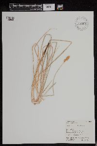 Carex macrorrhiza Boeck. 956109[1295622]Ruthsatz 8430 Chile, Tarapaca, -20.633333 -68.666667 |
MIN:Plants | 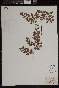 497055[1303438]Murray, Alex s.n. Chile |
MIN:Plants | 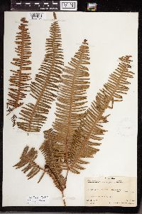 Dicranopteris linearis (Burm. f.) Underw. 416283[1338152]Fosberg, F.R. 114251934-07-08 Chile, Rapa, S.E. ridge Mt. Pukunia, 350m |
MIN:Plants | 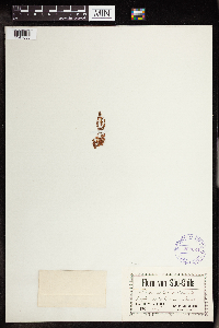 Crassula paludosa Reiche 292824[1347035]Buchtien, Otto 1091904-11-17 Chile |
MIN:Plants | 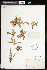 Stenandrium dulce (Cav.) Nees 191902[1356433]E. W. D. Holway 2411919-12-17 Chile |
MIN:Plants | 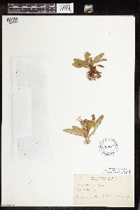 Stenandrium dulce (Cav.) Nees 191901[1356428]E. W. D. Holway 2411919-12-17 Chile |
1
Page 1, records 1-19 of 19
Google Map
Google Maps is a web mapping service provided by Google that features a map that users can pan (by dragging the mouse) and zoom (by using the mouse wheel). Collection points are displayed as colored markers that when clicked on, displays the full information for that collection. When multiple species are queried (separated by semi-colons), different colored markers denote each individual species.