University of Minnesota
http://www.umn.edu/
612-625-5000
http://www.umn.edu/
612-625-5000
Minnesota Biodiversity Atlas
Bell Museum
Dataset: MIN-Plants
Search Criteria: Honduras; Cortez; excluding cultivated/captive occurrences
1
Page 1, records 1-7 of 7
Bell Museum plants | |
 MIN:Plants | 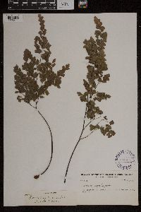 Adiantum tenerum Sw. 294305[1303411]Yuncker, T.G. 48881934-07-31 Honduras, Cortez, near Potrerillos, 14 -86.766667 |
MIN:Plants | Epidendrum difforme Jacq. 294656[1310324]Yuncker, T.G. Honduras, Cortez, Detailed locality information protected. This is typically done to protect rare or threatened species localities. |
MIN:Plants | Epidendrum difforme Jacq. 294668[1310325]Yuncker, T.G. Honduras, Cortez, Detailed locality information protected. This is typically done to protect rare or threatened species localities. |
MIN:Plants | Epidendrum difforme Jacq. 294706[1310327]Yuncker, T.G. Honduras, Cortez, Detailed locality information protected. This is typically done to protect rare or threatened species localities. |
MIN:Plants | Isochilus linearis (Jacq.) R.Br. 295780[1313479]Yuncker, T.G. Honduras, Cortez, Detailed locality information protected. This is typically done to protect rare or threatened species localities. |
MIN:Plants | 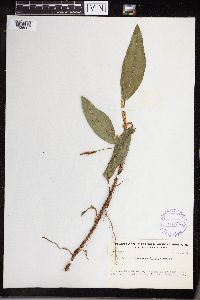 Anthurium scandens (Aublet) Engler 295762[1335007]Yuncker, T.G. 4836 Honduras, Cortez, Near the shore of Lake Yojoa., 14.871674 -87.982476, 640m |
MIN:Plants | 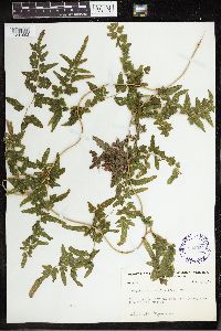 Lygodium polymorphum (Cav.) Kunth 294224[1341992]Yuncker, T.G. 48721934-07-31 Honduras, Cortez, near Potrerillos, 14 -86.766667 |
1
Page 1, records 1-7 of 7
Google Map
Google Maps is a web mapping service provided by Google that features a map that users can pan (by dragging the mouse) and zoom (by using the mouse wheel). Collection points are displayed as colored markers that when clicked on, displays the full information for that collection. When multiple species are queried (separated by semi-colons), different colored markers denote each individual species.