University of Minnesota
http://www.umn.edu/
612-625-5000
http://www.umn.edu/
612-625-5000
Minnesota Biodiversity Atlas
Bell Museum
Dataset: MIN-Plants
Search Criteria: Honduras; Morazan; excluding cultivated/captive occurrences
1
Page 1, records 1-27 of 27
Bell Museum plants | |
 MIN:Plants | 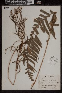 Blechnum ensiforme C.Chr. 426352[1309588]Glassman, S.F. 20401928-07-24 Honduras, Morazan, Mt. Uyuca, Cloud Forest, Drainage of the Rio Yeguare, at about Longitude 87o W and Latitiude 14o N, 1829m |
MIN:Plants | 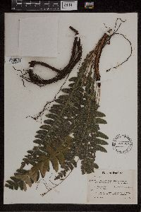 Blechnum maxonii C.Chr. 426503[1309591]Glassman, S.F. 2041 Honduras, Morazan, Mt. Uyuca, Cloud Forest, Drainage of the Rio Yeguare, at about Longitude 87 W. and Latitude 14 N, 1829m |
MIN:Plants | 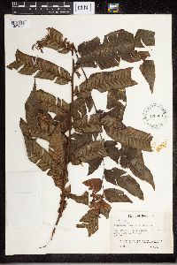 426508[1327346]Glassman, S.F. 20391948-07-24 Honduras, Morazan, Mt. Uyuca, Cloud Forest, Drainage of the Rio Yeguare, 1829m |
MIN:Plants | 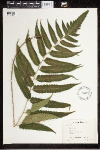 426412[1327347]Glassman, S.F. 16751948-06-19 Honduras, Morazan, Mt. San Juancito, 1676m |
MIN:Plants | 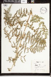 426398[1326281]Glassman, S.F. 16601948-06-19 Honduras, Morazan, Mt. San Juancito, 1829m |
MIN:Plants | 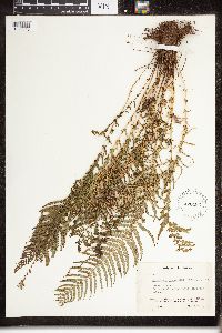 Dryopteris panamensis (Pr.) C.Chr. 426183[1326343]Glassman, S.F. 17271948-06-24 Honduras, Morazan, Jicarito River; Drainage of the Rio Yeguare |
MIN:Plants | 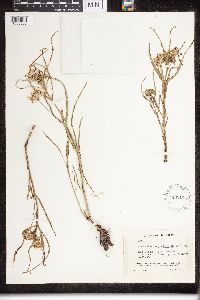 Asclepias angustifolia Schweigg. 426242[1330838] 15521948-06-11 Honduras, Morazan, Las Meses, drainage of the Rio Yeguare, 14 -87, 1097m |
MIN:Plants | 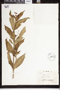 426447[1330854]Glassman, S.F. 18061943-06-28 Honduras, Morazan, Drainage of the Rio Yeguare, Along Chorrera River,, 14.45 -88.25, 792m |
MIN:Plants |  Dictyanthus asper (Mill.) W.D.Stevens 426554[1332143]Glassman, S.F. 1919 Honduras, Morazán, Yeguare River, 14.066669 -86.86669, 792m |
MIN:Plants |  Dictyanthus ceratopetalus Donn.Sm. 426512[1332145]Glassman, S.F. 1902 Honduras, Morazán, Jicarito River, Liana, 13.85 -87.033333, 792m |
MIN:Plants |  Mandevilla subsagittata (Ruiz & Pav.) Woodson 426314[1332310]Glassman, S.F. 1751 Honduras, Morazán, 3/4 mile northwest of Zamorano; Drainage of the Río Yeguare., 14.074381 -86.374619, 853 - 975m |
MIN:Plants |  Thevetia nitida A.DC. 426233[1332817]Glassman, S.F. 1819 Honduras, Morazán, Casa Blanca, 14.933333 -87.916667, 838m |
MIN:Plants | 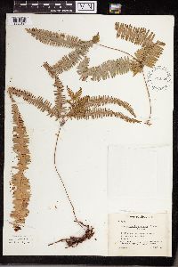 Gleichenia flexuosa (Schrad.) Mett. 426576[1338124]Glassman, S.F. 1948-06-14 Honduras, Morazan, 1 mile East of Penas Gordas. Drainage of the Rio Yeguare, 792m |
MIN:Plants | 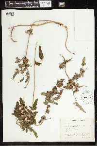 Lygodium polymorphum (Cav.) Kunth 426207[1341990]Glassman, S.F. 19271948-07-16 Honduras, Morazan, Yeguare River. Drainage of the Rio Yeguare, 14.066667 -86.866667, 792m |
MIN:Plants | 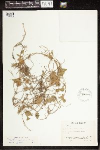 Marsilea mexicana A. Braun 426336[1342074]Glassman, S.F. 20541948-07-26 Honduras, Morazan, Casa Blanca, Rio Yeguare, 13.985833 -87.000833 |
MIN:Plants | 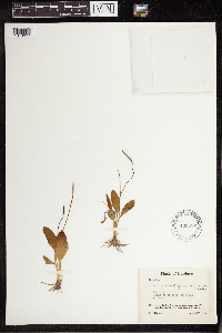 Ophioglossum ellipticum Hook. & Grev. 426552[1343077]Glassman, S.F. 17711948-06-26 Honduras, Morazan, Casitas, 14.383333 -87.916667, 853m |
MIN:Plants | 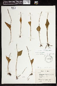 Ophioglossum petiolatum Hook. 426396[1343083]Glassman, S.F. 18371948-07-05 Honduras, Morazan, Mt. Uyuca, 15.5 -86.466667, 1676m |
MIN:Plants | 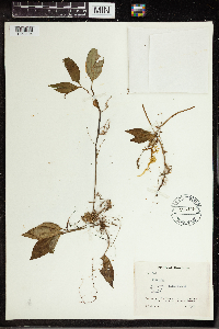 426419[1350104]Glassman, S.F. 1608 Honduras, Morazán, Mt. Uyuca - cloud forest., 14.043384 -87.078659, 1920m |
MIN:Plants | 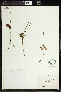 Peperomia condormiens Trel. 426511[1350116]Glassman, S.F. 1975 Honduras, Morazán, Mt. San Juancito; Cloud forest., 14.22317 -87.06867, 2134m |
MIN:Plants | 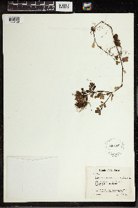 426215[1350158]Glassman, S.F. 1549 Honduras, Morazán, Mt. Uyuca - Cloud forest., 14.043384 -87.078659, 1920m |
MIN:Plants |  426452[1350256]Glassman, S.F. 2088 Honduras, Morazán, Drainage of the Río Yeguare., 14.066667 -86.866667, 1372m |
MIN:Plants |  Piper auritum Kunth 426258[1350271]Glassman, S.F. 2137 Honduras, Morazan, Vicinity of Jicarito River. Drainage of the Río Yeguare., 14.066667 -86.866667, 792m |
MIN:Plants |  Piper epilosipes Trel. 426178[1350278]Glassman, S.F. 1633 Honduras, Morazán, Mt. Uyuca - cloud forest. Drainage of Río Yeguare., 14.043384 -87.078659, 1920m |
MIN:Plants |  Acalypha arvensis Poepp. 426274[1351086]Glassman, S.F. 17361948-06-24 Honduras, Morazan, Along Jicarito River., 14.033333 -87.066667, 792m |
MIN:Plants |  Acalypha leptopoda Müll.Arg. 426593[1351114]Glassman, S.F. 19101948-07-16 Honduras, Morazan, Yeguare River. Liana?, 14.052778 -86.962223, 792m |
MIN:Plants |  Acalypha leptopoda Müll.Arg. 426293[1351115]Glassman, S.F. 1823 Honduras, Morazan, Casa Blanca. Drainage of the Rio Yeguare., 14.933333 -87.916667, 838m |
MIN:Plants |  Caperonia palustris (L.) A. St.-Hil. 426588[1351359]Glassman, S.F. 1794 Honduras, Morazan, Along Chorrera River. Drainage of the Rio Yeguare., 14 87, 792m |
1
Page 1, records 1-27 of 27
Google Map
Google Maps is a web mapping service provided by Google that features a map that users can pan (by dragging the mouse) and zoom (by using the mouse wheel). Collection points are displayed as colored markers that when clicked on, displays the full information for that collection. When multiple species are queried (separated by semi-colons), different colored markers denote each individual species.