University of Minnesota
http://www.umn.edu/
612-625-5000
http://www.umn.edu/
612-625-5000
Minnesota Biodiversity Atlas
Bell Museum
Dataset: MIN-Plants
Search Criteria: Nicaragua; Masaya; excluding cultivated/captive occurrences
1
Page 1, records 1-5 of 5
Bell Museum plants | |
 MIN:Plants | 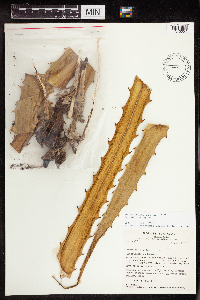 488862[1345057]Stevens, Warren Douglas 44371977-10-06 Nicaragua, Masaya, Parque Nacional Volcán Masaya, near W shore of Laguna de Masaya, ca. 7.1 km S of Hwy 4., 11.969618 -86.114508, 140 - 200m |
MIN:Plants | 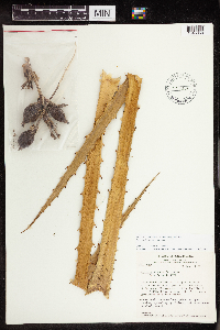 515309[1345058]Stevens, Warren Douglas 4296 Nicaragua, Masaya, Parque Nacional Volcán Masaya, small peninsula on W shore of Laguna de Masaya, ca. 3.9 km S of Hwy 4., 11.969618 -86.114508, 135 - 145m |
MIN:Plants | 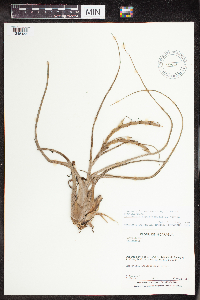 Tillandsia caput-medusae E.Morren 488105[1345155]Moreno, P. 89141981-05-30 Nicaragua, Masaya, Laguna de Masaya., 11.969618 -86.114508, 120 - 160m |
MIN:Plants | 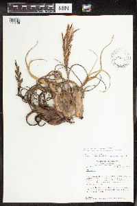 Tillandsia caput-medusae E.Morren 515326[1345156]Stevens, Warren Douglas 11,0551978-12-11 Nicaragua, Masaya, Parque Nacional Volcán Masaya, W shore of Laguna de Masaya, ca. 3.9 km S of Hwy. 4; ca., 11.969618 -86.114508, 140m |
MIN:Plants | 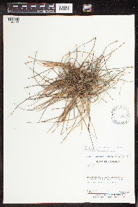 Tillandsia schiedeana Steud. 493786[1345199]Moreno, P. 89121981-05-30 Nicaragua, Masaya, Departamento de Masaya: Laguna de Masaya [Masaya Department: Masaya Lagoon], 11.983333 -86.133333, 120 - 160m |
1
Page 1, records 1-5 of 5
Google Map
Google Maps is a web mapping service provided by Google that features a map that users can pan (by dragging the mouse) and zoom (by using the mouse wheel). Collection points are displayed as colored markers that when clicked on, displays the full information for that collection. When multiple species are queried (separated by semi-colons), different colored markers denote each individual species.