University of Minnesota
http://www.umn.edu/
612-625-5000
http://www.umn.edu/
612-625-5000
Minnesota Biodiversity Atlas
Bell Museum
Dataset: MIN-Plants
Search Criteria: Sudan; excluding cultivated/captive occurrences
1
Page 1, records 1-16 of 16
Bell Museum plants | |
 MIN:Plants |  84504[1337411]G. Schweinforth 11111869-06-02 Sudan |
MIN:Plants |  58648[1369041] 10171969-01-15 Sudan, Lemonile region, Gebel (Njemati) |
MIN:Plants |  91402[1369109] 19721969-06-23 Sudan, In river region: Seriba Ghattas |
MIN:Plants |  80476[1374722]G. Schweinfurth 11731969-02-15 Sudan, In regione Bahr el Ghazal Nutr |
MIN:Plants | 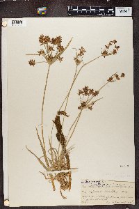 Cyperus mundii (Nees) Kunth 81043[1374731]Schweinfurth, G. A, 11191869-00-00 Sudan, Bahr-el-Arab River |
MIN:Plants | 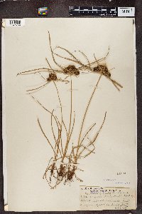 81094[1374732]G. Schweinfurth 19891969-06-28 Sudan, In regione Bjur: Seriba Ghattas |
MIN:Plants | 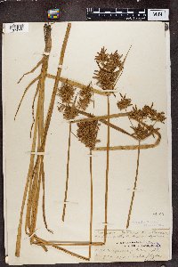 Cyperus pilosus Vahl 81105[1374735]G. Schweinfurth 20171869-07-05 Sudan, In regional Djur: Seriba Ghattas |
MIN:Plants | 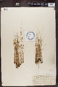 Cyperus afzelii Boeckeler 80494[1374738]Schweinfurth, G. A, 19481969-06-18 Sudan, Seriba Ghattas |
MIN:Plants | 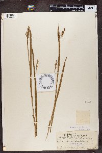 Scleria tessellata Willd. 84073[1374746]G. Schweinfurth 2560 Sudan, Djur region |
MIN:Plants | 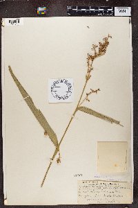 Scleria racemosa Benth. 84061[1374747]G. Schweinfurth 13531869-03-04 Sudan, In regione Bjur: Seriba Ghattas |
MIN:Plants | 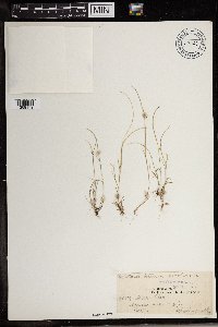 67863[1369179]Schweinfurth 25591869-12-09 Sudan, In Djur Region |
MIN:Plants | 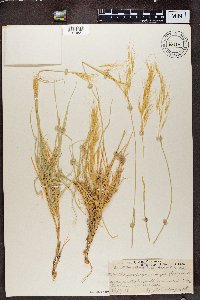 Chrysopogon quinqueplumis A. Rich. 63664[1374821]Schweinfurth 7071968-09-28 Sudan, between Suakin and Berber |
MIN:Plants | 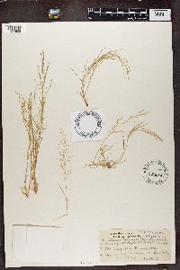 Eragrostis tenuiflora Rupr. ex Steud. 65655[1374845]Marig 3951868-09-24 Sudan, In region between Suakim and Berber |
MIN:Plants | 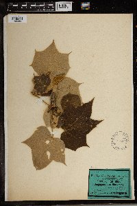 Sterculia hartmanniana Schweinf. 154194[1369868]Dr. C. Schweinfurth 12031865-08-00 Sudan, Umgegend von Matamma |
MIN:Plants | 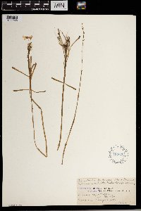 Dopatrium tricolor Engl. 187676[1302565] 25571969-10-16 Sudan, In Bongo region: Gir |
MIN:Plants | 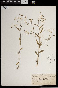 Hydrolea L. 229756[1302658] 25401969-10-02 Sudan, Djuri region; Seriba Ghattas |
1
Page 1, records 1-16 of 16
Google Map
Google Maps is a web mapping service provided by Google that features a map that users can pan (by dragging the mouse) and zoom (by using the mouse wheel). Collection points are displayed as colored markers that when clicked on, displays the full information for that collection. When multiple species are queried (separated by semi-colons), different colored markers denote each individual species.