University of Minnesota
http://www.umn.edu/
612-625-5000
http://www.umn.edu/
612-625-5000
Minnesota Biodiversity Atlas
Bell Museum
Dataset: MIN-Plants
Taxa: Calycadenia
Search Criteria: excluding cultivated/captive occurrences
1
Page 1, records 1-8 of 8
Bell Museum plants | |
 MIN:Plants | 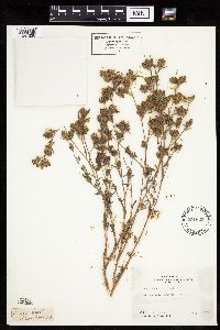 Calycadenia mollis A. Gray 231623[1041228]Congdon, J. s.n.1883-07-10 United States, California, Mariposa, Snow Creek;Yosemite National Park |
MIN:Plants | 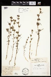 Calycadenia mollis A. Gray 231744[1041229]Congdon, J. s.n.1883-07-10 United States, California, Mariposa, Snow Creek Road;Yosemite National Park |
MIN:Plants | 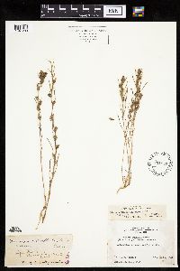 Calycadenia multiglandulosa de Candolle 231957[1041230]Congdon, J. s.n.1882-06-29 United States, California, Mariposa, Aqua Fria;Yosemite National Park |
MIN:Plants | Calycadenia mollis A. Gray 231628[]Congdon, J. s.n.1883-07-09 United States, California, Mariposa, Aqua Fria;Yosemite National Park |
MIN:Plants | 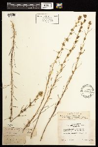 Calycadenia multiglandulosa de Candolle 231835[1181093]Congdon, J. s.n.1895-05-26 United States, California, Mariposa, Mormon Bar;Yosemite National Park;;;, 37.46222 -119.94694 |
MIN:Plants | Calycadenia mollis A. Gray 231632[]Congdon, J. s.n.1885-06-00 United States, California, Mariposa, Snow Creek;Yosemite National Park |
MIN:Plants | 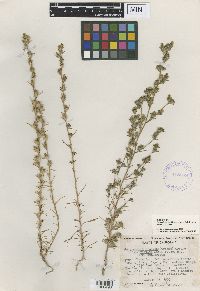 Calycadenia hispida subsp. reducta D.D. Keck 418568[1000496]Keck, D.D. 24871933-08-22 United States, California, Santa Clara, Colorado Creek (North Fork of Arroyo Bayo), Mt. Hamilton Range, 840m |
MIN:Plants | 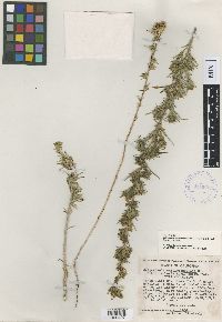 418602[1000497]Keck, D.D. 24861933-08-22 United States, California, Santa Clara, East flank of Mount Hamilton, 1 mile W. of Isabel Creek, on the San Antonio road, 671m |
1
Page 1, records 1-8 of 8
Google Map
Google Maps is a web mapping service provided by Google that features a map that users can pan (by dragging the mouse) and zoom (by using the mouse wheel). Collection points are displayed as colored markers that when clicked on, displays the full information for that collection. When multiple species are queried (separated by semi-colons), different colored markers denote each individual species.