University of Minnesota
http://www.umn.edu/
612-625-5000
http://www.umn.edu/
612-625-5000
Minnesota Biodiversity Atlas
Bell Museum
Dataset: MIN-Plants
Taxa: Cirsium discolor
Search Criteria: excluding cultivated/captive occurrences
Bell Museum plants | |
 MIN:Plants | 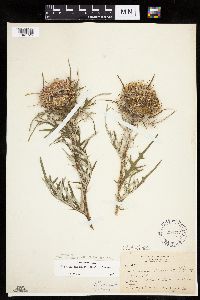 Cirsium discolor (Muhlenberg ex Willdenow) Sprengel 294773[1041726]Benner, F.; Benner, J. 971928-08-03 United States, Wisconsin, Polk, 3 mi. N. St. Croix Falls, Wis on the River Road;Saint Croix National Riverway;;;, 45.450989 -92.648462 |
MIN:Plants | 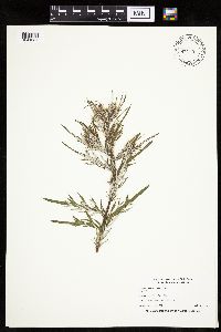 Cirsium discolor (Muhlenberg ex Willdenow) Sprengel 432119[1041684]Nation, R. 94-2591994-07-18 United States, Minnesota, Mower, Lake Louise State Park. Mower Co.; Tract 1B. T101N R14W W1/2 SE1/4 of Sec. 21;Lake Louise State Park;101N;14W;21, 43.536578 -92.519043 |
MIN:Plants | 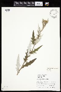 Cirsium discolor (Muhlenberg ex Willdenow) Sprengel 493599[1041651]Juhnke, C. 509 CMJ FRO1999-08-05 United States, Minnesota, Goodhue, Frontenac State Park. Frontenac State Park. Goodhue County ... adjacent to railroad tracks near southern border of park ... T112N R13W SW SW NE 14. 112N 13W 14, 44.505485 -92.339405 |
MIN:Plants | 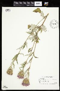 Cirsium discolor (Muhlenberg ex Willdenow) Sprengel 910930[1041659]Smith, Welby 219661992-09-07 United States, Minnesota, Watonwan, Eagle Nest County Park. Watonwan County...In Eagle Nest County Park, about 5 miles east of St. James...outh Fork Watonwan River... T 106N R 31W NE1/4 of NE1/4 of Sec 14. 106N 31W 14, 43.9925 -94.5097222 |
MIN:Plants | 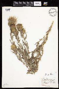 Cirsium discolor (Muhlenberg ex Willdenow) Sprengel 455731[1041720]Moore, John 5181971-08-29 United States, Minnesota, Sherburne, SE1/4 Sec 24 Santiago Tshp. [Sherburne Wildlife Refuge; Sherburne Co.];Sherburne National Wildlife Refuge;035N;28W;24, 45.508797 -93.768814 |
MIN:Plants | 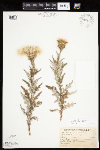 Cirsium discolor (Muhlenberg ex Willdenow) Sprengel 763555[1041683]Lugger, O. 4078 United States, Minnesota, Blue Earth, Mankato;;108N;26W;00, 44.152568 -93.948763 |
MIN:Plants | 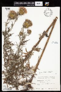 Cirsium discolor (Muhlenberg ex Willdenow) Sprengel 669902[1041675]Grimm, Eric 991974-08-20 United States, Minnesota, Hennepin, Hennepin County...YMCA Camp Ihduhapi, Loretto. Growing along the E side of the athletic field.;;118N;24W;12, 45.043836 -93.655981 |
MIN:Plants | 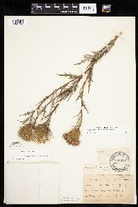 Cirsium discolor (Muhlenberg ex Willdenow) Sprengel 205394[1041709]Herrick, C. s.n.1879-05-00 United States, Minnesota, Hennepin, Minneapolis;;029N;24W;25, 44.96996 -93.23702 |
MIN:Plants |  Cirsium discolor (Muhlenberg ex Willdenow) Sprengel 205395[1041682]Taylor, B. T9001892-07-00 United States, Minnesota, Faribault, Minnesota Lake;;N;;, 43.804422 -93.827689 |
MIN:Plants |  Cirsium discolor (Muhlenberg ex Willdenow) Sprengel 205398[1041703]Oestlund, O. s.n.1886-00-00 United States, Minnesota, Hennepin, Minneapolis;;N;;, 44.979965 -93.263836 |
MIN:Plants |  Cirsium discolor (Muhlenberg ex Willdenow) Sprengel 205400[1127188]Sandberg, John s.n.1884-08-00 United States, Minnesota, Goodhue, Red Wing;;113N;14W;, 44.555216 -92.495543 |
MIN:Plants |  Cirsium discolor (Muhlenberg ex Willdenow) Sprengel 205401[1127187]Sandberg, John s.n.1890-08-00 United States, Minnesota, Hennepin, [no further data];;;;, 45 -93.47 |
MIN:Plants |  Cirsium discolor (Muhlenberg ex Willdenow) Sprengel 205402[1041672]Manning, Sara s.n.1883-08-29 United States, Minnesota, Wabasha, Lake City;;N;;, 44.449412 -92.266844 |
MIN:Plants |  Cirsium discolor (Muhlenberg ex Willdenow) Sprengel 205403[1127183]Oestlund, O. 88-11888-08-14 United States, Minnesota, Hennepin, [no further data];;;;, 45 -93.47 |
MIN:Plants |  Cirsium discolor (Muhlenberg ex Willdenow) Sprengel 205404[1041704]Kassube, J. s.n.1877-00-00 United States, Minnesota, Hennepin, Minneapolis;;N;;, 44.979965 -93.263836 |
MIN:Plants |  Cirsium discolor (Muhlenberg ex Willdenow) Sprengel 205405[1041687]MacMillan, C.; et al. 12Sk1900-08-00 United States, Minnesota, Polk, Crookston;;150N;46W;30, 47.782 -96.60007 |
MIN:Plants | 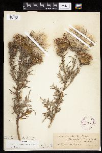 Cirsium discolor (Muhlenberg ex Willdenow) Sprengel 264208[1041725]Holzinger, John s.n.1923-08-21 United States, Minnesota, Winona, Warren Twp, Winona Co.;Dorer Memorial Hardwood State Forest;106N;08W;, 43.976663 -91.779559 |
MIN:Plants | 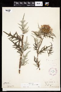 Cirsium discolor (Muhlenberg ex Willdenow) Sprengel 277914[1041671]Roberts, Thomas s.n.1878-08-16 United States, Minnesota, Hennepin, Minneapolis;;N;;, 44.979965 -93.263836 |
MIN:Plants | 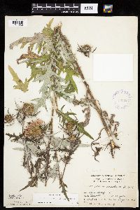 Cirsium discolor (Muhlenberg ex Willdenow) Sprengel 332622[1041722]Grant, Martin 66831935-08-26 United States, Minnesota, Clearwater, Itasca Park. Near campus [Univ. of Minn. Biol. Sta.] Sec NE-SE 2 T143 R36;Itasca State Park;143N;36W;2, 47.231973 -95.201528 |
MIN:Plants | 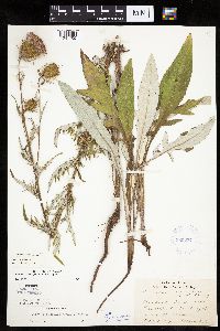 Cirsium discolor (Muhlenberg ex Willdenow) Sprengel 380237[1041705]Lakela, Olga 54861943-09-04 United States, Minnesota, Saint Louis, near Lester Park, Highway 61, Duluth;North Shore;050N;13W;05, 46.844016 -92.016103 |
MIN:Plants |  Cirsium discolor (Muhlenberg ex Willdenow) Sprengel 381758[1041723]Moore, John 156671942-09-10 United States, Minnesota, Washington, McKusick Lake, Stillwater;;030N;20W;29, 45.057568 -92.83305 |
MIN:Plants |  Cirsium discolor (Muhlenberg ex Willdenow) Sprengel 404545[1041692]Ownbey, Gerald; et al. 12561949-09-03 United States, Minnesota, Scott, Scott County...5.7 miles southwest of Belle Plaine on Hwy.169.;;113N;25W;00, 44.586519 -93.828706 |
MIN:Plants |  Cirsium discolor (Muhlenberg ex Willdenow) Sprengel 404595[1041680;1041681]Ownbey, Gerald 12331949-08-24 United States, Minnesota, Polk, Polk County ... Hwy. 2, 2 mi W of Fosston.;;148N;40W;, 47.630171 -95.747323 |
MIN:Plants |  Cirsium discolor (Muhlenberg ex Willdenow) Sprengel 404596[1041668]Ownbey, Gerald; et al. 12581949-09-04 United States, Minnesota, Blue Earth, Blue Earth County... 0.2 mi E of Eagle Lake on Hwy.60;;;;, 44.164043 -93.869837 |
MIN:Plants | 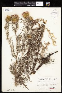 Cirsium discolor (Muhlenberg ex Willdenow) Sprengel 404598[1041678;1041679]Ownbey, Gerald; et al. 12071949-08-07 United States, Minnesota, Red Lake, Red Lake County ... 1.8 mi S of Plummer on Hwy.59. Between hwy. drainage ditch and railroad right-of-way.;;151N;42W;, 47.891159 -96.031763 |
MIN:Plants | 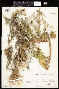 Cirsium discolor (Muhlenberg ex Willdenow) Sprengel 404645[1041693;1041694]Ownbey, Gerald; et al. 12551949-08-31 United States, Minnesota, McLeod, McLeod County ... 1.1 mi E of Plato on Hwy.212.;;115N;27W;, 44.760785 -94.070986 |
MIN:Plants | 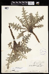 Cirsium discolor (Muhlenberg ex Willdenow) Sprengel 404647[1041663]Ownbey, Gerald 11681949-04-26 United States, Minnesota, Hennepin, Hennepin County...Ft. Snelling;Fort Snelling Military Reservation;028N;23W;18, 44.88823 -93.17951 |
MIN:Plants | 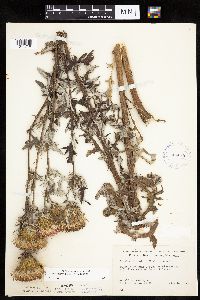 Cirsium discolor (Muhlenberg ex Willdenow) Sprengel 404648[1041718]Ownbey, Gerald; et al. 11861949-08-06 United States, Minnesota, Becker, Becker County...Highway #34, 4.3 miles east of Detroit Lakes;;139N;40W;29, 46.825167 -95.763806 |
MIN:Plants |  Cirsium discolor (Muhlenberg ex Willdenow) Sprengel 404649[1041661]Ownbey, Gerald 11741949-05-10 United States, Minnesota, Anoka, Anoka County...Moore Lake;;030N;24W;23, 45.073016 -93.257296 |
MIN:Plants |  Cirsium discolor (Muhlenberg ex Willdenow) Sprengel 415136[1041695;1041696]Ownbey, Gerald 1231a1949-08-17 United States, Minnesota, Polk, Polk County ... 13.5 mi W of Bagley.;;147N;39W;, 47.543024 -95.618124 |
MIN:Plants |  Cirsium discolor (Muhlenberg ex Willdenow) Sprengel 430111[1041656]Haferman, J. 1591995-08-20 United States, Minnesota, Scott, Scott Co. T115N R22W S36 SW of SW. Approx. 0.1 mi N-NE of intersection of State Hwy.13 and Co. Road 44 on N side of high Scott Co. T115N R22W S36 SW of SW. Approx. 0.1 mi N-NE of intersection of State Hwy.13 and Co. Road 44 on N side of highway.. 115N 22W 36, 44.724586 -93.409031 |
MIN:Plants |  Cirsium discolor (Muhlenberg ex Willdenow) Sprengel 440777[1041698]Smith, Welby 138601987-08-14 United States, Minnesota, Washington, Washington County ... About 2 mi south of St. Paul Park ... NW1/4 SE1/4 sec 30, T 27N R 21W;Grey Cloud Dunes Scientific Natural Area;027N;21W;30, 44.7949982 -92.9683304 |
MIN:Plants | 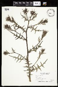 Cirsium discolor (Muhlenberg ex Willdenow) Sprengel 441079[1041676]Nation, R. 94-3071994-07-18 United States, Minnesota, Mower, Lake Louise State Park. Mower Co.; Tract 14. T101N R14W NW1/4 of SE1/4 of Sec. 20;Lake Louise State Park;101N;14W;20, 43.536572 -92.538986 |
MIN:Plants | 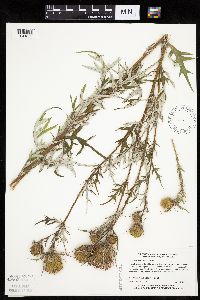 Cirsium discolor (Muhlenberg ex Willdenow) Sprengel 441329[1041652]Myhre, K. 44351993-08-10 United States, Minnesota, Pine, Located just E of the public access to the St. Croix River, 1/2 mi N of Danbury. SE1/4 of SE1/4 of section;Saint Croix State Forest;041N;16W;21, 46.020737 -92.372457 |
MIN:Plants | 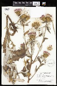 Cirsium discolor (Muhlenberg ex Willdenow) Sprengel 443425[1041685]Myhre, K. 30651992-08-14 United States, Minnesota, Cass, Cass Co.; Located one mile northwest of Lake Ada; T 139N R 29W NE1/4 of NW1/4 of Sec 21;;139N;29W;21, 46.841876 -94.352798 |
MIN:Plants | 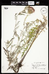 Cirsium discolor (Muhlenberg ex Willdenow) Sprengel 444374[1041677]Smith, Welby 210491992-07-20 United States, Minnesota, Redwood, Cedar Rock Wildlife Management Area. Redwood County ... In Cedar Rock State Wildlife Management Area, about 4 miles north-northwest of Redwood Falls ... T 113N R 36W NW1/4 of NW1/4 of Sec 11. 113N 36W 11, 44.6122208 -95.1563873 |
MIN:Plants | 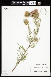 Cirsium discolor (Muhlenberg ex Willdenow) Sprengel 458571[1041654]Lee, Michael MDL3581993-09-01 United States, Minnesota, Dakota, Dakota Co.; mile north of Castle Rock; T 113N R 19W NW1/4 of NW1/4 of sec 31;;113N;19W;31, 44.550944 -93.146808 |
MIN:Plants | 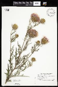 Cirsium discolor (Muhlenberg ex Willdenow) Sprengel 506793[1041655]Smith, Welby 180531990-09-22 United States, Minnesota, Steele, Marsh Wren Wildlife Management Area. Steele County ... in Marsh Wren State Wildlife Management Area, about 8 mi SE of Owatonna ... T106N R19W NE1/4 of NE1/4 of Sec 14. 106N 19W 14, 43.9936104 -93.0691681 |
MIN:Plants | 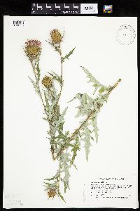 Cirsium discolor (Muhlenberg ex Willdenow) Sprengel 519633[1041658]Smith, Welby 213081992-08-10 United States, Minnesota, Wadena, Wadena County ... at the public access on the NE end of Blueberry Lake, about 3 mi N-NE of Manahga ... T 138N R 35W NE1/4 of SW1/4 of Sec 2. 138N 35W 2, 46.7949982 -95.0699997 |
MIN:Plants | 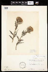 Cirsium discolor (Muhlenberg ex Willdenow) Sprengel 564438[1041690]Rhone, R. s.n.1940-10-08 United States, Minnesota, Ramsey, Ramsey Co.; South Mississippi River Boulevard, St. Paul;;028N;23W;, 44.905162 -93.166462 |
MIN:Plants |  Cirsium discolor (Muhlenberg ex Willdenow) Sprengel 564969[1041691]Cotter Tucker, Shirley 41911957-08-07 United States, Minnesota, Polk, about 5 miles north-north east of McIntosh, Polk County;;;;, 47.636905 -95.88642 |
MIN:Plants |  Cirsium discolor (Muhlenberg ex Willdenow) Sprengel 568593[1041666]Moore, John 248851959-09-29 United States, Minnesota, Blue Earth, Along the Blue Earth River 1 1/2 mi S of Mankato.;;N;;, 44.149384 -94.032277 |
MIN:Plants |  Cirsium discolor (Muhlenberg ex Willdenow) Sprengel 568734[1041689]Moore, John 249301959-10-01 United States, Minnesota, Blue Earth, Rail road 1 mi NW of Eagle Lake.;;N;;, 44.172284 -93.903919 |
MIN:Plants |  Cirsium discolor (Muhlenberg ex Willdenow) Sprengel 568754[1041673]Moore, John 252061960-08-12 United States, Minnesota, Anoka, Anoka County...S.W. 1/4 Sect. 26, Cedar Creek Forest Area.;Cedar Creek National History Area;034N;23W;26, 45.40666 -93.174005 |
MIN:Plants | 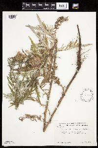 Cirsium discolor (Muhlenberg ex Willdenow) Sprengel 568906[1041667]Moore, John 252401960-08-15 United States, Minnesota, Blue Earth, Along creek 2 mi W of Mankato.;;N;;, 44.152457 -94.068583 |
MIN:Plants | 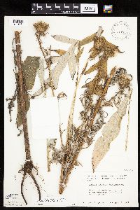 Cirsium discolor (Muhlenberg ex Willdenow) Sprengel 574825[1041664]Moore, John 244081958-10-09 United States, Minnesota, Blue Earth, Blue Earth County...bluff of the Minnesota River 1 mile west of Cambria.;;109N;29W;16, 44.244213 -94.323803 |
MIN:Plants | 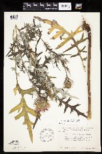 Cirsium discolor (Muhlenberg ex Willdenow) Sprengel 586467[1041712]Moore, John 264811963-08-19 United States, Minnesota, Houston, Houston County...north facing bluffs of the Root River Valley, 3 miles west of Houston.;Dorer Memorial Hardwood State Forest;104N;07W;00, 43.803498 -91.67066 |
MIN:Plants | 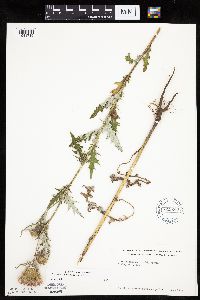 Cirsium discolor (Muhlenberg ex Willdenow) Sprengel 619260[1041715]Westkaemper, Remberta s.n.1969-08-00 United States, Minnesota, Stearns, Stearns County...St. Joseph;;124N;29W;10, 45.56617 -94.3117 |
MIN:Plants | 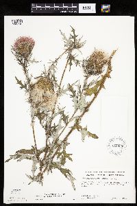 Cirsium discolor (Muhlenberg ex Willdenow) Sprengel 619808[1041719]Ownbey, Gerald 43861970-09-07 United States, Minnesota, Washington, Washington County...Afton Hills, 1 mile west of Afton. T 28 N, R 20 W, SW 1/4 Sect.15.;;028N;20W;15, 44.912609 -92.791861 |
MIN:Plants | 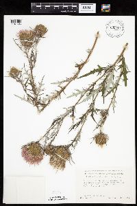 Cirsium discolor (Muhlenberg ex Willdenow) Sprengel 635040[1041686]Lindayen, T. 1591972-08-15 United States, Minnesota, Washington, Washington Co.; T30N, R21W, SE1/4 of Sec.16. 2.7 mi E of Hwy.96 from jnc. of Hwy.244 & 96.;;030N;21W;16, 45.086723 -92.934274 |
MIN:Plants | 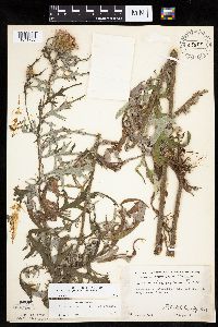 Cirsium discolor (Muhlenberg ex Willdenow) Sprengel 63893[1041706]Marlett, J. s.n.1955-08-09 United States, Minnesota, Dakota, Dakota County...One mile south of Mendota Bridge on Hwy 13.;;028N;23W;33, 44.869157 -93.177285 |
MIN:Plants | 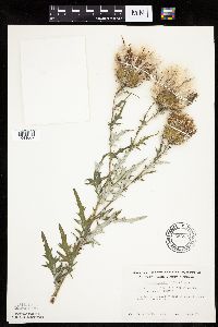 Cirsium discolor (Muhlenberg ex Willdenow) Sprengel 696833[1041669]Smith, Welby 5051978-08-28 United States, Minnesota, Wright, Wright Co.; T121N. T28W. NE1/4 of sec 29. 1/4 mi W of co. 6.;;121N;28W;29, 45.260967 -94.231137 |
MIN:Plants | 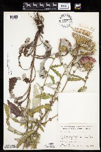 Cirsium discolor (Muhlenberg ex Willdenow) Sprengel 701006[1041649]Dorio, J. 7681977-08-11 United States, Minnesota, Morrison, Morrison County...Ripley Esker, about 3 mi NE of Camp Ripley junction...N of esker...T42N, R31W, Sec.19.;Ripley Esker Scientific Natural Area;042N;31W;19, 46.106283 -94.30299 |
MIN:Plants | 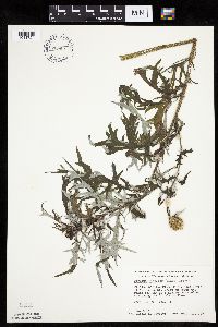 Cirsium discolor (Muhlenberg ex Willdenow) Sprengel 709927[1041724]Wheeler, Gerald 49541979-09-17 United States, Minnesota, Washington, William O'Brien State Park; just N of Marine on St. Croix on rt 95. Borderding the St. Croix River. T32N R19W Sec.31.;William O'Brien State Park;032N;19W;31, 45.217153 -92.76414 |
MIN:Plants | 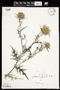 Cirsium discolor (Muhlenberg ex Willdenow) Sprengel 721102[1041670]Lustig, K. 9611979-08-21 United States, Minnesota, Sherburne, Clear Lake-Mississippi Scenic and Recreational River, SNA: 12 mi SE of St. Cloud, Sec.14, 22, 23, T34N, R30W.;Clear Lake Scientific Natural Area;034N;30W;, 45.446339 -94.043783 |
MIN:Plants | 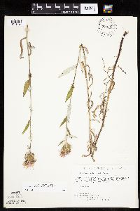 Cirsium discolor (Muhlenberg ex Willdenow) Sprengel 721202[1041716]Lustig, K. 9861979-08-21 United States, Minnesota, Sherburne, Clear Lake Scientific Natural Area. Sherburne County...Clear Lake-Mississippi Scenic and Recreational River, SNA: 12 mi SE of St. Cloud, Sec. 14, 22, 23, T34N, R30W.. 034N 30W 0, 45.446339 -94.043783 |
MIN:Plants |  Cirsium discolor (Muhlenberg ex Willdenow) Sprengel 722688[1041688]Lustig, K. 10841979-09-04 United States, Minnesota, Anoka, Anoka County...Boot Lake SNA: 18 mi SE of Cambridge, sec.17, 18, 19, 20, T33N, R22W.;Boot Lake Scientific Natural Area;033N;22W;00, 45.336495 -93.126267 |
MIN:Plants |  Cirsium discolor (Muhlenberg ex Willdenow) Sprengel 724835[1041662]Smith, Welby 33381980-08-17 United States, Minnesota, Wright, Wright County...T 119N R 25W; NW1/4 NE1/4 section 15. Between State Highway 55 and Soo Line Railroad tracks, about 1/4 mile northwest of the Springs Wayside.. 119N 25W 15, 45.115773 -93.817185 |
MIN:Plants |  Cirsium discolor (Muhlenberg ex Willdenow) Sprengel 727491[1041717]Severson, M.; Farrell, P. 1731979-07-24 United States, Minnesota, Polk, Pembina Trail Preserve Scientific Natural Area. Polk County...Pembina Trail Preserve...6 1/2 mi E of Harold, all sec. 36, frac. sec. 25, 30, 31, T149N, R45W, frac. sec. 1, 2, T148N, R45W. , 47.702107 -96.357761 |
MIN:Plants |  Cirsium discolor (Muhlenberg ex Willdenow) Sprengel 727896[1041711]Lustig, K. 8081979-08-08 United States, Minnesota, Sherburne, Mississippi River Islands Scientific Natural Area. Sherburne & Wright Counties...Mississippi Scenic and Recreational River Islands SNA: Mississippi River Islands between Monticello and Elk River. Sec. 2, 3, 4, T32N, R26, 27W; sec. 7, 9, 18, T121N, R23, 24W.. 032N 26W 3, 45.293483 -93.556246 |
MIN:Plants | 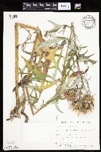 Cirsium discolor (Muhlenberg ex Willdenow) Sprengel 734376[1041665]Severson, M. 7291980-08-21 United States, Minnesota, Becker, Green Water Lake Natural Area: 5 mi W of Ponsford. NE1/4 SW1/4 Sec.34, T141N, R38W.;Greenwater Lake Scientific Natural Area / White Earth Indian Reservation;141N;38W;34, 46.984076 -95.476561 |
MIN:Plants | 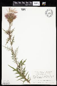 Cirsium discolor (Muhlenberg ex Willdenow) Sprengel 737255[1041721]Kachman, R. 4181980-08-19 United States, Minnesota, Mower, NW section of Adams Community Park.;;N;;, 43.566944 -92.718611 |
MIN:Plants | 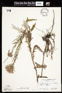 Cirsium discolor (Muhlenberg ex Willdenow) Sprengel 745769[1041708]Smith, Welby 55261981-08-26 United States, Minnesota, Mower, Wild Indigo Scientific Natural Area. Mower County...Wild Indigo Scientific and Natural Area. About 2 mi E-SE of the jjunction of State Highway 56 and County Highway 2 in Brownsdale...SE1/4 SE1/4 sec.11, T103N R17W.. 103N 17W 11, 43.739545 -92.839221 |
MIN:Plants | 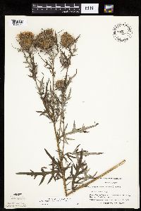 Cirsium discolor (Muhlenberg ex Willdenow) Sprengel 747133[1041714]Galatowitsch, S. 6371982-08-17 United States, Minnesota, Goodhue, Goodhue County...Grace Nature Preserve: T109N R18W parts of NW1/4 SW1/4 and SW1/4 SW1/4 of Sec. 8.;Grace Nature Preserve, The Nature Conservancy;109N;18W;08, 44.262012 -93.010544 |
MIN:Plants | 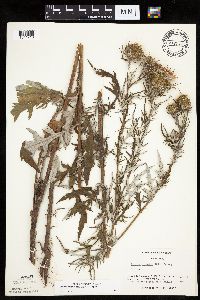 Cirsium discolor (Muhlenberg ex Willdenow) Sprengel 747147[1041713]Galatowitsch, S. 6141982-08-17 United States, Minnesota, Rice, Rice County...Trout Lily Preserve: T110N R20W S1/2 NW1/4 SW1/4 of Sec. 20; part of NE1/4 SE1/4 Sec.19.;Cannon River Trout Lily Scientific Natural Area;110N;20W;00, 44.326892 -93.221943 |
MIN:Plants | 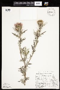 Cirsium discolor (Muhlenberg ex Willdenow) Sprengel 750657[1041697]Peterson, Jon 3291982-08-28 United States, Minnesota, Houston, Houston Co. Gap Hill #1; ca. 4 mi W of Hokah on N side of Minn. hwy.16. NW1/4 SW1/4 Sec.34, T104N, R5W.;Dorer Memorial Hardwood State Forest;104N;05W;34, 43.767742 -91.42281 |
MIN:Plants | 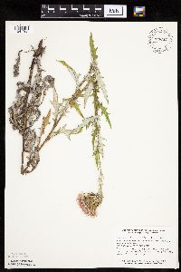 Cirsium discolor (Muhlenberg ex Willdenow) Sprengel 758363[1041702]Smith, Welby 72921982-08-15 United States, Minnesota, Wright, Wright Co.; about 2 1/2 mi W-NW of Maple Lake. Adjacent to State Hwy 55. SW1/4 SW1/4 sec.35, T121N R27W.;;121N;27W;35, 45.246053 -94.045354 |
MIN:Plants | 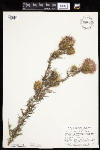 Cirsium discolor (Muhlenberg ex Willdenow) Sprengel 758957[1041701]Smith, Welby 74561982-08-20 United States, Minnesota, Mower, Racine Prairie Scientific Natural Area. Racine Prairie State Scientific and Natural Area. Adjacent to the E side of U.S. Trunk Hwy 63, about 2 mi N of Racine. N Racine Prairie State Scientific and Natural Area. Adjacent to the E side of U.S. Trunk Hwy 63, about 2 mi N of Racine. NE1/4 NE1/4 sec.22, T104N R14W.. 104N 14W 22, 43.797643 -92.499267 |
MIN:Plants | 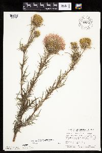 Cirsium discolor (Muhlenberg ex Willdenow) Sprengel 796064[1041710]Smith, Welby 109941985-08-10 United States, Minnesota, Dodge, Iron Horse Prairie Scientific Natural Area. Dodge County...Iron Horse Prairie State Scientific and Natural Area, about 1-1/2 mi S of Hayfield...NW1/4 SE1/4 section 27, T105N R17W. 105N 17W 27, 43.8675 -92.8486111 |
MIN:Plants | 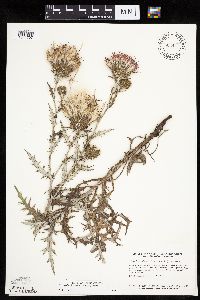 Cirsium discolor (Muhlenberg ex Willdenow) Sprengel 804447[1041707]Smith, Welby 108661985-07-24 United States, Minnesota, Lyon, Lyon County..Prairie Marshes State Wildlife Management Area, about 4 mi N-NW of Russell..SE1/4 SW1/4 sec.36, T111N R43W.;Prairie Marshes Wildlife Management Area;111N;43W;36, 44.378119 -95.968102 |
MIN:Plants | 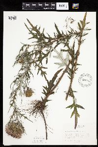 Cirsium discolor (Muhlenberg ex Willdenow) Sprengel 816383[1041700]Bender, J. s.n.1986-08-15 United States, Minnesota, Washington, Belwin Outdoor Education Laboratory, T28N R20W S10. And on the W side of Bullrush Slough.;Belwin Outdoor Education Laboratory;028N;20W;10, 44.927188 -92.791852 |
MIN:Plants | 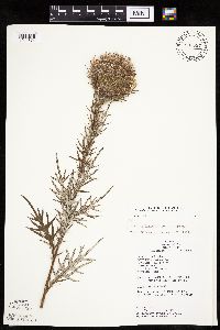 Cirsium discolor (Muhlenberg ex Willdenow) Sprengel 833587[1041674]Juhnke, C. 2231991-07-27 United States, Minnesota, Fillmore, Forestville State Park. Fillmore County...T: 102N R: 12W Sec:13 Quarter Sec: NE SW NE;Forestville State Park;102N;12W;13, 43.637724 -92.219269 |
MIN:Plants | 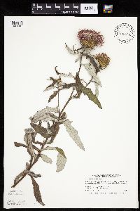 Cirsium discolor (Muhlenberg ex Willdenow) Sprengel 833977[1041660]Smith, Welby 198301991-07-31 United States, Minnesota, Todd, Grey Eagle Wildlife Management Area. Todd County ... Grey Eagle State Wildlife Management Area, about 4 mi west of Grey Eagle ... T127N R33W SW1/4 of SE1/4 of Sec 9. 127N 33W 9, 45.8202782 -94.8366699 |
MIN:Plants | 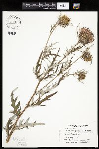 Cirsium discolor (Muhlenberg ex Willdenow) Sprengel 834450[1041650]Myhre, K. 44691993-08-17 United States, Minnesota, Pine, Pine Co. Locatd 2.5 mi SE of the town of Rock Creek; T38N R21W SW1/4 of NE1/4 of sec.36;;038N;21W;36, 45.737277 -92.908731 |
MIN:Plants | 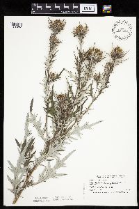 Cirsium discolor (Muhlenberg ex Willdenow) Sprengel 836067[1041653]Smith, Welby 199221991-08-06 United States, Minnesota, Le Sueur, Chamberlain Woods Scientific Natural Area. LeSueur County ... Chamberlain Woods State Scientific and Natural Area, about 3 mi S-SW of Le Sueur ... T 111N R 26W SW1/4 of SW1/4 of Sec 22. 111N 26W 22, 44.4005547 -93.9472198 |
MIN:Plants |  Cirsium discolor (Muhlenberg ex Willdenow) Sprengel 840601[1041657]Smith, Welby 182991990-09-05 United States, Minnesota, Faribault, Osmundson Prairie Scientific Natural Area. Faribault County ... Osmundson Prairie State Scientific and Natural Area, about 3 mi SE of Kiester ... T101N R24W SE1/4 of NE1/4 of Sec 36. 101N 24W 36, 43.5111122 -93.6511078 |
MIN:Plants | 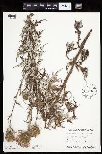 Cirsium discolor (Muhlenberg ex Willdenow) Sprengel 841171[1041699]Smith, Welby 137901987-08-11 United States, Minnesota, Washington, Washington Co. About 3 mi NW of Afton; SW1/4 NE1/4 sec.4, T28N R20W;;028N;20W;4, 44.941687 -92.81216 |
MIN:Plants | 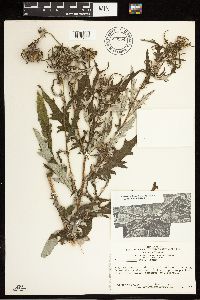 Cirsium discolor (Muhlenberg ex Willdenow) Sprengel 680954[1273863]Swanson, Steven 19561975-07-31 United States, Wisconsin, La Crosse, Mississippi River (Navigation Pool #8)...La Crosse Co, Site 20, railroad levee built on an island along a side channel;Upper Mississippi National Wildlife Refuge |
MIN:Plants | 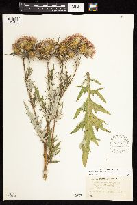 Cirsium discolor (Muhlenberg ex Willdenow) Sprengel 576879[1127186]Stevens, O.; Moir, D. 23331960-08-02 United States, Minnesota, Red Lake, Oklee, Polk Co. [sic, actually in Red Lake Co.];;150N;41W;01, 47.840839 -95.847603 |
MIN:Plants | 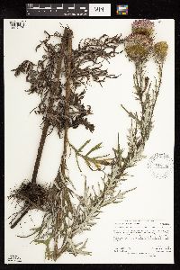 Cirsium discolor (Muhlenberg ex Willdenow) Sprengel 919539[1127198]Anderson, Derek 9822008-08-13 United States, Minnesota, Freeborn, Panicum Prairie Wildlife Management Area. Freeborn County...Panicum prairie WMA, ca. 3.5 km east of Interstate-35, on the Minnesota-Iowa border...T101N, R21W, SESE35. 101N 21W 35, 43.5013889 -93.3097222 |
MIN:Plants | 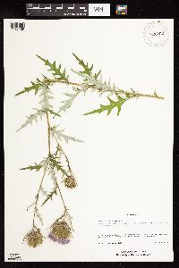 Cirsium discolor (Muhlenberg ex Willdenow) Sprengel 920202[1127189]Schimpf, D. DJS5992010-08-07 United States, Minnesota, Saint Louis, St. Louis County, Duluth. T49N R15W Sec 34.;;049N;15W;34, 46.6833333 -92.2311111 |
MIN:Plants | 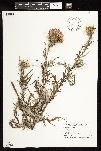 Cirsium discolor (Muhlenberg ex Willdenow) Sprengel 918255[1127196]Smith, Welby 252431994-08-23 United States, Minnesota, Carver, Minnesota Valley State Park. Carver County...In Minnesota Valley State Park, about 1.5 miles north-northeast of Belle Plain [sic]...T114N R24W SW1/4 of SE1/4 of Sec 30. 114N 24W 30, 44.6458333 -93.7541667 |
MIN:Plants | 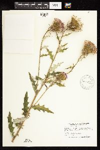 Cirsium discolor (Muhlenberg ex Willdenow) Sprengel 911781[1127184]Smith, Welby 252691994-08-25 United States, Minnesota, Jackson, Jackson County... Kilen Woods State Park, about 8 miles north-northwest of Jackson. T103N R35W NW1/4 of NE1/4 of Sec 17;Kilen Woods State Park;103N;35W;17, 43.7255556 -95.0583333 |
MIN:Plants | 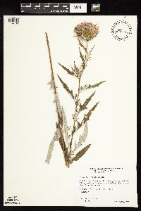 Cirsium discolor (Muhlenberg ex Willdenow) Sprengel 478156[1127195]Wheeler, Gerald 204151999-08-21 United States, Minnesota, Sibley, Sibley County ... Ca. 1.5 mi. SW of Arlington on Rte. 5 ... N1/2 NW1/4 NE1/4 Sec. 19 T113N R27W;;113N;27W;19, 44.579657 -94.122791 |
MIN:Plants | 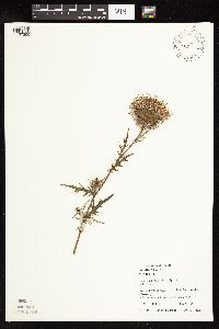 Cirsium discolor (Muhlenberg ex Willdenow) Sprengel 488421[1127200]Juhnke, C. 009 CMJ FRO1998-08-18 United States, Minnesota, Goodhue, Frontenac State Park Goodhue County ... where trail to Sand Point parallels Mississippi River ...T112N R13W SW SE NW 13;Frontenac State Park;112N;13W;13, 44.505359 -92.319092 |
MIN:Plants |  Cirsium discolor (Muhlenberg ex Willdenow) Sprengel 924460[1127193]Smith, Welby 214351992-08-12 United States, Minnesota, Marshall, About 11 miles east of Argyle. NW1/4 of SE1/4 of section;Old Mill State Park;156N;46W;04, 48.3602778 -96.5702778 |
MIN:Plants |  Cirsium discolor (Muhlenberg ex Willdenow) Sprengel 923852[1127194]Smith, Welby 216521992-08-26 United States, Minnesota, Nicollet, About 7 miles north of Mankato; bank of Seven Mile Creek. NW1/4 of NE1/4 of section.;Seven Mile Creek County Park;109N;27W;11, 44.2680556 -94.0344444 |
MIN:Plants |  Cirsium discolor (Muhlenberg ex Willdenow) Sprengel 922812[1127197]Smith, Welby 238091993-09-01 United States, Minnesota, Fillmore, Beaver Creek Wildlife Management Area. Beaver Creek State Wildlife Management Area, about 9.5 miles south of Spring Valley...T 101N R 31W NE1/4 of SW1/4 of Sec 21. 101N 31W 21, 43.5341667 -92.4025 |
MIN:Plants |  Cirsium discolor (Muhlenberg ex Willdenow) Sprengel 921184[1127185]Smith, Welby 235691993-08-11 United States, Minnesota, Isanti, About 8 miles northwest of Cambridge. SW1/4 of NW1/4 of section;;037N;24W;26, 45.6658333 -93.3072222 |
MIN:Plants |  Cirsium discolor (Muhlenberg ex Willdenow) Sprengel 922146[1127199]Smith, Welby 233531993-08-04 United States, Minnesota, Olmsted, Chester Woods County Park. Chester Woods County Park. About 3.5 miles northeast of Marion, along Bear Creek...T106N R13W SE1/4 of NE1/4 of Sec 13. 106N 13W 13, 43.9875 -92.3194444 |
MIN:Plants | 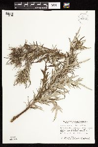 Cirsium discolor (Muhlenberg ex Willdenow) Sprengel 931001[1127190]Smith, Welby R. 158891989-07-24 United States, Minnesota, Freeborn, About 3.5 miles northeast of Alden. NW1/4 of NE1/4 of section.;Halls Lake Wildlife Management Area;103N;22W;30, 43.7008333 -93.5222222 |
MIN:Plants | 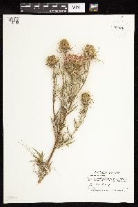 Cirsium discolor (Muhlenberg ex Willdenow) Sprengel 933932[1127192]Smith, Welby R. 215791992-08-18 United States, Minnesota, Pine, About one mile south-southwest of Willow River (town). Willard Munger State Trail. SW1.4 of SE1/4 of section;;044N;20W;10, 46.3030556 -92.9758333 |
MIN:Plants | 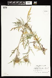 Cirsium discolor (Muhlenberg ex Willdenow) Sprengel 934416[1127191]Smith, Welby R. 217111992-08-27 United States, Minnesota, Brown, About 3 miles northwest of New Ulm, in the Minnesota River Valley SW of NW of section;Boesch Wildlife Management Area;110N;31W;03, 44.3625 -94.5494444 |
MIN:Plants | 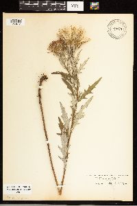 Cirsium discolor (Muhlenberg ex Willdenow) Sprengel 948895[1254913]Kramer, Leona s.n.1927-00-00 United States, Minnesota, Mower, 43.6667 -92.7667 |
MIN:Plants | 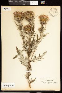 Cirsium discolor (Muhlenberg ex Willdenow) Sprengel 948896[1254914]Kramer, Leona s.n.1927-00-00 United States, Minnesota, Mower, 43.6667 -92.7667 |
MIN:Plants | 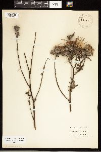 Cirsium discolor (Muhlenberg ex Willdenow) Sprengel 948894[1254915]Marsh, Lucian 96 United States, Minnesota, Cass, 46.9167 -94.2833 |
MIN:Plants |  Cirsium discolor (Muhlenberg ex Willdenow) Sprengel 948893[1254916]Marsh, Lucian 98 United States, Minnesota, Cass, 46.9167 -94.2833 |
MIN:Plants | 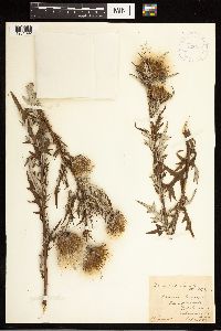 Cirsium discolor (Muhlenberg ex Willdenow) Sprengel 423643[1261692]Shimek, B. s.n. United States, Iowa, Delaware |
MIN:Plants | 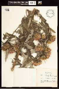 Cirsium discolor (Muhlenberg ex Willdenow) Sprengel 480388[1261693]Russell, N.H. NR 831522 United States, Iowa, Poweshiek |
MIN:Plants | 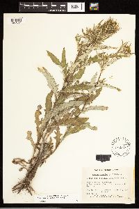 Cirsium discolor (Muhlenberg ex Willdenow) Sprengel 206528[1261694]Bassett, I.J. 2652 Canada, Quebec, Saint Johns |
Google Map
Google Maps is a web mapping service provided by Google that features a map that users can pan (by dragging the mouse) and zoom (by using the mouse wheel). Collection points are displayed as colored markers that when clicked on, displays the full information for that collection. When multiple species are queried (separated by semi-colons), different colored markers denote each individual species.