University of Minnesota
http://www.umn.edu/
612-625-5000
http://www.umn.edu/
612-625-5000
Minnesota Biodiversity Atlas
Bell Museum
Dataset: MIN-Plants
Taxa: Conioselinum
Search Criteria: excluding cultivated/captive occurrences
1
Page 1, records 1-10 of 10
Bell Museum plants | |
 MIN:Plants | 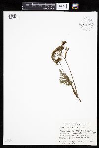 Conioselinum chinense (L.) Britton, Sterns & Poggenburg 657300[1034623]Noble, Mark; et al. 3391974-08-05 United States, Alaska, Muir Point; from site deglaciated ca. 1880.;Glacier Bay National Park;;;, 58.82694 -136.07722 |
MIN:Plants | 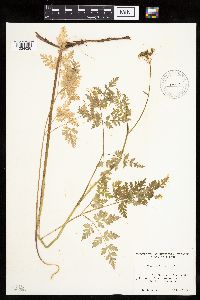 Conioselinum gmelinii (Chamisso & Schlechtendal) Steudel 520364[1034628]Lawrence, Donald s.n.1952-08-19 United States, Alaska, Tlingit Point area.;Glacier Bay National Park;;;, 58.7577778 -136.18 |
MIN:Plants | 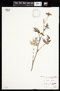 Conioselinum gmelinii (Chamisso & Schlechtendal) Steudel 520235[1034630]Lawrence, Donald s.n.1952-08-17 United States, Alaska, Glacier Bay National Monument. Sandy Cove.;Glacier Bay National Park;;;, 58.797428 -136.838127 |
MIN:Plants | 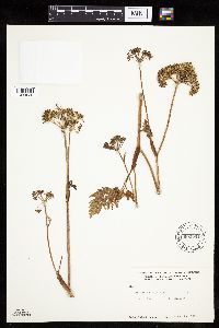 Conioselinum gmelinii (Chamisso & Schlechtendal) Steudel 600051[1034626]Cooper, William 1451921-08-24 United States, Alaska, Glacier Bay.;Glacier Bay National Park;;;, 58.797428 -136.838127 |
MIN:Plants | 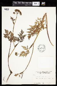 Conioselinum gmelinii (Chamisso & Schlechtendal) Steudel 600065[1034627]Cooper, William 2571929-07-21 United States, Alaska, Glacier Bay, Station 20.;Glacier Bay National Park;;;, 58.76083 -136.34861 |
MIN:Plants | 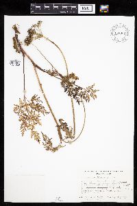 Conioselinum chinense (L.) Britton, Sterns & Poggenburg 657002[1034625]Noble, Mark; et al. 5011974-08-05 United States, Alaska, Muir Point; from site deglaciated ca. 1880.;Glacier Bay National Park;;;, 58.82694 -136.07722 |
MIN:Plants | 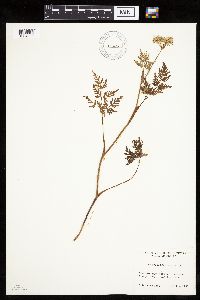 Conioselinum gmelinii (Chamisso & Schlechtendal) Steudel 520256[1034631]Lawrence, Donald s.n.1952-08-17 United States, Alaska, Glacier Bay National Monument. Sandy Cove.;Glacier Bay National Park;;;, 58.797428 -136.838127 |
MIN:Plants | 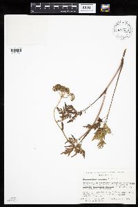 Conioselinum chinense (L.) Britton, Sterns & Poggenburg 657335[1034624]Noble, Mark; et al. 4701974-08-05 United States, Alaska, Muir Point; from site deglaciated ca. 1880.;Glacier Bay National Park;;;, 58.82694 -136.07722 |
MIN:Plants | 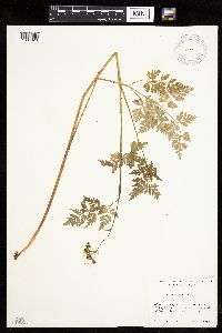 Conioselinum gmelinii (Chamisso & Schlechtendal) Steudel 520366[1034629]Lawrence, Donald s.n.1952-08-19 United States, Alaska, Tlingit Point area.;Glacier Bay National Park;;;, 58.7577778 -136.18 |
MIN:Plants | Conioselinum scopulorum (A. Gray) J.M. Coult. & Rose []Roop, J. GW24542004-08-04 United States, Colorado, Gunnison, Gothic, 38.960389 -106.992889, 2914m |
1
Page 1, records 1-10 of 10
Google Map
Google Maps is a web mapping service provided by Google that features a map that users can pan (by dragging the mouse) and zoom (by using the mouse wheel). Collection points are displayed as colored markers that when clicked on, displays the full information for that collection. When multiple species are queried (separated by semi-colons), different colored markers denote each individual species.