University of Minnesota
http://www.umn.edu/
612-625-5000
http://www.umn.edu/
612-625-5000
Minnesota Biodiversity Atlas
Bell Museum
Dataset: MIN-Plants
Taxa: Cryptotaenia
Search Criteria: excluding cultivated/captive occurrences
Bell Museum plants | |
 MIN:Plants | 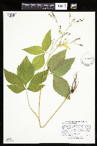 Cryptotaenia canadensis (L.) de Candolle 910584[1034701]Lee, Michael MDL44932007-08-07 United States, Minnesota, Wadena, Wadena County...Along the Leaf River ~two miles downstream from the mouth of the Redeye River, nine miles north-northwest of downtown Staples...T135N R33W E1/2 of SW1/4 of NW1/4 Sec. 28...UTM: 5148955N 357355E. 135N 33W 28, 46.477312 -94.852412 |
MIN:Plants | 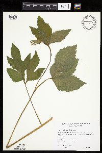 Cryptotaenia canadensis (L.) de Candolle 511239[1034664]Wheeler, Gerald 198141999-06-04 United States, Minnesota, Jackson, Jackson County ... Ca. 6.5 mi. NE of Lakefield; Kilen Woods State Park ... N1/2 SE1/4 Sec. 17 T104N R35W (Belmont 17);Kilen Woods State Park;103N;35W;17, 43.724814 -95.064648 |
MIN:Plants | 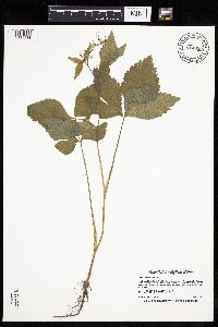 Cryptotaenia canadensis (L.) de Candolle 914859[1034744]Smith, Welby 226871993-07-01 United States, Minnesota, Otter Tail, Maplewood State Park. Otter Tail County ... Maplewood State Park, about 5 miles east-southeast of Pelican Rapids ... T135N R 42W SE1/4 of NE1/4 of Sec 9. 135N 42W 9, 46.5225 -95.9727778 |
MIN:Plants | 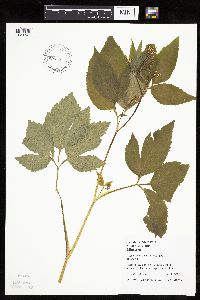 Cryptotaenia canadensis (L.) de Candolle 459615[1034740]Juhnke, C. 362 CMJ FRO1999-06-12 United States, Minnesota, Goodhue, Frontenac State Park Goodhue County...North-facing slope of Rattlesnake Bluff...T112N R13W NW NE NE 5;Frontenac State Park;112N;13W;05, 44.535196 -92.399973 |
MIN:Plants | 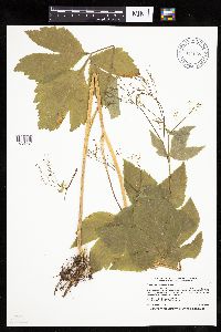 Cryptotaenia canadensis (L.) de Candolle 914665[1034794]Smith, Welby 226141993-06-29 United States, Minnesota, Swift, Swift County...Lake Monson State Park, about 17 miles northwest of Wilmar [sic]...T 121N R 37W SW1/4 of NW1/4 of Sec 1;Monson Lake State Park;121N;37W;01, 45.3236111 -95.2688889 |
MIN:Plants | 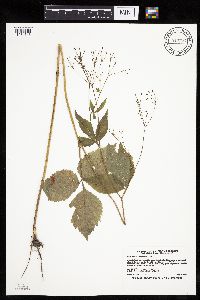 Cryptotaenia canadensis (L.) de Candolle 913724[1034743]Smith, Welby 227741993-07-09 United States, Minnesota, Rock, Rock County...About 0.5 mile southeast of Luverne...along the Rock River...T102N R45W NE1/4 of SE1/4 of sec 11;;102N;45W;11, 43.6505556 -96.1961111 |
MIN:Plants | 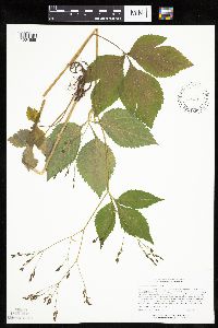 Cryptotaenia canadensis (L.) de Candolle 454618[1034665]Lee, Michael MDL14631996-08-08 United States, Minnesota, Aitkin, Rice Lake National Wildlife Refuge. Aitkin County ... Rice Lake National Wildlife Refuge ... 7 miles south of Mc Gregor. ... esker on the east side of Rice Lake ... T47N R24W NE1/4 SW 1/4 Sec. 36. 047N 24W 36, 46.512013 -93.316347 |
MIN:Plants | 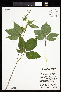 Cryptotaenia canadensis (L.) de Candolle 911604[1034723]Cholewa, A. 26422009-06-15 United States, Minnesota, Anoka, Rum River County Park. Anoka County, Rum River County Park (central unit), west side of Rum River, hiking/biking trail south of boat ramp. T32N R24W Sec 6. 032N 24W 6, 45.25517 -93.32696 |
MIN:Plants | 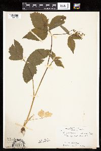 Cryptotaenia canadensis (L.) de Candolle 163369[1034759]Skinner, S. 8501902-06-12 United States, Minnesota, Jackson, Edge of Lower Heron Lake;;N;;, 43.753807 -95.256418 |
MIN:Plants | 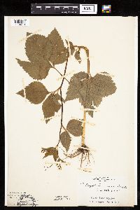 Cryptotaenia canadensis (L.) de Candolle 163370[1034770]Skinner, S. 1841902-06-23 United States, Minnesota, Jackson, Heron Lake Region. From "Pat's Grove".;;N;;, 43.753807 -95.256418 |
MIN:Plants | 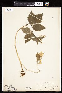 Cryptotaenia canadensis (L.) de Candolle 163371[1034755]Skinner, S. 1841902-06-20 United States, Minnesota, Jackson, Heron Lake region;;N;;, 43.753807 -95.256418 |
MIN:Plants | 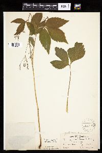 Cryptotaenia canadensis (L.) de Candolle 163372[1034648]Bergman, H. 28321913-06-29 United States, Minnesota, Meeker, Darwin;;119N;30W;22, 45.101872 -94.431078 |
MIN:Plants | 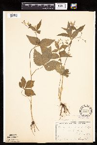 Cryptotaenia canadensis (L.) de Candolle 163389[1034693]Campbell, Jennie C1601896-07-00 United States, Minnesota, Stearns, Waite Park, St. Cloud;;124N;28W;, 45.541667 -94.205126 |
MIN:Plants | 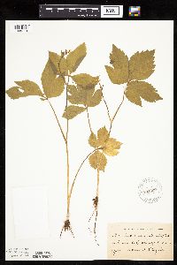 Cryptotaenia canadensis (L.) de Candolle 163390[1034714]Taylor, B. T12901892-06-00 United States, Minnesota, Chisago, Center City;;N;;, 45.39291 -92.81542 |
MIN:Plants | 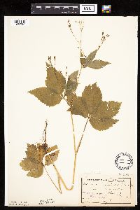 Cryptotaenia canadensis (L.) de Candolle 163391[1034716]Taylor, B. T9971891-07-00 United States, Minnesota, Pope, Lake Minnewaska, near Glenwood;;N;;, 45.617836 -95.450645 |
MIN:Plants | 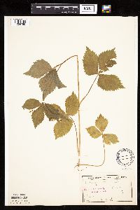 Cryptotaenia canadensis (L.) de Candolle 163392[1034785]Frost, W. F2451892-07-00 United States, Minnesota, Kandiyohi, Willmar;;N;;, 45.121908 -95.043342 |
MIN:Plants | 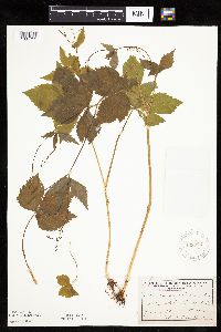 Cryptotaenia canadensis (L.) de Candolle 163393[1034712]Ballard, C. s.n.1892-06-00 United States, Minnesota, Nicollet, Nicollet;;109N;28W;, 44.239687 -94.190492 |
MIN:Plants | 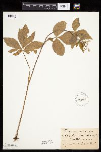 Cryptotaenia canadensis (L.) de Candolle 163394[1034720]Ballard, C. B9741892-06-00 United States, Minnesota, Nicollet, Nicollet;;109N;28W;, 44.239687 -94.190492 |
MIN:Plants | 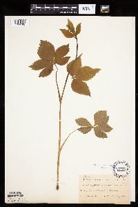 Cryptotaenia canadensis (L.) de Candolle 163395[1034782]Taylor, B. T2741891-06-00 United States, Minnesota, Waseca, Janesville;;N;;, 44.116429 -93.717711 |
MIN:Plants | 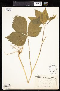 Cryptotaenia canadensis (L.) de Candolle 163396[1034786]Wheeler, William 1931899-06-14 United States, Minnesota, Houston, Winnebago Valley;Dorer Memorial Hardwood State Forest;N;;, 43.536598 -91.399388 |
MIN:Plants | 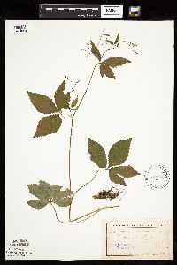 Cryptotaenia canadensis (L.) de Candolle 163397[1034694]Campbell, Jennie s.n.1895-07-00 United States, Minnesota, Stearns, Waite Park;;124N;28W;, 45.541667 -94.205126 |
MIN:Plants | 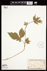 Cryptotaenia canadensis (L.) de Candolle 163398[1034771]Taylor, B. T12901892-06-00 United States, Minnesota, Chisago, Lindstrom;;N;;, 45.389408 -92.847992 |
MIN:Plants | 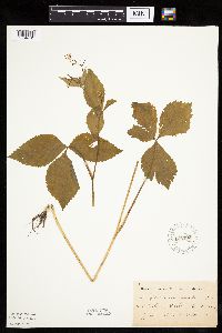 Cryptotaenia canadensis (L.) de Candolle 163400[1034761]Frost, W. F1711892-06-00 United States, Minnesota, Meeker, Acton [pioneer village];;119N;32W;26, 45.08778 -94.66538 |
MIN:Plants | 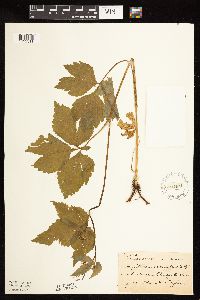 Cryptotaenia canadensis (L.) de Candolle 163401[1122311]Taylor, B. T12901892-06-00 United States, Minnesota, Chisago, Lindstrom;;N;;, 45.389408 -92.847992 |
MIN:Plants | 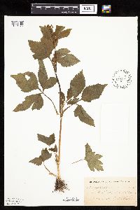 Cryptotaenia canadensis (L.) de Candolle 163402[1034673]Sheldon, Edmund S2361891-06-00 United States, Minnesota, Blue Earth, Lake Washington;;N;;, 44.24984 -93.873858 |
MIN:Plants | 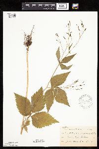 Cryptotaenia canadensis (L.) de Candolle 163403[1034713]Sheldon, Edmund S8881891-07-00 United States, Minnesota, Brown, Sleepy Eye;;110N;32W;, 44.325885 -94.684758 |
MIN:Plants | 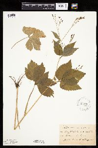 Cryptotaenia canadensis (L.) de Candolle 163404[1034718]Taylor, B. T9991891-07-00 United States, Minnesota, Pope, Glenwood;;N;;, 45.650239 -95.389758 |
MIN:Plants | 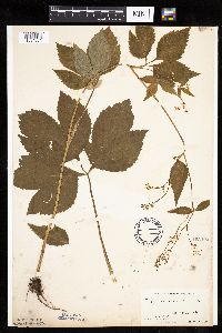 Cryptotaenia canadensis (L.) de Candolle 163405[1034661]Manning, Sara; Moyer, Lycurgus s.n.1895-06-20 United States, Minnesota, Hennepin, Minneapolis;;N;;, 44.979965 -93.263836 |
MIN:Plants | 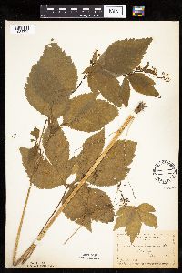 Cryptotaenia canadensis (L.) de Candolle 163406[1034756]Manning, Sara s.n.1886-07-15 United States, Minnesota, Wabasha, Lake City;;N;;, 44.4081 -92.252454 |
MIN:Plants | 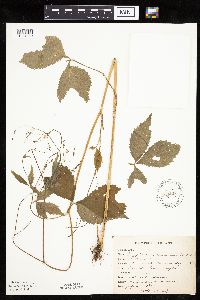 Cryptotaenia canadensis (L.) de Candolle 163407[1034660]Rosendahl, C. 22671909-07-10 United States, Minnesota, Snelling Reservation [old regional park spanning junction of Minnesota and Mississippi rivers];;028N;23W;, 44.90516 -93.16646 |
MIN:Plants | 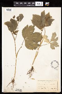 Cryptotaenia canadensis (L.) de Candolle 163408[1034729]Moyer, Lycurgus; et al. s.n.1894-06-00 United States, Minnesota, Chippewa, Myers [original name for pioneer village of Wegdahl, northeast of Montevideo];;117N;40W;, 44.934626 -95.675774 |
MIN:Plants | 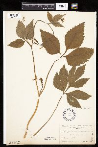 Cryptotaenia canadensis (L.) de Candolle 163409[1034757]Manning, Sara s.n.1892-07-05 United States, Minnesota, Wabasha, Lake City;;N;;, 44.4081 -92.252454 |
MIN:Plants | 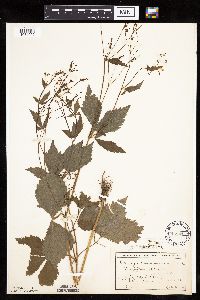 Cryptotaenia canadensis (L.) de Candolle 163410[1034692]MacMillan, C.; et al. 2081900-08-00 United States, Minnesota, Polk, Crookston;;150N;46W;30, 47.782 -96.60007 |
MIN:Plants | 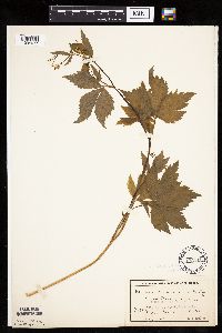 Cryptotaenia canadensis (L.) de Candolle 163411[1034677]MacMillan, C.; et al. 3251900-08-00 United States, Minnesota, Polk, Crookston;;150N;46W;30, 47.782 -96.60007 |
MIN:Plants | 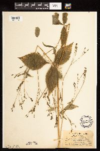 Cryptotaenia canadensis (L.) de Candolle 163412[1122314]Aiton, G. s.n.1890-07-00 United States, Minnesota, Hennepin, Vic. of Minneapolis;;N;;, 44.979965 -93.263836 |
MIN:Plants | 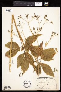 Cryptotaenia canadensis (L.) de Candolle 163413[1034678]MacMillan, C.; et al. 3261900-08-00 United States, Minnesota, Polk, Crookston;;150N;46W;30, 47.782 -96.60007 |
MIN:Plants | 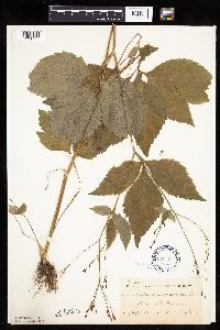 Cryptotaenia canadensis (L.) de Candolle 163414[1034717]Taylor, B. T8061891-07-00 United States, Minnesota, Pope, Glenwood;;N;;, 45.650239 -95.389758 |
MIN:Plants | 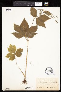 Cryptotaenia canadensis (L.) de Candolle 163415[1034704]Taylor, B. T6661891-07-00 United States, Minnesota, Blue Earth, Cobb River;;N;;, 43.99652 -93.95439 |
MIN:Plants | 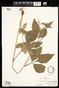 Cryptotaenia canadensis (L.) de Candolle 163416[1034784]Ballard, C. 28351901-06-05 United States, Minnesota, Clay, Moorhead;;N;;, 46.873852 -96.767581 |
MIN:Plants | 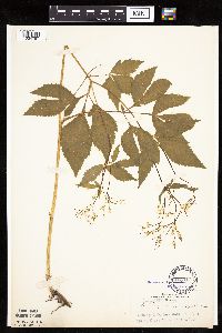 Cryptotaenia canadensis (L.) de Candolle 163417[1034787]Rosendahl, C. 4531902-06-10 United States, Minnesota, Houston, Spring Grove;;101N;07W;, 43.543923 -91.6707 |
MIN:Plants | 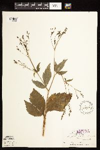 Cryptotaenia canadensis (L.) de Candolle 163418[1122320]Holzinger, John s.n.1886-07-00 United States, Minnesota, Winona, Winona Co.;;N;;, 43.972094 -91.701335 |
MIN:Plants | 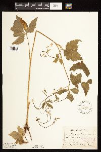 Cryptotaenia canadensis (L.) de Candolle 163419[1122312]Sandberg, John s.n.1886-06-00 United States, Minnesota, Chisago, [no further data];;;;, 45.517323 -92.920986 |
MIN:Plants | 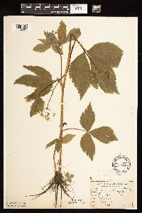 Cryptotaenia canadensis (L.) de Candolle 163420[1122307]Sandberg, John s.n.1890-06-00 United States, Minnesota, Hennepin, [no further data];;;;, 45 -93.47 |
MIN:Plants | 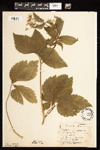 Cryptotaenia canadensis (L.) de Candolle 163421[1122313]Aiton, G. s.n.1889-06-00 United States, Minnesota, Hennepin, [no further data];;;;, 45 -93.47 |
MIN:Plants | 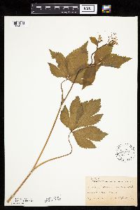 Cryptotaenia canadensis (L.) de Candolle 163422[1034659]Ballard, C. B2081891-06-00 United States, Minnesota, Scott, Jordan;;114N;23W;, 44.674435 -93.582701 |
MIN:Plants | 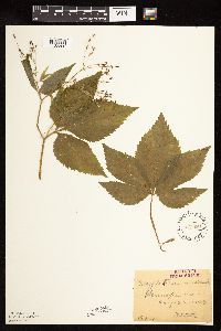 Cryptotaenia canadensis (L.) de Candolle 163423[1122306]Oestlund, O. 197-11888-08-22 United States, Minnesota, Hennepin, [no further data];;;;, 45 -93.47 |
MIN:Plants | 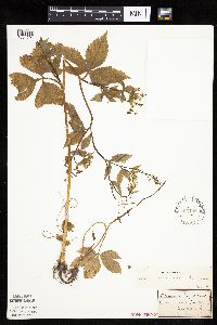 Cryptotaenia canadensis (L.) de Candolle 163424[1034691]Sandberg, John s.n.1881-06-00 United States, Minnesota, Goodhue, Cannon Falls;;N;;, 44.506911 -92.905484 |
MIN:Plants | 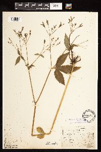 Cryptotaenia canadensis (L.) de Candolle 163425[1122308]Sandberg, John s.n.1890-07-00 United States, Minnesota, Hennepin, [no further data];;;;, 45 -93.47 |
MIN:Plants | 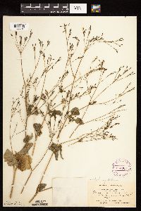 Cryptotaenia canadensis (L.) de Candolle 264369[1122310]Holzinger, John s.n.1897-00-00 United States, Minnesota, Winona, Winona Co.;;N;;, 43.972094 -91.701335 |
MIN:Plants | 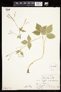 Cryptotaenia canadensis (L.) de Candolle 276168[1034763]Moyle, J. 3091930-07-20 United States, Minnesota, Clearwater, Itasca Park. Campus. SE1/4 SE1/4 Sec. 2, T143N, R36W.;Itasca State Park;143N;36W;2, 47.231973 -95.201528 |
MIN:Plants | 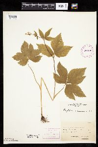 Cryptotaenia canadensis (L.) de Candolle 281425[1034647]Roberts, Thomas s.n.1878-06-11 United States, Minnesota, Hennepin, Minneapolis;;N;;, 44.979965 -93.263836 |
MIN:Plants | 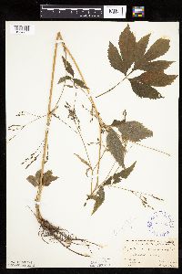 Cryptotaenia canadensis (L.) de Candolle 292959[1034753]Fassett, N.; Hotchkiss, N. 34451926-08-25 United States, Minnesota, Wabasha, Minneiska;;N;;, 44.194964 -91.871825 |
MIN:Plants | 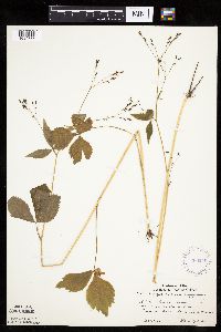 Cryptotaenia canadensis (L.) de Candolle 360249[1034777]Lakela, Olga 41851940-09-01 United States, Minnesota, Saint Louis, In Mission Creek Valley, Fond du Lac;;N;;, 46.68049 -92.28618 |
MIN:Plants | 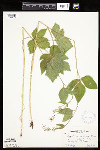 Cryptotaenia canadensis (L.) de Candolle 362793[1034773]Moyle, J. 34751940-07-10 United States, Minnesota, Saint Louis, Along Sucker River;;N;;, 47.0667 -91.8667 |
MIN:Plants | 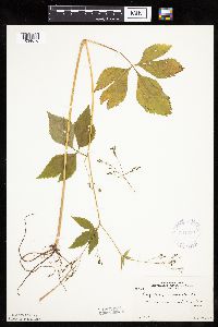 Cryptotaenia canadensis (L.) de Candolle 364239[1034670]Moyle, J. 28601937-08-14 United States, Minnesota, Fillmore, Forestville, Fillmore Co.;Dorer Memorial Hardwood State Forest;102N;12W;, 43.630764 -92.269323 |
MIN:Plants | 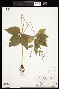 Cryptotaenia canadensis (L.) de Candolle 370581[1034683]Rosendahl, C.; et al. 133741940-06-28 United States, Minnesota, Yellow Medicine, Yellow Medicine County...3.5 mi SE of Montevideo, S of the road;;;;, 44.92543 -95.70602 |
MIN:Plants | 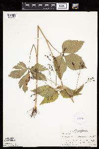 Cryptotaenia canadensis (L.) de Candolle 383630[1034725]Moore, John 160161943-08-25 United States, Minnesota, Winona, Winona Co.; Creek below Gwinn's Bluff;Great River Bluffs State Park;106N;05W;, 43.963328 -91.43962 |
MIN:Plants | 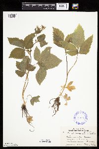 Cryptotaenia canadensis (L.) de Candolle 386221[1034758]Lakela, Olga 8411934-06-03 United States, Minnesota, Hennepin, Minnehaha Glen, Minneapolis;;N;;, 44.915 -93.21 |
MIN:Plants | 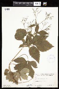 Cryptotaenia canadensis (L.) de Candolle 421331[1034705]Jacobs, D.; et al. 4831948-07-26 United States, Minnesota, Blue Earth, Blue Earth County...Glenwood Ave. ravine, Mankato;;;;, 44.163578 -93.9994 |
MIN:Plants | 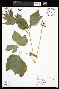 Cryptotaenia canadensis (L.) de Candolle 428313[1034645]Haferman, J. 1071995-06-17 United States, Minnesota, Scott, Scott Co. T115N R22W S36 SW of SW. Approx. 0.1 mi N-NE of intersection of State Hwy.13 and Co. Road 44 on N side of high Scott Co. T115N R22W S36 SW of SW. Approx. 0.1 mi N-NE of intersection of State Hwy.13 and Co. Road 44 on N side of highway.. 115N 22W 36, 44.724586 -93.409031 |
MIN:Plants |  Cryptotaenia canadensis (L.) de Candolle 430014[1034695]Smith, Welby 193601991-09-10 United States, Minnesota, Koochiching, Grand Mound Historical Site. Koochiching Co.; Grand Mound Historic Site, about 18 miles west of International Falls. In the Rainy River Valley; Koochiching Co.; Grand Mound Historic Site, about 18 miles west of International Falls. In the Rainy River Valley; T 70N R 26W NW1/4 of NE1/4 of sec 32. 070N 26W 32, 48.5158348 -93.7083359 |
MIN:Plants |  Cryptotaenia canadensis (L.) de Candolle 434813[1034642]Myhre, K. 2344A1992-06-22 United States, Minnesota, Cass, Cass Co.; Located on the west side of Ottertail Peninsula in Leech Lake; t 143N R 30W NW1/4 of SE1/4 of Sec 1;Chippewa National Forest / Leech Lake Indian Reservation;143N;30W;1, 47.229462 -94.414339 |
MIN:Plants |  Cryptotaenia canadensis (L.) de Candolle 441864[1034792]Husveth, J. 95-18081995-09-05 United States, Minnesota, Goodhue, Goodhue Co, T113N R16W NE1/4 of the SW1/4 of S25; along the Cannon River.;Dorer Memorial Hardwood State Forest;113N;16W;25, 44.564811 -92.682382 |
MIN:Plants |  Cryptotaenia canadensis (L.) de Candolle 441865[1034680]Husveth, J. 95-43181995-08-29 United States, Minnesota, Wabasha, Wabasha Co.; T110N R11W SE1/4 of the SW1/4 of S22; Zumbro River;Dorer Memorial Hardwood State Forest;110N;11W;22, 44.315962 -92.119047 |
MIN:Plants | 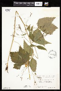 Cryptotaenia canadensis (L.) de Candolle 448329[1034671]Moore, John; Huff, N. 188761946-08-01 United States, Minnesota, Benton, 2 mi. SW of Foley;;036N;29W;, 45.603678 -93.945583 |
MIN:Plants | 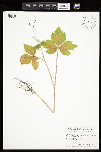 Cryptotaenia canadensis (L.) de Candolle 456823[1034768]Smith, Welby 146881988-08-04 United States, Minnesota, Mille Lacs, Mille lacs [sic] Co.; about 11 miles north of Milaca; SW1/4 SE1/4 sec.26, T 40N R 27W;;040N;27W;26, 45.9249992 -93.6680527 |
MIN:Plants | 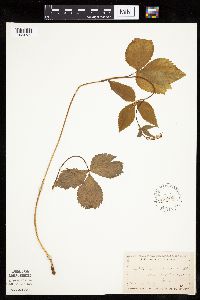 Cryptotaenia canadensis (L.) de Candolle 457905[1034730]Manning, Sara 3571884-06-14 United States, Minnesota, Wabasha, Mount Pleasant;;N;;, 44.410833 -92.35 |
MIN:Plants | 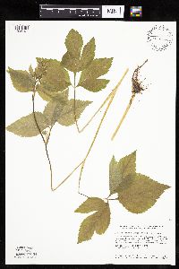 Cryptotaenia canadensis (L.) de Candolle 459434[1034791]Smith, Welby 128051987-06-02 United States, Minnesota, Scott, Murphy-Hanrahan County Park Reserve. Scott County...Murphy-Hanrahan Regional Park; on the S side of Hanrahan Lake, about 2 mi W of Burnsville. SW1/4 NW1/4 sec 34, T115N R21W. 115N 21W 34, 44.7277778 -93.3363889 |
MIN:Plants | 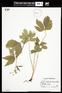 Cryptotaenia canadensis (L.) de Candolle 460341[1034739]Smith, Welby 169111990-06-20 United States, Minnesota, Dodge, Vorce Wildlife Management Area. dodge Co.; Vorce State Wildlife Management Area, about 2 miles north-northeast of Claremont; dodge Co.; Vorce State Wildlife Management Area, about 2 miles north-northeast of Claremont; T 107N R 18W SE1/4 of SW1/4 of sec 15. 107N 18W 15, 44.0686111 -92.9788895 |
MIN:Plants | 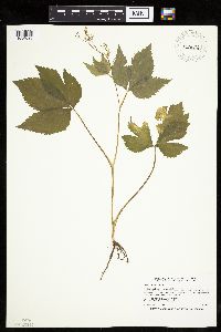 Cryptotaenia canadensis (L.) de Candolle 460626[1034696]Smith, Welby 205871992-06-25 United States, Minnesota, Redwood, Redwood County...In Alexander Ramsey city park in Redwood Falls...in the Redwood River Valley... T 113N R 36W NW1/4 of SE1/4 of Sec 36. 113N 36W 36, 44.5480556 -95.1244444 |
MIN:Plants | 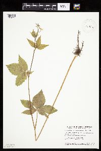 Cryptotaenia canadensis (L.) de Candolle 460806[1034790]Smith, Welby 155541989-07-04 United States, Minnesota, Freeborn, Carex Wildlife Management Area. Freeborn County...'Carex' State Wildlife Management Area, about 7 miles east-southeast of Hollandale; NW1/4 NW1/4 section 23, T 103N R 19W. 103N 19W 23, 43.7155556 -93.0866667 |
MIN:Plants | 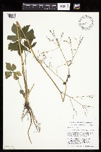 Cryptotaenia canadensis (L.) de Candolle 463937[1034699]Husveth, J. 95-33261995-09-05 United States, Minnesota, Goodhue, Goodhue co.; T113N R16W NE1/4 of the SW1/4 of S25; Cannon River.;Dorer Memorial Hardwood State Forest;113N;16W;25, 44.564811 -92.682382 |
MIN:Plants | 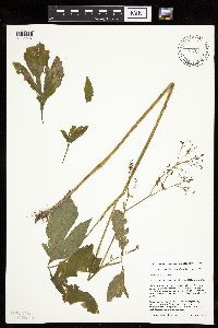 Cryptotaenia canadensis (L.) de Candolle 463938[1034697]Husveth, J. 95-30071995-08-31 United States, Minnesota, Wabasha, Wabasha Co. T110N R12W SW1/4 of the SE1/4 of S27; along Zumbro River;Dorer Memorial Hardwood State Forest;110N;12W;27, 44.302288 -92.23979 |
MIN:Plants | 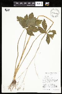 Cryptotaenia canadensis (L.) de Candolle 463939[1034700]Husveth, J. 95-40301995-09-09 United States, Minnesota, Fillmore, Fillmore Co. T104N R9W NW1/4 of the SE1/4 of S35; Root River.;Dorer Memorial Hardwood State Forest;104N;09W;35, 43.767547 -91.880027 |
MIN:Plants | 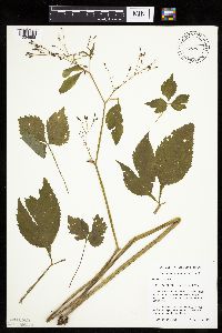 Cryptotaenia canadensis (L.) de Candolle 463941[1034698]Husveth, J. 95-24061995-09-07 United States, Minnesota, Houston, Houston Co. T104N R7W SW1/4 of the NE1/4 of S34; along Root River;Dorer Memorial Hardwood State Forest;104N;07W;34, 43.767285 -91.66068 |
MIN:Plants | 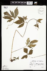 Cryptotaenia canadensis (L.) de Candolle 476437[1034738]Sather, Nancy s.n.1995-07-13 United States, Minnesota, Mahnomen, Mahnomen Co.; Biological Survey Site 96. T144 R39SWSW of sec. 8;White Earth Indian Reservation;144N;39W;8, 47.302218 -95.647362 |
MIN:Plants | 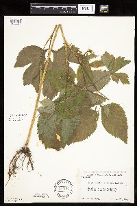 Cryptotaenia canadensis (L.) de Candolle 507126[1034719]Moore, John 206931950-06-21 United States, Minnesota, Martin, Along the W shore of Amber Lake;;N;;, 43.607184 -94.473421 |
MIN:Plants | 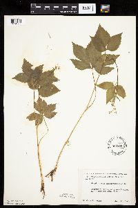 Cryptotaenia canadensis (L.) de Candolle 507276[1034767]Moore, John 207261950-06-22 United States, Minnesota, Faribault, 2 mi. NW of Blue Earth;;N;;, 43.657936 -94.130487 |
MIN:Plants | 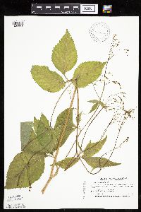 Cryptotaenia canadensis (L.) de Candolle 514305[1034638]Smith, Welby 189671991-06-25 United States, Minnesota, Todd, Todd Co.; Grey Eagle State Wildlife Management Area, about 3 miles W of Grey Eagle; T127N R33W SW1/4 of SE1/4 of Sec 10;Grey Eagle Wildlife Management Area;127N;33W;10, 45.8191681 -94.815834 |
MIN:Plants | 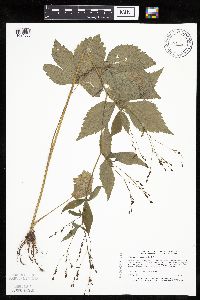 Cryptotaenia canadensis (L.) de Candolle 519032[1034635]Puchalski, L. 3501993-08-03 United States, Minnesota, Mahnomen, Mahnomen Co.; in small forest bordering Hwy 4; T 146N R 39W SE1/4 of SE1/4 of Sec 5;White Earth Indian Reservation;146N;39W;5, 47.491483 -95.647525 |
MIN:Plants | 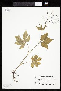 Cryptotaenia canadensis (L.) de Candolle 519759[1034643]Smith, Welby 192261991-07-08 United States, Minnesota, Koochiching, Franz Jevne State Park. Koochiching Co.; Franz Jevne State Park, in the Rainy River Valley, about 2 miles northeast of Birchdale; Koochiching Co.; Franz Jevne State Park, in the Rainy River Valley, about 2 miles northeast of Birchdale; T 160N R 27W SW1/4 of SW1/4 of Sec 26. 160N 27W 26, 48.6427765 -94.078331 |
MIN:Plants | 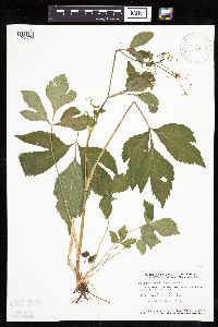 Cryptotaenia canadensis (L.) de Candolle 520317[1034722]Smith, Welby 129021987-06-09 United States, Minnesota, Washington, Belwin Outdoor Education Laboratory. Washington County...Belwin Outdoor Education Center, about 1 mile N of Afton. On the floodplain of the St. Croix River. SW1/4 NE1/4 sec.15, T28N R20W [lat/long incorrect]. 028N 20W 15, 44.912609 -92.791861 |
MIN:Plants | 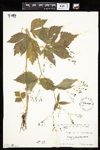 Cryptotaenia canadensis (L.) de Candolle 526200[1034766]Moore, John 213221951-08-09 United States, Minnesota, Douglas, 1 mi. NW of Evansville;;N;;, 46.014365 -95.697563 |
MIN:Plants | 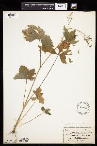 Cryptotaenia canadensis (L.) de Candolle 526619[1034733]Merrell, Ted s.n.1947-10-13 United States, Minnesota, Dakota, Rice Co.; Sec.3, T112N R20 [this locale is in Dakota Co.];;112N;20W;3, 44.536689 -93.211086 |
MIN:Plants | 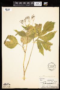 Cryptotaenia canadensis (L.) de Candolle 526646[1034780]Merrell, Ted s.n.1947-09-22 United States, Minnesota, Rice, Nerstrand Woods;Nerstrand Woods State Park;110N;19W;, 44.327064 -93.100886 |
MIN:Plants | 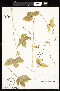 Cryptotaenia canadensis (L.) de Candolle 532391[1034775]Lakela, Olga 202711956-07-05 United States, Minnesota, Saint Louis, Mission Creek Valley adjoining Arboretum grounds, Fond du Lac, Duluth;;N;;, 46.66473 -92.27142 |
MIN:Plants | 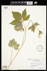 Cryptotaenia canadensis (L.) de Candolle 532708[1034772]Lakela, Olga 201791956-07-01 United States, Minnesota, Saint Louis, Bank of Little Fork River, hwy no. 5 at the bridge, S side;;N;;, 47.89363 -93.06209 |
MIN:Plants | 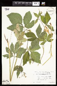 Cryptotaenia canadensis (L.) de Candolle 532759[1034776]Lakela, Olga 199491956-06-22 United States, Minnesota, Saint Louis, Bank of Little Swam River, hwy no. 5 N of Toivola;;N;;, 47.166882 -92.811028 |
MIN:Plants | 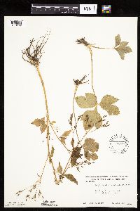 Cryptotaenia canadensis (L.) de Candolle 542493[1034779]Moore, John 214071951-10-10 United States, Minnesota, Steele, Along the S shore of Beaver Lake;;N;;, 43.891429 -93.349127 |
MIN:Plants | 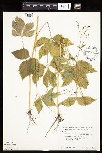 Cryptotaenia canadensis (L.) de Candolle 542696[1034781]Moore, John 218131954-07-19 United States, Minnesota, Wilkin, Along the Otter Tail River at Breckenridge;;N;;, 46.270086 -96.585023 |
MIN:Plants | 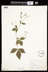 Cryptotaenia canadensis (L.) de Candolle 550594[1034765]Cotter, Shirley 7961948-07-30 United States, Minnesota, Clearwater, Bear Paw Point, Itasca Park;Itasca State Park;143N;36W;11, 47.217521 -95.201495 |
MIN:Plants | 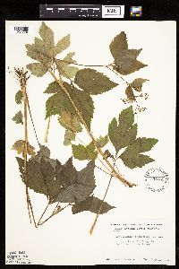 Cryptotaenia canadensis (L.) de Candolle 554051[1034778]Moore, John 225111955-06-01 United States, Minnesota, Sibley, Sibley Co. Along the E shore of Mud Lake;;114N;8;, 44.63761 -94.203213 |
MIN:Plants | 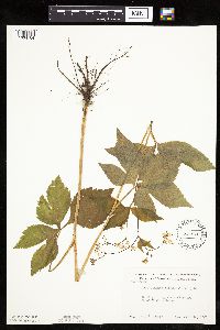 Cryptotaenia canadensis (L.) de Candolle 554610[1034764]Moore, John 232691957-06-18 United States, Minnesota, Martin, Along the E shore of East Chain Lake;;N;;, 43.543655 -94.30781 |
MIN:Plants | 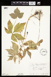 Cryptotaenia canadensis (L.) de Candolle 554647[1034715]Moore, John 230591956-09-15 United States, Minnesota, Clay, Forest along the river at Ulen;;N;;, 47.07885 -96.258949 |
MIN:Plants | 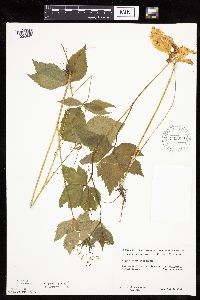 Cryptotaenia canadensis (L.) de Candolle 583989[1034649]Gunderson, R. 3781961-07-03 United States, Minnesota, Washington, Washington County ... St. Croix River, 3 mi. N of Stillwater. Middle shore.;Saint Croix National Riverway;030N;20W;, 45.084979 -92.817348 |
MIN:Plants | 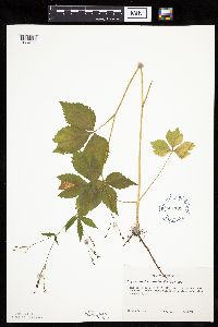 Cryptotaenia canadensis (L.) de Candolle 607193[1034668]Grafstrom, M. 1131968-07-23 United States, Minnesota, Pine, Pine Co. T40N, R18W, NW1/4 Sec. 14.;Saint Croix State Park;040N;18W;14, 45.95558 -92.56051 |
MIN:Plants | 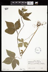 Cryptotaenia canadensis (L.) de Candolle 607241[1034676]Grafstrom, M. 791968-06-26 United States, Minnesota, Pine, Pine Co. T40N, R18W, NW1/4 Sec. 12.;Saint Croix State Park;040N;18W;12, 45.97238 -92.54592 |
MIN:Plants | 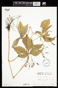 Cryptotaenia canadensis (L.) de Candolle 609979[1034675]Rosendahl, C. 74851941-07-20 United States, Minnesota, Houston, 1 1/2 mi. NE of Spring Grove;;N;;, 43.576442 -91.614777 |
MIN:Plants | 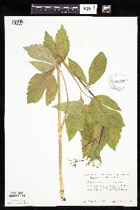 Cryptotaenia canadensis (L.) de Candolle 611337[1034788]Hsi, Yu-tseng [Eugene] 9371969-06-16 United States, Minnesota, Lyon, State conservation area, ca. 1.5 mi SW of Camden State Park;;N;;, 44.347099 -95.946511 |
MIN:Plants | 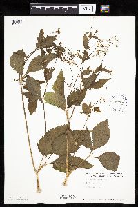 Cryptotaenia canadensis (L.) de Candolle 614594[1034706]Westkaemper, Remberta s.n.1969-06-00 United States, Minnesota, Stearns, Stearns Co. Lake George Woods, Spring Hill;;124N;33W;, 45.542482 -94.823804 |
Google Map
Google Maps is a web mapping service provided by Google that features a map that users can pan (by dragging the mouse) and zoom (by using the mouse wheel). Collection points are displayed as colored markers that when clicked on, displays the full information for that collection. When multiple species are queried (separated by semi-colons), different colored markers denote each individual species.