University of Minnesota
http://www.umn.edu/
612-625-5000
http://www.umn.edu/
612-625-5000
Minnesota Biodiversity Atlas
Bell Museum
Dataset: MIN-Plants
Taxa: Raillardella
Search Criteria: excluding cultivated/captive occurrences
1
Page 1, records 1-4 of 4
Bell Museum plants | |
 MIN:Plants | 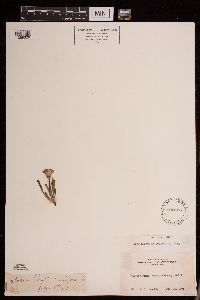 Raillardella scaposa (A. Gray) A. Gray 232766[1289326]Congdon, J. W. s.n.1891-07-23 United States, California, Mariposa, Glacier Point, Mariposa County;Yosemite National Park;;;, 37.73083 -119.57278 |
MIN:Plants | 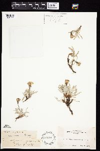 Raillardella argentea (A. Gray) A. Gray 232781[1049655]Congdon, J. s.n.1890-08-19 United States, California, Mariposa, Mt. Hoffman, Mariposa County;Yosemite National Park;;;, 37.84691 -119.51054 |
MIN:Plants | 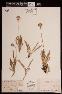 Raillardella scaposa (A. Gray) A. Gray 232780[1289327]Congdon, J. W. s.n.1889-08-23 United States, California, Mariposa, Mt. Buena Vista, Mariposa County;Yosemite National Park |
MIN:Plants | 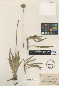 Raillardella pringlei Greene 213006[1002121]Pringle, C.G. s.n.1882-09-01 United States, California, head of the Sacramento River |
1
Page 1, records 1-4 of 4
Google Map
Google Maps is a web mapping service provided by Google that features a map that users can pan (by dragging the mouse) and zoom (by using the mouse wheel). Collection points are displayed as colored markers that when clicked on, displays the full information for that collection. When multiple species are queried (separated by semi-colons), different colored markers denote each individual species.