University of Minnesota
http://www.umn.edu/
612-625-5000
http://www.umn.edu/
612-625-5000
Minnesota Biodiversity Atlas
Bell Museum
Dataset: MIN-Plants
Taxa: Carex
Search Criteria: excluding cultivated/captive occurrences
Bell Museum plants | |
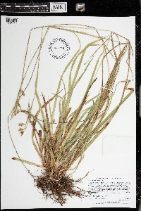
MIN:Plants | Carex emoryi Dewey 973237[1398790]Lee, Michael MDL58852012-06-13 United States, Minnesota, Koochiching, Along the Rainy River at the Frontier Public Water Access, 1/2 mile downstream from the mouth of Whitefish Creek, 16 miles east-southeast of Baudette., 48.6559215409 -94.2522357117, 323m |
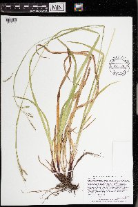
MIN:Plants | Carex peckii Howe 973239[1398792]Lee, Michael MDL58882012-06-13 United States, Minnesota, Koochiching, On the banks of the Rainy River one mile east of Laurel, 12 miles west-southwest of International Falls., 48.5168013021 -93.6466185718, 332m |
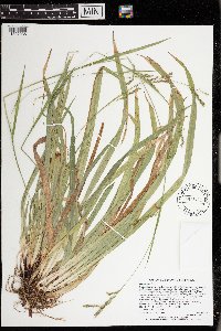
MIN:Plants | Carex pedunculata Muhlenberg ex Willdenow 973231[1398784]Lee, Michael MDL58912012-06-13 United States, Minnesota, Koochiching, On the banks of the Rainy River one mile east of Laurel, 12 miles west-southwest of International Falls; between the river and Highway 11., 48.5165989804 -93.6474014029, 332m |
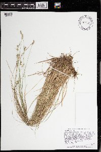
MIN:Plants | Carex radiata (Wahlenberg) Small 973240[1398793]Lee, Michael MDL58932012-06-13 United States, Minnesota, Koochiching, On the banks of the Rainy River one mile east of Laurel, 12 miles west-southwest of International Falls; between the river and Highway 11., 48.5163472503 -93.6473711126, 335m |
MIN:Plants | Carex castanea Wahlenberg 973416[1398969]Lee, Michael MDL58982012-06-14 United States, Minnesota, Lake, Rugged bedrock terrain north of the Fernberg Road, 15 miles east-southeast of Ely., 47.9746055172 -91.5273999774, 451m |
MIN:Plants | Carex gracillima Schweinitz 973238[1398791]Lee, Michael MDL58992012-06-14 United States, Minnesota, Lake, Rugged bedrock terrain north of the Fernberg Road, 15 miles east-southeast of Ely., 47.9746055172 -91.5273999774, 451m |
MIN:Plants | Carex ormostachya Wiegand 973403[1398956]Lee, Michael United States, Minnesota, Lake, Detailed locality information protected. This is typically done to protect rare or threatened species localities. |
MIN:Plants | Carex arctata Boott 973481[1397035]Lee, Michael MDL59062012-06-20 United States, Minnesota, Lake, Gently rolling forested terrain on the south side of Fall Lake, seven miles northeast of Ely. Along the Stub Lake hiking trail east of the Fall Lake Campground., 47.9519451365 -91.7047055898, 405m |
MIN:Plants | Carex interior L.H. Bailey 973232[1398785]Lee, Michael MDL59112012-06-20 United States, Minnesota, Lake, Gently rolling forested terrain on the south side of Fall Lake, seven miles northeast of Ely; just off the Stub Lake hiking trail south of the Fall Lake Campground., 47.9498535367 -91.7179633667, 402m |
MIN:Plants | Carex diandra Schrank 973241[1398794]Lee, Michael MDL59232012-06-21 United States, Minnesota, Lake, Strongly rolling bedrock terrain north of the Fernberg Road between the Moose Lake Road and Uncle Judas Creek, 16 miles east-northeast of Ely., 47.9667921597 -91.5089996193, 436m |
MIN:Plants | 973105[1398658]Lee, Michael MDL59242012-06-21 United States, Minnesota, Lake, Strongly rolling bedrock terrain north of the Fernberg Road between the Moose Lake Road and Uncle Judas Creek, 16 miles east-northeast of Ely., 47.9682730117 -91.5059424636, 442m |
MIN:Plants | Carex projecta Mackenzie 973081[1398634]Lee, Michael MDL59262012-06-21 United States, Minnesota, Lake, Strongly rolling bedrock terrain north of the Fernberg Road, east of the Moose Lake Road, 16 miles east-northeast of Ely., 47.969037721 -91.5004137893, 430m |
MIN:Plants | Carex jamesii Schweinitz 973045[1398598]Lee, Michael United States, Minnesota, Fillmore, Detailed locality information protected. This is typically done to protect rare or threatened species localities. |
MIN:Plants | Carex utriculata Boott in W.J. Hooker 973417[1398970]Lee, Michael MDL58802012-06-04 United States, Minnesota, Stearns, Rolling till plain along County Road 11, three miles north-northwest of St. Martin. T124N R32W S15, 45.5436638289 -94.700620971, 363m |
MIN:Plants | Carex lasiocarpa Ehrhart 973664[1397219]Dunevitz, Hannah L. 3291990-07-12 United States, Minnesota, Rice, Rice County Wilderness Park., 44.392139 -93.211172 |
MIN:Plants | Carex blanda Dewey 973709[1397264]Dunevitz, Hannah L. 12001996-07-09 United States, Minnesota, Rice, in the Cannon River Wilderness Area county park. Floodplain on the west side of the Cannon River,, 44.37 -93.22 |
MIN:Plants | Carex stipata Muhlenberg ex Willdenow 973705[1397260]Dunevitz, Hannah L. 11931996-07-09 United States, Minnesota, Rice, in the Cannon River Wilderness Area county park. 1/4 mile west of the Cannon River, 44.37 -93.22 |
MIN:Plants | Carex intumescens Rudge 973704[1397259]Dunevitz, Hannah L. 11941996-07-09 United States, Minnesota, Rice, in the Cannon River Wilderness Area county park. On the west side of the Cannon River, 44.37 -93.22 |
MIN:Plants | Carex tenera Dewey 973703[1397258]Dunevitz, Hannah L. 11951996-07-09 United States, Minnesota, Rice, in the Cannon River Wilderness Area county park. 1/4 mile west of the Cannon River, 44.37 -93.22 |
MIN:Plants | Carex hystericina Muhlenberg ex Willdenow 973708[1397263]Dunevitz, Hannah L. 3651990-06-08 United States, Minnesota, Rice, in the Cannon River Wilderness Area county park, On the east side of the Cannon River, 44.38 -93.2 |
MIN:Plants | Carex comosa Boott 973696[1397251]Bezanson, Char A. 1481991-07-10 United States, Minnesota, Rice, in Paulson Wildlife Management Area. 0.5 miles south of Union Lake, 44.439854 -93.316459 |
MIN:Plants | Carex albursina E. Sheldon 973711[1397266]Dunevitz, Hannah L. 3691990-05-30 United States, Minnesota, Rice, Southwest of Northfield, just south of 110th Street SE and 1/2 mile east of Faribault Blvd., 44.43 -93.18 |
MIN:Plants | Carex blanda Dewey 973710[1397265]Dunevitz, Hannah L. 3771990-05-30 United States, Minnesota, Rice, One mile southeast of Dundas., 44.41 -93.19 |
MIN:Plants | Carex lacustris Willdenow 973707[1397262]Dunevitz, Hannah L. 10501994-06-01 United States, Minnesota, Dakota, 2.8 miles north of Dakota County's southern border, on the east side of railroad tracks and just south of Chub Creek., 44.513831 -93.155137 |
MIN:Plants | Carex rosea Schkuhr ex Willdenow 973706[1397261]Dunevitz, Hannah L. 3811990-06-14 United States, Minnesota, Rice, Two miles west of Nerstrand Big Woods State Park, just east of Farmer Trail Road in area known locally as Seven Mile Woods., 44.36 -93.16 |
MIN:Plants | Carex peckii Howe 973657[1397212]Dunevitz, Hannah L. 3761990-06-06 United States, Minnesota, Rice, Northeastern-most island in Cedar Lake., 44.298045 -93.422288 |
MIN:Plants | Carex blanda Dewey 973656[1397211]Dunevitz, Hannah L. 3711990-06-06 United States, Minnesota, Rice, Northeastern-most island in Cedar Lake., 44.298045 -93.421944 |
MIN:Plants | Carex lupulina Willdenow 973625[1397180]Dunevitz, Hannah L. 6781992-07-09 United States, Minnesota, Winona, One mile east of Minnesota City., 44.100571 -91.728075 |
MIN:Plants | Carex gracillima Schweinitz []Timothy J. S. Whitfeld 35422023-05-24 United States, Minnesota, Washington, Crystal Spring Scientific and Natural Area, 0.4 miles northeast of the intersection of Scandia Trail North and Hwy 95, 45.2581 -92.76481, 275m |
MIN:Plants | Carex normalis Mackenzie []Timothy J. S. Whitfeld 35612023-06-13 United States, Minnesota, Washington, Crystal Spring Scientific and Natural Area; 0.4 miles northeast of the intersection of Scandia Trail North and Hwy 95, 45.258155 -92.764969, 271m |
MIN:Plants | Carex cephalophora Muhlenberg ex Willdenow []Timothy J. S. Whitfeld 35702023-06-13 United States, Minnesota, Washington, Crystal Spring Scientific and Natural Area; 0.4 miles northeast of the intersection of Scandia Trail North and Hwy 95, 45.25899 -92.76404, 269m |
MIN:Plants | Carex cephalophora Muhlenberg ex Willdenow []Timothy J. S. Whitfeld 35772023-06-30 United States, Minnesota, Washington, Crystal Spring Scientific and Natural Area; 0.4 miles northeast of the intersection of Scandia Trail North and Hwy 95, 45.2596 -92.7636, 242m |
MIN:Plants | Carex deweyana Schweinitz []Timothy J. S. Whitfeld 37322023-07-18 United States, Minnesota, Washington, Crystal Spring Scientific and Natural Area; 0.4 miles northeast of the intersection of Scandia Trail North and Hwy 95, 45.25944 -92.76398, 275m |
MIN:Plants | Carex katahdinensis Fernald 974602[1396931]Smith, Welby R WRS361772019-06-14 United States, Minnesota, Lake, In the Boundary Waters Canoe Area Wilderness, Superior National Forest. About 33 km (20.5 miles) due east of the approximate center of Ely. On a small island in Lake Four., 47.90246 -91.39503 |
MIN:Plants | Carex limosa L. 974603[1396932]Smith, Welby R WRS361822019-06-15 United States, Minnesota, Lake, In the Boundary Waters Canoe Area Wilderness, Superior National Forest. About 45 km (28 miles) due east of the approximate center of Ely. Along the flowage between Insula Lake and Hope Lake., 47.89733 -91.24982 |
MIN:Plants | Carex castanea Wahlenberg 974402[1396766]Smith, Welby R WRS361922019-06-16 United States, Minnesota, Lake, In the Boundary Waters Canoe Area Wilderness, Superior National Forest. About 42 km (26 miles) nearly due east of the approximate center of Ely. On an island in Insula Lake (unburned by the Pagami Creek Fire of 2011)., 47.91084 -91.28675 |
MIN:Plants | Carex deflexa Hornemann 974374[1396738]Smith, Welby R WRS362032019-06-16 United States, Minnesota, Lake, In the Boundary Waters Canoe Area Wilderness, Superior National Forest. About 44 km (27 miles) east of the approximate center of Ely at 85 degrees. Upland habitat at the north end of Insula Lake., 47.93541 -91.26816 |
MIN:Plants | Carex disperma Dewey 974382[1396746]Smith, Welby R WRS362122019-06-16 United States, Minnesota, Lake, In the Boundary Waters Canoe Area Wilderness, Superior National Forest. About 45 km (28 miles) east of the approximate center of Ely at 86 degrees. In a Thuja swamp at the NW end of Insula Lake., 47.92609 -91.26321 |
MIN:Plants | Carex granularis Muhlenberg ex Willdenow 974506[1396870]Smith, Welby R WRS363672019-07-16 United States, Minnesota, McLeod, Phasianus Waterfowl Production Area. Just SE of the junction of 140th street and Nature Avenue, about 2 km (1.3 miles) SW of Biscay., 44.81573 -94.29491 |
MIN:Plants | Carex retrorsa Schweinitz 974667[1396997]Smith, Welby R WRS363742019-07-16 United States, Minnesota, McLeod, Phasianus Waterfowl Production Area. Just SE of the junction of 140th street and Nature Avenue, about 2 km (1.3 miles) SW of Biscay., 44.81573 -94.29491 |
MIN:Plants | 974556[1396920]Smith, Welby R WRS363752019-07-16 United States, Minnesota, McLeod, Phasianus Waterfowl Production Area. Just SE of the junction of 140th street and Nature Avenue, about 2 km (1.3 miles) SW of Biscay., 44.81573 -94.29491 |
MIN:Plants | Carex vulpinoidea Michaux 974668[1396998]Smith, Welby R WRS363782019-07-16 United States, Minnesota, McLeod, Phasianus Waterfowl Production Area. Just SE of the junction of 140th street and Nature Avenue, about 2 km (1.3 miles) SW of Biscay., 44.81573 -94.29491 |
MIN:Plants | Carex annectens (E.P. Bicknell) E.P. Bicknell 974630[1396960]Smith, Welby R United States, Minnesota, Anoka, Detailed locality information protected. This is typically done to protect rare or threatened species localities. |
MIN:Plants | Carex intumescens Rudge 974642[1396972]Smith, Welby R WRS364332019-08-07 United States, Minnesota, McLeod, Stahls Lake County Park. About 7.6 km (4.7 miles) northwest of the approximate center of Hutchinson at a heading of 324 degrees., 44.947652 -94.426073 |
MIN:Plants | Carex lupulina Willdenow 974645[1396975]Smith, Welby R WRS364362019-08-07 United States, Minnesota, McLeod, Stahls Lake County Park. About 7.6 km (4.7 miles) northwest of the approximate center of Hutchinson at a heading of 324 degrees., 44.947652 -94.426073 |
MIN:Plants | Carex tenera Dewey []Timothy J. S. Whitfeld 36042023-07-06 United States, Minnesota, Marshall, Agassiz National Wildlife Refuge, Agassiz Wilderness Area, 1 mile west of Webster Creek Pool, 4.7 miles north of main administration building, 48.3689 -95.96569, 346m |
MIN:Plants | Carex stipata Muhlenberg ex Willdenow []Timothy J. S. Whitfeld 36052023-07-06 United States, Minnesota, Marshall, Agassiz National Wildlife Refuge, Agassiz Wilderness Area, 1 mile west of Webster Creek Pool, 4.7 miles north of main administration building, 48.3689 -95.96569, 346m |
MIN:Plants | Carex buxbaumii Wahlenberg []Timothy J. S. Whitfeld 36492023-07-07 United States, Minnesota, Marshall, New Maine Wildlife Management Area, 0.3 miles north northeast of intersection of 390th St NW and Center Ave N., 48.4464 -96.2803, 341m |
MIN:Plants | Carex chordorrhiza Ehrhart ex L. f. []Timothy J. S. Whitfeld 36512023-07-07 United States, Minnesota, Marshall, New Maine Wildlife Management Area, 0.3 miles north northeast of intersection of 390th St NW and Center Ave N., 48.4464 -96.2803, 341m |
MIN:Plants | Carex diandra Schrank []Timothy J. S. Whitfeld 36522023-07-07 United States, Minnesota, Marshall, New Maine Wildlife Management Area, 0.3 miles north northeast of intersection of 390th St NW and Center Ave N., 48.4464 -96.2803, 341m |
MIN:Plants | Carex lasiocarpa Ehrhart []Timothy J. S. Whitfeld 36592023-07-07 United States, Minnesota, Marshall, New Maine Wildlife Management Area, 0.3 miles north northeast of intersection of 390th St NW and Center Ave N., 48.4464 -96.2803, 341m |
MIN:Plants | Carex livida (Wahlenberg) Willdenow []Timothy J. S. Whitfeld 36622023-07-07 United States, Minnesota, Marshall, New Maine Wildlife Management Area, 0.3 miles north northeast of intersection of 390th St NW and Center Ave N., 48.4464 -96.2803, 341m |
MIN:Plants | Carex xerantica L.H. Bailey []Timothy J. S. Whitfeld United States, Minnesota, Marshall, Detailed locality information protected. This is typically done to protect rare or threatened species localities. |
MIN:Plants | Carex siccata Dewey []Timothy J. S. Whitfeld 36942023-07-07 United States, Minnesota, Marshall, Huntley Management Area, 0.5 miles northwest of right angle turn of 130th Avenue NE, 48.45447 -96.19626, 354m |
MIN:Plants | Carex pensylvanica Lamarck []Timothy J. S. Whitfeld 36952023-07-07 United States, Minnesota, Marshall, Huntley Management Area, 0.5 miles northwest of right angle turn of 130th Avenue NE, 48.45447 -96.19626, 354m |
MIN:Plants | Carex pensylvanica Lamarck []J. C. B. Waddington 151966-05-07 United States, Minnesota, Hennepin, Bluff overlooking Mississippi River at Fort Snelling, 44.893533 -93.18173 |
MIN:Plants | Carex praegracilis W. Boott 974225[1397415]Dunevitz, Hannah L. 3701990-05-30 United States, Minnesota, Rice, One mile south of Dundas., 44.42 -93.18 |
MIN:Plants | Carex alopecoidea Tuckerman 974701[1397468]Dunevitz, Hannah L. 3741990-06-05 United States, Minnesota, Goodhue, 7 miles north of Kenyon, 0.8 miles west of the Little Cannon River., 44.37 -92.95 |
MIN:Plants | Carex rosea Schkuhr ex Willdenow 974706[1397473]Dunevitz, Hannah L. 3791990-06-26 United States, Minnesota, Goodhue, About 6 mies south of Cannon Falls, east of County State Aid Highway 14., 44.42 -92.9 |
MIN:Plants | Carex sparganioides Muhlenberg ex Willdenow 974688[1397455]Dunevitz, Hannah L. 3781990-06-26 United States, Minnesota, Goodhue, About 6 miles south of Cannon Falls and 1/3 mile east of County State Aid Highway 14, on a west-facing bluff., 44.42 -92.9 |
MIN:Plants | Carex sprengelii Dewey ex Sprengel 974675[1397442]Dunevitz, Hannah L. 3721990-06-07 United States, Minnesota, Goodhue, About 7 miles south of Cannon Falls and 1.7 miles west of U.S. Trunk Highway 52., 44.41 -92.89 |
MIN:Plants | Carex rosea Schkuhr ex Willdenow 974705[1397472]Dunevitz, Hannah L. 3731990-06-07 United States, Minnesota, Goodhue, About 7 miles south of Cannon Falls and 1.7 miles west of U.S. Trunk Highway 52., 44.41 -92.89 |
MIN:Plants | Carex lupulina Willdenow 974692[1397459]Dunevitz, Hannah L. 7421992-06-23 United States, Minnesota, Goodhue, In a large expanse of floodplain between Prairie Island and the Mississippi River. Just east of Sharp Muskrat Lake, 0.7 miles southwest of the Mississippi River., 44.69 -92.71 |
MIN:Plants | Carex sprengelii Dewey ex Sprengel 974673[1397440]Dunevitz, Hannah L. 3611990-05-31 United States, Minnesota, Goodhue, Just south of the Cannon River on the east side of the U.S. Highway 61 bridge, close to the bridge., 44.58 -92.65 |
MIN:Plants | Carex trichocarpa Willdenow 974681[1397448]Dunevitz, Hannah L. 10561994-06-07 United States, Minnesota, Goodhue, in the Perched Valley Wildlife Management Area. About 2 miles west of the city of Frontenac,, 44.52 -92.4 |
MIN:Plants | Carex pensylvanica Lamarck 975976[1373529]Smith, Welby R WRS366672020-05-14 United States, Minnesota, Dakota, Pine Bend State Scientific and Natural Area in Inver Grove Heights., 44.79224 -93.03218 |
MIN:Plants | Carex lupulina Willdenow 976022[1373575]Smith, Welby R WRS367132020-06-23 United States, Minnesota, Anoka, Lamprey Pass State Wildlife Management Area, about 4 km (2.5 miles) southwest of the approximate center of the town of Forest Lake., 45.2552 -93.0249 |
MIN:Plants | Carex emoryi Dewey 976004[1373557]Smith, Welby R WRS367152020-06-23 United States, Minnesota, Dakota, Lake Rebecca Park; on the north side of Hastings just south of Lock and Dam #2 on the Mississippi River., 44.75391 -92.8702 |
MIN:Plants | Carex muskingumensis Schweinitz 976002[1373555]Smith, Welby R United States, Minnesota, Dakota, Detailed locality information protected. This is typically done to protect rare or threatened species localities. |
MIN:Plants | Carex laeviconica Dewey 976021[1373574]Smith, Welby R WRS367192020-06-23 United States, Minnesota, Dakota, Lake Rebecca Park; on the north side of Hastings just south of Lock and Dam #2 on the Mississippi River., 44.75391 -92.8702 |
MIN:Plants | Carex typhina Michaux 976087[1373640]Smith, Welby R United States, Minnesota, Wabasha, Detailed locality information protected. This is typically done to protect rare or threatened species localities. |
MIN:Plants | Carex grayi J. Carey 976091[1373644]Smith, Welby R United States, Minnesota, Wabasha, Detailed locality information protected. This is typically done to protect rare or threatened species localities. |
MIN:Plants | Carex muskingumensis Schweinitz 976092[1373645]Smith, Welby R United States, Minnesota, Wabasha, Detailed locality information protected. This is typically done to protect rare or threatened species localities. |
MIN:Plants | 976451[1402079]Scott A. Milburn 342021-06-03 United States, Minnesota, Roseau, Sprague Creek Peatland SNA, 1.75km south of the Canadian Border and 2.5km west of County Rd 310; T164N, R40W, Sec. 34; 48.981702 -95.802859, 48.981702 -95.802859 |
MIN:Plants | Carex foenea Willdenow 976452[1402080]Scott A. Milburn 402021-06-10 United States, Minnesota, Lake, between Birch Lake and Forest Rd 428, approx. 13.7km southeast of Ely; T61N, R11W, Sec. 8, 47.784196 -91.752098 |
MIN:Plants | Carex houghtoniana Torrey ex Dewey 976462[1402090]Scott A. Milburn 422021-06-10 United States, Minnesota, Lake, between Birch Lake and Forest Rd 428, approx. 13.7km southeast of Ely; T61N, R11W, Sec. 8; 47.784196 -91.752098, 47.784196 -91.752098 |
MIN:Plants | Carex backii W. Boott 976463[1402091]Scott A. Milburn 412021-06-10 United States, Minnesota, Lake, between Birch Lake and Forest Rd 428, approx. 13.7km southeast of Ely; T61N, R11W, Sec. 8; 47.784196 -91.752098, 47.784196 -91.752098 |
MIN:Plants | Carex typhina Michaux 976467[1402095]Scott A. Milburn United States, Minnesota, Washington, Detailed locality information protected. This is typically done to protect rare or threatened species localities. |
MIN:Plants | Carex grayi J. Carey 976478[1402106]Scott A. Milburn United States, Minnesota, Washington, Detailed locality information protected. This is typically done to protect rare or threatened species localities. |
MIN:Plants | Carex lasiocarpa Ehrhart 976363[1403145]Dunevitz, Hannah L. 8671992-06-19 United States, Minnesota, Winona, In the Whitewater Wildlife Management Area. 5 miles northeast of St. Charles, in a wetland in an isolated 3/4 acre bowl-shaped depression on a broad mid-bluff terrace along the South Fork Whitewater River., 44.01 -91.97 |
MIN:Plants | Carex intumescens Rudge 976364[1403144]Dunevitz, Hannah L. 8681992-06-19 United States, Minnesota, Winona, In the Whitewater Wildlife Management Area. 5 miles northeast of St. Charles, in a wetland in an isolated 3/4 acre bowl-shaped depression on a broad mid-bluff terrace along the South Fork Whitewater River., 44.01 -91.97 |
MIN:Plants | Carex comosa Boott 976413[1373996]Dunevitz, Hannah L. 7431992-06-25 United States, Minnesota, Winona, 1.6 miles east of Highway 61, east of Minnesota City, just south of Prairie Island Road., 44.09 -91.72 |
MIN:Plants | Carex lupulina Willdenow 976362[1403146]Dunevitz, Hannah L. 7441992-06-25 United States, Minnesota, Winona, 1.5 miles east of Highway 61, east of Minnesota City, just south of Prairie Island Road., 44.09 -91.72 |
MIN:Plants | Carex bicknellii Britton 976406[1403102]Dunevitz, Hannah L. 7841993-09-01 United States, Minnesota, Winona, West-southwest facing bluff above Trunk Highway 76, 1 mile north of the southern Winona County boundary., 43.86 -91.64 |
MIN:Plants | Carex deweyana Schweinitz 976361[1403147]Dunevitz, Hannah L. 9721993-09-20 United States, Minnesota, Winona, About 3 miles south of Lewiston and 1/4 mile north of Interstate 90, in woodland area east of Rush Creek., 43.94 -91.86 |
MIN:Plants | Carex pensylvanica Lamarck []J.C.B. Waddington 151966-05-07 United States, Minnesota, Hennepin, Bluff overlooking Mississippi River at Fort Snelling, 44.892256 -93.179413 |
Google Map
Google Maps is a web mapping service provided by Google that features a map that users can pan (by dragging the mouse) and zoom (by using the mouse wheel). Collection points are displayed as colored markers that when clicked on, displays the full information for that collection. When multiple species are queried (separated by semi-colons), different colored markers denote each individual species.
