University of Minnesota
http://www.umn.edu/
612-625-5000
http://www.umn.edu/
612-625-5000
Minnesota Biodiversity Atlas
Bell Museum
Dataset: MIN-Plants
Taxa: Cornus
Search Criteria: excluding cultivated/captive occurrences
Bell Museum plants | |
 MIN:Plants | 764662[]Ballard, C. s.n.1893-06-00 United States, Minnesota, Cass, Gull Lake;;N;;, 46.446379 -94.35099 |
MIN:Plants | 770069[]Smith, Welby 81281983-06-14 United States, Minnesota, Clearwater, On the E side of co. hwy 5, ca. 2 1/4 mi N of its jnc with st. hwy 92 in Clearbrook; SW1/4 NW1/4 Sec. 17 T149N R37W;;149N;37W;17, 47.724444 -95.420116 |
MIN:Plants | 770176[]Smith, Welby 85331983-08-01 United States, Minnesota, Carlton, Carlton Co. Hemlock Ravine State Scientific and Natural Area, about 2.5 mi S of Esko; NW1/4 SE1/4 Sec. 3 T48N R16W;Hemlock Ravine Scientific Natural Area;048N;16W;3, 46.670563 -92.353928 |
MIN:Plants | 773083[]Boe, J. 2311979-06-17 United States, Minnesota, Lake of the Woods, Near Norris Camp; T159N R35W Sec. 8;;159N;35W;8, 48.605309 -95.181076 |
MIN:Plants | 773131[]Boe, J. 1141979-06-12 United States, Minnesota, Lake of the Woods, Brown's Lake, State Waterfowl Refuge, near Faunce Road; T159N R35W SW1/4 Sec. 1;;159N;35W;1, 48.619742 -95.09399 |
MIN:Plants | 773421[]Boe, J. 1281979-06-13 United States, Minnesota, Lake of the Woods, Lost Lake Trail, near Lost Lake Trail; T159N R35W Sec. 32;;159N;35W;32, 48.547301 -95.180915 |
MIN:Plants | 774171[]Monson, Paul 53411983-06-16 United States, Minnesota, Saint Louis, Voyageurs National Park, Kabetogama Peninsula E of Camel Back Island; T70N R21W Sec. 34;Voyageurs National Park;070N;21W;34, 48.507134 -93.015207 |
MIN:Plants | 774335[]Monson, Paul 53061983-06-14 United States, Minnesota, Saint Louis, Voyaguers National Park, Kabetogama Narrows Ranger Station; T69N R20W SW1/4 NW1/4 Sec. 25;Voyageurs National Park;069N;20W;25, 48.43325 -92.842322 |
MIN:Plants | 776499[]Wheeler, Gerald 89241985-07-23 United States, Minnesota, Itasca, Marcell Bog. Ca. 18 mi. N of Grand Rapids on Rte. 49; between Cutaway Lake and Spring Lake. T58N, R25W, Sec. 13.;Chippewa National Forest;058N;25W;13, 47.507443 -93.459706 |
MIN:Plants | 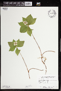 781347[1348692]Smith, Welby 91461984-06-13 United States, Minnesota, Lake of the Woods, Mulligan Lake Peatland. SE1/4 NW1/4 Sec. 35, T159N, R36W.;Mulligan Lake Peatland Scientific Natural Area;159N;36W;35, 48.54709 -95.24468 |
MIN:Plants | 781806[]Smith, Welby 90091984-06-11 United States, Minnesota, Morrison, Pellager Peatland, ca. 4 mi. SW of Pellager. NW1/4 NW1/4 Sec. 36, T133N, R31W.;;133N;31W;36, 46.289663 -94.527456 |
MIN:Plants | 794077[]Wheeler, Gerald 64991982-08-12 United States, Minnesota, Marshall, Thief Lake Wildlife Management Area. Thief Lake Wildlife Management Area; 3.6 mi. N of the jct. of Rte. 6 and Rte. 89 (on E side of Rte. 89). T158N, R39W, S Thief Lake Wildlife Management Area; 3.6 mi. N of the jct. of Rte. 6 and Rte. 89 (on E side of Rte. 89). T158N, R39W, Sec. 30.. 158N 39W 30, 48.474658 -95.720625 |
MIN:Plants | 795637[]Wheeler, Gerald 62241982-08-10 United States, Minnesota, Mahnomen, White Earth Indian Reservation. Mahnomen Co. Approx. 2.3 mi N of the jct. of Rt. 4 and an unmarked Co. Rd. (runs just W of Lambert Lake, W of road). T1 Mahnomen Co. Approx. 2.3 mi N of the jct. of Rt. 4 and an unmarked Co. Rd. (runs just W of Lambert Lake, W of road). T146N, R39W, Sec. 34.. 146N 39W 34, 47.418241 -95.603918 |
MIN:Plants | 806929[]Siemers, Ross 41977-06-06 United States, Minnesota, Stearns, Stearns Co. Rockville Tamarack Bog Preserve, T123N R29W Sec.17;Rockville Tamarack Bog;123N;29W;17, 45.464811 -94.353471 |
MIN:Plants | 817631[]Engels, A. s.n.1991-05-22 United States, Minnesota, Aitkin, Aitkin Co. Ca. 2.5 mi SW of Palisade, along the Mississippi River; T49N R25W Sec. 33;;049N;25W;33, 46.688685 -93.516311 |
MIN:Plants | 83062[]Gerhardt, F. s.n.1981-06-14 United States, Minnesota, Saint Louis, St. Louis County ... R-12W T-63N Sec.2;Superior National Forest;063N;12W;2, 47.969196 -91.831648, 418m |
MIN:Plants | 831364[]Cloutier, H. s.n.1943-07-20 United States, Minnesota, Itasca, Itasca Co, Coleraine, Trout Lake vicinity.;;N;;, 47.239348 -93.38457 |
MIN:Plants | 832061[]Bagley, S. 81969-06-02 United States, Minnesota, Cook, St. Louis County ... Sec.28 R-4W T-66N [this locale is in Cook Co.];Boundary Waters Canoe Area Wilderness / Superior National Forest;066N;04W;28, 48.171107 -90.84609, 436m |
MIN:Plants | 832403[]Moyle, J.; et al. 37011941-06-29 United States, Minnesota, Fillmore, Fillmore Co, near Wykoff;Dorer Memorial Hardwood State Forest;103N;12W;, 43.71741 -92.26928 |
MIN:Plants | 833704[]Monson, Paul 59221984-06-05 United States, Minnesota, Cook, Grand Portage National Monument. Cook Co, R-6E, T-64N, S-32, ca. 1.5 mi NW of Visitor Center;Grand Portage National Monument / North Shore;064N;06E;32, 47.983468 -89.705538 |
MIN:Plants | 835669[]Cholewa, A.; Engels, A. 21591995-06-01 United States, Minnesota, Aitkin, Aitkin Co. Savanna Portage State Park, about 17 mi NE of McGregor, SW end of Wolf Lake, T50N R22W S6 NE1/4;Savanna Portage State Park;050N;22W;6, 46.848227 -93.171098 |
MIN:Plants | 837368[]Smith, Welby 175971990-08-01 United States, Minnesota, Morrison, Camp Ripley Military Reservation. Camp Ripley Military Reservation Morrison Co. About 200 m NE of the junction of Normandy Road and Luzon Road. UTM: 38470 Camp Ripley Military Reservation Morrison Co. About 200 m NE of the junction of Normandy Road and Luzon Road. UTM: 384700E 5113500N T131N R30W SE1/4 of SW1/4 of Sec 8. 131N 30W 8, 46.17291 -94.485675 |
MIN:Plants | 842046[]Smith, Welby 150471988-09-06 United States, Minnesota, Washington, Washington Co. About 1 mi NE of Woodbury; NE1/4 SE1/4 sec.8, T28N R21W;;028N;21W;8, 44.9261093 -92.9472198 |
MIN:Plants | Cornus racemosa Lamarck 165978[]Illegible name 391900-06-24 United States, Minnesota, [no further data];;;;, 46 -94 |
MIN:Plants | Cornus racemosa Lamarck 165991[]Camp, S.; Camp, D. s.n.1895-06-07 United States, Minnesota, Jackson, Jackson Co.;;;;, 43.68 -95.16 |
MIN:Plants | Cornus racemosa Lamarck 165998[]Rosendahl, C. 32771916-06-25 United States, Minnesota, Freeborn, Ca. 4 mi. W of Albert Lea;;N;;, 43.647985 -93.448337 |
MIN:Plants | Cornus racemosa Lamarck 165999[]Rosendahl, C.; Butters, F. 30331915-06-24 United States, Minnesota, Houston, Spring Grove;;101N;07W;, 43.543923 -91.6707 |
MIN:Plants | Cornus racemosa Lamarck 166000[]Goldsmith, G. G1241912-00-00 United States, Minnesota, Rice, Northfield;;N;;, 44.458298 -93.161604 |
MIN:Plants | Cornus racemosa Lamarck 166001[]Campbell, Jennie c181896-07-00 United States, Minnesota, Stearns, Braun's farm, Stearns Co.;;N;;, 45.557693 -94.1603 |
MIN:Plants | Cornus racemosa Lamarck 166003[]Rosendahl, C. 21891909-06-28 United States, Minnesota, Fort Snelling Reservation [old regional park spanning junction of Minnesota and Mississippi rivers];;028N;23W;, 44.905162 -93.166462 |
MIN:Plants | Cornus racemosa Lamarck 166005[]Rosendahl, C. 25051911-09-03 United States, Minnesota, Hennepin, Purgatory Swamp;;N;;, 44.918379 -93.513566 |
MIN:Plants | Cornus racemosa Lamarck 166006[]Bergman, H. 28091913-06-21 United States, Minnesota, Meeker, Darwin;;N;;, 45.10923 -94.440517 |
MIN:Plants | Cornus racemosa Lamarck 166007[]Taylor, B. T2601891-06-00 United States, Minnesota, Waseca, Janesville;;N;;, 44.116078 -93.708004 |
MIN:Plants | Cornus racemosa Lamarck 166008[]Aiton, G. s.n.1892-06-00 United States, Minnesota, Hennepin, Vic. [Minneapolis];;N;;, 44.979965 -93.263836 |
MIN:Plants | Cornus racemosa Lamarck 166009[]Sheldon, Edmund s.n.1892-07-00 United States, Minnesota, Mille Lacs, Milaca;;036N;26W;, 45.602777 -93.573848 |
MIN:Plants | Cornus racemosa Lamarck 166010[]Kassube, J. s.n.1878-06-00 United States, Minnesota, Hennepin, Minneapolis;;N;;, 44.979965 -93.263836 |
MIN:Plants | Cornus racemosa Lamarck 166011[]Taylor, B. T13861892-07-00 United States, Minnesota, Chisago, Center City;;N;;, 45.393852 -92.816602 |
MIN:Plants | Cornus racemosa Lamarck 166012[]Burglehaus, F. s.n.1891-09-00 United States, Minnesota, Hennepin, [no further data];;;;, 45 -93.47 |
MIN:Plants | Cornus racemosa Lamarck 166013[]MacMillan, C.; et al. s.n.1900-08-00 United States, Minnesota, Polk, Crookston;;150N;46W;30, 47.782 -96.60007 |
MIN:Plants | Cornus racemosa Lamarck 166014[]Ballard, C. B9581892-06-00 United States, Minnesota, Brown, New Ulm;;110N;30W;, 44.326359 -94.431802 |
MIN:Plants | Cornus racemosa Lamarck 166015[]Ballard, C. B14341893-07-00 United States, Minnesota, Cass, Lake Kilpatrick;;135N;29W;, 46.500163 -94.32908 |
MIN:Plants | Cornus racemosa Lamarck 166016[]Wheeler, William 1721899-06-12 United States, Minnesota, Houston, Winnebago Valley;Dorer Memorial Hardwood State Forest;N;;, 43.53909 -91.40968 |
MIN:Plants | Cornus racemosa Lamarck 166017[]Sheldon, Edmund S3231891-06-00 United States, Minnesota, Blue Earth, Smith's Mill;;N;;, 44.138266 -93.766707 |
MIN:Plants | Cornus racemosa Lamarck 166018[]Sheldon, Edmund s.n.1892-07-00 United States, Minnesota, Kanabec, Mora;;039N;24W;, 45.860683 -93.327529 |
MIN:Plants | Cornus racemosa Lamarck 166019[]Wheeler, William 1721899-06-12 United States, Minnesota, Houston, Winnebago Valley;Dorer Memorial Hardwood State Forest;;;, 43.53909 -91.40968 |
MIN:Plants | Cornus racemosa Lamarck 166020[]Manning, Sara s.n.1886-06-00 United States, Minnesota, Wabasha, Lake City;;N;;, 44.439117 -92.279204 |
MIN:Plants | Cornus racemosa Lamarck 166021[]Moyer, Lycurgus 27181897-06-25 United States, Minnesota, Hennepin, [no further data];;;;, 45 -93.47 |
MIN:Plants | Cornus racemosa Lamarck 166022[]Moyer, Lycurgus 27181895-06-20 United States, Minnesota, Ramsey, State Farm [prob. referring to Univ. of Minn. agricultural campus]. St. Anthony Park.;;029N;23W;, 44.992077 -93.166387 |
MIN:Plants | Cornus racemosa Lamarck 166023[]Menzel, Max s.n.1895-06-00 United States, Minnesota, Pipestone, Pipestone [assuming the quarry area; town generally noted as Pipestone City by collector];Pipestone National Monument;106N;46W;01, 44.01585 -96.31767 |
MIN:Plants | Cornus racemosa Lamarck 166024[]Ballard, C. s.n.1893-07-00 United States, Minnesota, Cass, Lake Kilpatrick;;135N;29W;, 46.500163 -94.32908 |
MIN:Plants | Cornus racemosa Lamarck 166025[]Taylor, B. T3341891-06-00 United States, Minnesota, Waseca, Janesville;;N;;, 44.116078 -93.708004 |
MIN:Plants | Cornus racemosa Lamarck 166026[]Sandberg, John s.n.1889-07-00 United States, Minnesota, Hennepin, [no further data];;;;, 45 -93.47 |
MIN:Plants | Cornus racemosa Lamarck 166027[]Burglehaus, F. 27181891-09-00 United States, Minnesota, Hennepin, [no further data];;;;, 45 -93.47 |
MIN:Plants | Cornus racemosa Lamarck 166028[]Menzel, Max s.n.1895-06-00 United States, Minnesota, Pipestone, Pipestone [assuming the quarry area; town generally noted as Pipestone City by collector];Pipestone National Monument;106N;46W;01, 44.01585 -96.31767 |
MIN:Plants | Cornus racemosa Lamarck 166029[]Ballard, C. B971891-06-00 United States, Minnesota, Scott, Shakopee;;115N;22W;, 44.760853 -93.459533 |
MIN:Plants | Cornus racemosa Lamarck 166030[]Sandberg, John s.n.1882-07-00 United States, Minnesota, Goodhue, Cannon Falls;;N;;, 44.506911 -92.905484 |
MIN:Plants | Cornus racemosa Lamarck 166031[]Ballard, C. s.n.1892-06-00 United States, Minnesota, Brown, New Ulm;;110N;30W;, 44.326359 -94.431802 |
MIN:Plants | Cornus racemosa Lamarck 166032[]Ballard, C. 27521900-08-00 United States, Minnesota, Kittson, Hallock, Kittson Co.;;161N;49W;, 48.760418 -96.996127 |
MIN:Plants | Cornus racemosa Lamarck 166033[]Bergman, H. 28091913-06-21 United States, Minnesota, Meeker, Darwin;;N;;, 45.10923 -94.440517 |
MIN:Plants | Cornus racemosa Lamarck 166035[]Herrick, C. s.n.1878-06-00 United States, Minnesota, Hennepin, Minneapolis;;N;;, 44.979965 -93.263836 |
MIN:Plants | Cornus racemosa Lamarck 166036[]Sheldon, Edmund S7161891-07-00 United States, Minnesota, Brown, Sleepy Eye;;110N;32W;, 44.325885 -94.684758 |
MIN:Plants | Cornus racemosa Lamarck 166037[]Holzinger, John s.n.1886-06-00 United States, Minnesota, Winona, Winona Co.;;N;;, 43.912765 -91.724681 |
MIN:Plants | Cornus racemosa Lamarck 166038[]Sheldon, Edmund S27731892-07-00 United States, Minnesota, Mille Lacs, Milaca;;N;;, 45.755799 -93.654408 |
MIN:Plants | Cornus racemosa Lamarck 166039[]McElligott, T. s.n.1890-06-10 United States, Minnesota, McLeod, Glencoe;;N;;, 44.769129 -94.151642 |
MIN:Plants | Cornus racemosa Lamarck 166284[]Oestlund, O. s.n.1876-06-00 United States, Minnesota, Ramsey, Ramsey Co.;;;;, 45.006408 -93.09794 |
MIN:Plants | Cornus racemosa Lamarck 166285[]Ballard, C. B7431891-07-00 United States, Minnesota, Carver, Waconia;;116N;25W;, 44.8476 -93.827753 |
MIN:Plants | Cornus racemosa Lamarck 166288[]Oestlund, O. s.n.1888-08-17 United States, Minnesota, Hennepin, [no further data];;;;, 45 -93.47 |
MIN:Plants | Cornus racemosa Lamarck 166312[]Taylor, B. T7981891-07-00 United States, Minnesota, Pope, Glenwood;;N;;, 45.65 -95.365833 |
MIN:Plants | Cornus racemosa Lamarck 225260[]Bergman, H. 28091913-06-21 United States, Minnesota, Meeker, Darwin;;N;;, 45.10923 -94.440517 |
MIN:Plants | Cornus racemosa Lamarck 225261[]Holzinger, John s.n.1901-05-00 United States, Minnesota, Winona, Winona Co.;;N;;, 43.912765 -91.724681 |
MIN:Plants | Cornus racemosa Lamarck 225278[]Rosendahl, C. 25011911-08-24 United States, Minnesota, Hennepin, Near Mound, Lake Minnetonka;;N;;, 44.93663 -93.666072 |
MIN:Plants | Cornus racemosa Lamarck 225280[]Rosendahl, C. 25051912-09-03 United States, Minnesota, Hennepin, Purgatory Swamp, Lake Minnetonka;;N;;, 44.918379 -93.513566 |
MIN:Plants | Cornus racemosa Lamarck 225281[]Rosendahl, C. 25011911-08-24 United States, Minnesota, Hennepin, Near Mound, Lake Minnetonka;;N;;, 44.93663 -93.666072 |
MIN:Plants | Cornus racemosa Lamarck 225299[]Rosendahl, C. 53631927-08-13 United States, Minnesota, Houston, Sec. 22, Spring Grove Twp.;;101N;07W;22, 43.536807 -91.660825 |
MIN:Plants | Cornus racemosa Lamarck 225300[]Rosendahl, C. 53871927-08-18 United States, Minnesota, Houston, Sec. 22 Spring Grove Twp.;;101N;07W;22, 43.536807 -91.660825 |
MIN:Plants | Cornus racemosa Lamarck 225303[]Rosendahl, C. 53581929-08-10 United States, Minnesota, Fillmore, N of Fountain (almost 2 mi.);;104N;11W;, 43.803917 -92.14917 |
MIN:Plants | Cornus racemosa Lamarck 225304[]Rosendahl, C. 53581927-08-10 United States, Minnesota, Fillmore, N of Fountain (ca. 2 mi.);;104N;11W;, 43.803917 -92.14917 |
MIN:Plants | Cornus racemosa Lamarck 225305[]Rosendahl, C. 56531927-08-13 United States, Minnesota, Houston, Sec. 22, Spring Grove Twp.;;101N;07W;22, 43.536807 -91.660825 |
MIN:Plants | Cornus racemosa Lamarck 261964[]Rasmusson, M. s.n.1927-08-19 United States, Minnesota, Polk, Sand Hill River, 1/4 mi. W of Fertile;;N;;, 47.526723 -96.285996 |
MIN:Plants | Cornus racemosa Lamarck 263621[]Rosendahl, C. 3901902-06-06 United States, Minnesota, Houston, Spring Grove;;101N;07W;, 43.543923 -91.6707 |
MIN:Plants | Cornus racemosa Lamarck 265912[]Skinner, S. 1311902-06-17 United States, Minnesota, Jackson, Heron Lake region;;N;;, 43.762734 -95.329202 |
MIN:Plants | Cornus racemosa Lamarck 276179[]Moyle, J. 2601930-07-14 United States, Minnesota, Clearwater, Itasca Park. SE1/4 NW1/4 T143N, R36W.;Itasca State Park;143N;36W;1, 47.232293 -95.180237 |
MIN:Plants | Cornus racemosa Lamarck 277594[]Jones, Percy 5121930-09-14 United States, Minnesota, Dakota, Inver Grove, Inver Grove Twp.;;027N;22W;, 44.818658 -93.044965 |
MIN:Plants | Cornus racemosa Lamarck 284625[]Rosendahl, C. 4851902-06-13 United States, Minnesota, Houston, Spring Grove;;101N;07W;, 43.543923 -91.6707 |
MIN:Plants | Cornus racemosa Lamarck 332020[]Rosendahl, C. 53581927-08-10 United States, Minnesota, Fillmore, N of Fountain (ca. 2 mi.);;104N;11W;, 43.803917 -92.14917 |
MIN:Plants | Cornus racemosa Lamarck 332021[]Rosendahl, C. 53581927-08-10 United States, Minnesota, Fillmore, N of Fountain (ca. 2 mi.);;104N;11W;, 43.803917 -92.14917 |
MIN:Plants | Cornus racemosa Lamarck 332499[]Grant, Martin 65841935-08-06 United States, Minnesota, Clearwater, Itasca Park. NE1/4 SW1/4 Sec. 1, T143N, R36W.;Itasca State Park;143N;36W;1, 47.232293 -95.180237 |
MIN:Plants | Cornus racemosa Lamarck 334146[]Oestlund, O. 201-11888-09-03 United States, Minnesota, Hennepin, [no further data];;;;, 45 -93.47 |
MIN:Plants | Cornus racemosa Lamarck 334688[]Anonymous [poss. R.C. Perry] s.n.1884-06-00 United States, Minnesota, Washington, Dellwood;;030N;21W;, 45.079652 -92.9239 |
MIN:Plants | Cornus racemosa Lamarck 334690[]Anonymous [poss. R.C. Perry] s.n.1885-06-00 United States, Minnesota, Washington, Dellwood;;030N;21W;, 45.079652 -92.9239 |
MIN:Plants | Cornus racemosa Lamarck 348590[]Cook, E. 651938-06-21 United States, Minnesota, Hennepin, Stone wall near Armory, University campus, Minneapolis;;N;;, 44.97762 -93.23238 |
MIN:Plants | Cornus racemosa Lamarck 357973[]Rosendahl, C. s.n.1915-06-00 United States, Minnesota, Houston, 1/2 mi. S of Spring Grove village;;101N;07W;, 43.543923 -91.6707 |
MIN:Plants | Cornus racemosa Lamarck 360392[]Lakela, Olga 40891940-08-18 United States, Minnesota, Carlton, Shore of Moosehead Lake;;N;;, 46.447795 -92.757636 |
MIN:Plants | Cornus racemosa Lamarck 362655[]Butters, F.; et al. 135801940-09-18 United States, Minnesota, Chisago, Chisago County...3 mi. N of Taylors Falls;;;;, 45.40625 -92.652429 |
MIN:Plants | Cornus racemosa Lamarck 363791[]Weiss, F. s.n.1914-06-12 United States, Minnesota, Ramsey, University [of Minnesota] Farm;;029N;23W;, 44.992077 -93.166387 |
MIN:Plants | Cornus racemosa Lamarck 368850[]Lakela, Olga 45151941-07-21 United States, Minnesota, Saint Louis, Near Idington on Hwy. 53;;N;;, 47.733255 -92.651845 |
MIN:Plants | Cornus racemosa Lamarck 369905[]Moore, John 130181940-06-18 United States, Minnesota, Le Sueur, 2 mi N of Le Sueur, Le Sueur Co.;;112N;25W;, 44.499869 -93.828378 |
MIN:Plants | Cornus racemosa Lamarck 369917[]Moore, John 130061940-06-18 United States, Minnesota, Scott, 3 mi. NE of Belle Plaine;;N;;, 44.653454 -93.72541 |
MIN:Plants | Cornus racemosa Lamarck 370669[]Moore, John; et al. 136551940-09-28 United States, Minnesota, Anoka, Anoka County...1 mi. E of Golden Lake;;031N;23W;36, 45.131443 -93.153414 |
MIN:Plants | Cornus racemosa Lamarck 371289[]Moore, John; et al. 149891941-08-07 United States, Minnesota, Kanabec, NE shore of Knife Lake, Kanabec Co.;;041N;23W;, 46.026571 -93.243665 |
Google Map
Google Maps is a web mapping service provided by Google that features a map that users can pan (by dragging the mouse) and zoom (by using the mouse wheel). Collection points are displayed as colored markers that when clicked on, displays the full information for that collection. When multiple species are queried (separated by semi-colons), different colored markers denote each individual species.