University of Minnesota
http://www.umn.edu/
612-625-5000
http://www.umn.edu/
612-625-5000
Minnesota Biodiversity Atlas
Bell Museum
Dataset: MIN-Plants
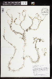
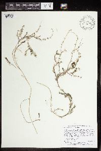
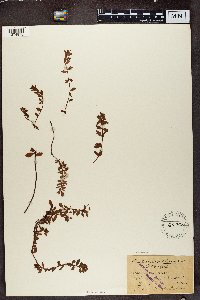
Taxa: Haloragaceae
Search Criteria: excluding cultivated/captive occurrences
Bell Museum plants | |
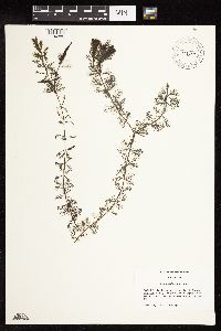
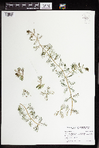
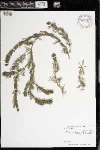
MIN:Plants | 427253[1134886]Grossinger, Mariel 342002-10-18 United States, Minnesota, Wright, Wright County...Beebe Lake shoreline at north end boat launch.;;120N;24W;29, 45.2391667 -93.7227778 |
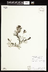
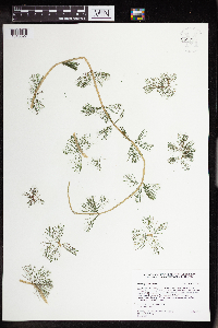
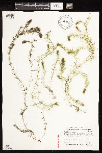
MIN:Plants | 910398[1134892]Swanson, Dan 16932006-06-28 United States, Minnesota, Cass, Leech Lake, Lake ID: 11020300, Big Rock Resort, Main basin of Leech Lake. UTM: 388766.2, 5217478;Chippewa National Forest / Leech Lake Indian Reservation;142N;30W;27, 47.1014236 -94.4659008 |
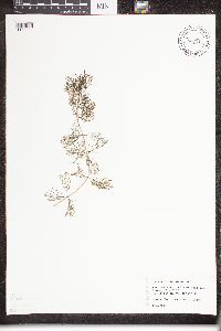
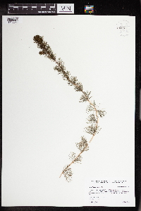
MIN:Plants | 508639[]Myhre, K. 66861996-08-31 United States, Minnesota, Crow Wing, Crow Wing Co. Located 0.5 mi NE of the town of Emily; N bay of Ruth Lake; T138N R26W SW1/4 of SE1/4 of sec 15;;138N;26W;15, 46.7670073 -93.9558721 |
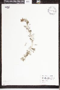
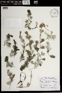
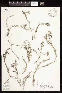
MIN:Plants | 833211[1134882]Sheridan, Donna; et al. s.n.1994-06-13 United States, Minnesota, Ramsey, Lake Wabasso (Little Bass Lake) Ramsey Co.;;030N;23W;36, 45.0461111 -93.1161111 |
MIN:Plants | 833213[]Welling, C. s.n.1994-06-17 United States, Minnesota, Chisago, Rush Lake, Chisago Co.; 45 42'25"N, 93 03'08"W;;037N;22W;, 45.706944 -93.052222 |
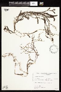
MIN:Plants | 833217[1134885]Welling, C. s.n.1994-06-17 United States, Minnesota, Chisago, Rush Lake, Chisago Co.; 45 41'33"N, 93 02'42"W;;037N;22W;, 45.6925 -93.045 |
MIN:Plants | 833218[]Crowell, Wendy s.n.1994-06-22 United States, Minnesota, Hennepin, Little Long Lake, Henn. Co. 44 57'11"N, 93 42'22"W;;117N;24W;, 44.953056 -93.706111 |
MIN:Plants | 833221[]Crowell, Wendy s.n.1994-06-23 United States, Minnesota, Hennepin, Cedar Lake / Lake of the Isles connecting channel. Henn. Co. 44 57'18"N, 93 18'52"W;;029N;24W;, 44.955 -93.314444 |
MIN:Plants | 833222[]Crowell, Wendy s.n.1994-06-23 United States, Minnesota, Carver, Auburn Lake, Carver Co. 44 52'14"N, 93 41'33"W;;116N;24W;, 44.870556 -93.6925 |
MIN:Plants | 833224[]Crowell, Wendy s.n.1994-06-20 United States, Minnesota, Dakota, Crystal Lake, Dakota Co. 44 43'16"N, 93 16'15"W;;115N;21W;, 44.721111 -93.270833 |
MIN:Plants | 833225[1134881]Miller, Bud s.n.1994-06-02 United States, Minnesota, Washington, White Bear Lake, Ramsey/Washington Co. Ordway site near Dellwood. 45 05'46"N, 92 59'05"W;;030N;21W;, 45.0796523 -92.9239 |
MIN:Plants | 833226[]Crowell, Wendy s.n.1994-06-23 United States, Minnesota, Hennepin, Cedar Lake, Hennepin Co, 44 57'32"N, 93 19'06";;029N;24W;, 44.958889 -93.318333 |
MIN:Plants | 833227[]Crowell, Wendy s.n.1994-06-20 United States, Minnesota, Dakota, Crystal Lake, Dakota Co. 44 43'07"N, 93 15'22"W;;115N;21W;, 44.718611 -93.256111 |
MIN:Plants | 833228[]Miller, Bud s.n.1994-06-02 United States, Minnesota, Washington, White Bear Lake, Commercial Bay, Ramsey/Washington Co. 45 04'29"N, 93 00'55"W;;030N;21W;, 45.0796523 -92.9239 |
MIN:Plants | 833229[]Welling, C. s.n.1994-06-17 United States, Minnesota, Chisago, Rush Lake, Chisago Co.; 45 41'32" N, 93 02'07" W;;037N;22W;, 45.692222 -93.035278 |
MIN:Plants | 833230[]Welling, C. s.n.1994-06-02 United States, Minnesota, Ramsey, White Bear Lake, Ramsey Co. Ordway Bay;;030N;22W;, 45.0961113 -92.984726 |
MIN:Plants | 833231[]Sheridan, Donna; et al. s.n.1994-06-13 United States, Minnesota, Ramsey, Lake Wabasso (Little Bass Lake), Ramsey Co.;;030N;23W;, 45.0436111 -93.115 |
MIN:Plants | 833232[]Welling, C. s.n.1994-06-09 United States, Minnesota, Ramsey, Bald Eagle Lake, Ramsey Co.;;030N;22W;, 45.1313896 -93.0166702 |
MIN:Plants | 833233[]Welling, C. s.n.1994-06-09 United States, Minnesota, Ramsey, Bald Eagle Lake, Ramsey Co.;;030N;22W;, 45.1208344 -93.0113907 |
MIN:Plants | 833234[]Welling, C. s.n.1994-06-09 United States, Minnesota, Ramsey, Bald Eagle Lake, Ramsey Co.;;030N;22W;, 45.1136093 -93.0044479 |
MIN:Plants | 833235[]Welling, C. s.n.1994-06-17 United States, Minnesota, Chisago, Rush Lake, Chisago Co.; 45 41'32" N, 93 04'12" W;;037N;22W;, 45.692222 -93.07 |
MIN:Plants | 833236[1134879]Welling, C. s.n.1994-06-09 United States, Minnesota, Ramsey, Bald Eagle Lake, Ramsey Co.;;030N;22W;, 45.1208344 -93.0113907 |
MIN:Plants | 906269[1134884]Perleberg, D.; et al. 2552004-06-22 United States, Minnesota, Le Sueur, County: Le Sueur. Lake: German. Northeast shoreline...DNRSite# 304. utm: 4903369 N 442812 E;;109N;24W;04, 44.2813889 -93.7166667 |
MIN:Plants | 462418[]Jones-Loss s.n.2003-08-11 United States, Minnesota, Pine, Pine County, Sand Lake;;045N;19W;05, 46.4112379 -92.772436 |
MIN:Plants | 920927[1134890]Smith, Welby 231001993-07-22 United States, Minnesota, Carver, Public access on the west side of Pierson Lake, about 2 miles southwest of Victoria ... T116N R24W NE1/4 of NE1/4 of Sec 28. 116N 24W 28, 44.8338889 -93.7036111 |
MIN:Plants | 912010[1134889]Smith, Welby 230951993-07-22 United States, Minnesota, Carver, Carver County...At the west end of Lake Bavaria, about 2 miles SSE of Victoria...T 116N R 24W NW1/4 of SE1/4 of Sec 24;;116N;24W;24, 44.8394444 -93.6494444 |
MIN:Plants | 436904[]Hansel-Welch, N. s.n.2000-07-31 United States, Minnesota, Otter Tail, Otter Tail County, Long Lake;;;;, 46.410212 -95.549278 |
MIN:Plants | 910399[1134893]Knopik, J. 17032004-08-27 United States, Minnesota, Cass, Leech Lake. Lake ID: 11020300. Stony Point, Exact location is unknown [sic]. UTM: 389811 5221573.;Chippewa National Forest / Leech Lake Indian Reservation;142N;30W;03, 47.1384364 -94.4531367 |
MIN:Plants | 437807[]Crowell, Wendy s.n.1999-09-15 United States, Minnesota, Saint Louis, St. Louis County. Horseshoe Lake.;;058N;17W;36, 47.4652889 -92.4452718 |
MIN:Plants | 906277[1134880]Perleberg, D.; et al. 6782005-06-14 United States, Minnesota, Isanti, Isanti County...Green Lake...utm: N; 5047368 E: 464942. DNRSite# 33;;036N;25W;00, 45.6016814 -93.4504468 |
MIN:Plants | 922648[1134891]Smith, Welby 234101993-08-05 United States, Minnesota, Ramsey, Otter Lake in White Bear...T 30N R 22W SE1/4 of NW1/4 of Sec 3;;030N;22W;03, 45.1208333 -93.0388889 |
MIN:Plants | 931834[1134894]Marko, Michelle s.n.2002-08-15 United States, Minnesota, Carver, Lake Auburn, north shore.;;116N;24W;10, 44.8701086 -93.6926466 |
MIN:Plants | 936789[1134896]Smith, Welby R. 297032006-07-18 United States, Minnesota, Faribault, Shallow bay at the south end of Lura Lake. SE of NE of section;;104N;27W;03, 43.8434751 -94.0507857 |
MIN:Plants | 962748[1346287]Jurek, Christine A. 82019-07-14 United States, Minnesota, Sherburne, Big Lake (DOW 71008200); T33N R27W Sec19, 45.33433 -93.75577 |
MIN:Plants | 962750[1346330]Jurek, Christine A. 122019-08-20 United States, Minnesota, Todd, Little Birch Lake (DOW 77008900); 3 miles SW of Grey Eagle; T27N R33W Sec 23, 45.7942 -94.79382 |
MIN:Plants | 962752[1346328]Millaway, Courtney, L. 42014-09-09 United States, Minnesota, Isanti, Skogman Lake (DOW 30002200); E side of the lake near the public water access; T36N R23W Sec 25, 45.57349 -93.15199 |
MIN:Plants | 962753[1346327]Millaway, Courtney, L. 32014-07-02 United States, Minnesota, Stearns, St. Anna Lake (DOW 73018300); near the town of St. Rosa; multiple locations around lake; T126N R31W Sec 6, 45.74611 -94.61743 |
MIN:Plants | 962755[1346325]Jurek, Christine A. 12012-06-07 United States, Minnesota, Morrison, Lake Shamineau (DOW 49012700); near the town of Motley; T132N R31W Sec 7, 46.264585 -94.62869 |
MIN:Plants | 969458[1371064]Myhre, Karen M. 115182014-07-21 United States, Minnesota, Chisago, Little Horseshoe Lake. Located 1 miles north of the town of Stark. T36N R22W NE1/4 SE1/4 of Sec 22, 45.591667 -93.066389 |
MIN:Plants | 969475[1371080]Myhre, Karen M. 115242014-07-30 United States, Minnesota, Wright, Charlotte Lake. Located 7 miles southeast of the town of Buffalo. T120N R24W SW1/4 of NW1/4 of Sec 32, 45.159444 -93.746111 |
MIN:Plants | 972101[1395836]Janssens, J. 75/951976-06-20 Belgium |
MIN:Plants | 975817[1404805]Plude, Timothy M. s.n.2018-08-08 United States, Minnesota, Cass, Gull Lake (11030500) found floating at boat access at Madden's Resort, 46.399452 -94.37315 |
MIN:Plants | 975816[1404806]Plude, Timothy M. s.n.2019-08-27 United States, Minnesota, Aitkin, French Lake (01010400), 46.628696 -93.54674 |
MIN:Plants | 976385[1403123]Dunevitz, Hannah L. 7371992-07-15 United States, Minnesota, Winona, In the Mississippi River, just off of Island Number 64, about 3/4 miles southwest of Fountain City, Wisconsin., 44.12 -91.71 |
MIN:Plants | Myriophyllum alterniflorum de Candolle 431479[]Gerdes, Lynden 42902000-08-28 United States, Minnesota, Lake, North Shore / Tettegouche State Park. T56N R07W S08SENW. Lake County...Tettegouche State Park, vicinity of Silver Bay, MN. Bay of lake, just south of drainage between MicMac Lake and Nipisquit Lake...MicMac Lake. 056N 07W 8, 47.3505163 -91.2508593 |
MIN:Plants | Myriophyllum alterniflorum de Candolle 455683[]Gerdes, Lynden 27831998-06-23 United States, Minnesota, Cook, Boundary Waters Canoe Area Wilderness / Superior National Forest. T64N R01E S03SWSW. Cook Co.; Superior National Forest, BWCAW. Alder Lake, just east of portage going to the NE Arm of East Bearskin.. 064N 01E 3, 48.055437 -90.3068467 |
MIN:Plants | Myriophyllum alterniflorum de Candolle 918048[1134818]Myhre, K. 106112009-08-07 United States, Minnesota, Cook, Cook County...McDonald Lake. Located 12 miles northwest of the town of Grand Marais...T62N R2W SW1/4 of SE1/4 of Sec 12;Superior National Forest;062N;02W;12, 47.8636111 -90.5166667 |
MIN:Plants | Myriophyllum alterniflorum de Candolle 256933[]Aiken, Susan; et al. s.n.1977-03-27 United States, Minnesota, Carlton, Carlton Coutny...Moose Head Lake; near the lake outlet.;;;;, 46.451285 -92.746576 |
MIN:Plants | Myriophyllum alterniflorum de Candolle 331932[]U.S. Fish & Wildlife personnel s.n.1935-08-13 United States, Minnesota, Delay Lake, Superior National Forest;Superior National Forest;;;, 47.623127 -91.304757 |
MIN:Plants | Myriophyllum alterniflorum de Candolle 331933[]U.S. Fish & Wildlife personnel s.n.1935-08-28 United States, Minnesota, Cook, Cook Co.; Bearskin Lake, Superior National Forest;Superior National Forest;065N;01W;, 48.0823334 -90.4479397 |
MIN:Plants | Myriophyllum alterniflorum de Candolle 332300[]U.S. Fish & Wildlife personnel s.n.1935-08-05 United States, Minnesota, Lena Lake, Superior National Forest;Superior National Forest;;;, 47.711383 -91.385902 |
MIN:Plants | Myriophyllum alterniflorum de Candolle 332302[]U.S. Fish & Wildlife personnel s.n.1935-08-09 United States, Minnesota, Lake, Grass Lake, T60N R9W SE 1 + 6 [sic]. Superior National Forest.;Superior National Forest;060N;09W;06, 47.7114811 -91.5234494 |
MIN:Plants | Myriophyllum alterniflorum de Candolle 336494[]Reif, Charles A41936-07-24 United States, Minnesota, Cook, Temperance River Sector 12. Cook Co.;North Shore / Temperance River State Park;059N;04W;12, 47.6101598 -90.7791274 |
MIN:Plants | Myriophyllum alterniflorum de Candolle 337941[]Moore, W. V5081936-07-19 United States, Minnesota, Lake, Spring Lake;;N;;, 47.7333 -91.6167 |
MIN:Plants | Myriophyllum alterniflorum de Candolle 347568[]Morse, Marius s.n.1937-00-00 United States, Minnesota, Saint Louis, Bates Lake;;N;;, 47.5833 -92.5 |
MIN:Plants | Myriophyllum alterniflorum de Candolle 362075[]Moyle, J. 34501940-08-01 United States, Minnesota, Lake, E br of Baptism R.;;N;;, 47.460942 -91.302967 |
MIN:Plants | Myriophyllum alterniflorum de Candolle 368185[]Gunderson, Harvey s.n.1940-07-27 United States, Minnesota, Lake, Lax Lake;;N;;, 47.345921 -91.297479 |
MIN:Plants | Myriophyllum alterniflorum de Candolle 369199[]Gunderson, Harvey s.n.1940-07-26 United States, Minnesota, Lake, Lax Lake;;N;;, 47.345921 -91.297479 |
MIN:Plants | Myriophyllum alterniflorum de Candolle 395328[]Butters, F.; Abbe, E. 8381944-08-01 United States, Minnesota, Cook, Poplar Lake, T64N R1 or 2W. Cook Co.;Superior National Forest;;;, 48.046734 -90.508674 |
MIN:Plants | Myriophyllum alterniflorum de Candolle 417508[]Lakela, Olga 118991950-08-30 United States, Minnesota, Saint Louis, Caribou Lake, 14 mi NW of Duluth;Superior National Forest;N;;, 46.898761 -92.30961 |
MIN:Plants | Myriophyllum alterniflorum de Candolle 526062[]Lakela, Olga 193601955-08-17 United States, Minnesota, Saint Louis, In small bay of Fox Island, Rainy Lake, International Boundary;Voyageurs National Park;071N;21W;, 48.624299 -92.961608 |
MIN:Plants | Myriophyllum alterniflorum de Candolle 527516[]Lakela, Olga 184951954-09-19 United States, Minnesota, Lake, Basswood Lake at Basswood Lodge grounds. Quetico-Superior Wilderness Research Center. Lake Co.;Boundary Waters Canoe Area Wilderness / Superior National Forest;064N;10W;09, 48.0316509 -91.6188616 |
MIN:Plants | Myriophyllum alterniflorum de Candolle 542931[]Lakela, Olga 222431957-09-04 United States, Minnesota, Lake, Farm Lake 6 mi NE of Ely;;N;;, 47.89695 -91.716911 |
MIN:Plants | Myriophyllum alterniflorum de Candolle 543517[]Lakela, Olga; Davidson, Donald 224021957-09-10 United States, Minnesota, Lake, Basswood Lake, near Wilderness Resort;Boundary Waters Canoe Area Wilderness / Superior National Forest;;;, 48.074893 -91.588166 |
MIN:Plants | Myriophyllum alterniflorum de Candolle 700402[]Aiken, Susan; et al. s.n.1977-03-26 United States, Minnesota, Carlton, Carlton County...Moose Head Lake, near the outlet;;;;, 46.451285 -92.746576 |
MIN:Plants | Myriophyllum alterniflorum de Candolle 824108[1134821]Gessler, Walt s.n.1993-00-00 United States, Minnesota, Saint Louis, St. Louis Co. Third Lake, along Echo Trail (NW of Ely). T65N R13W S21 NE NE SW.;Superior National Forest;065N;13W;21, 48.1004523 -92.0058224 |
MIN:Plants | Myriophyllum alterniflorum de Candolle 832344[]Saari, H. s.n.1941-07-11 United States, Minnesota, Cook, Cook Co. Cross R.;Superior National Forest;059N;05W;, 47.5872786 -90.9587805 |
MIN:Plants | Myriophyllum alterniflorum de Candolle 461391[]Gerdes, Lynden; et al. 32031998-08-18 United States, Minnesota, Cook, T65N R02E S13. Cook County; Superior National Forest, BWCAW. Western portion Fan Lake.;Boundary Waters Canoe Area Wilderness / Superior National Forest;065N;02E;13, 48.1096347 -90.13742 |
MIN:Plants | Myriophyllum alterniflorum de Candolle 461380[]Gerdes, Lynden 30211998-07-22 United States, Minnesota, Cook, Superior National Forest. T64N R01W S02SWSE. Cook County; Superior National Forest, Flour Lake, vicinity of public canoe access/campground west of landing.. 064N 01W 2, 48.0558786 -90.4150172 |
MIN:Plants | Myriophyllum alterniflorum de Candolle 510728[]Gerdes, Lynden; et al. 31291998-08-10 United States, Minnesota, Cook, T65N R02W S19NWNE. Cook County ... Superior National Forest. Northeast corner of Gunflint Lake, along eastern ... island;Superior National Forest;065N;02W;19, 48.0987095 -90.6304157 |
MIN:Plants | Myriophyllum alterniflorum de Candolle 461416[1134822]Gerdes, Lynden; et al. 31761998-08-14 United States, Minnesota, Cook, T65N R01W S20. Cook County; Superior National Forest, BWCAW. Western end of Rove Lake.;Boundary Waters Canoe Area Wilderness / Superior National Forest;065N;01W;20, 48.0976809 -90.4819007 |
MIN:Plants | Myriophyllum alterniflorum de Candolle 478894[1134817]Gerdes, Lynden; et al. 32261998-08-27 United States, Minnesota, Cook, T64N R01E S11NWNE. Cook Co.; Superior National Forest, BWCAW. North shore of Alder Lake.;Boundary Waters Canoe Area Wilderness / Superior National Forest;064N;01E;11, 48.0414374 -90.284947 |
MIN:Plants | Myriophyllum alterniflorum de Candolle 476135[1134819]Gerdes, Lynden; et al. 31381998-08-11 United States, Minnesota, Cook, T65N R02W S21. Cook County; Superior National Forest, String of small islands in the southwestern portion of North Lake.;Superior National Forest;065N;02W;21, 48.100572 -90.5860834 |
MIN:Plants | Myriophyllum alterniflorum de Candolle 921054[1134820]Smith, Welby 236831993-08-23 United States, Minnesota, Cook, Boundary Waters Canoe Area Wilderness / Superior National Forest. Superior National Forest, Boundary Waters Canoe Area Wilderness...west end of Morgan Lake...T64N R1W SW1/4 of SE1/4 of Sec 28. 064N 01W 28, 47.9936111 -90.4561111 |
MIN:Plants | Myriophyllum alterniflorum de Candolle 929436[1134823]Gerdes, Lynden B.; Smith, Welby R. 63502011-08-11 United States, Minnesota, Lake, Northern portion of Boga Lake near the western shore. SESESWNE of section;Superior National Forest;062N;07W;31, 47.8105556 -91.2636111 |
MIN:Plants | Myriophyllum alterniflorum de Candolle 965495[1356361]Lee, Michael MDL54382010-08-30 United States, Minnesota, Cook, Boundary Waters Canoe Area Wilderness, Rolling bedrock terrain southwest of Poplar Lake, 21 miles north-northwest of Grand Marais.T64N R2W N1/2 of NW1/4 of SW1/4 Sec. 15, 48.02541606 -90.57432388, 572m |
MIN:Plants | Myriophyllum alterniflorum de Candolle 965546[1356413]Lee, Michael MDL54962010-09-15 United States, Minnesota, Cook, Boundary Waters Canoe Area Wilderness, Fairly rugged forested bedrock terrain along the South Brule River drainage north of Brule Mountain, 14 miles north-northwest of Grand Marais. T63N R1W SW1/4 of NW1/4 Sec. 15, 47.94157716 -90.44474801, 500m |
MIN:Plants | 162204[1374875]Schlechter 19451892-12-03 South Africa |
Google Map
Google Maps is a web mapping service provided by Google that features a map that users can pan (by dragging the mouse) and zoom (by using the mouse wheel). Collection points are displayed as colored markers that when clicked on, displays the full information for that collection. When multiple species are queried (separated by semi-colons), different colored markers denote each individual species.
