University of Minnesota
http://www.umn.edu/
612-625-5000
http://www.umn.edu/
612-625-5000
Minnesota Biodiversity Atlas
Bell Museum
Dataset: MIN-Plants
Taxa: Lygodiaceae
Search Criteria: excluding cultivated/captive occurrences
Bell Museum plants | |
 MIN:Plants | 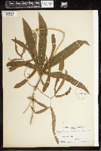 Lygodium circinatum (Burm. f.) Sw. 220512[1342013]Weber, C.M. 11841911-03-00 Philippines, Butuan, Mindanao, 7.2575 124.203611 |
MIN:Plants | 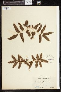 Lygodium flexuosum (L.) Sw. 220517[1342020]Weber, C.M. 14651911-09-00 Philippines, Davao District, Mindanao, 14.19258 121.167904 |
MIN:Plants | 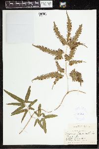 Lygodium flexuosum (L.) Sw. 383459[1342019]Topping, D. L. 4991904-02-00 Philippines, Pampanga, Mount Arayat, Luzon, 15.2053 120.7422 |
MIN:Plants | 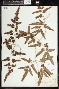 Lygodium flexuosum (L.) Sw. 349417[1342018]Topping, D. LeRoy 9021908-01-26 Philippines, Antipolo, Rizal, Luzon, 11.766667 122.133333 |
MIN:Plants | 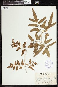 Lygodium flexuosum (L.) Sw. 349418[1342017]Topping, D. L. 9001908-01-16 Philippines, Antipole, Rizal, Luzon, 13.9 122.016667 |
MIN:Plants | 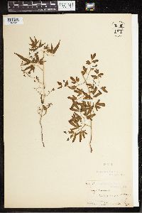 Lygodium dichotomum (Cav.) Sw. 50509[1342021]unknown s.n. Australia, North Queensland, Bloomfield [River] |
MIN:Plants | 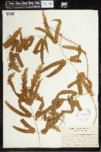 Lygodium merrillii Copel. 349442[1342025]Topping, D. L. 13181914-12-10 Philippines, Between Malieboy and Atimonan, Tayabad, Luzon, 13.966667 121.883333 |
MIN:Plants | 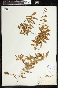 Lygodium reticulatum Schkuhr 289702[1342031]Grant, Martin L. 49721931-01-03 French Polynesia, Bora Bora, Tevaitapu: Tarapaia, -16.501354 -151.739023, 506m |
MIN:Plants | 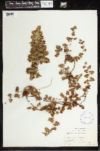 Lygodium reticulatum Schkuhr 289703[1342030]Grant, Martin L. 38941930-07-01 French Polynesia, Tahiti, Teahupoo District, Ronui, -17.846451 -149.266821, 137m |
MIN:Plants | 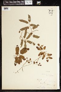 Lygodium reticulatum Schkuhr 50526[1342029]unknown s.n. Australia, North Queensland, Bloomfield River, -17.624749 143.152344 |
MIN:Plants | 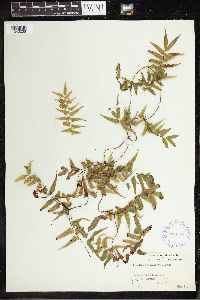 Lygodium reticulatum Schkuhr 289704[1342028]Grant, Martin L. 36111930-05-14 French Polynesia, Tahiti, Punaauia District, Diadem, -17.633333 -149.6, 701m |
MIN:Plants | 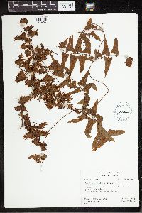 Lygodium reticulatum Schkuhr 620022[1342027]Moore, John W. 671926-09-16 French Polynesia, Raiatea, Uturoa, -16.726482 -151.447529, 300m |
MIN:Plants | 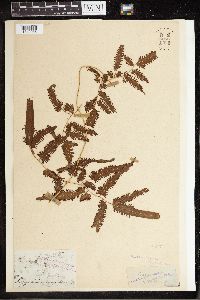 Lygodium scandens (L.) Sw. 50527[1342036] India, Bengal, 24 88 |
MIN:Plants | 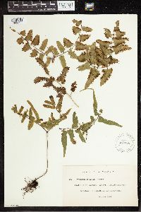 Lygodium scandens (L.) Sw. 270153[1342035]Leland, B. 491909-10-00 French Polynesia, Tahiti, Papeari District, -17.751386 -149.356016 |
MIN:Plants | 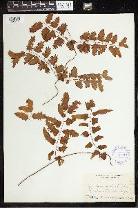 Lygodium scandens (L.) Sw. 349443[1342034]Topping, D. L. 12941914-11-29 Philippines, Mauban, Tayabas, Luzon, 14.01681 121.90203 |
MIN:Plants | 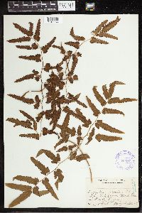 Lygodium scandens (L.) Sw. 349419[1342033]Topping, D. L. 6221906-12-24 Philippines, Rizal, Luzon. Near Montalban, 14.783333 121.233333 |
MIN:Plants |  Lygodium scandens (L.) Sw. 270150[1342032]Leland, B. 491909-10-00 French Polynesia, Tahiti, Papeari District, -17.751386 -149.356016 |
MIN:Plants |  Lygodium semihastatum (Cav.) Desv. 349420[1342037]Topping, D. L. 13161924-12-10 Philippines, Malicboy, Tayabas, Luzon, 13.981551 121.788883 |
Google Map
Google Maps is a web mapping service provided by Google that features a map that users can pan (by dragging the mouse) and zoom (by using the mouse wheel). Collection points are displayed as colored markers that when clicked on, displays the full information for that collection. When multiple species are queried (separated by semi-colons), different colored markers denote each individual species.