University of Minnesota
http://www.umn.edu/
612-625-5000
http://www.umn.edu/
612-625-5000
Minnesota Biodiversity Atlas
Bell Museum
Dataset: MIN-Plants
Taxa: Matteuccia
Search Criteria: excluding cultivated/captive occurrences
Bell Museum plants | |
 MIN:Plants | 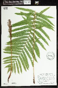 Matteuccia struthiopteris var. pensylvanica (Willdenow) C.V. Morton 941883[1342208]Smith, Welby R. 303252007-07-13 United States, Minnesota, Clearwater, Where County Road 5 crosses the Clearwater River, about 9 miles north of Clearbrook. NW of NW of section;;150N;37W;08, 47.830965 -95.4257341 |
MIN:Plants | 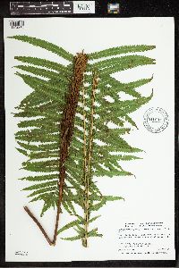 Matteuccia struthiopteris var. pensylvanica (Willdenow) C.V. Morton 941691[1342215]Smith, Welby R. 303972007-07-26 United States, Minnesota, Roseau, NW of NW of section;Hayes Lake State Park;160N;38W;33, 48.6388189 -95.5562797 |
MIN:Plants | 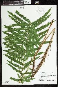 Matteuccia struthiopteris var. pensylvanica (Willdenow) C.V. Morton 945988[1291496]Smith, Welby R. WRS346042013-07-08 United States, Minnesota, Roseau, Along the Roseau River less than one km south of Wannaska. SW of SW of section; T160N R39W sec19, 48.6567667 -95.7338167 |
MIN:Plants | 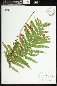 Matteuccia struthiopteris var. pensylvanica (Willdenow) C.V. Morton 948216[1292393]Smith, Welby R. WRS308242007-09-14 United States, Minnesota, Wabasha, Along the Zumbro River, about 2.5 miles southwest of Dumfries.; T110N R11W sec20, 44.3135275 -92.1528847 |
MIN:Plants | 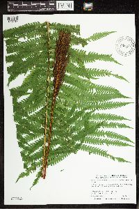 Matteuccia struthiopteris var. pensylvanica (Willdenow) C.V. Morton 948192[1292417]Smith, Welby R. WRS303772007-07-20 United States, Minnesota, Washington, In Afton State Park, in the St. Croix River Valley.; T028N R20W sec35, 44.8652778 -92.7727778 |
MIN:Plants | 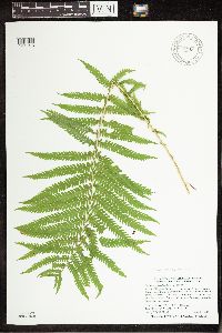 Matteuccia struthiopteris var. pensylvanica (L.) Todaro 947848[1291918]Smith, Welby R. 304692007-08-01 United States, Minnesota, Cass, In the Chippewa National Forest, about 4 miles north of Hackensack. SW of SW of section; T141N R30W sec29, 46.9970501 -94.5087041 |
MIN:Plants | 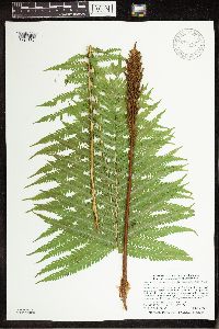 Matteuccia struthiopteris var. pensylvanica (Willdenow) C.V. Morton 947787[1291857]Smith, Welby R. 304072007-07-26 United States, Minnesota, Roseau, Beltrami Island State Forest, about 12 miles south of Warroad. NW of SE of section; T161N R37W sec26, 48.7317615 -95.380983 |
MIN:Plants | 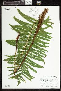 Matteuccia struthiopteris var. pensylvanica (Willdenow) C.V. Morton 947807[1291877]Smith, Welby R. 304272007-07-26 United States, Minnesota, Roseau, Beltrami Island State Forest. SE of SE of section; T161N R35W sec18, 48.7590293 -95.2037557 |
MIN:Plants | 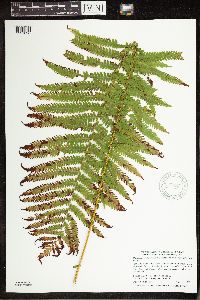 Matteuccia struthiopteris var. pensylvanica (Willdenow) C.V. Morton 947826[1291896]Smith, Welby R. 304472007-08-01 United States, Minnesota, Cass, Foot Hills State Forest, about 4 miles west of Backus. NE of SW of section; T139N R31W sec33, 46.8091524 -94.6116174 |
MIN:Plants | 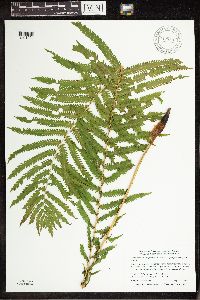 Matteuccia struthiopteris var. pensylvanica (Willdenow) C.V. Morton 947859[1291994]Smith, Welby R. 304812007-08-01 United States, Minnesota, Cass, About 6 miles east of Whipholt. SE of NW of section; T141N R28W sec10, 47.0479306 -94.2189318 |
MIN:Plants | 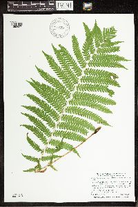 Matteuccia struthiopteris var. pensylvanica (Willdenow) C.V. Morton 947872[1292007]Smith, Welby R. 304932007-08-02 United States, Minnesota, Cass, Chippewa National Forest, about 5 miles N-NW of Remer. SW of NE of section; T142N R26W sec10, 47.1317422 -93.9511369 |
MIN:Plants | 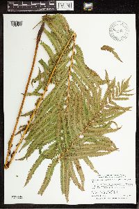 Matteuccia struthiopteris var. pensylvanica (Willdenow) C.V. Morton 947878[1292013]Smith, Welby R. 304992007-08-02 United States, Minnesota, Aitkin, Hill River State Forest, about 6 miles east of Hill City. SW of SE of section; T052N R25W sec14, 46.9892306 -93.4724094 |
MIN:Plants | 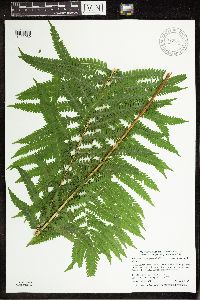 Matteuccia struthiopteris var. pensylvanica (Willdenow) C.V. Morton 947895[1292030]Smith, Welby R. 305162007-08-07 United States, Minnesota, Dodge, Dodge Center Creek Park. On the north side of Dodge Center Creek, and one mile west of the town of Dodge Center SW of SW of section; T107N R17W sec28, 44.0405556 -92.8780556 |
MIN:Plants | 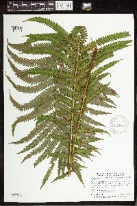 Matteuccia struthiopteris var. pensylvanica (Willdenow) C.V. Morton 947910[1292341]Smith, Welby R. 305342007-08-14 United States, Minnesota, Pine, About 9 miles east of Askov on Highway 32. SW of SE of section; T043N R18W sec22, 46.1891817 -92.6013078 |
MIN:Plants | 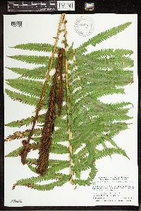 Matteuccia struthiopteris var. pensylvanica (Willdenow) C.V. Morton 947923[1291929]Smith, Welby R. 305492007-08-14 United States, Minnesota, Pine, About 16 miles east of Askov on Highway 32. NW of NW of section; T043N R17W sec25, 46.1832005 -92.4423753 |
MIN:Plants | 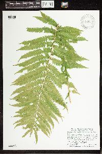 Matteuccia struthiopteris var. pensylvanica (Willdenow) C.V. Morton 947946[1291952]Smith, Welby R. 305732007-08-16 United States, Minnesota, Carlton, At the northwest end of Kettle Lake in Fond Du Lac State Forest, about 5 miles southeast of Cromwell. NW of NW of section; T048N R19W sec20, 46.6327434 -92.7827544 |
MIN:Plants | 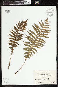 Matteuccia struthiopteris (L.) Todaro 954296[1294606]Koyama, S. 51 Japan, Osaka Prefecture |
MIN:Plants | 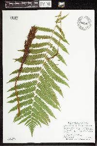 Matteuccia struthiopteris var. pensylvanica (Willdenow) C.V. Morton 941738[1296885]Smith, Welby R. 30348A2007-07-17 United States, Minnesota, Aitkin |
MIN:Plants | 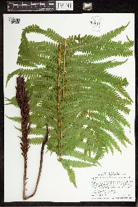 Matteuccia struthiopteris var. pensylvanica (Willdenow) C.V. Morton 952013[1297005]Smith, Welby R. 348762014-06-10 United States, Minnesota, Steele |
MIN:Plants | 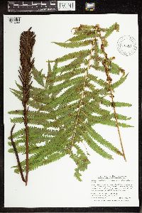 Matteuccia struthiopteris var. pensylvanica (Willdenow) C.V. Morton 905001[1342090]Smith, Welby R. 283101999-09-10 United States, Minnesota, Pine, Banning State Park, about 3 miles SW of Askov...T43N R20W NE1/4 of SW1/4 Sec 35;Banning State Park;043N;20W;35; 46.1630556 -92.8383333, 46.1630556 -92.8383333 |
MIN:Plants | 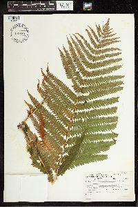 Matteuccia struthiopteris var. pensylvanica (Willdenow) C.V. Morton 492840[1342281]Lakela, O. 16327 Canada, Ontario |
MIN:Plants | 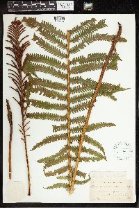 Matteuccia struthiopteris var. pensylvanica (Willdenow) C.V. Morton 261166[1342282]Chase, Agnes 15881901-07-13 United States, Illinois, Starved Rock State Park, 41.3 -88.9667 |
MIN:Plants | 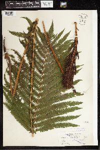 Matteuccia struthiopteris var. pensylvanica (Willdenow) C.V. Morton 53871[1342283]Fernald, M.L. 1896-08-00 United States, Maine, Somerset, Dead River Valley, 45.526219 -70.020874 |
MIN:Plants | 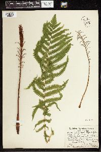 Matteuccia struthiopteris var. pensylvanica (Willdenow) C.V. Morton 261159[1342284]Stevens, O.A. 12251916-08-13 United States, North Dakota, Ransom, Sheyenne River, 46.455584 -97.71079 |
MIN:Plants | 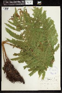 Matteuccia struthiopteris var. pensylvanica (Willdenow) C.V. Morton 291564[1342285]Palmer, Ernest J. 413291933-07-05 United States, Missouri, Mercer, between Moore and Saline, 40.5167 -93.7167 |
MIN:Plants | 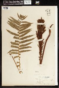 Matteuccia struthiopteris var. pensylvanica (Willdenow) C.V. Morton 53869[1342286]Davis, Charles A. 151890-08-10 United States, Michigan, Alma |
MIN:Plants | 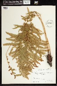 Matteuccia struthiopteris var. pensylvanica (Willdenow) C.V. Morton 548802[1342287]Oldenburg, Margaret 40-1171940-08-17 Canada, Alberta, Embarrass, 58.5 -111.25 |
MIN:Plants | 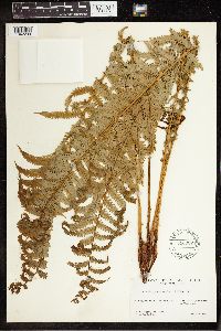 Matteuccia struthiopteris var. pensylvanica (Willdenow) C.V. Morton 546987[1342288]Baldwin, W.K.W. 74161950-06-27 Canada, Manitoba, Riding Mountain National Park, by Moon Lake, 50.75 -100 |
MIN:Plants | 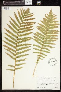 Matteuccia struthiopteris var. pensylvanica (Willdenow) C.V. Morton 546922[1342289]Scoggan, H.J. 39851948-07-15 Canada, Manitoba, Hill Lake, 35 mi N of Lake Winnipeg, 52.506227 -97 |
MIN:Plants | 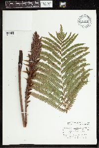 Matteuccia struthiopteris var. pensylvanica (Willdenow) C.V. Morton 702258[1342290]Croteau, Gerard 501977-07-15 Canada, Quebec, Sherbrooke, Parc du Mont Orford. Orford, 45.316667 -72.233333 |
MIN:Plants | 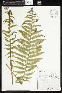 Matteuccia struthiopteris var. pensylvanica (Willdenow) C.V. Morton 787358[1342291]Wojtas, W.A. 2181979-06-04 Canada, Manitoba, Riding Mountain National Park, at park entrance on Mt. Aggassiz Road, 50.786667 -99.571667 |
MIN:Plants | 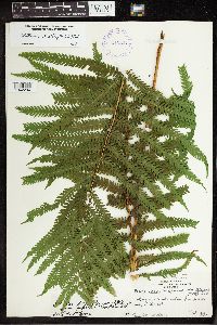 Matteuccia struthiopteris var. pensylvanica (Willdenow) C.V. Morton 414344[1342294]Russell, N. 1948-07-00 United States, Wisconsin, St. Croix, Adlauyon[?], 2 miles upstream from junction with St. Croix River, 45.04806 -92.782116 |
MIN:Plants | 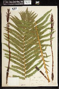 Matteuccia struthiopteris var. pensylvanica (Willdenow) C.V. Morton 261160[1342295]Poyser, W.A. 1907-07-13 United States, Pennsylvania, Bucks, Upper Black Eddy, 40.56538 -75.099617 |
MIN:Plants | 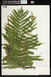 Matteuccia struthiopteris var. pensylvanica (Willdenow) C.V. Morton 364441[1342296]Tryon, R.M. Jr 43761940-07-26 United States, Indiana, Steuben, About 5 mi N of Angola, 41.707222 -84.999409 |
MIN:Plants | 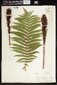 Matteuccia struthiopteris var. pensylvanica (Willdenow) C.V. Morton 53870[1342297]Cole, E.J. 1898-08-01 United States, Michigan, Lowell, 42.933643 -85.341961 |
MIN:Plants | 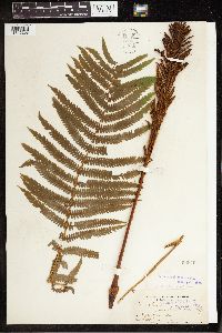 Matteuccia struthiopteris var. pensylvanica (Willdenow) C.V. Morton 53876[1342298]Davis, Charles A. 1899-08-19 United States, Michigan, Alma, 43.37892 -84.659727 |
MIN:Plants | 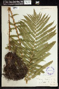 Matteuccia struthiopteris var. pensylvanica (Willdenow) C.V. Morton 288692[1342299]Maxon, William 531902-05-25 United States, Virginia, Fairfax, Potomac River Opposite High Island, Maryland, 38.943122 -77.129255 |
MIN:Plants | 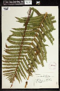 Matteuccia struthiopteris var. pensylvanica (Willdenow) C.V. Morton 279058[1342300]Carpenter, Dana S. 10280000-07-25 United States, Vermont, The Island, Weston, 43.25 -72.7833 |
MIN:Plants | 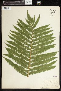 Matteuccia struthiopteris var. pensylvanica (Willdenow) C.V. Morton 261165[1342301]Chase, Agnes 15881901-07-13 United States, Illinois, Starved Rock State Park, 41.3 -88.9667 |
MIN:Plants | 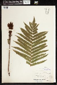 Matteuccia struthiopteris var. pensylvanica (Willdenow) C.V. Morton 53879[1342302]Ruth, J.A. & H.F. 1885-09-01 United States, Pennsylvania, Bucks, banks of Deleware River, S of the Nockamixon Rocks. Nockamixon twp., 40.516984 -75.167712 |
MIN:Plants | 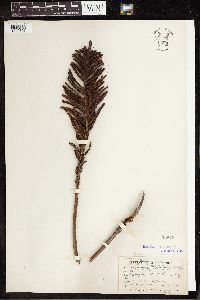 Matteuccia struthiopteris var. pensylvanica (Willdenow) C.V. Morton 53877[1342303]Lucy, T.F. 100241885-08-09 United States, New York, Chemung, Henington's Island[?], 42.144046 -76.747177 |
MIN:Plants | 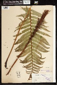 Matteuccia struthiopteris var. pensylvanica (Willdenow) C.V. Morton 53875[1342304]Lucy, T.F. 126611897-08-20 United States, New York, Chemung, Upper waters of the Susquehanna River, 42.142859 -76.733664 |
MIN:Plants | 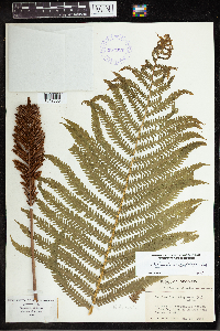 Matteuccia struthiopteris var. pensylvanica (Willdenow) C.V. Morton 387917[1342305]Wadmond, S.C. 1934-05-26 United States, Wisconsin, Jefferson, Hebron near Cushman's Mill, 42.925285 -88.692603 |
MIN:Plants | 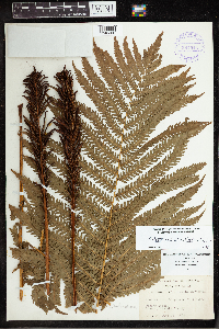 Matteuccia struthiopteris var. pensylvanica (Willdenow) C.V. Morton 387915[1342306]Wadmond, S.C. 541903-06-28 United States, Wisconsin, Kenosha, Pike's Woods. Somers, 42.640297 -87.910356 |
MIN:Plants | 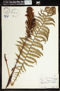 Matteuccia struthiopteris var. pensylvanica (Willdenow) C.V. Morton 476636[1342307]Abbott, R.S. 3221950-05-20 United States, Connecticut, Litchfield, Salisbury, W of Undermountian Rd., 41.983426 -73.421232 |
MIN:Plants |  Matteuccia struthiopteris var. pensylvanica (Willdenow) C.V. Morton 568249[1342308]Tryon, R.M. and A.F. 1960-00-00 Canada, Montreal, 45.5 -73.583333 |
MIN:Plants | 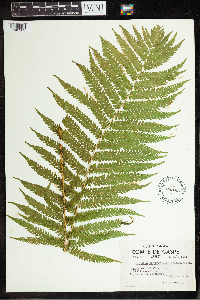 Matteuccia struthiopteris var. pensylvanica (Willdenow) C.V. Morton 450103[1342309]Louis-Marie 51-4351951-08-13 Canada, Quebec, Gaspe, between Mont-St-Pierre and Riviere-a-Claude, 49.22474 -65.859675 |
MIN:Plants | 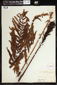 Matteuccia struthiopteris var. pensylvanica (Willdenow) C.V. Morton 281621[1342310]Topping, D.L. 1898-08-24 Canada, Quebec, Lake Saint-Jean, 45.183333 -73.3 |
MIN:Plants | 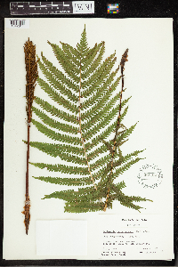 Matteuccia struthiopteris var. pensylvanica (Willdenow) C.V. Morton 565316[1342311]Grevatt, J.G. 2011957-08-08 Canada, Ontario, Grey, Bighead River near Meaford, St. Vincent Twp., 44.6 -80.583333 |
MIN:Plants | 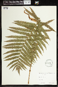 Matteuccia struthiopteris var. pensylvanica (Willdenow) C.V. Morton 545102[1342312]Daubenmire, R.F. 1930-08-02 United States, Indiana, Parke, Parke Co, 39.773625 -87.20636 |
MIN:Plants | 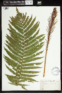 Matteuccia struthiopteris var. pensylvanica (Willdenow) C.V. Morton 489692[1342313]Stevens, O.A. 1936-07-03 United States, North Dakota, Ransom, Anselm, 46.52858 -97.495648 |
MIN:Plants | 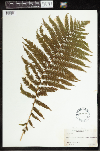 Matteuccia struthiopteris var. pensylvanica (Willdenow) C.V. Morton 485439[1342314]Scamman, Edith 41211946-08-07 Canada, Nova Scotia, Victoria, Port Bevis; Cape Breton, 46.133333 -60.615833 |
MIN:Plants |  Matteuccia struthiopteris var. pensylvanica (Willdenow) C.V. Morton 531623[1342315]Greene, Duane L. 1956-01-24 United States, North Dakota, Bottineau, Lake Thompson, T163N R75W S36, 48.899673 -100.326468 |
MIN:Plants |  Matteuccia struthiopteris var. pensylvanica (Willdenow) C.V. Morton 558011[1342316]Mais, D.R. 20421958-06-19 United States, North Dakota, Bottineau, near Thompson Lake, Tuetle twp., 48.9 -100.3167 |
MIN:Plants |  Matteuccia struthiopteris var. pensylvanica (Willdenow) C.V. Morton 401247[1342317]Wood, R. 2-18-2-11934-07-15 United States, Indiana, Cedar Creek Woods, 10 miles out of Fort Wayne on rt 27, 41.2167 -85.6333 |
MIN:Plants |  Matteuccia struthiopteris var. pensylvanica (Willdenow) C.V. Morton 581300[1342318]Dutton, D. Lewis 1923-08-25 United States, Vermont, Brandon, 43.79812 -73.087612, 145m |
MIN:Plants |  Matteuccia struthiopteris var. pensylvanica (Willdenow) C.V. Morton 387916[1342319]Burnham, Stewart H. 35591892-08-16 United States, New York, Washington, 43.313703 -73.430759 |
MIN:Plants |  Matteuccia struthiopteris var. pensylvanica (Willdenow) C.V. Morton 452473[1342320]Durand, E.J. United States, New York, Ithaca, 42.440628 -76.496607 |
MIN:Plants |  Matteuccia struthiopteris var. pensylvanica (Willdenow) C.V. Morton 53872[1342321]Small. John K. 1889-05-18 United States, Pennsylvania, Safe Harbor, 39.9301 -76.379406 |
MIN:Plants |  Matteuccia struthiopteris var. pensylvanica (Willdenow) C.V. Morton 291436[1342322]Raup, H.M. 40071932-07-22 Canada, British Columbia, N bank of Peace River, about 6 mi below Wicked River, 56.033333 -123.55, 610m |
MIN:Plants | 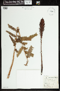 Matteuccia struthiopteris var. pensylvanica (Willdenow) C.V. Morton 763880[1342323]Lugger, Otto 0000-08-20 United States, Wisconsin, Manitowoc, 44.088606 -87.657584 |
MIN:Plants | 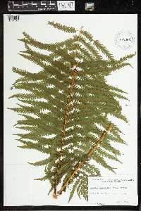 Matteuccia struthiopteris var. pensylvanica (Willdenow) C.V. Morton 622365[1342324]Poland, Roberta G. 1946-07-03 United States, Massachusetts, Franklin, Pine Hill, Deerfield, 42.544531 -72.605645 |
MIN:Plants | 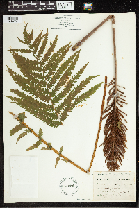 Matteuccia struthiopteris var. pensylvanica (Willdenow) C.V. Morton 521496[1342325]Cooper, W.S. 1901-07-23 United States, Michigan, Black River Valley W of Port Huron, 43.5 -82.5 |
MIN:Plants | 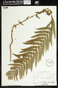 Matteuccia struthiopteris var. pensylvanica (Willdenow) C.V. Morton 556754[1342326]Moir, D.R. 4891952-07-13 Canada, Ontario, Island in Fawn River about 30 mi upstream from Otter River |
MIN:Plants | 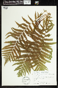 Matteuccia struthiopteris var. pensylvanica (Willdenow) C.V. Morton 556755[1342327]Moir, D.R. 40731957-07-09 Canada, Ontario, Sandborn Bay; Vicinity of Sandy Lake, 53.033333 -93.233333 |
MIN:Plants | 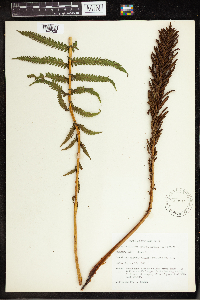 Matteuccia struthiopteris var. pensylvanica (Willdenow) C.V. Morton 589215[1342328]Jensen, L. 1261959-08-15 United States, New York, Sullivan, 1.5 mi N of Mongaup Valley, W branch of Mongaup River, 41.677191 -74.775855 |
MIN:Plants | 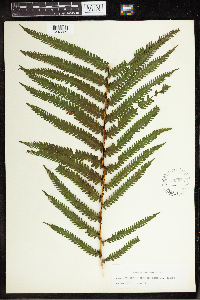 Matteuccia struthiopteris var. pensylvanica (Willdenow) C.V. Morton 589216[1342329] 126 United States, New York, 43 -75 |
MIN:Plants | 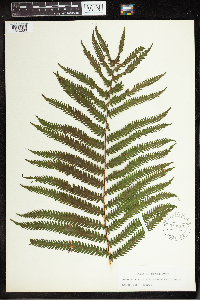 Matteuccia struthiopteris var. pensylvanica (Willdenow) C.V. Morton 589217[1342330] 126 United States, New York, 43 -75 |
MIN:Plants | 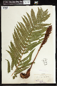 Matteuccia struthiopteris var. pensylvanica (Willdenow) C.V. Morton 53873[1342331]Waghorne, A.C. 381896-08-11 Canada, Newfoundland and Labrador, Chimney, 46.908804 -54.181471 |
MIN:Plants | 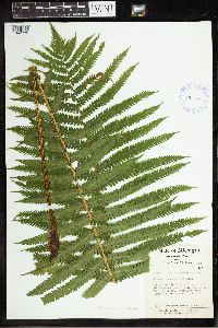 Matteuccia struthiopteris var. pensylvanica (Willdenow) C.V. Morton 385137[1342332]Tryon, R.M. Jr and P.F. 46751941-07-14 United States, Michigan, Marquette, Huron Mountains 35 mi NW of Marquette. Between Howe and Rush Lakes, 46.900647 -87.916345 |
MIN:Plants | 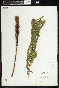 Matteuccia struthiopteris var. pensylvanica (Willdenow) C.V. Morton 359917[1342333]Denike, W.N. 10241939-08-01 Canada, Manitoba, Winnipeg, 49.883333 -97.166667 |
MIN:Plants | 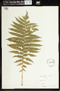 Matteuccia struthiopteris var. pensylvanica (Willdenow) C.V. Morton 545152[1342334]Daubenmire, R.F. 1930-07-07 United States, Indiana, Parke, 39.773625 -87.20636 |
MIN:Plants |  Matteuccia struthiopteris var. pensylvanica (Willdenow) C.V. Morton 826188[1342336]Vixie, Douglas N. 4431979-08-23 United States, Wisconsin, Polk, S end of Somer's Lake, 6 miles east of Frederic. Clam Falls twp., 45.659052 -92.342842, 351m |
MIN:Plants |  Matteuccia struthiopteris var. pensylvanica (Willdenow) C.V. Morton 355789[1342337] 1880-08-15 United states, Wisconsin, Prairie River Falls, 45.2333 -89.55 |
MIN:Plants |  Matteuccia struthiopteris (L.) Todaro 343481[1342338]Bengtsson, J.B. 1933-09-25 Sweden, Palarna, Karlberg, St. Tuna, 59.833333 19.05 |
MIN:Plants |  Matteuccia struthiopteris (L.) Todaro 343456[1342339]Olson, A.O. 1914-06-06 Sweden, Vestrogothia, Berget, 64.9 19.55, 200m |
MIN:Plants | 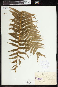 Matteuccia struthiopteris (L.) Todaro 343457[1342340]Olson, A.O. 1914-06-18 Sweden, Vestrogothia, Slatthall, 57.383333 12.333333, 170m |
MIN:Plants | 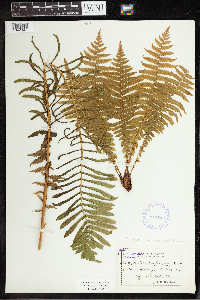 Matteuccia struthiopteris (L.) Todaro 343455[1342341]Bengtsson, J.B. 1932-08-00 Sweden, Delama, Karlberg, St. Tuna, 59.25 17.483333 |
MIN:Plants | 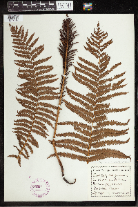 Matteuccia struthiopteris (L.) Todaro 275116[1342342]Gluck, H. 1900-08-01 Germany, Wald, Murgshal, Baden, 53.002724 9.085933 |
MIN:Plants | 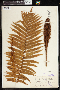 Matteuccia struthiopteris (L.) Todaro 53897[1342343] Slovenia, Gorenjska, Upper Carnolia between Eisern and Zary, 46.309614 14.359619 |
MIN:Plants |  Matteuccia struthiopteris (L.) Todaro 53896[1342344]Hulphers, A. 1899-08-15 Sweden, Vermelandia, Karlstad, Sandbacken, 59.35 13.466667 |
MIN:Plants |  Matteuccia struthiopteris (L.) Todaro 59084[1342345]Hofst, C. 1879-00-00 Germany, Dresden, Boden in [illegible], 51.205259 13.77122 |
MIN:Plants |  Matteuccia struthiopteris (L.) Todaro 59989[1342346] Sweden |
MIN:Plants |  Matteuccia struthiopteris (L.) Todaro 53895[1342347]Walde, U. 1901-08-00 Germany, Rotenbach river near Alpirsbach, 48.329136 8.397231 |
MIN:Plants | 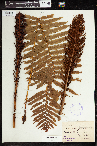 Matteuccia struthiopteris (L.) Todaro 343458[1342348]Reuterman, C. 1886-08-20 Sweden, Varmland, Karlskoza, Forshaya[?], 59.8 13.05 |
MIN:Plants | 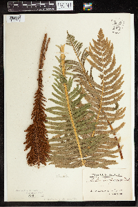 Matteuccia struthiopteris (L.) Todaro 53894[1342349]Soderholm, G.E. 1910-08-11 Sweden, Overlannas, 63.166667 17.65 |
MIN:Plants | 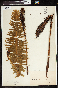 Matteuccia struthiopteris (L.) Todaro 53892[1342350]Bildt, C.A. 1895-08-00 Sweden, Boh, Hjertmans, 58.080797 11.818088 |
MIN:Plants | 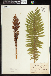 Matteuccia struthiopteris (L.) Todaro 53893[1342351]Bagenholm, Gosta 1893-00-00 Sweden, Vastergotland, Nariestad in Vastergotland, Suguati, 58.016667 13.05 |
MIN:Plants | 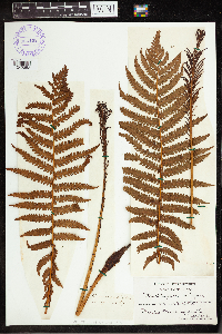 Matteuccia struthiopteris (L.) Todaro 384402[1342352] 1800-00-00 Europe, 54.304226 20.398437 |
MIN:Plants | 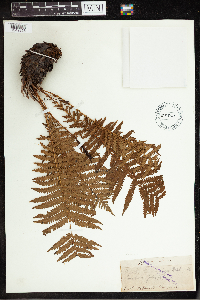 53900[1342353]Stanford, Arthur N. 460000-07-09 Japan, Sapporo, 43.066667 141.35 |
MIN:Plants | 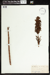 Matteuccia struthiopteris var. pensylvanica (Willdenow) C.V. Morton 53878[1342335] 1893-08-00 United States, Maine, Hallowell, 44.285902 -69.790879 |
MIN:Plants | 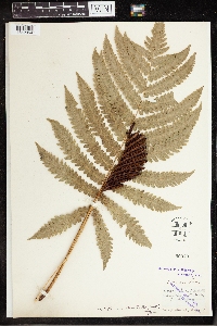 Matteuccia orientalis (Hook.) Trevis. 52970[1342354]Stanford, Arthur N. 1894-10-13 Japan, Atago, Yama, 33.313744 130.176414 |
MIN:Plants | 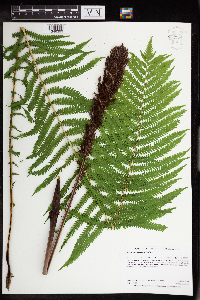 Matteuccia struthiopteris (L.) Todaro 962774[1346399]Dahlberg, Nathan B. NBD812018-06-28 United States, Minnesota, Saint Louis, 3.44mi southwest of Markham; 2.09mi south of Long Lake rd.; 356m southeast of forest rd UT-122., 47.27 -92.28 |
MIN:Plants | 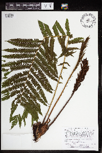 Matteuccia struthiopteris var. pensylvanica (Willdenow) C.V. Morton 965301[1375970]Lee, Michael MDL52382010-07-08 United States, Minnesota, Cook, Boundary Waters Canoe Area Wilderness, Fairly rugged bedrock terrain in the Misquah Hills southwest of Misquah Lake, 17 miles north-northwest of Grand Marais.T64N R1W S1/2 of SE1/4 of SE1/4 Sec. 31, 47.97688449 -90.49159723, 607m |
MIN:Plants | 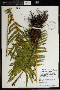 Matteuccia struthiopteris var. pensylvanica (Willdenow) C.V. Morton 966332[1359172]Timothy J. S. Whitfeld 28362021-07-08 United States, Minnesota, Washington, Lost Valley Prairie Scientific and Natural Area, 2 miles east north east of intersection of State Highway 95 and 110th., 44.797355 -92.825493, 278m |
MIN:Plants | 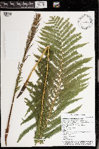 Matteuccia struthiopteris (L.) Todaro 976658[1402249]Timothy J. S. Whitfeld 29112021-07-17 United States, Minnesota, St. Louis, Voyageurs National Park, 0.8 miles west of the northern mouth of Browns Bay, Sand Point Lake, 48.384186 -92.558894, 351m |
MIN:Plants | Matteuccia struthiopteris (L.) Todaro MPCA_Dummy19[]Mark Gernes 2021-08-23 United States, Minnesota, Chisago, St. Croix Nat. Scenic River, Collected as part of the US Environmental Protection Agency National Wetland Condition Assessment (EPA siteID NWC21-MN-10001) and MN Pollution Control Agency MN Wetland Condition Assessment (MPCA siteID 16CHIS211), 45.44573817 -92.65208819 |
MIN:Plants | Matteuccia struthiopteris (L.) Todaro []Timothy J. S. Whitfeld 32702022-07-01 United States, Minnesota, Washington, Crystal Spring Scientific and Natural Area, 0.4 miles northeast of the intersection of Scandia Trail North and Hwy 95, 45.25709 -92.763989, 264m |
MIN:Plants |  Matteuccia struthiopteris (L.) Todaro 969992[1371577]Brad Bolduan 1962020-05-19 United States, Minnesota, Martin, Perch Creek Wildlife Management Area. Edge of wetland along Perch Creek just north of Perch Lake., 43.804499 -94.472689 |
MIN:Plants |  Matteuccia struthiopteris var. pensylvanica (Willdenow) C.V. Morton 970812[1394293]Smith, Welby R WRS357552017-07-09 United States, Minnesota, Anoka, Rice Creek Chain of Lakes Park Reserve. On a penninsula at the north end of George Watch Lake, about 3 km (1.9 miles) north of the approximate center of Centerville at a heading of 133 degrees., 45.1809167 -93.0831389 |
Google Map
Google Maps is a web mapping service provided by Google that features a map that users can pan (by dragging the mouse) and zoom (by using the mouse wheel). Collection points are displayed as colored markers that when clicked on, displays the full information for that collection. When multiple species are queried (separated by semi-colons), different colored markers denote each individual species.