University of Minnesota
http://www.umn.edu/
612-625-5000
http://www.umn.edu/
612-625-5000
Minnesota Biodiversity Atlas
Bell Museum
Dataset: MIN-Plants
Taxa: Polygonaceae
Search Criteria: excluding cultivated/captive occurrences
Bell Museum plants | |
 MIN:Plants | 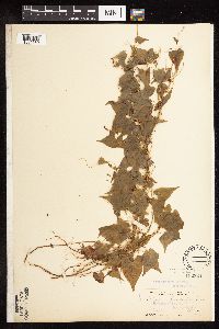 Fallopia convolvulus (L.) A. L̦ve 102321[1085669]Steele, E.; et al. 2341901-08-15 United States, Virginia, Page, Stony Man Mountain and vicinity in the Blue Ridge, near Luray;Shenandoah National Park, 1128m |
MIN:Plants | 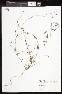 Fallopia convolvulus (L.) A. L̦ve 493980[1085641]Gerdes, Lynden 43192000-09-26 United States, Minnesota, Lake, Silver Bay. Approximately 1.0 mile north of Nicado Lake. West of Highway. NWNE of section;North Shore / Tettegouche State Park;056N;07W;06, 47.33958 -91.198054 |
MIN:Plants | 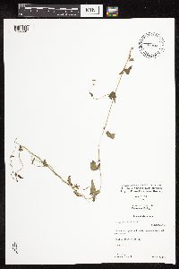 Fallopia convolvulus (L.) A. L̦ve 431956[1085591]Cully, Anne; et al. s.n.1997-08-08 United States, Minnesota, Pipestone, UTM 071456N 4876879E;Pipestone National Monument;106N;46W;01, 44.013519 -96.324755 |
MIN:Plants | 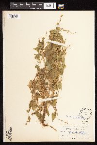 Fallopia convolvulus (L.) A. L̦ve 102329[1085665]Nelson, Aven; et al. 67721899-08-30 United States, Wyoming, Park, Yellowstone National Park ... Madison River;Yellowstone National Park |
MIN:Plants | 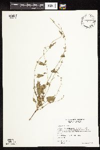 Fallopia convolvulus (L.) A. L̦ve 511121[1085581]Wheeler, Gerald 174711997-08-30 United States, Minnesota, Nicollet, Nicollet County ... Ca. 2.5 mi. NW of Courtland on Rte. 14; Red Rock area ... Bordering the Minnesota River ... E1/2 SE1/4 SW1/4 Sec. 34 T110N R30W (Courtland 34). 110N 30W 34, 44.292954 -94.420107 |
MIN:Plants | 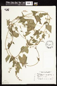 Fallopia convolvulus (L.) A. L̦ve 426754[1085482]Smith, Welby 206481992-06-30 United States, Minnesota, Rice, Rice County ... About 3/4 mile southwest of Litle Chicago ... T112N R21W NW1/4 of NE1/4 of Sec 34;;112N;21W;34, 44.4702778 -93.3286111 |
MIN:Plants | 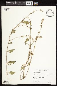 Fallopia convolvulus (L.) A. L̦ve 440581[1085642]Wheeler, Gerald 175011997-08-31 United States, Minnesota, Renville, Ca. 3 mi. W of Bird Island, N side of Rte 212. N1/2 N1/2 of section;;115N;34W;16, 44.767456 -94.932268 |
MIN:Plants | 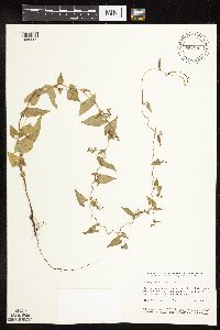 Fallopia convolvulus (L.) A. L̦ve 431876[1085582]Smith, Welby 157791989-07-18 United States, Minnesota, Freeborn, Freeborn County ... right-of-way of the C.M.St.P.& P. Railroad, on the south side of Oakland. NE1/4 NE1/4 sec. 3 T 102N R 19W. 102N 19W 3, 43.666499 -93.099247 |
MIN:Plants | 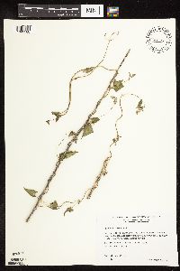 Fallopia convolvulus (L.) A. L̦ve 509024[1085580]Wheeler, Gerald 203521999-08-17 United States, Minnesota, McLeod, McLeod County ... Ca. 3 mi. S of Hutchinson on Rte. 15; 0.5 mi. E of road ... S1/2 Sec.19 & N1/2 Sec. 30 T116N R29W;;116N;29W;30, 44.841409 -94.366247 |
MIN:Plants | 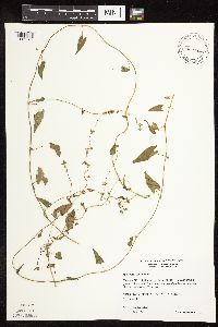 Fallopia convolvulus (L.) A. L̦ve 461967[1085583]Wheeler, Gerald 177911997-09-06 United States, Minnesota, Redwood, Redwood County ... Ca. 6 mi. NNE of Morgan, 0.2 mi. W of Rte.11 ... SW1/4 SW1/4 SE1/4 Sec 14 T 112N R 34W (Sherman 14);;112N;34W;14, 44.513365 -94.889882 |
MIN:Plants | 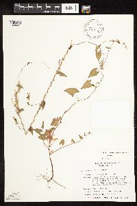 Fallopia convolvulus (L.) A. L̦ve 464302[1085584]Smith, Michael 321996-08-13 United States, Minnesota, Koochiching, Voyageurs National Park. Koochiching County ... Plot Name: Voya 05 DNR #5763;Voyageurs National Park;070N;22W;00, 48.5925 -93.1511111 |
MIN:Plants | 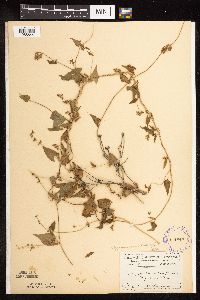 Fallopia convolvulus (L.) A. L̦ve 101812[1085644]Menzel, Max 92201895-07-00 United States, Minnesota, Pipestone, Pipestone [assuming the quarry area; town generally noted as "Pipestone City" by collector];Pipestone National Monument;106N;46W;01, 44.01585 -96.31767 |
MIN:Plants | 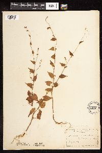 Fallopia convolvulus (L.) A. L̦ve 102355[1085518]Manning, Sara s.n.1884-07-08 United States, Minnesota, Goodhue, Central Point [pioneer town on Sand Point, Lake Pepin];Frontenac State Park;112N;13W;12, 44.507468 -92.326291 |
MIN:Plants | 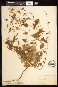 Fallopia convolvulus (L.) A. L̦ve 102356[1085600]Moyer, Lycurgus s.n.1895-06-20 United States, Minnesota, Chippewa, Montevideo;;117N;40W;, 44.941389 -95.722222 |
MIN:Plants | 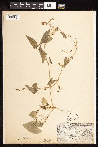 Fallopia convolvulus (L.) A. L̦ve 102357[1085510]Moyer, Lycurgus s.n.1893-08-28 United States, Minnesota, Chippewa, Montevideo.;;117N;40W;, 44.941389 -95.722222 |
MIN:Plants | 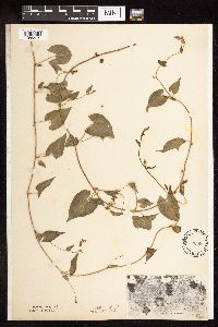 Fallopia convolvulus (L.) A. L̦ve 102358[1085515]Moyer, Lycurgus s.n.1893-07-00 United States, Minnesota, Chippewa, Montevideo;;117N;40W;, 44.941389 -95.722222 |
MIN:Plants | 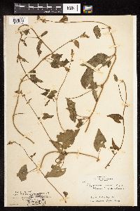 Fallopia convolvulus (L.) A. L̦ve 102360[1085503]Skinner, S. 2861902-07-05 United States, Minnesota, Jackson, Heron Lake Region;;N;;, 43.794959 -95.320276 |
MIN:Plants | 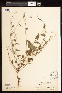 Fallopia convolvulus (L.) A. L̦ve 102362[1085596]Ballard, C. 30481901-08-10 United States, Minnesota, Clay, Muskoda [historic RR station near Hawley];;139N;45W;17, 46.854778 -96.396816 |
MIN:Plants | 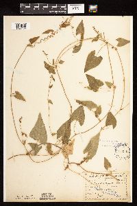 Fallopia convolvulus (L.) A. L̦ve 102363[1122153]Sandberg, John s.n.1890-08-00 United States, Minnesota, Hennepin, [no further data];;;;, 45 -93.47 |
MIN:Plants | 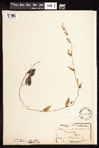 Fallopia convolvulus (L.) A. L̦ve 102364[1085597]Skinner, A. 561900-08-00 United States, Minnesota, Polk, Crookston;;N;;, 47.77169 -96.609582 |
MIN:Plants | 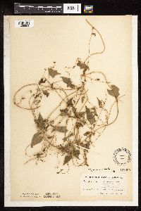 Fallopia convolvulus (L.) A. L̦ve 102365[1085598]Ainslie, G. 1349 United States, Minnesota, Olmsted, Rochester;;106N;14W;, 43.97834 -92.49834 |
MIN:Plants | 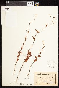 Fallopia convolvulus (L.) A. L̦ve 102367[1085649]Sheldon, Edmund S30931892-07-00 United States, Minnesota, Mille Lacs, Princeton;;036N;26W;, 45.569965 -93.581628 |
MIN:Plants | 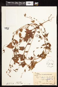 Fallopia convolvulus (L.) A. L̦ve 102368[1085622]Ballard, C. B6301891-07-00 United States, Minnesota, Carver, Chaska;;;;, 44.78944 -93.60194 |
MIN:Plants | 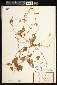 Fallopia convolvulus (L.) A. L̦ve 102370[1085505]Wheeler, William 4511899-08-03 United States, Minnesota, Houston, Jefferson, Houston Co.;Dorer Memorial Hardwood State Forest;101N;04W;35, 43.508039 -91.282558 |
MIN:Plants |  Fallopia convolvulus (L.) A. L̦ve 102371[1085624]Sheldon, Edmund S15631891-08-00 United States, Minnesota, Lincoln, Lake Benton;;109N;45W;00, 44.261079 -96.287539 |
MIN:Plants |  Fallopia convolvulus (L.) A. L̦ve 102372[1085627]Ballard, C. 11461892-08-00 United States, Minnesota, Goodhue, Zumbrota;;109N;16W;, 44.294132 -92.669081 |
MIN:Plants |  Fallopia convolvulus (L.) A. L̦ve 102373[1085504]Ballard, C. 26021900-08-00 United States, Minnesota, Kittson, Humboldt;;163N;50W;, 48.906625 -97.093393 |
MIN:Plants |  Fallopia convolvulus (L.) A. L̦ve 102374[1085657]Heller, A. s.n.1896-09-00 United States, Minnesota, Hennepin, Cedar Lake [other Heller collections indicated Hennepin Co.];;029N;24W;00, 44.959833 -93.319814 |
MIN:Plants | 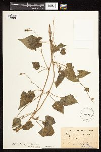 Fallopia convolvulus (L.) A. L̦ve 102375[1085623]Oestlund, O. s.n.1886-00-00 United States, Minnesota, Hennepin, Minneapolis;;N;;, 44.98 -93.26361 |
MIN:Plants | 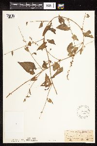 Fallopia convolvulus (L.) A. L̦ve 102377[1085651]Sandberg, John s.n.1882-07-00 United States, Minnesota, Goodhue, Cannon Falls;;112N;17W;18, 44.506911 -92.905484 |
MIN:Plants | 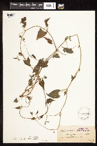 Fallopia convolvulus (L.) A. L̦ve 102378[1085626]Roberts, Thomas s.n.1879-08-13 United States, Minnesota, Cook, Grand Marais;North Shore;061N;01E;, 47.750447 -90.334273 |
MIN:Plants | 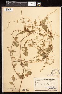 Fallopia convolvulus (L.) A. L̦ve 102379[1085645]Lugger, O. s.n.1894-06-00 United States, Minnesota, Ramsey, St. Anthony Park [St. Paul neighborhood near U of M];;029N;23W;, 44.98382 -93.194806 |
MIN:Plants | 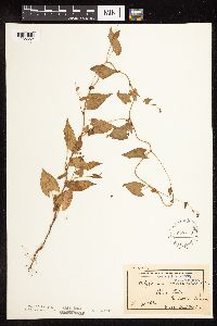 Fallopia convolvulus (L.) A. L̦ve 102380[1085652]Ballard, C. B5061891-07-00 United States, Minnesota, Scott, Prior Lake;;N;;, 44.720982 -93.425645 |
MIN:Plants | 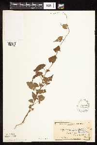 Fallopia convolvulus (L.) A. L̦ve 102381[1085538]Sheldon, Edmund S4271891-06-00 United States, Minnesota, Blue Earth, Ash Lake;;N;;, 43.91778 -93.798896 |
MIN:Plants | 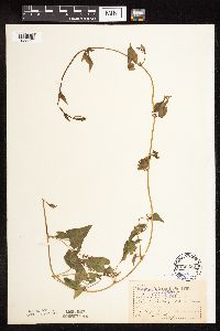 Fallopia convolvulus (L.) A. L̦ve 102382[1085520]Lugger, O. s.n.1893-08-00 United States, Minnesota, Ramsey, St. Anthony Park [St. Paul neighborhood near U of M];;029N;23W;, 44.98382 -93.194806 |
MIN:Plants | 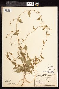 Fallopia convolvulus (L.) A. L̦ve 102383[1085616]Sheldon, Edmund s.n.1895-06-00 United States, Minnesota, Hennepin, Ft. Snelling;Fort Snelling Military Reservation;028N;23W;, 44.890943 -93.184951 |
MIN:Plants | 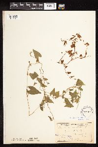 Fallopia convolvulus (L.) A. L̦ve 102384[1085615]Sheldon, Edmund s.n.1892-07-00 United States, Minnesota, Otter Tail, East Battle Lake;;133N;39W;, 46.32563 -95.59426 |
MIN:Plants | 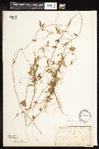 Fallopia convolvulus (L.) A. L̦ve 102385[1085629]Sheldon, Edmund s.n.1892-08-00 United States, Minnesota, Otter Tail, Battle Lake;;133N;40W;, 46.280516 -95.713658 |
MIN:Plants | 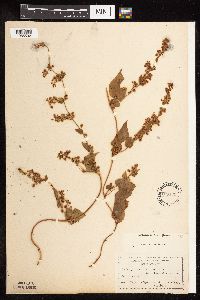 Fallopia convolvulus (L.) A. L̦ve 103179[1085592]Aiton, G. 89.41890-09-00 United States, Minnesota, Chippewa, Montevideo;;117N;40W;, 44.941389 -95.722222 |
MIN:Plants | 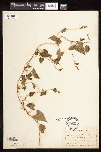 Fallopia convolvulus (L.) A. L̦ve 103181[1085603]Manning, Sara s.n.1883-08-29 United States, Minnesota, Wabasha, Lake City;;111N;12W;, 44.449412 -92.266844 |
MIN:Plants |  Fallopia convolvulus (L.) A. L̦ve 227797[1085492]Roberts, Thomas s.n.1904-08-15 United States, Minnesota, Wabasha, Wabasha Co.;;;;, 44.28333 -92.21667 |
MIN:Plants |  Fallopia convolvulus (L.) A. L̦ve 264255[1085609]Holzinger, John 23991885-08-04 United States, Minnesota, Goodhue, Kenyon;;N;;, 44.262012 -93.010543 |
MIN:Plants |  Fallopia convolvulus (L.) A. L̦ve 264531[1122152]Holzinger, John s.n.1901-07-00 United States, Minnesota, Winona, Winona Co.;;N;;, 43.98685 -91.779129 |
MIN:Plants |  Fallopia convolvulus (L.) A. L̦ve 264534[1122151]Holzinger, John s.n. United States, Minnesota, Winona, Winona Co.;;N;;, 43.98685 -91.779129 |
MIN:Plants | 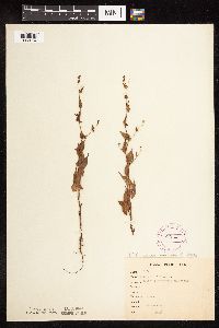 Fallopia convolvulus (L.) A. L̦ve 265431[1085604]Goldsmith, G. G71912-00-00 United States, Minnesota, Rice, Northfield;;N;;, 44.458298 -93.161604 |
MIN:Plants | 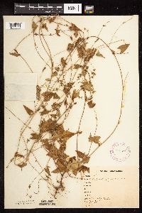 Fallopia convolvulus (L.) A. L̦ve 265566[1085650]Stevenson, J. 2331912-07-26 United States, Minnesota, Beltrami, Bemidji;;N;;, 47.536341 -94.82277 |
MIN:Plants | 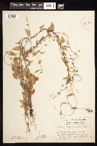 Fallopia convolvulus (L.) A. L̦ve 276047[1085575]Grant, Martin 31291929-08-22 United States, Minnesota, Clearwater, Itasca Park. North boundary.;Itasca State Park;143N;36W;2, 47.231974 -95.201528 |
MIN:Plants | 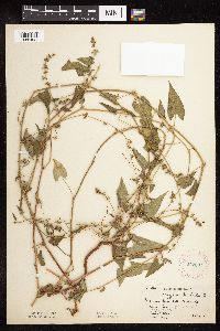 Fallopia convolvulus (L.) A. L̦ve 277607[1085498]Hotchkiss, N.; et al. 4661930-09-03 United States, Minnesota, Carlton, Near Birch Lake. Corona Twp. T48N, R19W. Carlton Co.;;048N;19W;, 46.628007 -92.424571 |
MIN:Plants | 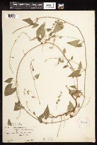 Fallopia convolvulus (L.) A. L̦ve 277630[1085499]Jones, Percy 3751930-08-10 United States, Minnesota, Otter Tail, Near Star Lake. Dora Twp.;;136N;41W;, 46.521501 -95.810119 |
MIN:Plants | 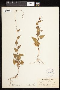 Fallopia convolvulus (L.) A. L̦ve 284622[1085572]Rosendahl, C. 4961902-06-14 United States, Minnesota, Houston, Spring Grove.;;101N;07W;, 43.543165 -91.672028 |
MIN:Plants | 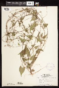 Fallopia convolvulus (L.) A. L̦ve 336299[1085593]Lakela, Olga 15851936-07-30 United States, Minnesota, Saint Louis, Bay shore, Duluth; Sec. 19 [other collections indicates this is in T49N R13W, Minnesota Point];Minnesota Point;049N;13W;19, 46.7833 -92.1 |
MIN:Plants | 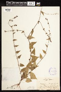 Fallopia convolvulus (L.) A. L̦ve 352307[1085494]Benner, F.; Benner, J. 6161929-08-22 United States, Minnesota, Cook, 1/2 mi. E of Grand Portage.;Grand Portage Indian Reservation / North Shore;063N;06E;, 47.963775 -89.674004 |
MIN:Plants |  Fallopia convolvulus (L.) A. L̦ve 352349[1085487]Benner, F.; Benner, J. 5621929-07-29 United States, Minnesota, Cook, Near McLean's cottage, Grand Portage.;Grand Portage Indian Reservation / North Shore;063N;06E;, 47.9667 -89.7667 |
MIN:Plants |  Fallopia convolvulus (L.) A. L̦ve 352773[1085571]Jukkola, E. 101937-06-18 United States, Minnesota, Hennepin, Barge terminal, Mississippi River flats, S of Washington Ave. bridge, Minneapolis.;;N;;, 44.958976 -93.216579 |
MIN:Plants |  Fallopia convolvulus (L.) A. L̦ve 357608[1085496]Stork, H. s.n.1925-06-00 United States, Minnesota, Itasca, Itasca Co. Plants of Bowstring;Chippewa National Forest;;;, 47.537188 -93.905046 |
MIN:Plants |  Fallopia convolvulus (L.) A. L̦ve 360307[1085640]Lakela, Olga 40121940-08-13 United States, Minnesota, Carlton, Hwy 23, about 3 mi NW of Holyoke;;;;, 46.510876 -92.388528 |
MIN:Plants | 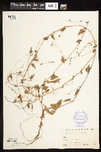 Fallopia convolvulus (L.) A. L̦ve 363939[1085648]Buell, Murray 19761940-08-05 United States, Minnesota, Clearwater, Itasca Park;Itasca State Park;143N;36W;, 47.197458 -95.201964 |
MIN:Plants | 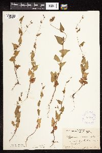 Fallopia convolvulus (L.) A. L̦ve 364809[1085497]Gilbert, H. 2731923-07-12 United States, Minnesota, Saint Louis, Near Duluth.;;N;;, 46.7833 -92.1 |
MIN:Plants | 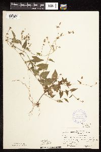 Fallopia convolvulus (L.) A. L̦ve 367010[1085533]Moore, John; Butters, F. 135211940-09-05 United States, Minnesota, Cass, S shore of Leech Lake, 1/2 mi. E of Whipholt.;Chippewa National Forest / Leech Lake Indian Reservation;141N;29W;, 47.048843 -94.344014 |
MIN:Plants | 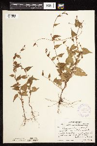 Fallopia convolvulus (L.) A. L̦ve 367108[1085594]Moore, John; Moore, Marjorie 101941938-06-26 United States, Minnesota, Dakota, 1/4 mi W of Fifth Avenue and just S of Church Steet, South St. Paul;;028N;22W;, 44.879525 -93.055094 |
MIN:Plants | 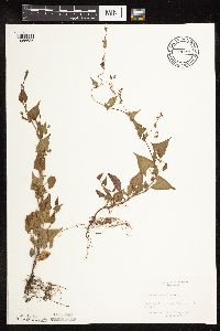 Fallopia convolvulus (L.) A. L̦ve 367830[1085635]Siemers, Ross 271977-06-02 United States, Minnesota, Morrison, MacDougall Homestead Preserve;MacDougall Homestead, The Nature Conservancy;039N;32W;, 45.86758 -94.326425 |
MIN:Plants | 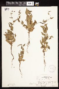 Fallopia convolvulus (L.) A. L̦ve 370950[1085516]Moore, John; et al. 133521940-06-27 United States, Minnesota, Redwood, Ca. 7 mi. S of Sacred Heart. Redwood Co.;;114N;37W;, 44.315321 -95.2333 |
MIN:Plants | 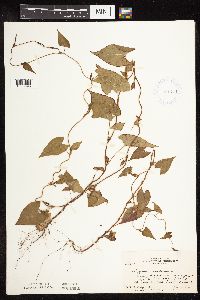 Fallopia convolvulus (L.) A. L̦ve 381741[1085595]Moore, John; et al. 153101942-06-19 United States, Minnesota, Steele, Straight River, bridge at N end of Medford; Medford Twp. NE1/4 Sec. 8. Steele Co.;;;;, 44.17417 -93.24611 |
MIN:Plants | 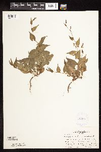 Fallopia convolvulus (L.) A. L̦ve 383223[1085506]Moore, John 158251943-06-24 United States, Minnesota, Washington, Washington Co.; 1 mile east of intersection of hwy 100 [hwy 120?] by hwy 36, along north side of rr;;029N;31W;, 45.038753 -92.883883 |
MIN:Plants | 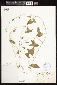 Fallopia convolvulus (L.) A. L̦ve 385988[1085599]Lakela, Olga 58301944-08-26 United States, Minnesota, Saint Louis, Along Northern Pacific rr tracks between the Steel Plant and Oliver Bridge, Duluth;;;;, 46.7833 -92.1 |
MIN:Plants | 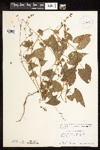 Fallopia convolvulus (L.) A. L̦ve 412038[1085611]Moore, John; Moore, Marjorie 119971939-08-22 United States, Minnesota, Lake of the Woods, Shore at the mouth of the Rapid River, Clementson;;N;;, 48.6833 -94.4333 |
MIN:Plants | 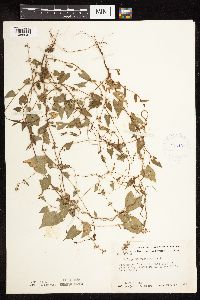 Fallopia convolvulus (L.) A. L̦ve 413198[1085545]Moore, John; Moore, Marjorie 117501939-08-14 United States, Minnesota, Koochiching, Koochiching Co.; east side of Tilson Bay, Rainy Lake; T71N R23;;071N;23W;, 48.606604 -93.401815 |
MIN:Plants | 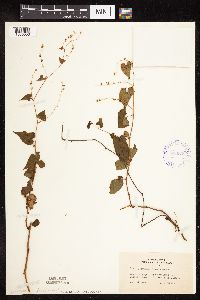 Fallopia convolvulus (L.) A. L̦ve 416659[1085553]Lakela, Olga 94901949-08-28 United States, Minnesota, Saint Louis, Near Arrowhead Resort, Lake Kabetogama;Voyageurs National Park;N;;, 48.499611 -93.060333 |
MIN:Plants | 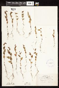 Fallopia convolvulus (L.) A. L̦ve 421020[1085546]Lakela, Olga 107241950-07-16 United States, Minnesota, Saint Louis, Skyline Parkway, below 39th Ave. W, Duluth;;N;;, 46.7833 -92.1 |
MIN:Plants | 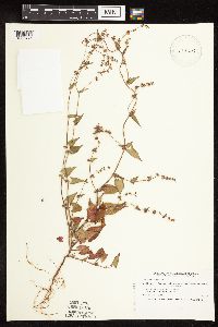 Fallopia convolvulus (L.) A. L̦ve 429447[1085475]Smith, Welby 208261992-07-14 United States, Minnesota, Roseau, Roseau Co.; T 159N R 39W NW1/4 of NE1/4 of Sec 1;;159N;39W;1, 48.6236111 -95.6111111 |
MIN:Plants | 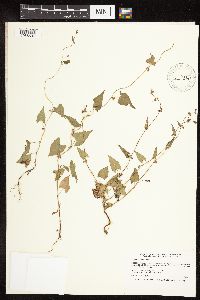 Fallopia convolvulus (L.) A. L̦ve 429816[1085507]Smith, Welby 209381992-07-15 United States, Minnesota, Marshall, Old Mill State Park. Marshall Co.; In Old Mill State Park, about 11 miles east of Argyle; along the Middle River; Marshall Co.; In Old Mill State Park, about 11 miles east of Argyle; along the Middle River; T 156N R 46W NW1/4 of SE1/4 of sec 4. 156N 46W 4, 48.3602778 -96.5702778 |
MIN:Plants | 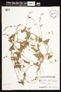 Fallopia convolvulus (L.) A. L̦ve 436374[1085527]Smith, Welby 138161987-08-11 United States, Minnesota, Washington, Washington Co. Bayport State Wildlife Management Area, about 1 mi S of Bayport; NE1/4 SE1/4 sec.15, T29N R20W;Saint Croix Savanna Scientific Natural Area;029N;20W;15, 44.8738889 -92.7825 |
MIN:Plants |  Fallopia convolvulus (L.) A. L̦ve 440840[1085588]Haferman, J. 1561995-08-05 United States, Minnesota, Scott, Scott Co. T115N R22W S36 SW of SW. Approx. 0.1 mi N-NE of intersection of State Hwy.13 and Co. Road 44 on N side of high Scott Co. T115N R22W S36 SW of SW. Approx. 0.1 mi N-NE of intersection of State Hwy.13 and Co. Road 44 on N side of highway.. 115N 22W 36, 44.718671 -93.419417 |
MIN:Plants |  Fallopia convolvulus (L.) A. L̦ve 441031[1085586]Darveaux, B. s.n.1991-07-02 United States, Minnesota, Washington, Forest Lake, Anoka Co. [Washington Co.] Left side of exit ramp 129 off of highway 35.;;032N;21W;7, 45.275646 -93.009582 |
MIN:Plants |  Fallopia convolvulus (L.) A. L̦ve 442436[1085608]Lakela, Olga 130491951-07-11 United States, Minnesota, Saint Louis, Shore of Rainy Lake at Kettle Falls;Voyageurs National Park;070N;18W;, 48.49944 -92.63889 |
MIN:Plants |  Fallopia convolvulus (L.) A. L̦ve 444448[1085563]Smith, Welby 210571992-07-20 United States, Minnesota, Redwood, Cedar Rock Wildlife Management Area. Redwood Co.; In Cedar Rock State Wildlife Management Area, about 4 miles north-northwest of Redwood Falls; Redwood Co.; In Cedar Rock State Wildlife Management Area, about 4 miles north-northwest of Redwood Falls; T 113N R 36W NW1/4 of NW1/4 of Sec 11. 113N 36W 11, 44.6122222 -95.1563889 |
MIN:Plants | 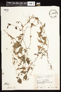 Fallopia convolvulus (L.) A. L̦ve 446272[1085601]Moore, John; Huff, N. 188071946-07-31 United States, Minnesota, Benton, Along the roadside 5 mi NE of East St. Cloud;;N;;, 45.611147 -94.095102 |
MIN:Plants | 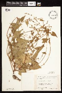 Fallopia convolvulus (L.) A. L̦ve 446666[1085512]Moore, John; Huff, N. 178001945-07-23 United States, Minnesota, Morrison, Below the dam at Little Falls.;;;;, 45.976354 -94.362502 |
MIN:Plants | 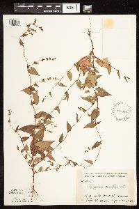 Fallopia convolvulus (L.) A. L̦ve 449034[1085602]Moore, John 166521944-06-30 United States, Minnesota, Washington, Washington Co. 1 mi west of Marine;;031N;20W;, 45.203968 -92.793675 |
MIN:Plants | 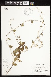 Fallopia convolvulus (L.) A. L̦ve 457225[1085476]Puchalski, L. 3161993-07-28 United States, Minnesota, Polk, Polk Co.; Polk WMA. App 1/3 mi. west of entrance to WMA; T 149N R 41W NW1/4 of SW1/4 of Sec 29;Polk Wildlife Management Area;149N;41W;29, 47.695262 -95.934096 |
MIN:Plants | 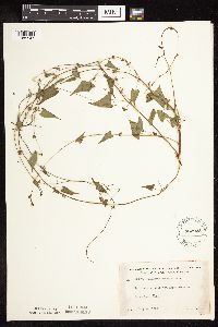 Fallopia convolvulus (L.) A. L̦ve 462925[1085547]Lakela, Olga 150971952-07-16 United States, Minnesota, Saint Louis, On Lost Bay, N shore of Kabetogama Lake;Voyageurs National Park;N;;, 48.470908 -93.008801 |
MIN:Plants | 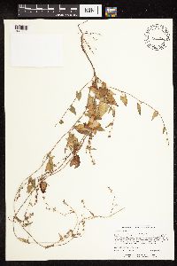 Fallopia convolvulus (L.) A. L̦ve 464259[1085660]Lee, Michael MDL14951996-08-16 United States, Minnesota, Carlton, Carlton Co.; On large outcrops; one mile east of Thomson; T48N R16W SE1/4 SW1/4 SW1/4 Sec. 4;;048N;16W;4, 46.66426 -92.381889 |
MIN:Plants | 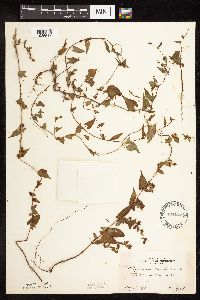 Fallopia convolvulus (L.) A. L̦ve 494425[1085517]Huff, N. s.n.1941-08-18 United States, Minnesota, Beltrami, Blackduck;;N;;, 47.73301 -94.548579 |
MIN:Plants | 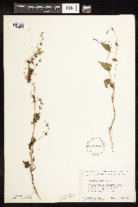 Fallopia convolvulus (L.) A. L̦ve 499905[1085573]Ball, E. 171946-07-22 United States, Minnesota, Marshall, Mud Lake Nat'l Wildlife Refuge, R41W, T156N, Sec. 14.;Agassiz National Wildlife Refuge;156N;41W;14, 48.313302 -96.01363 |
MIN:Plants | 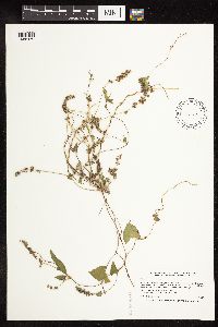 Fallopia convolvulus (L.) A. L̦ve 506773[1085479]Smith, Welby 180431990-08-22 United States, Minnesota, Steele, Aurora Wildlife Management Area. Steele Co.; Aurora State Wildlife Management Area, on the W side of TH 218, about 9 mi SE of Owatonna; Steele Co.; Aurora State Wildlife Management Area, on the W side of TH 218, about 9 mi SE of Owatonna; T106N R19W NE1/4 of NW1/4 of Sec 28. 106N 19W 28, 43.9627778 -93.1175 |
MIN:Plants | 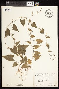 Fallopia convolvulus (L.) A. L̦ve 507345[1085605]Moore, John 208601950-09-15 United States, Minnesota, Swift, Swift Co. Appleton;;120N;43W;, 45.199167 -96.024444 |
MIN:Plants | 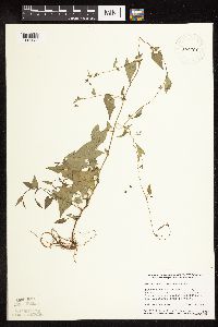 Fallopia convolvulus (L.) A. L̦ve 514558[1085638]Smith, Welby 155151989-06-30 United States, Minnesota, Chisago, Chisago Co. Interstate State Park in Taylors Falls, in the St. Croix Valley. SW1/4 SE1/4 section 25, T 34N R 19W;Interstate State Park;034N;19W;25, 45.397269 -92.659567 |
MIN:Plants | 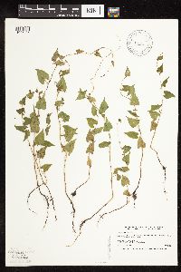 Fallopia convolvulus (L.) A. L̦ve 514715[1085485]Smith, Welby 169991990-06-21 United States, Minnesota, Faribault, Pihls County Park. Fairbault [sic] Co. ... Pihls County Park, on the west side of Rice Lake, about 6 mi south of Wells ... UTM: 337413E 157105N, T102N R24W SW1/4 of NW1/4 of Sec 16. 102N 24W 16, 43.63729 -93.71815 |
MIN:Plants | 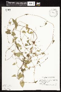 Fallopia convolvulus (L.) A. L̦ve 519969[1085587]Smith, Welby 194841991-07-16 United States, Minnesota, Koochiching, Koochiching County...on the W side of Silverdale...T64N R22W SW1/4 of NE1/4 of Sec 35;Koochiching State Forest;064N;22W;35, 47.9866667 -93.1188889 |
MIN:Plants | 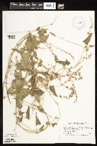 Fallopia convolvulus (L.) A. L̦ve 520482[1085474]Smith, Welby 210961992-07-23 United States, Minnesota, Le Sueur, Le Sueur Co.; about 1 mi E of Elysian, on the N side of Highway 60. In abandoned gravel pit; Le Sueur Co.; about 1 mi E of Elysian, on the N side of Highway 60. In abandoned gravel pit; T109N R23W SW1/4 of SW1/4 of Sec 31. 109N 23W 31, 44.1983333 -93.6436111 |
MIN:Plants | 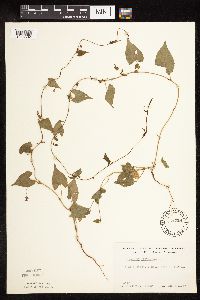 Fallopia convolvulus (L.) A. L̦ve 551228[1085502]Cotter Tucker, Shirley 41721957-06-30 United States, Minnesota, Polk, 1 mi S, 4 mi W of Fertile;;N;;, 47.52157 -96.36607 |
MIN:Plants | 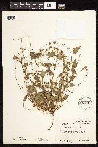 Fallopia convolvulus (L.) A. L̦ve 554019[1085508]Moore, John; et al. 223641954-09-23 United States, Minnesota, Pipestone, Pipestone County...Along Pipestone Creek, Pipestone National Monument, Pipestone.;Pipestone National Monument;106N;46W;01, 44.013519 -96.324755 |
MIN:Plants |  Fallopia convolvulus (L.) A. L̦ve 558426[1085647]Moore, John; Hsi, Yu-tseng [Eugene] 233891957-08-06 United States, Minnesota, Blue Earth, At Mankato;;N;;, 44.163578 -93.9994 |
MIN:Plants |  Fallopia convolvulus (L.) A. L̦ve 558625[1085646]Moore, John; Hsi, Yu-tseng [Eugene] 234611957-08-09 United States, Minnesota, Waseca, Along the E shore of Lake Elysian;;109N;24W;, 44.1333 -93.7 |
MIN:Plants |  Fallopia convolvulus (L.) A. L̦ve 560855[1085544]Ownbey, Gerald; Anderson, Henry 28041959-07-08 United States, Minnesota, Clearwater, Ca. 3.0 straight-line mi NNW of Gonvick; SW1/4 Sec. 28 T150N R38W;;150N;38W;28, 47.782365 -95.527434 |
MIN:Plants |  Fallopia convolvulus (L.) A. L̦ve 565133[1085614]Cotter Tucker, Shirley 41871957-08-06 United States, Minnesota, Polk, Along rr (Great Northern) right-of-way, E of Northwest School of Agriculture, Crookston;;N;;, 47.788613 -96.608121 |
MIN:Plants | 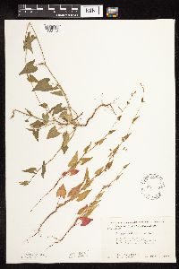 Fallopia convolvulus (L.) A. L̦ve 568510[1085495]Moore, John; Benner, J. 250971960-06-30 United States, Minnesota, Anoka, N side of road opposite, D.B. Lawrence's entrance.;Cedar Creek National History Area;034N;23W;, 45.40217 -93.199397 |
MIN:Plants | 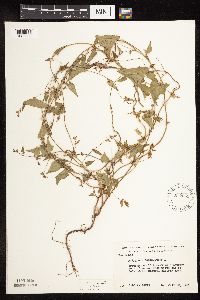 Fallopia convolvulus (L.) A. L̦ve 572531[1085606]Moore, John 256451961-07-20 United States, Minnesota, Isanti, W of access road N end of Cedar Creek Natural History Area;Cedar Creek Ecosystem Reserve;034N;23W;, 45.435716 -93.21836 |
MIN:Plants | 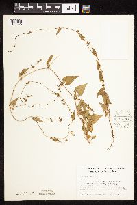 Fallopia convolvulus (L.) A. L̦ve 575018[1085625]Wertman, Freida 561960-07-04 United States, Minnesota, Anoka, Cedar Creek National History Area. Cedar Creek Natural History Area, opposite Lawrence property, co. rd 24, N side; Sec. 28 SE Athens Twp, Coordinates, Ma Cedar Creek Natural History Area, opposite Lawrence property, co. rd 24, N side; Sec. 28 SE Athens Twp, Coordinates, Map area surveyed 1960 877.1-2204.1. 034N 23W 28, 45.319728 -93.336809 |
MIN:Plants | 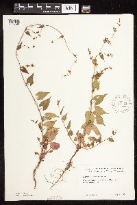 Fallopia convolvulus (L.) A. L̦ve 584715[1085490]Morean, Edith s.n.1961-07-04 United States, Minnesota, Hennepin, N of the Minnesota River on South Lyndale Ave.;;N;;, 44.890206 -93.284282 |
Google Map
Google Maps is a web mapping service provided by Google that features a map that users can pan (by dragging the mouse) and zoom (by using the mouse wheel). Collection points are displayed as colored markers that when clicked on, displays the full information for that collection. When multiple species are queried (separated by semi-colons), different colored markers denote each individual species.