University of Minnesota
http://www.umn.edu/
612-625-5000
http://www.umn.edu/
612-625-5000
Minnesota Biodiversity Atlas
Bell Museum
Dataset: MIN-Plants
Taxa: Scirpus cyperinus
Search Criteria: excluding cultivated/captive occurrences
Bell Museum plants | |
 MIN:Plants | 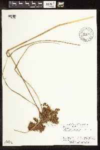 Scirpus cyperinus (L.) Kunth 910622[1106158]Perry, Ethan 080672008-09-26 United States, Minnesota, Itasca, 4.4 miles S of Warba. SE1/4 of NE1/4 of section;;053N;23W;20, 47.065 -93.275 |
MIN:Plants | 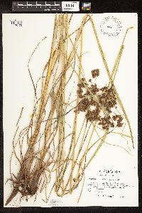 Scirpus cyperinus (L.) Kunth 484802[1106173]Kaul, R. 26771982-07-29 United States, Minnesota, Becker, Becker Co.; on MN 113 between Itasca Park and White Earth Reservation;Itasca State Park;142N;36W;, 47.108802 -95.233537 |
MIN:Plants | 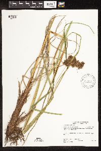 Scirpus cyperinus (L.) Kunth 917099[1106157]Gerdes, Lynden; et al. 59002009-08-25 United States, Minnesota, Cook, Boundary Waters Canoe Area Wilderness / Superior National Forest. T66N R05W S12 NWSESWNW Cook County ... Superior National Forest. Boundary Waters Canoe Area Wilderness. Saganaga Lake. Munker Island.. 066N 05W 12, 48.215119 -90.912522 |
MIN:Plants | 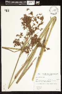 Scirpus cyperinus (L.) Kunth 455120[1106100]Gerdes, Lynden 23601998-09-09 United States, Minnesota, Cook, Superior National Forest. T65N R04W S27NWSE. Cook County ... Superior National Forest. Road edge along the Round Lake Road (Cty 47); just south of it's junction with the Gunflint Trail (Hwy 12).. 065N 04W 27, 48.084242 -90.825443 |
MIN:Plants | 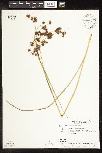 Scirpus cyperinus (L.) Kunth 456087[1106121]Smith, Michael 460a1997-08-02 United States, Minnesota, Koochiching, Plot name: Voya 61, DNR #7250; Rat Root Peatland. [collector's longtitude would place this in Lake of the Woods County, corrected for this county];Voyageurs National Park;069N;22W;00, 48.4883333 -93.1238889 |
MIN:Plants | 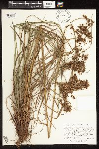 Scirpus cyperinus (L.) Kunth 906387[1106196]Lee, Michael MDL38932004-09-24 United States, Minnesota, Becker, Pickerel Potholes Wildlife Management Area. Becker County...Pickerel Lake Potholes State Wildlife Management Area...south of Pickerel Lake, 1-1/2 miles west-southwest of Rochert...basin just north of Irish Lake...T139N R40W NW1/4 of SE1/4 of SE1/4 Sec. 16. 139N 40W 16, 46.854098 -95.742136 |
MIN:Plants | 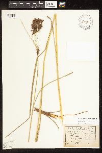 Scirpus cyperinus (L.) Kunth 83798[1106233]Sandberg, John s.n.1890-07-00 United States, Minnesota, Hennepin, Hennepin Co.;;;;, 45.004579 -93.476877 |
MIN:Plants | 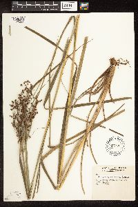 Scirpus cyperinus (L.) Kunth 598792[1106292]Tryon, R. 15221935-07-26 United States, Indiana, Porter, Dunes State Park, Porter Co.;Indiana Dunes National Lakeshore;;;, 41.663093 -87.032128 |
MIN:Plants | 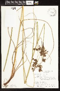 Scirpus cyperinus (L.) Kunth 429716[1106178]Smith, Michael 681996-08-14 United States, Minnesota, Koochiching, Voyageurs National Park. Koochiching Co.; Plot name: Voya 08 DNR # 5766; West Kabetogama Penn.;Voyageurs National Park;071N;22W;00, 48.586113 -93.1341629 |
MIN:Plants |  Scirpus cyperinus (L.) Kunth 699676[1106294_1;1106294_2]Ziegler, S. 7131974-08-29 United States, Wisconsin, Vernon, Vernon Co.; Island 10; Mississippi River-mile #689.2; T14N R7W Sec 7 ... Large island E side of main channel ... S end;Upper Mississippi National Wildlife Refuge;014N;07W;07, 193m |
MIN:Plants | 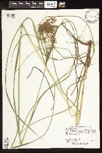 Scirpus cyperinus (L.) Kunth 477678[1106156]Lee, Michael MDL23101998-07-29 United States, Minnesota, Crow Wing, Crow Wing County ... Along the Little Pine River 6 1/2 miles south of Emily ...T137N R26W SE1/4 of NE1/4 Sec 33;;137N;26W;33, 46.637052 -93.977989 |
MIN:Plants | 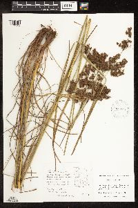 Scirpus cyperinus (L.) Kunth 927195[1106203]Fevold, Brick 291994-08-08 United States, Minnesota, Lake of the Woods, Hogsback Forest Rd, 1 mi. W of gravel pit.;Beltrami Island State Forest;159N;34W;, 48.583308 -95.017745 |
MIN:Plants | 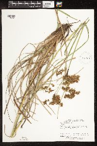 Scirpus cyperinus (L.) Kunth 923399[1106202]Perry, Ethan 100352010-08-05 United States, Minnesota, Cook, Near W end of Saganaga Lake, 0.38 miles SE of NW corner of Cook County...T66N R5W NE1/4 of SW1/4 of Sec19;Boundary Waters Canoe Area Wilderness / Superior National Forest;066N;05W;19, 48.1863889 -91.0238889 |
MIN:Plants |  Scirpus cyperinus (L.) Kunth 922774[1106190]Smith, Welby 237961993-09-01 United States, Minnesota, Fillmore, Beaver Creek Wildlife Management Area. Beaver Creek State Wildlife Management Area, about 9.5 miles south of Spring Valley...T 101N R 31W NE1/4 of SW1/4 of Sec 21. 101N 31W 21, 43.5341667 -92.4025 |
MIN:Plants | 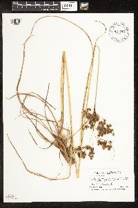 Scirpus cyperinus (L.) Kunth 921798[1106241]Smith, Welby 250241994-08-02 United States, Minnesota, Wadena, Huntersville State Forest / Wildlife Management Area. Huntersville State Wildlife Management Area, about 2 miles east of the town of Huntersville...T138N R 33W NW1/4 of NW1/4 of Sec 15. 138N 33W 15, 46.7752778 -94.8491667 |
MIN:Plants | 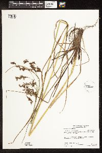 Scirpus cyperinus (L.) Kunth 931144[1106245]Gerdes, Lynden B.; Myhre, Karen 62012010-08-20 United States, Minnesota, Cook, Whack Lake. Shoreline of bay just east of the portage to Vern Lake. SENESWNW of section;Superior National Forest;063N;03W;33, 47.8988889 -90.7186111 |
MIN:Plants |  Scirpus cyperinus (L.) Kunth 931160[1106244]Gerdes, Lynden B. 62342010-08-20 United States, Minnesota, Cook, Whack Lake. Shoreline of bay just east of the portage to Vern Lake. SENESWNW of section;Superior National Forest;063N;03W;33, 47.8988889 -90.7186111 |
MIN:Plants | 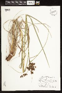 Scirpus cyperinus (L.) Kunth 933897[1106102]Smith, Welby; Gerdes, Lynden 310792008-08-05 United States, Minnesota, Saint Louis, Clark Lake. NE1/4 of SW1/4 of section.;Superior National Forest / Boundary Waters Canoe Area Wilderness;063N;14W;23, 47.9213889 -92.0877778 |
MIN:Plants | 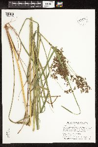 Scirpus cyperinus (L.) Kunth 933894[1106172]Smith, Welby; Gerdes, Lynden 310742008-08-05 United States, Minnesota, Saint Louis, Clark Lake. NE1/4 of SW1/4 of section.;Superior National Forest / Boundary Waters Canoe Area Wilderness;063N;14W;23, 47.9213889 -92.0877778 |
MIN:Plants | 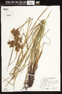 Scirpus cyperinus (L.) Kunth 934061[1106106]Smith, Welby R. 33514 United States, Minnesota, Renville, On a federal waterfowl production area about 9 miles north of the town of Buffalo Lake. NE of NE of section;;116N;31W;18, 44.8631 -94.60225 |
MIN:Plants |  Scirpus cyperinus (L.) Kunth 935482[1106105]Smith, Welby R. 330942011-07-27 United States, Minnesota, Sherburne, On the west side of Zimmerman. SE of SE of section;Fremont Wildlife Management Area;034N;26W;18, 45.43 -93.6166106 |
MIN:Plants | 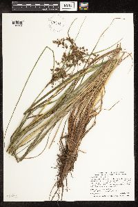 Scirpus cyperinus (L.) Kunth 935433[1106104]Smith, Welby R. 331922011-08-03 United States, Minnesota, Koochiching, About 8 miles NW of Big Falls along Toumey Willams Rd. NW of SE of section;Pine Island State Forest;155N;26W;16, 48.2438889 -93.9811111 |
MIN:Plants | 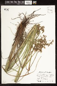 Scirpus cyperinus (L.) Kunth 935410[1106103]Smith, Welby R. 332432011-08-04 United States, Minnesota, Koochiching, About 9 miles E-SE of Littlefork along Galvin Line. SW of SE of section;Koochiching State Forest;068N;24W;24, 48.3618318 -93.3628929 |
MIN:Plants | 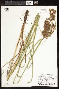 Scirpus cyperinus (L.) Kunth 935362[1106107]Smith, Welby R; Gerdes, Lynden B 333052011-08-09 United States, Minnesota, Lake, At the west end of Lake Isabella where it joins the Isabella River. SE of NW of section;Boundary Waters Canoe Area Wilderness / Superior National Forest;062N;07W;31, 47.8108667 -91.2675167 |
MIN:Plants | 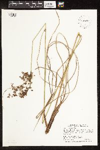 Scirpus cyperinus (L.) Kunth 939701[1106218]Smith, Welby R. 321942010-08-30 United States, Minnesota, Cook, About 7 miles N-NW of Lutsen. NE of NE of section;Superior National Forest;061N;03W;20, 47.7575 -90.7280556 |
MIN:Plants | 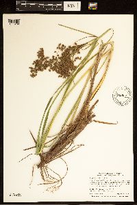 Scirpus cyperinus (L.) Kunth 942022[1285289]Smith, Welby R. 323052010-09-05 United States, Minnesota, Lake, Along County Road 7 (Cramer Road) about 1.5 miles west of the Cook County Line. SW of SE of section;;061N;06W;02, 47.7918248 -91.0498828 |
MIN:Plants |  Scirpus cyperinus (L.) Kunth 942076[1285293]Smith, Welby R. 319482010-07-29 United States, Minnesota, Koochiching, Small roadside marsh about 2 miles west of Gemmell. NE of SE of section;;152N;28W;24, 47.9666664 -94.1705556 |
MIN:Plants | 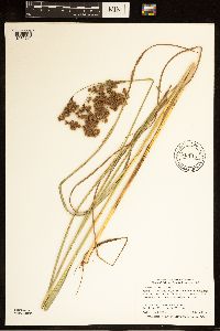 Scirpus cyperinus (L.) Kunth 942116[1285291]Smith, Welby R. 319062010-07-28 United States, Minnesota, Beltrami, Marshy roadside along Hwy 72, about 5 miles north of Kelliher. NE of NW of section;;152N;30W;02, 48.0170096 -94.45428 |
MIN:Plants | 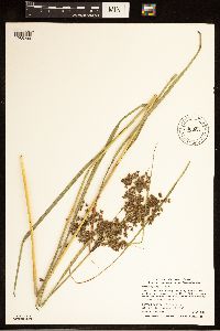 Scirpus cyperinus (L.) Kunth 942065[1285299]Smith, Welby R. 319592010-07-29 United States, Minnesota, Koochiching, About 2 miles west of Margie on County Road 61. Along a small, unnamed tributary of Hay Creek. SE of SE of section;;153N;26W;04, 48.0951431 -93.9764286 |
MIN:Plants | 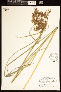 Scirpus cyperinus (L.) Kunth 942097[1285301]Smith, Welby R. 319272010-07-28 United States, Minnesota, Beltrami, On the west side of hwy 72, about 4 miles south of Waskish. NE of NW of section;;153N;30W;05, 48.1032599 -94.5241317 |
MIN:Plants | 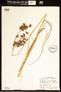 Scirpus cyperinus (L.) Kunth 942047[1285296]Smith, Welby R. 319772010-07-29 United States, Minnesota, Koochiching, Along Highway 30, about 6 miles west of Big Falls. NW of SE of section;;155N;26W;26, 48.2131032 -93.9355907 |
MIN:Plants | 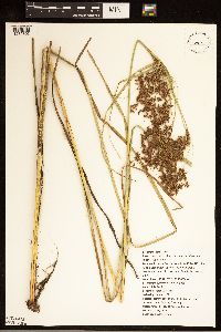 Scirpus cyperinus (L.) Kunth 938550[1285303]Wragg, Peter 19212011-07-03 United States, Minnesota, Isanti, Beckman Bog, adjacent to 249th Ave NE (1 km W of junction with Naples St NE);Cedar Creek Ecosystem Preserve;;;, 45.421759 -93.186764 |
MIN:Plants | 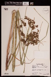 946445[1289974]Gerdes, Lynden B. 61172010-07-18 United States, Minnesota, Cook, Superior National Forest. BWCAW. Northwestern shores of the large island in Paulson Lake. NESWSWNE of section; T065N R05W sec24, 48.100121 -90.909712 |
MIN:Plants |  943023[1291089]Smith, Welby R. 347662013-08-08 United States, Minnesota, Goodhue, About 2.3 km (1.4 miles) northwest of Zumbrota. NW of NW of section; T110N R16W sec25, 44.3098833 -92.6879833 |
MIN:Plants | 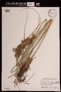 943001[1291111]Smith, Welby R. 347442013-08-01 United States, Minnesota, Crow Wing, At the southeast end of Greer Lake, about 12.5 km (8 miles) southwest of the town of Emily. SE of SW of section; T137N R27W sec36, 46.63315 -94.0411667 |
MIN:Plants | 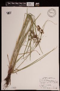 948297[1292474]Smith, Welby R. WRS338722012-06-28 United States, Minnesota, Otter Tail, In a federal waterfowl production area, about 2.75 miles (4.5 km) southwest of Dent.; T135N R40W sec08, 46.5183167 -95.74425 |
MIN:Plants | 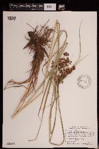 947719[1291792]Smith, Welby R. WRS296532006-07-07 United States, Minnesota, Wright, Succonix State Wildlife Management Area, about 5 miles south of Clearwater. SE of SW of section; T122N R27W sec26, 45.3429487 -94.049324 |
MIN:Plants | 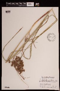 947733[1291805]Smith, Welby R. 296872006-07-12 United States, Minnesota, Steele, A moist, springy spot on the south side of U.S. Hwy 14, about one mile south of Owatonna. NE of SE of section; T107N R20W sec20, 44.0561508 -93.2498098 |
MIN:Plants |  Scirpus cyperinus (L.) Kunth 947761[1291832]Smith, Welby R. 297452006-08-02 United States, Minnesota, Freeborn, Carex State Wildlife Management Area, about 5 miles northwest of Austin. SW of SW of section; T103N R19W sec15, 43.7199012 -93.1054529 |
MIN:Plants |  947771[1291842]Smith, Welby R. 297762006-08-08 United States, Minnesota, Freeborn, A wide mashy zone at the east end of Lower Twin Lake. NE of SE of section; T101N R22W sec11, 43.5617633 -93.4321641 |
MIN:Plants |  948340[1292644]Smith, Welby R. 341142012-08-06 United States, Minnesota, Beltrami, Red Lake State Wildlife Management Area, about 26 miles (41.8 km) northwest of Waskish. T156N R34W SW1/4 of NW1/4 of Sec 21, 48.317222 -95.029167 |
MIN:Plants |  945811[1296638]Smith, Welby R. 34006 United States, Minnesota, Becker |
MIN:Plants |  945813[1296640]Smith, Welby R. 34008 United States, Minnesota, Becker |
MIN:Plants | 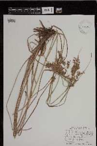 945824[1296693]Smith, Welby R. 34019 United States, Minnesota, Becker |
MIN:Plants | 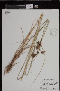 945844[1296706]Smith, Welby R. 34039 United States, Minnesota, Pine |
MIN:Plants | 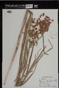 945950[1296772]Smith, Welby R. 35261 United States, Minnesota, Winona |
MIN:Plants | 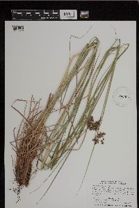 943396[1296890]Smith, Welby R. 339042012-07-06 United States, Minnesota, Morrison |
MIN:Plants | 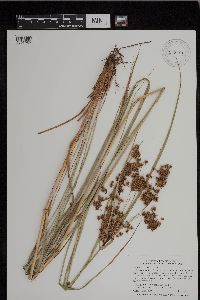 943491[1296959]Smith, Welby R. 340512012-07-23 United States, Minnesota, Pine |
MIN:Plants | 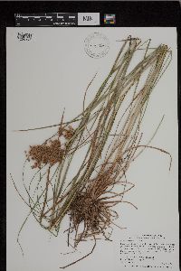 943499[1296967]Smith, Welby R. 340592012-07-27 United States, Minnesota, Pine |
MIN:Plants |  943534[1297061]Smith, Welby R. 34235 United States, Minnesota, Mower |
MIN:Plants | 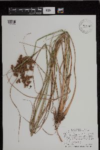 943545[1297072]Smith, Welby R. 34248 United States, Minnesota, Fillmore |
MIN:Plants | 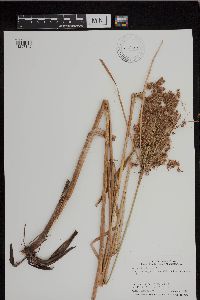 943584[1297142]Smith, Welby R. 342902012-09-11 United States, Minnesota, Sibley |
MIN:Plants |  943424[1297654]Smith, Welby R. 33937 United States, Minnesota, Morrison |
MIN:Plants |  943448[1297659]Smith, Welby R. 33962 United States, Minnesota, Becker |
MIN:Plants |  962873[1346488]Whitfeld, T.J.S. 23872019-08-27 United States, Minnesota, Aitkin, US Army Corps of Engineers Big Sandy Lake Recreation Area, 46.788813 -93.322464 |
MIN:Plants |  962791[1346416]Dahlberg, Nathan B. NBD1032018-08-17 United States, Minnesota, Lake of the Woods, Red Lake WMA, 0.92mi south of Rapid River rd; 2.36mi west of 17th Ave SW; 18.5mi north northwest of Waskish., 48.43 -94.7 |
MIN:Plants | 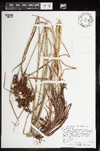 965166[1356316]Lee, Michael MDL5394A2010-08-26 United States, Minnesota, Cook, 48.03602093 -90.51814836, 578m |
MIN:Plants | 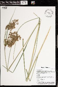 Scirpus cyperinus (L.) Kunth 976642[1402233]Timothy J. S. Whitfeld 28632021-07-14 United States, Minnesota, St. Louis, Voyageurs National Park, Sand Point Lake, area around campsite S7 Granite Cliffs South, 48.399796 -92.478801, 350m |
MIN:Plants | 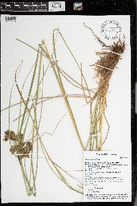 Scirpus cyperinus (L.) Kunth 976553[1402143]Timothy J. S. Whitfeld 28822021-07-15 United States, Minnesota, St. Louis, Voyageurs National Park, 1/4 mile east of O’Leary Lake, 1/10th mile south of Hammer Bay, 48.415609 -92.520687, 380m |
MIN:Plants | 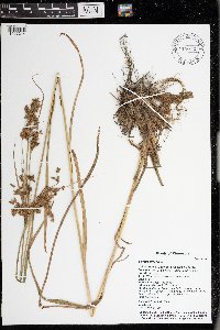 Scirpus cyperinus (L.) Kunth 976623[1402214]Timothy J. S. Whitfeld 30482021-07-23 United States, Minnesota, St. Louis, Southeast arm of Sand Point Lake, close to Little Vermillion Lake, 48.321909 -92.452557, 339m |
MIN:Plants | 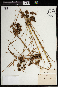 965650[1356508]Arthur Stanley Pease 315441945-08-21 United States, Vermont, Orleans |
MIN:Plants | 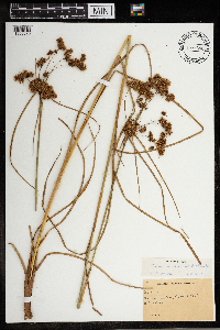 Scirpus cyperinus (L.) Kunth 965690[1356573]Arthur Stanley Pease 341001948-09-11 United States, Maine, Oxford |
MIN:Plants | 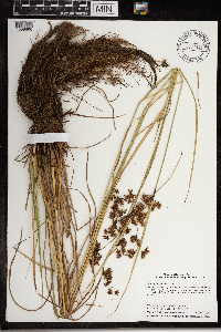 967341[1359896]Welby R Smith 353672015-08-04 United States, Minnesota, Koochiching, In a slow-moving side channel of the Rat Root River, about 14 km (8.7 miles) S-SE of the approximate center of International Falls. SE of SE of section, 48.4905278 -93.3130556 |
MIN:Plants | MPCA_Dummy40[]Mark Gernes 2021-07-26 United States, Minnesota, Kanabec, Collected as part of the US Environmental Protection Agency National Wetland Condition Assessment (EPA siteID NWC21-MN-10015) and MN Pollution Control Agency MN Wetland Condition Assessment (MPCA siteID 21KANA015), 45.98121743 -93.1690339 |
MIN:Plants |  968166[1368797]Timothy J. S. Whitfeld 16272017-08-16 United States, Rhode Island, Washington, Frying Pan Pond, Wood River, 0.75 miles north-northwest of dam on Arcadia Road., 41.54914 -71.70397 |
MIN:Plants | 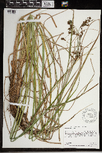 968431[1391055]Dahlberg, Nathan B. NBD2552020-08-20 United States, Minnesota, Scott, Murphy Hanrehan Park Reserve. 60m east of Sunset Lake rd.; 4.65 miles southwest of Burnsville., 44.71 -93.33 |
MIN:Plants |  969330[1384953]Rowe, Erika R. ERR7132011-09-10 United States, Minnesota, Lake of the Woods, Lake of the Woods State Forest. 0.90 miles east of MN Truck Highway 72; 0.5 miles south of LOW Twp Rd. 150; 20 miles north of Waskish., 48.46 -94.54 |
MIN:Plants | 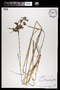 969636[1371227]Dunevitz, Hannah L. 9381993-07-20 United States, Minnesota, Wabasha, in the McCarthy Lake Wildlife Management Area. About 3 miles southeast of Kellogg, just west of County Road 84, 44.27 -91.94 |
MIN:Plants | 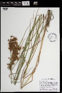 971139[1394608]Smith, Welby R WRS361052018-08-30 United States, Minnesota, Washington, Hardwood Creek State Wildlife Management Area, about 6.4 km (4 miles) southeast (at 146 degrees) from the junction of Co Rd 2 and State Hwy 61 in Forest Lake., 45.2311167 -92.9394833 |
MIN:Plants | 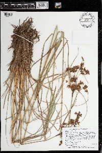 973399[1398952]Lee, Michael MDL57302011-08-30 United States, Minnesota, Lake, Boundary Waters Canoe Area Wilderness; Rugged bedrock terrain along the Canadian border, 34 miles east-northeast of Ely, on the ridge between the North and South Arms of Knife Lake., 48.1071382 -91.18476413, 436m |
MIN:Plants | 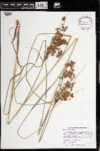 972982[1398535]Lee, Michael MDL60242012-07-20 United States, Minnesota, Lake, Boundary Waters Canoe Area Wilderness; On the eastern shore of Wind Lake, in rolling bedrock terrain 17 miles east-northeast of Ely. Local in the back of a small bay in the northeast part of the lake., 48.0170889956 -91.5076704201, 411m |
MIN:Plants | 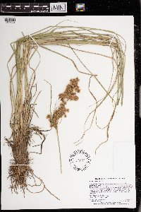 972970[1398523]Lee, Michael MDL61142012-08-18 United States, Minnesota, Lake, Boundary Waters Canoe Area Wilderness; On the shores of Basswood Lake in rugged bedrock terrain 14 miles north-northeast of Ely; at the northeast end of Jackfish Bay., 48.0776149816 -91.6789038565, 396m |
MIN:Plants | 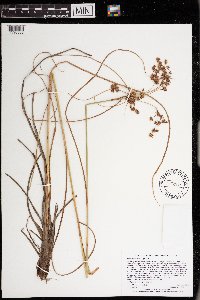 972983[1398536]Lee, Michael MDL61412012-08-21 United States, Minnesota, Lake, Boundary Waters Canoe Area Wilderness; Along the lower reaches of Muskeg Creek, in rolling bedrock terrain east of Pipestone Bay, Basswood Lake, 11 miles northeast of Ely., 48.0165211298 -91.6748466682, 398m |
MIN:Plants | 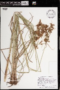 972984[1398537]Lee, Michael MDL61742012-09-11 United States, Minnesota, Lake, Boundary Waters Canoe Area Wilderness; Along the shores of Fall Lake, on both sides of the Boundary Waters Canoe Area Wilderness line, 7 miles northeast of Ely., 47.9535857595 -91.7275146886, 401m |
Google Map
Google Maps is a web mapping service provided by Google that features a map that users can pan (by dragging the mouse) and zoom (by using the mouse wheel). Collection points are displayed as colored markers that when clicked on, displays the full information for that collection. When multiple species are queried (separated by semi-colons), different colored markers denote each individual species.