University of Minnesota
http://www.umn.edu/
612-625-5000
http://www.umn.edu/
612-625-5000
Minnesota Biodiversity Atlas
Bell Museum
Dataset: MIN-Plants
Taxa: Zannichellia
Search Criteria: excluding cultivated/captive occurrences
Bell Museum plants | |
 MIN:Plants | 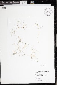 976821[1402430]Perleberg, Donna J. DJP2018.0626-062018-06-26 United States, Minnesota, Big Stone, Artichoke Lake (06000200) east shore of south basin, 45.33781 -96.12478 |
MIN:Plants | 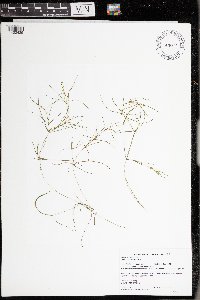 976820[1402429]Perleberg, Donna J. DJP2018.0628-072018-06-28 United States, Minnesota, Big Stone, Big Stone Lake (06015200) public boat launch east shore off Co Rd 68/34, 45.3555 -96.4768 |
MIN:Plants | 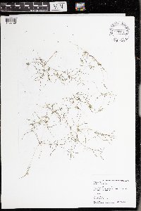 976817[1402426]Simon, Stephanie A. SAS2017.0712-042017-07-12 United States, Minnesota, Stearns, Koronis Lake (73020002), 45.34187 -94.71915 |
MIN:Plants | 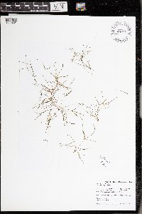 976822[1402431]Perleberg, Donna J. DJP2017.0630-042017-06-30 United States, Minnesota, Lyon, Cottonwood Lake (42001400) swim beach, 44.61338 -95.66933 |
Google Map
Google Maps is a web mapping service provided by Google that features a map that users can pan (by dragging the mouse) and zoom (by using the mouse wheel). Collection points are displayed as colored markers that when clicked on, displays the full information for that collection. When multiple species are queried (separated by semi-colons), different colored markers denote each individual species.