University of Minnesota
http://www.umn.edu/
612-625-5000
http://www.umn.edu/
612-625-5000
Minnesota Biodiversity Atlas
Bell Museum
Dataset: MIN-Plants
Taxa: Albizia
Search Criteria: excluding cultivated/captive occurrences
1
Page 1, records 1-15 of 15
Bell Museum plants | |
 MIN:Plants | 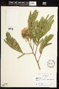 Albizia julibrissin Durazzini 600365[1073974]Radford, A.; et al. 449161966-07-12 United States, North Carolina, Yadkin, Yadkin County ... near N.C. 67 on Yadkin River near East Bend |
MIN:Plants | Albizia saman NULL 939723[]P 412011-06-21 Costa Rica, Guanacaste, Liberia, , 10.84 -85.61, 320m |
MIN:Plants | Albizia NULL 939846[]Takeuchi, Wayne 74231991-08-18 Papua New Guinea, On the Gabensis road;;;;, -6.7 146.766667, 808m |
MIN:Plants | Albizia procera (Roxb.) Benth. 913473[]Weiblen, G.D. & Binatang Research Center WS1Z33082008-04-22 Papua New Guinea, Madang, Wanang Village, -5.229583 145.178467, 115m |
MIN:Plants | 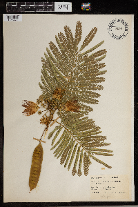 Albizia julibrissin Durazzini 965914[1356677] 1944-08-04 United States, District of Columbia, Catholic University Campus. |
MIN:Plants | 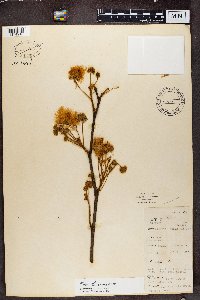 Albizia adianthifolia (Schumach.) W. Wight 488266[1374910]Richards, M 214041966-08-31 Zambia, Ndundu - abercorn, 1768m |
MIN:Plants | 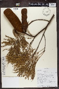 491284[1374911]Randrianaivo, R. 6422001-05-20 Madagascar, Commune Belobaka. Fkt. Antsahanitia. Antsahanitia forest station 16km north of Mahajanga, -15.588333 46.433611, 20m |
MIN:Plants | 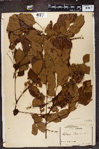 133568[1374912]Zenker 6861896-00-00 Cameroon |
MIN:Plants | 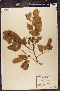 133567[1374913]Staudt 6221896-00-00 Cameroon, Station Johann-Albrechtshöhe, Urwaldgebiet |
MIN:Plants | 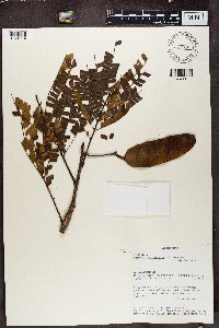 482253[1374914]Rakotozafy, A 27081991-09-02 Madagascar, Forest near Anjozorabe - Forest margin, -18.441667 47.841667, 1400m |
MIN:Plants | 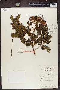 Albizia gummifera (J.F. Gmel.) C.A. Sm. 577993[1374915]Troupin, G. 6721959-04-07 Rwanda, Mutara region, around Mimuli, IRSAC reserve, Gikandura hill, 1400 - 1450m |
MIN:Plants | 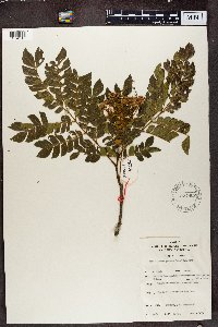 Albizia gummifera (J.F. Gmel.) C.A. Sm. 577902[1374916]Mat. Alcool II.6511959-04-02 Rwanda, Region du Mutara, environ de Mimuli; reserve IRSAC, colline Nyakage. Umusebeya, (dial Kinyaruanda), 1400 - 1450m |
MIN:Plants | 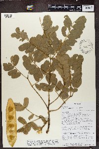 Albizia lebbeck (L.) Benth. 499331[1374917]Randrianaivo, R. 6372001-05-18 Madagascar, Fiv. Ambatoboeny, Manerinerina commune, Village de Bevazaha 18km north of Manerinerina ; Ankarafantsika RNI, -16.256667 47.161111, 125m |
MIN:Plants | 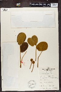 Albizia versicolor Welw. ex Oliv. 577916[1374918]Troupin, G 117861959-06-10 Rwanda, Mutara Region, Mimuli, IRSAC reserve, Mayebe Hill, 1400 - 1450m |
MIN:Plants | 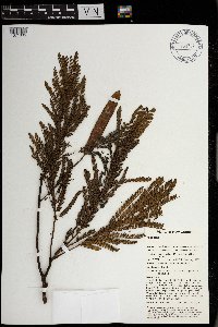 969734[1371335]Weiblen, G. D. & Binatang Research Center NS2A00802013-11-28 Papua New Guinea, Madang, Numba, -5.7222 145.2714, 1200m |
1
Page 1, records 1-15 of 15
Google Map
Google Maps is a web mapping service provided by Google that features a map that users can pan (by dragging the mouse) and zoom (by using the mouse wheel). Collection points are displayed as colored markers that when clicked on, displays the full information for that collection. When multiple species are queried (separated by semi-colons), different colored markers denote each individual species.