University of Minnesota
http://www.umn.edu/
612-625-5000
http://www.umn.edu/
612-625-5000
Minnesota Biodiversity Atlas
Bell Museum
Dataset: MIN-Plants
Taxa: Amphicarpaea
Search Criteria: excluding cultivated/captive occurrences
Bell Museum plants | |
 MIN:Plants | 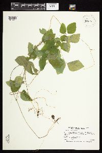 Amphicarpaea bracteata (L.) Fernald 910055[1074482]Smith, Welby 246701994-07-13 United States, Minnesota, Polk, Polk County ... About 5 miles southwest of Erskine ... T148N R43W NE1/4 of NW1/4 of Sec 25;;148N;43W;25, 47.6094444 -96.0797222 |
MIN:Plants | 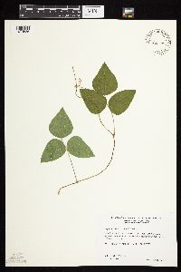 Amphicarpaea bracteata (L.) Fernald 479724[1074536]Wheeler, Gerald 200871999-07-16 United States, Minnesota, Nicollet, Nicollet Co.; Ca. 1.2 mi. W of Rte. 15 on Rte. 21, E of road; SW1/4 NW1/4 NW1/4 Sec. 16 T110N R30W;;110N;30W;16, 44.3334899 -94.4420242 |
MIN:Plants | 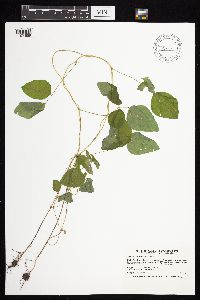 Amphicarpaea bracteata (L.) Fernald 438664[1074559]Smith, Welby 168481990-06-18 United States, Minnesota, Steele, Steele County...Kaplan Woods City Park, on the south side of Owatonna...north side of Straight River...T 107N R 20W NE1/4 of NW1/4 of Sec 21. 107N 20W 21, 44.0644444 -93.235 |
MIN:Plants | 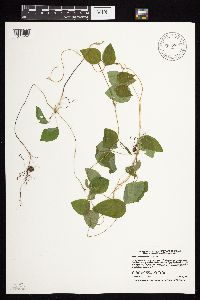 Amphicarpaea bracteata (L.) Fernald 915867[1074452]Smith, Welby 224701993-06-18 United States, Minnesota, Grant, Grant County...On the south side of Ask Lake, about 1.5 miles east-southest of Ashby...T 130N R 41W NW1/4 of SW1/4 of Sec 12. 130N 41W 12, 46.0847222 -95.7886111 |
MIN:Plants |  Amphicarpaea bracteata (L.) Fernald 509219[1074535]Wheeler, Gerald 203361999-08-17 United States, Minnesota, Carver, Carver County ... Ca. 1.3 mi. SSW of Watertown; where rte. 25 crosses the South Fork Crow River ... S1/2 SW1/4 NE1/4 Sec. 17 T117N R25 W. (Watertown 17). 117N 25W 17, 44.9417241 -93.8588865 |
MIN:Plants |  Amphicarpaea bracteata (L.) Fernald 477379[1074487]Smith, Welby 205461992-06-25 United States, Minnesota, Brown, Boesch Wildlife Management Area. Brown County ... Boesch State Wildlife Management Area, about 3 miles northwest of New Ulm, in the Minnesota River Valley ... T110N R31W SW1/4 of NW1/4 of Sec 3. 110N 31W 3, 44.3624992 -94.5494461 |
MIN:Plants |  Amphicarpaea bracteata (L.) Fernald 911167[1074558]Smith, Welby 218341992-09-03 United States, Minnesota, Watonwan, Watonwan County...At the public access on the north side of Fedji Lake, about 2 miles northeast of Madelia...T 107N R 30W SW1/4 of SW1/4 of Sec 12. 107N 30W 12, 44.0816667 -94.3880556 |
MIN:Plants |  Amphicarpaea bracteata (L.) Fernald 918227[1074503]Smith, Welby 252391994-08-23 United States, Minnesota, Sibley, Vale Wildlife Management Area. Sibley County ... Vale State Wildlife Management Area, about 3 miles northwest of Henderson ... T113N R26W SE1/4 of NW1/4 of Sec 27. 113N 26W 27, 44.5680556 -93.9413889 |
MIN:Plants | 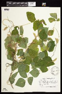 Amphicarpaea bracteata (L.) Fernald 911340[1074557]Smith, Welby 252881994-08-25 United States, Minnesota, Jackson, Jackson County...Kilen Woods State Park about 8 miles north-northwest of Jackson...T 103N R 35W NW1/4 of NE1/4 of Sec 17;Kilen Woods State Park;103N;35W;17, 43.7255556 -95.0583333 |
MIN:Plants | 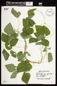 Amphicarpaea bracteata (L.) Fernald 912473[1074553]Smith, Welby 230521993-07-21 United States, Minnesota, Meeker, Meeker County... On the south side of T.H. 12; about 2 miles southeast of Darwin... T119N R30W NW1/4 of SE1/4 of Sec 25;;119N;30W;25, 45.0872222 -94.3916667 |
MIN:Plants | 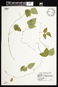 Amphicarpaea bracteata (L.) Fernald 913789[1074555]Smith, Welby 227401993-07-02 United States, Minnesota, Becker, Dunton County Park. Becker County... In Dunton County Park, about 3 miles southwest of Detroit Lakes...Muskrat Lake...T138N R41W SE1/4 of NE1/4 of Sec 8. 138N 41W 8, 46.7825 -95.8816667 |
MIN:Plants | 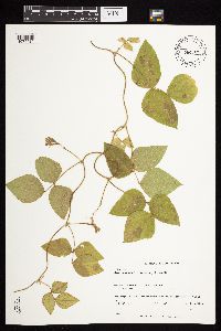 Amphicarpaea bracteata (L.) Fernald 560788[1074484]Kiefer, Gretel 1861998-07-21 United States, Minnesota, Douglas, Douglas Co ... Kensington- 0.5 to 1 mile west of Cnty Rd. 15 on Hegg lake Rd; T127N R40W 23 S2;;127N;40W;23, 45.7957908 -95.6652763 |
MIN:Plants |  Amphicarpaea bracteata (L.) Fernald 137441[1074451]G. & L. 32-371885-08-05 United States, Minnesota, Chippewa River;;;;, 45.58233 -95.69092 |
MIN:Plants |  Amphicarpaea bracteata (L.) Fernald 137449[1074473]Wheeler, William 5071899-08-12 United States, Minnesota, Houston, Winnebago Valley;Dorer Memorial Hardwood State Forest;;;, 43.67 -91.49 |
MIN:Plants |  Amphicarpaea bracteata (L.) Fernald 137450[1074467]Butters, F.; et al. R27951914-06-13 United States, Minnesota, Morrison, Near Randall;;130N;30W;07, 46.08583 -94.50466 |
MIN:Plants |  Amphicarpaea bracteata (L.) Fernald 137451[1074466]Lyon, H. 3321899-08-14 United States, Minnesota, Houston, Winnebago Valley, Houston Co.;Dorer Memorial Hardwood State Forest;N;;, 43.539205 -91.384455 |
MIN:Plants |  Amphicarpaea bracteata (L.) Fernald 137452[1074445]Sheldon, Edmund S10521891-07-00 United States, Minnesota, Brown, Sleepy Eye;;N;;, 44.299394 -94.725867 |
MIN:Plants |  Amphicarpaea bracteata (L.) Fernald 137453[1074586]Lyon, H. 4691899-08-26 United States, Minnesota, Houston, Crooked Creek;Dorer Memorial Hardwood State Forest;N;;, 43.613007 -91.332761 |
MIN:Plants |  Amphicarpaea bracteata (L.) Fernald 137454[1074579]MacMillan, C.; et al. 162Sk1900-08-00 United States, Minnesota, Polk, Crookston;;150N;46W;30, 47.782 -96.60007 |
MIN:Plants |  Amphicarpaea bracteata (L.) Fernald 137455[1074571]Sheldon, Edmund S25461892-06-00 United States, Minnesota, Mille Lacs, Mille Lacs Reservation;Mille Lacs Indian Reservation;N;;, 46.117896 -93.622253 |
MIN:Plants | 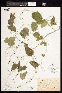 Amphicarpaea bracteata (L.) Fernald 137456[1074515]Sheldon, Edmund S32511892-07-00 United States, Minnesota, Mille Lacs, Milaca;;037N;27W;, 45.755799 -93.654408 |
MIN:Plants | 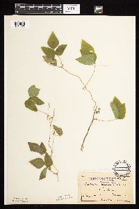 Amphicarpaea bracteata (L.) Fernald 137457[1074578]Menzel, Max s.n.1895-08-00 United States, Minnesota, Pipestone, Pipestone [assuming the quarry area; town generally noted as Pipestone City by collector];Pipestone National Monument;106N;46W;01, 44.01585 -96.31767 |
MIN:Plants | 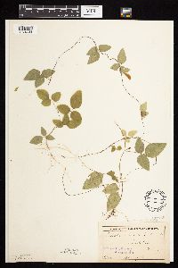 Amphicarpaea bracteata (L.) Fernald 137458[1074603]Taylor, B. s.n.1892-08-00 United States, Minnesota, Chisago, Lindstrom;;N;;, 45.376628 -92.844215 |
MIN:Plants | 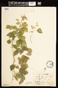 Amphicarpaea bracteata (L.) Fernald 137459[1122561]Aiton, G. s.n.1889-08-00 United States, Minnesota, Hennepin, [no further data];;;;, 45 -93.47 |
MIN:Plants | 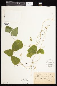 Amphicarpaea bracteata (L.) Fernald 137460[1074587]Taylor, B. T15851892-08-00 United States, Minnesota, Chisago, Center City;;N;;, 45.396263 -92.817975 |
MIN:Plants | 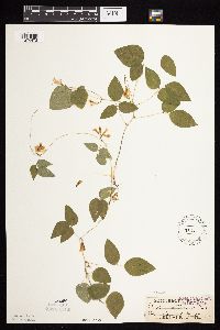 Amphicarpaea bracteata (L.) Fernald 137461[1074478]Sandberg, John s.n.1885-08-00 United States, Minnesota, Goodhue, Red Wing;;113N;14W;, 44.592792 -92.586673 |
MIN:Plants | 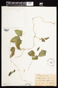 Amphicarpaea bracteata (L.) Fernald 137462[1074499]Sheldon, Edmund S37681892-08-00 United States, Minnesota, Otter Tail, Lake Lida;;N;;, 46.580385 -95.968507 |
MIN:Plants | 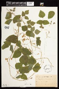 Amphicarpaea bracteata (L.) Fernald 137463[1074498]Oestlund, O. s.n.1886-00-00 United States, Minnesota, Hennepin, Minneapolis;;N;;, 44.970736 -93.268643 |
MIN:Plants |  Amphicarpaea bracteata (L.) Fernald 137464[1074545]Ballard, C. B11511892-08-00 United States, Minnesota, Goodhue, Zumbrota;;N;;, 44.2894248 -92.6611953 |
MIN:Plants |  Amphicarpaea bracteata (L.) Fernald 137476[1074551]Taylor, B. T9941891-07-00 United States, Minnesota, Pope, Glenwood;;N;;, 45.652639 -95.382892 |
MIN:Plants |  Amphicarpaea bracteata (L.) Fernald 137477[1122562]Oestlund, O. 47-71888-08-17 United States, Minnesota, Hennepin, [no further data];;;;, 45 -93.47 |
MIN:Plants |  Amphicarpaea bracteata (L.) Fernald 137478[1074544]Hoosly, H. s.n.1892-00-00 United States, Minnesota, Fillmore, Lanesboro;;103N;10W;, 43.717075 -91.969269 |
MIN:Plants | 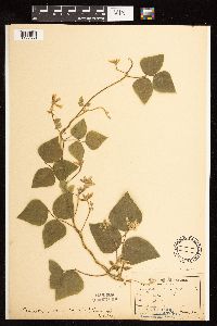 Amphicarpaea bracteata (L.) Fernald 137479[1122560]Sandberg, John s.n.1889-08-00 United States, Minnesota, Hennepin, [no further data];;;;, 45 -93.47 |
MIN:Plants | 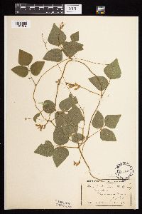 Amphicarpaea bracteata (L.) Fernald 137480[1074549]Wheeler, William 5731899-08-19 United States, Minnesota, Houston, Jefferson;Dorer Memorial Hardwood State Forest;101N;04W;35, 43.50806 -91.28287 |
MIN:Plants | 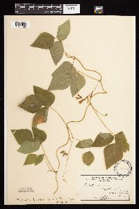 Amphicarpaea bracteata (L.) Fernald 137481[1074450]Sheldon, Edmund s.n. United States, Minnesota, Otter Tail, Battle Lake;;133N;40W;00, 46.283601 -95.713658 |
MIN:Plants | 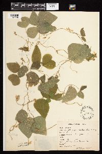 Amphicarpaea bracteata (L.) Fernald 137482[1074449]Rosendahl, C. 23601909-08-16 United States, Minnesota, Ft. Snelling Reservation [old regional park spanning junction of Minnesota and Mississippi rivers].;Fort Snelling Reservation [former regional park];028N;23W;, 44.90516 -93.16646 |
MIN:Plants | 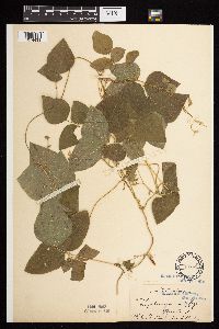 Amphicarpaea bracteata (L.) Fernald 137483[1074433]Ballard, C. 29671901-08-06 United States, Minnesota, Clay, Moorhead;;N;;, 46.869627 -96.747325 |
MIN:Plants | 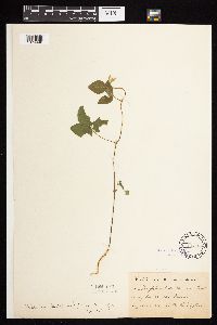 Amphicarpaea bracteata (L.) Fernald 137484[1074448]Taylor, B. T2331891-06-00 United States, Minnesota, Waseca, Janesville;;108N;24W;, 44.116078 -93.708004 |
MIN:Plants | 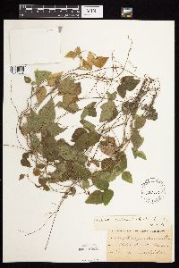 Amphicarpaea bracteata (L.) Fernald 137485[1074552]Sheldon, Edmund s.n.1891-08-00 United States, Minnesota, Lincoln, Lake Benton;;109N;45W;, 44.24108 -96.26172 |
MIN:Plants | 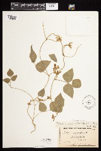 Amphicarpaea bracteata (L.) Fernald 137486[1074479]Kassube, J. s.n.1876-00-00 United States, Minnesota, Hennepin, Minneapolis;;029N;24W;25, 44.96996 -93.23702 |
MIN:Plants | 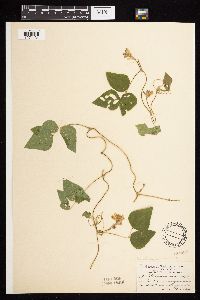 Amphicarpaea bracteata (L.) Fernald 137487[1074434]Aiton, G. s.n.1891-08-00 United States, Minnesota, Hennepin, near Minneapolis;;N;;, 44.970736 -93.263836 |
MIN:Plants | 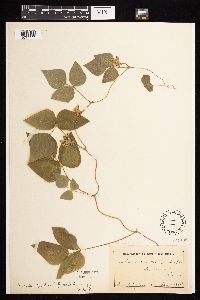 Amphicarpaea bracteata (L.) Fernald 137488[1074444]Campbell, Jennie s.n.1897-08-00 United States, Minnesota, Otter Tail, Underwood;;N;;, 46.285238 -95.870885 |
MIN:Plants | 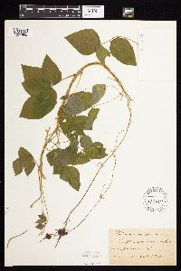 Amphicarpaea bracteata (L.) Fernald 137489[1074550]Taylor, B. T3331891-06-00 United States, Minnesota, Waseca, Janesville;;108N;24W;, 44.116078 -93.708004 |
MIN:Plants | 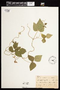 Amphicarpaea bracteata (L.) Fernald 137499[1074538]Frost, W. F3411892-08-00 United States, Minnesota, Kandiyohi, Spicer;;120N;34W;, 45.23302 -94.937949 |
MIN:Plants | 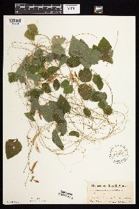 Amphicarpaea bracteata (L.) Fernald 141953[1074501]Ainslie, G. 22341902-09-11 United States, Minnesota, Olmsted, Rochester;;106N;14W;, 43.97834 -92.49834 |
MIN:Plants | 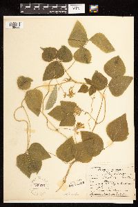 Amphicarpaea bracteata (L.) Fernald 226223[1122558]Roberts, Thomas s.n.1904-07-00 United States, Minnesota, Wabasha, Brook Lodge;;N;;, 44.277558 -92.210339 |
MIN:Plants | 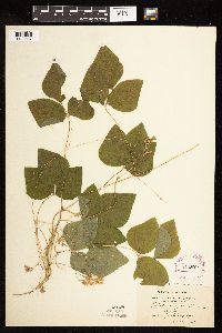 Amphicarpaea bracteata (L.) Fernald 264078[1122557]Holzinger, John s.n.1901-06-00 United States, Minnesota, Winona, [no further data];;;;, 44.0479 -91.6404 |
MIN:Plants | 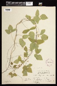 Amphicarpaea bracteata (L.) Fernald 276056[1074491]Moyle, J. 3341930-07-24 United States, Minnesota, Clearwater, Itasca Park, N of Campus, NE-SE-2, T143N, R36W;Itasca State Park;143N;36W;2, 47.1452906 -95.2013601 |
MIN:Plants |  Amphicarpaea bracteata (L.) Fernald 281414[1074460]Roberts, Thomas s.n.1877-08-13 United States, Minnesota, Hennepin, Minneapolis;;N;;, 44.970736 -93.268643 |
MIN:Plants |  Amphicarpaea bracteata (L.) Fernald 288143[1074599]Linnaean Club, U of M, 2711943-07-10 United States, Minnesota, Rice, Nerstrand Woods. Along wagon road running S of main road.;Nerstrand Woods State Park;110N;19W;, 44.344855 -93.106783 |
MIN:Plants |  Amphicarpaea bracteata (L.) Fernald 338139[1074432]Moyle, J. 28131937-08-11 United States, Minnesota, Winona, near La Moille;;106N;06W;, 44.000842 -91.473318 |
MIN:Plants |  Amphicarpaea bracteata (L.) Fernald 357246[1074438]Stevenson, J. 3221912-08-15 United States, Minnesota, Itasca, Grand Rapids;;N;;, 47.225976 -93.523348 |
MIN:Plants | 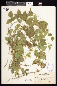 Amphicarpaea bracteata (L.) Fernald 360406[1074441]Rosendahl, C. 65011933-09-09 United States, Minnesota, Crow Wing, Serpent Lake, E of Crosby;;N;;, 46.480225 -93.927719 |
MIN:Plants | 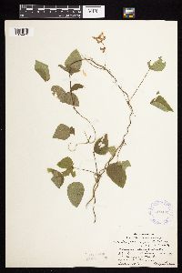 Amphicarpaea bracteata (L.) Fernald 360432[1074439]Lakela, Olga 42311940-09-01 United States, Minnesota, Saint Louis, St. Louis River bank at Morgan Park, Duluth;;N;;, 46.687966 -92.203261 |
MIN:Plants | 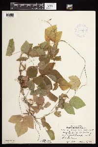 Amphicarpaea bracteata (L.) Fernald 362632[1074596]Lakela, Olga 42511940-09-14 United States, Minnesota, Saint Louis, Fond du Lac;;048N;15W;, 46.659664 -92.273248 |
MIN:Plants | 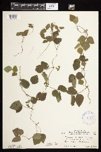 Amphicarpaea bracteata (L.) Fernald 363286[1074576]Lakela, Olga 42301940-09-01 United States, Minnesota, Saint Louis, Mission Creek Valley at Fond du Lac;;048N;15W;, 46.658831 -92.276026 |
MIN:Plants | 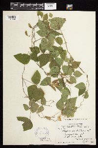 Amphicarpaea bracteata (L.) Fernald 367450[1074442]Moore, John; et al. 104161938-09-07 United States, Minnesota, Ramsey, Ramsey County...North west shore of White Bear Lake;;030N;22W;, 45.08893 -93.007022 |
MIN:Plants | 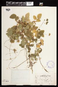 Amphicarpaea bracteata (L.) Fernald 370714[1074437]Moore, John; et al. 137271940-10-01 United States, Minnesota, Isanti, Isanti County...N shore of Spectacle Lake; SE1/4 S26, Wyanett Twp;Spectacle Lake Wildlife Management Area;;;, 45.577544 -93.406204 |
MIN:Plants | 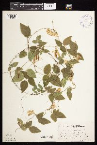 Amphicarpaea bracteata (L.) Fernald 370857[1074426]Moore, John; et al. 135521940-09-12 United States, Minnesota, Washington, Washington County...Bluffs along the St. Croix River, 2 mi. S of Afton;;028N;20W;, 44.874755 -92.772551 |
MIN:Plants | 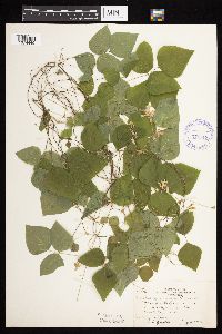 Amphicarpaea bracteata (L.) Fernald 371518[1074440]Moore, John; et al. 149511941-08-07 United States, Minnesota, Kanabec, Kanabec County...Along Snake River, 1/2 mi S of Mora;;039N;24W;, 45.830887 -93.288663 |
MIN:Plants | 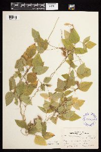 Amphicarpaea bracteata (L.) Fernald 374099[1074447]Lakela, Olga 51971942-08-30 United States, Minnesota, Pine, Pine Co. near Askov;;043N;19W;, 46.188634 -92.78242 |
MIN:Plants | 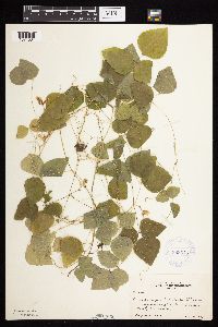 Amphicarpaea bracteata (L.) Fernald 383575[1074531]Moore, John 159301943-08-18 United States, Minnesota, Dakota, Four Corners, Dakota Co.;;113N;17W;, 44.5865611 -92.8532466 |
MIN:Plants | 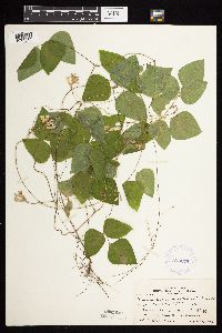 Amphicarpaea bracteata (L.) Fernald 383675[1074546]Moore, John 160081943-08-25 United States, Minnesota, Winona, creek below Guinn's Bluff. Winona Co.;Great River Bluffs State Park;106N;05W;, 43.943881 -91.395189 |
MIN:Plants | 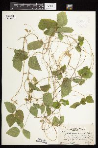 Amphicarpaea bracteata (L.) Fernald 385710[1074569]Rosendahl, C. 76981944-07-19 United States, Minnesota, Fillmore, Hwy 52 N of bridge across Root River, E of Chatfield, Fillmore Co.;Dorer Memorial Hardwood State Forest;104N;11W;15, 43.8115262 -92.1388868 |
MIN:Plants |  Amphicarpaea bracteata (L.) Fernald 386134[1074570]Lakela, Olga 58311944-08-26 United States, Minnesota, Saint Louis, On terrace of the St. Louis River, between Oliver Bridge and Steel Plant, Duluth.;;N;;, 46.657218 -92.211214 |
MIN:Plants |  Amphicarpaea bracteata (L.) Fernald 407862[1074588]Lakela, Olga 93381949-08-13 United States, Minnesota, Saint Louis, Shore of Prairie Lake;;050N;20W;, 46.809279 -92.8706753 |
MIN:Plants |  Amphicarpaea bracteata (L.) Fernald 412027[1074583]Moore, John; et al. 121061939-08-24 United States, Minnesota, Lake of the Woods, Along the Rainy River at Clementson. Lake of the Woods Co.;;160N;30W;, 48.66397 -94.49827 |
MIN:Plants |  Amphicarpaea bracteata (L.) Fernald 419705[1074594]Lakela, Olga 120041950-09-04 United States, Minnesota, Saint Louis, At Fond du Lac, Duluth;;048NN;15W;, 46.672446 -92.270759 |
MIN:Plants | 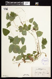 Amphicarpaea bracteata (L.) Fernald 420604[1074598]Lakela, Olga 119711950-09-01 United States, Minnesota, Saint Louis, Hwy. 73, 2 mi. N of Floodwood.;;N;;, 46.959468 -92.904542 |
MIN:Plants | 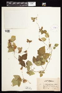 Amphicarpaea bracteata (L.) Fernald 422689[1074436]Lakela, Olga 78931948-09-26 United States, Minnesota, Saint Louis, Praririe Lake, SW corner St. Louis Co;;050N;20W;, 46.809279 -92.8706753 |
MIN:Plants | 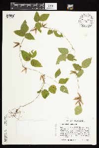 Amphicarpaea bracteata (L.) Fernald 428300[1074615]Haferman, J. 1811995-09-30 United States, Minnesota, Scott, Scott Co. T115N R22W S36 SW of SW. Approx. 0.1 mi N-NE of intersection of State Hwy.13 and Co. Road 44 on N side of high Scott Co. T115N R22W S36 SW of SW. Approx. 0.1 mi N-NE of intersection of State Hwy.13 and Co. Road 44 on N side of highway.. 115N 22W 36, 44.7245862 -93.4090306 |
MIN:Plants | 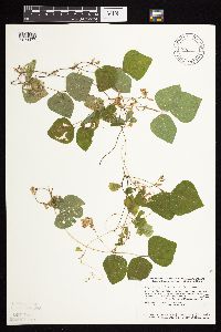 Amphicarpaea bracteata (L.) Fernald 428345[1074477]Smith, Welby 139081987-08-30 United States, Minnesota, Sherburne, Sherburne National Wildlife Refuge. Sherburne Co. Sherburne National Wildlife Refuge, about 4 mi N-NW of Orrock, along the Blue Hill Trail; SW1/4 NW1/4 sec.28, T35N R27W. 035N 27W 28, 45.4972229 -93.7180557 |
MIN:Plants | 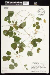 Amphicarpaea bracteata (L.) Fernald 428349[1074476]Smith, Welby 139211987-09-01 United States, Minnesota, Scott, Murphy-Hanrahan County Park Reserve. Scott Co. Murphy-Hanrahan Regional Park, on the S side of Hanrahan Lake, about 2 mi W of Burnsville; SW1/4 NW1/4 sec.34, T115N R21W. 115N 21W 34, 44.7277794 -93.3363876 |
MIN:Plants | 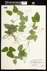 Amphicarpaea bracteata (L.) Fernald 429442[1074533]Smith, Welby 192421991-07-08 United States, Minnesota, Koochiching, Franz Jevne State Park. Koochiching County ... Franz Jevne State Park, in the Rainy River Valley, about 2 miles northeast of Birchdale ... T 160N R 27W SW1/4 of SW1/4 of sec 26. 160N 27W 26, 48.6427765 -94.078331 |
MIN:Plants | 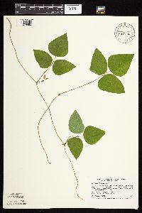 Amphicarpaea bracteata (L.) Fernald 429821[1074485]Smith, Welby 193621991-09-10 United States, Minnesota, Koochiching, Grand Mound Historical Site. Koochiching County ... Grand Mound Historic Site, about 18 miles west of International Falls. In the Rainy River Valley ... T 70N R 26W NW1/4 of NE1/4 of Sec 32.. 070N 26W 32, 48.5158348 -93.7083359 |
MIN:Plants | 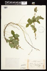 Amphicarpaea bracteata (L.) Fernald 442738[1074591]Lakela, Olga 131991951-07-13 United States, Minnesota, Saint Louis, Wooded trailside to Bald Rock Lake, Rainy Lake;Voyageurs National Park;N;;, 48.579942 -93.079797 |
MIN:Plants | 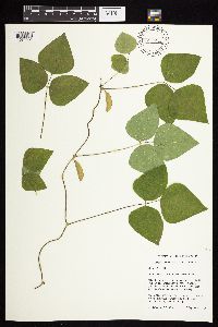 Amphicarpaea bracteata (L.) Fernald 444096[1074481]Husveth, J. 95-37371995-09-12 United States, Minnesota, Winona, Winona Co. T107N R10W SW1/4 of the SE1/4 of S6; North Fork of the Whitewater River.;Whitewater Wildlife Management Area;107N;10W;6, 44.0995403 -92.0694287 |
MIN:Plants | 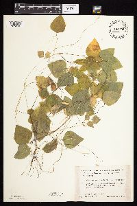 Amphicarpaea bracteata (L.) Fernald 446799[1074580]Moore, John; Huff, N. 191901946-08-31 United States, Minnesota, Morrison, 1 mi. S of Snow School House, Parker Twp.;;N;;, 46.060035 -94.561584 |
MIN:Plants | 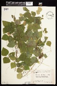 Amphicarpaea bracteata (L.) Fernald 448330[1074589]Moore, John; Huff, N. 188771946-08-01 United States, Minnesota, Benton, Benton Co. 2 mi SW of Foley;;036N;29W;, 45.642288 -93.943122 |
MIN:Plants | 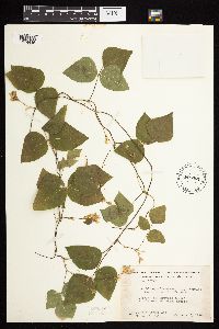 Amphicarpaea bracteata (L.) Fernald 449061[1074446]Moore, John; Hall, Robert 167901944-08-03 United States, Minnesota, Itasca, 1 mi W of Grand Rapids;;N;;, 47.238801 -93.57591 |
MIN:Plants |  Amphicarpaea bracteata (L.) Fernald 458069[1074568]Garrison, O. 1421879-08-16 United States, Minnesota, Stearns, near St. Cloud;;N;;, 45.5582 -94.181183 |
MIN:Plants |  Amphicarpaea bracteata (L.) Fernald 462969[1074593]Lakela, Olga 144141952-06-23 United States, Minnesota, Saint Louis, Hammer Creek, above the beaver dam, off Namakan Lake, 3 mi. from the narrows.;Voyageurs National Park;N;;, 48.504571 -92.636188 |
MIN:Plants |  Amphicarpaea bracteata (L.) Fernald 491720[1074595]Lakela, Olga 169851953-09-03 United States, Minnesota, Saint Louis, St. Louis County...Trout Lake portage from Vermilion Lake;Boundary Waters Canoe Area Wilderness / Superior National Forest;063N;16W;24, 47.9243525 -92.3193738 |
MIN:Plants |  Amphicarpaea bracteata (L.) Fernald 491794[1074575]Lakela, Olga 165521953-08-04 United States, Minnesota, Saint Louis, Banks of stream at Coone Lake;;N;;, 47.273459 -93.046287 |
MIN:Plants |  Amphicarpaea bracteata (L.) Fernald 491918[1074443]Lakela, Olga 168931953-08-25 United States, Minnesota, Saint Louis, White Face River on Hwy No. 5;;N;;, 47.036712 -92.742424 |
MIN:Plants |  Amphicarpaea bracteata (L.) Fernald 494352[1074572]Huff, N. s.n.1941-08-30 United States, Minnesota, Houston, Houston;;N;;, 43.761316 -91.571223 |
MIN:Plants |  Amphicarpaea bracteata (L.) Fernald 500031[1074600]Rustad, Orwin 111946-06-10 United States, Minnesota, Rice, Faribault;;N;;, 44.29865 -93.276723 |
MIN:Plants |  Amphicarpaea bracteata (L.) Fernald 507103[1074539]Moore, John 207621950-09-11 United States, Minnesota, Big Stone, 1 1/2 mi SE of Ortonville;;N;;, 45.272174 -96.405089 |
MIN:Plants | 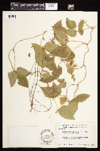 Amphicarpaea bracteata (L.) Fernald 507108[1074540]Moore, John 207901950-09-12 United States, Minnesota, Stevens, 4 mi W of Morris;;N;;, 45.586042 -95.996701 |
MIN:Plants | 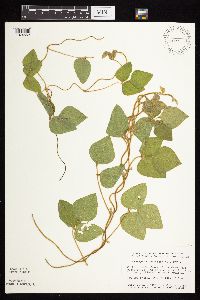 Amphicarpaea bracteata (L.) Fernald 508459[1074562]Smith, Welby 144231988-07-01 United States, Minnesota, Nobles, Nobles Co. On the right-of-way fo the C&NW railroad, about 4 mi W of Worthington; NE1/4 SW1/4 sec.25, T103N R41W;;102N;41W;25, 43.609293 -95.7038647 |
MIN:Plants | 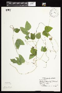 Amphicarpaea bracteata (L.) Fernald 515641[1074530]Smith, Welby 179681990-09-10 United States, Minnesota, Marshall, Thief Lake Wildlife Management Area. Marshall County ... Thief Lake State Wildlife Management Area, about 17.5 miles north of Grygla ... T 158N R 39W NW1/4 of NW1/4 of Sec 31. 158N 39W 31, 48.4633331 -95.7277756 |
MIN:Plants | 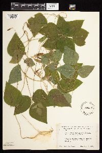 Amphicarpaea bracteata (L.) Fernald 526217[1074528]Moore, John 212331951-08-07 United States, Minnesota, Traverse, 2 mi SW of Wheaton;;N;;, 45.783925 -96.528607 |
MIN:Plants |  Amphicarpaea bracteata (L.) Fernald 532933[1074495]Lakela, Olga 202021956-07-01 United States, Minnesota, Saint Louis, Little Fork River near the shore, Hwy No. 5 at the bridge;;N;;, 47.8167 -92.45 |
MIN:Plants |  Amphicarpaea bracteata (L.) Fernald 550096[1074547]Moore, John; et al. 223251954-09-23 United States, Minnesota, Lincoln, Lincoln County...1 mi W of Lake Benton;;198N;45W;, 44.296511 -96.280831 |
MIN:Plants |  Amphicarpaea bracteata (L.) Fernald 550143[1074542]Moore, John 220171954-09-14 United States, Minnesota, Sherburne, along SE shore of Lake Ann, 5 1/2 mi SW of Zimmerman;;N;;, 45.421503 -93.692978 |
MIN:Plants |  Amphicarpaea bracteata (L.) Fernald 550302[1074490]Cotter, Shirley 6531948-08-06 United States, Minnesota, Clearwater, roadside to Bear Paw Point, Itasca Pk.;Itasca State Park;143N;36W;11, 47.2175215 -95.2014955 |
MIN:Plants |  Amphicarpaea bracteata (L.) Fernald 553774[1074474]Moore, John; et al. 223851954-09-23 United States, Minnesota, Pipestone, Pipestone County...Along Pipestone Creek, Pipestone National Monument, Pipestone.;Pipestone National Monument;106N;46W;01, 44.0158476 -96.3176691 |
MIN:Plants |  Amphicarpaea bracteata (L.) Fernald 553886[1074472]Moore, John 228061956-06-09 United States, Minnesota, Clay, Along the Red River, in wooded area 8 1/2 mi. S of Moorhead.;;N;;, 46.756225 -96.770473 |
MIN:Plants |  Amphicarpaea bracteata (L.) Fernald 554630[1074489]Moore, John 230471956-09-15 United States, Minnesota, Clay, along the river at Ulen;;N;;, 47.078675 -96.258177 |
MIN:Plants |  Amphicarpaea bracteata (L.) Fernald 558187[1074582]Moore, John 238581958-06-12 United States, Minnesota, Kittson, Along the Red River 10 mi. W of Hallock.;;N;;, 48.774671 -97.144066 |
Google Map
Google Maps is a web mapping service provided by Google that features a map that users can pan (by dragging the mouse) and zoom (by using the mouse wheel). Collection points are displayed as colored markers that when clicked on, displays the full information for that collection. When multiple species are queried (separated by semi-colons), different colored markers denote each individual species.