University of Minnesota
http://www.umn.edu/
612-625-5000
http://www.umn.edu/
612-625-5000
Minnesota Biodiversity Atlas
Bell Museum
Dataset: MIN-Plants
Taxa: Antidesma
Search Criteria: excluding cultivated/captive occurrences
1
Page 1, records 1-14 of 14
Bell Museum plants | |
 MIN:Plants | Antidesma NULL 935506[]Takeuchi, W.; Ama, D. 24243-B2008-07-21 Papua New Guinea, Southern Highlands Province; Strickland drainage, Umge Fly Camp. Mossy montane forest on limestone karst.., -5.3040833 142.5117333, 1440m |
MIN:Plants | 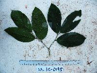 Antidesma excavatum var. indutum (Airy Shaw) Petra Hoffm. 923672[]Whitfeld, T.J.S. SA3C01952008-07-14 Papua New Guinea, Madang, Wanang Village, -5.238167 145.170983, 73m |
MIN:Plants | 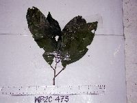 Antidesma excavatum Miq. 915180[]Weiblen, G.D. & Binatang Research Center WP2C04732006-06-07 Papua New Guinea, Madang, Wanang Village, -5.2373 145.177183, 115m |
MIN:Plants | 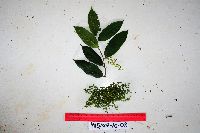 Antidesma contractum J.J.Sm. 923011[]Ctvrtecka, R. 25972008-10-07 Papua New Guinea, Madang, Mis Village, -5.15 145.783, 10m |
MIN:Plants | 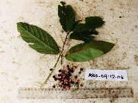 Antidesma excavatum var. indutum (Airy Shaw) Petra Hoffm. 923012[]Ctvrtecka, R. 35862008-12-04 Papua New Guinea, Madang, Wanang Village, -5.23088 145.182, 115m |
MIN:Plants | 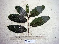 Antidesma excavatum Miq. 915164[]Weiblen, G.D. & Binatang Research Center WP4A09652007-08-21 Papua New Guinea, Madang, Wanang Village, -5.2373 145.177183, 115m |
MIN:Plants | Antidesma excavatum var. indutum (Airy Shaw) Petra Hoffm. 896662[]Weiblen, G.D. TP3451996-07-31 Papua New Guinea, Simbu, O-Pio 1 ha plot, block 14, Crater Mountain Wildlife Management Area, -6.788611 145.036667, 550m |
MIN:Plants | 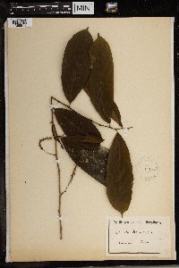 147507[1369511]Preuss 1321 Cameroon |
MIN:Plants | 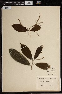 147508[1369512]Preuss 1321 Cameroon |
MIN:Plants | 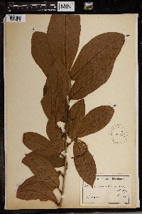 Antidesma laciniatum Müll. Arg. 147512[1369513]Preuss 1104 Cameroon |
MIN:Plants | 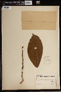 Antidesma laciniatum Müll. Arg. 147513[1369514]Reuss 1104 Cameroon |
MIN:Plants | 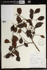 491305[1369515]Fidy Ratovoson 1862000-05-30 Madagascar, Parc National de Zahamena. Andranomalaza, Ambonin' Antoby, -17.640278 48.645278 |
MIN:Plants | 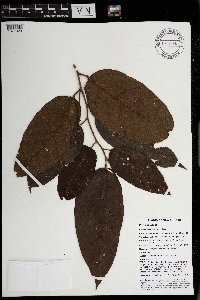 Antidesma contractum J.J.Sm. 969740[1371329]Weiblen, G. D. & Binatang Research Center NP4B02912014-05-17 Papua New Guinea, Madang, Numba, -5.7222 145.2714, 1200m |
MIN:Plants | 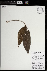 Antidesma excavatum Miq. 969743[1371326]Weiblen, G. D. & Binatang Research Center NP4B03082014-05-15 Papua New Guinea, Madang, Numba, -5.7222 145.2714, 1200m |
1
Page 1, records 1-14 of 14
Google Map
Google Maps is a web mapping service provided by Google that features a map that users can pan (by dragging the mouse) and zoom (by using the mouse wheel). Collection points are displayed as colored markers that when clicked on, displays the full information for that collection. When multiple species are queried (separated by semi-colons), different colored markers denote each individual species.