University of Minnesota
http://www.umn.edu/
612-625-5000
http://www.umn.edu/
612-625-5000
Minnesota Biodiversity Atlas
Bell Museum
Dataset: MIN-Plants
Taxa: Aporosa
Search Criteria: excluding cultivated/captive occurrences
1
Page 1, records 1-9 of 9
Bell Museum plants | |
 MIN:Plants |  Aporosa papuana Pax & Hoffm. 921389[]Whitfeld, T.J.S. PB5D03302008-08-29 Papua New Guinea, Madang, Wanang Village, -5.226533 145.085317, 130m |
MIN:Plants | 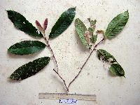 Aporosa papuana Pax & Hoffm. 915179[]Weiblen, G.D. & Binatang Research Center WP5E12682007-04-25 Papua New Guinea, Madang, Wanang Village, -5.2373 145.177183, 115m |
MIN:Plants | 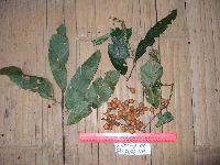 Aporosa papuana Pax & Hoffm. 922112[]Ctvrtecka, R. 23832008-09-25 Papua New Guinea, Madang, Ohu Village, -5.21667 145.683, 100m |
MIN:Plants | 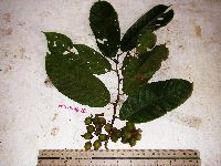 Aporosa papuana Pax & Hoffm. 923209[]Ctvrtecka, R. 10852008-06-11 Papua New Guinea, Madang, Wanang Village, -5.23088 145.182, 115m |
MIN:Plants |  488891[1351274]Weiblen, G.D. GW16982003-01-22 Papua New Guinea, Madang, Wanang village, -5.25 145.266667, 115m |
MIN:Plants | 488891[]Weiblen, G.D. GW16982003-01-22 Papua New Guinea, Madang, Wanang village, -5.25 145.266667, 115m |
MIN:Plants | 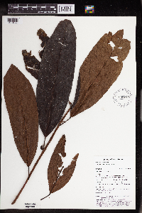 896740[1351290]Weiblen, G.D. TP0061996-07-31 Papua New Guinea, Simbu, O-Pio 1 ha plot, block 1, Crater Mountain Wildlife Management Area, -6.788611 145.036667, 550m |
MIN:Plants | 896740[]Weiblen, G.D. TP0061996-07-31 Papua New Guinea, Simbu, O-Pio 1 ha plot, block 1, Crater Mountain Wildlife Management Area, -6.788611 145.036667, 550m |
MIN:Plants | 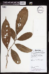 Aporosa selangorica Pax & K.Hoffm. 921482[1351291] Malaysia |
1
Page 1, records 1-9 of 9
Google Map
Google Maps is a web mapping service provided by Google that features a map that users can pan (by dragging the mouse) and zoom (by using the mouse wheel). Collection points are displayed as colored markers that when clicked on, displays the full information for that collection. When multiple species are queried (separated by semi-colons), different colored markers denote each individual species.