University of Minnesota
http://www.umn.edu/
612-625-5000
http://www.umn.edu/
612-625-5000
Minnesota Biodiversity Atlas
Bell Museum
Dataset: MIN-Plants
Taxa: Bulbostylis
Search Criteria: excluding cultivated/captive occurrences
1
Page 1, records 1-35 of 35
Bell Museum plants | |
 MIN:Plants |  Bulbostylis capillaris (L.) C.B. Clarke 473224[1006500]Lee, Michael MDL18901997-07-31 United States, Minnesota, Stearns, Stearns County ... Along the Sauk River in the city of Waite Park ... T124N R28W NE1/4 of NW1/4 of NW1/4 Sec. 17;;124N;28W;17, 45.551658 -94.229265 |
MIN:Plants |  Bulbostylis capillaris (L.) C.B. Clarke 480877[1006498]Harris, Fred 991651999-07-16 United States, Minnesota, Scott, Minnesota Valley National Wildlife Refuge. Scott County ... Louisville Swamp Unit, Minnesota Valley National Wildlife Refuge ... T115N R23W, SE1/4 of NE1/4 of NW1/4 Sec. 32. 115N 23W 32, 44.725535 -93.612653 |
MIN:Plants |  Bulbostylis capillaris (L.) C.B. Clarke 473357[1006499]Lee, Michael MDL19681997-09-23 United States, Minnesota, Sherburne, Sherburne County ... on the southeast side of St. Cloud ... T35N R30W NE1/4 of SW1/4 of SW1/4 Sec. 17;;035N;30W;17, 45.523054 -94.099361 |
MIN:Plants |  Bulbostylis capillaris (L.) C.B. Clarke 359547[1006513]Mason, Herbert 118581938-07-06 United States, California, Tuolumne, Yosemite National Park ... between Swamp Lake and Miguel Meadow, Tuolumne County.;Yosemite National Park, 1646m |
MIN:Plants |  Bulbostylis capillaris (L.) C.B. Clarke 359548[1006514]Mason, Herbert 119461938-07-13 United States, California, Mariposa, Yosemite National Park ... base of El Capitan, Yosemite Valley, Mariposa County;Yosemite National Park, 1227m |
MIN:Plants |  Bulbostylis capillaris (L.) C.B. Clarke 541334[1285195]Wheeler, Gerald 175401997-09-01 United States, Minnesota, Renville, Renville County ... W side of Morton, Morton Outcrop complex ... SW1/4 NW1/4 NW1/4 Sec. 31 T113N R34W (Birch Cooley 31);;113N;34W;31, 44.543269 -94.990327 |
MIN:Plants |  Bulbostylis capillaris (L.) C.B. Clarke 480878[1006494]Harris, Fred 991211999-06-30 United States, Minnesota, Redwood, Redwood County ... Glacial River Warren valley ... T113N R36W, NE1/4 of NE1/4 of NW1/4 Sec. 10;;113N;36W;10, 44.606918 -95.167652 |
MIN:Plants |  Bulbostylis capillaris (L.) C.B. Clarke 233578[1006511]Congdon, J. s.n.1890-08-15 United States, California, Mariposa, Yosemite Valley, Mariposa County;Yosemite National Park |
MIN:Plants | 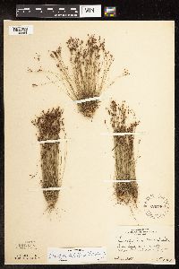 Bulbostylis capillaris (L.) C.B. Clarke 220790[1102284]Rosendahl, C. 54781927-10-03 United States, Minnesota, Anoka, west of Moore Lake, Anoka County;;030N;24W;, 45.080985 -93.255535 |
MIN:Plants | 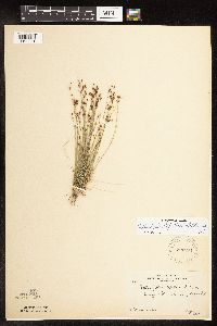 Bulbostylis capillaris (L.) C.B. Clarke 220791[1102281]Rosendahl, C. 48881925-08-04 United States, Minnesota, Anoka, Moore Lake;;030N;24W;, 45.07639 -93.2475 |
MIN:Plants | 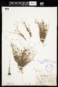 Bulbostylis capillaris (L.) C.B. Clarke 352628[1006510]Moyle, J.; et al. 26711934-05-08 United States, Minnesota, Rouche Mountain; 2 mi. north of St. Cloud.;;;;, 45.57896 -94.15 |
MIN:Plants | 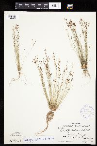 Bulbostylis capillaris (L.) C.B. Clarke 367397[1006503]Moore, John; et al. 102651938-08-07 United States, Minnesota, Anoka, west side of Moore Lake, Anoka County;;030N;24W;, 45.080985 -93.255535 |
MIN:Plants |  Bulbostylis capillaris (L.) C.B. Clarke 370711[1006504]Moore, John; et al. 137241940-10-01 United States, Minnesota, Isanti, north shore of Spectacle Lake; SE1/4, Sec. 26, Wyanette Township, Isanti County;Spectacle Lake Wildlife Management Area;036N;25W;26, 45.579704 -93.420007 |
MIN:Plants |  Bulbostylis capillaris (L.) C.B. Clarke 558368[1006505]Moore, John; et al. 235151957-09-17 United States, Minnesota, Anoka, Anoka County ... along the west shore of Fish Lake, Cedar Creek Forest.;Cedar Creek National History Area;034N;23W;, 45.428063 -93.203997 |
MIN:Plants |  Bulbostylis capillaris (L.) C.B. Clarke 568719[1006506]Moore, John 249101959-09-29 United States, Minnesota, Blue Earth, Blue Earth County ... 2 miles west of Mankato.;;;;, 44.152457 -94.068583 |
MIN:Plants |  Bulbostylis capillaris (L.) C.B. Clarke 676387[1006502]Ownbey, Gerald 55011976-09-03 United States, Minnesota, Washington, Washington County ... T28N, R20W, SW1/4 SW1/4, Sec. 14. 0.5 mi. N of Afton Village, just N of its confluence with Lake St. Croix.. 028N 20W 14, 44.912738 -92.771768 |
MIN:Plants | 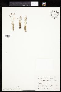 Bulbostylis capillaris (L.) C.B. Clarke 743628[1006507]Nietering, E. 1611982-07-12 United States, Minnesota, Renville, Renville County ... NW 1/4 NW 1/4 Sec. 31, R 34W, T 113N, Morton Outcrop, Morton;;113N;34W;31, 44.543269 -94.990327 |
MIN:Plants | 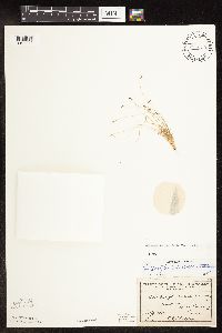 Bulbostylis capillaris (L.) C.B. Clarke 84173[1102279]Sheldon, Edmund s.n.1891-07-00 United States, Minnesota, Nicollet, Redstone [pioneer village across river from], near New Ulm;;110N;29W;35, 44.314516 -94.392468 |
MIN:Plants | 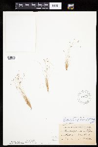 Bulbostylis capillaris (L.) C.B. Clarke 84175[1006508]Sheldon, Edmund S12011891-07-00 United States, Minnesota, Nicollet, Redstone [pioneer village across river from], near New Ulm;;110N;29W;35, 44.314516 -94.392468 |
MIN:Plants | 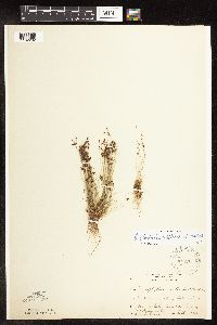 Bulbostylis capillaris (L.) C.B. Clarke 84176[1102282]Rosendahl, C.; et al. s.n.1917-09-00 United States, Minnesota, Anoka, Moore Lake;;030N;24W;23, 45.071682 -93.257896 |
MIN:Plants |  Bulbostylis capillaris (L.) C.B. Clarke 84177[1006509]Rosendahl, C.; Butters, F. 36291918-07-17 United States, Minnesota, Anoka, Moore Lake;;030N;24W;23, 45.071682 -93.257896 |
MIN:Plants |  Bulbostylis capillaris (L.) C.B. Clarke 84178[1102283]Rosendahl, C.; et al. s.n.1917-09-09 United States, Minnesota, Anoka, Moore Lake, Anoka County;;030N;24W;, 45.080985 -93.255535 |
MIN:Plants |  Bulbostylis capillaris (L.) C.B. Clarke 84179[1102280]Sheldon, Edmund s.n.1891-07-00 United States, Minnesota, Brown, New Ulm.;;110N;30W;, 44.326359 -94.431802 |
MIN:Plants |  Bulbostylis capillaris (L.) C.B. Clarke 84180[1006501]Sheldon, Edmund S. 12011891-07-00 United States, Minnesota, Brown, New Ulm.;;110N;30W;, 44.326359 -94.431802 |
MIN:Plants |  Bulbostylis capillaris (L.) C.B. Clarke 456472[1006496]Lee, Michael MDL24241998-08-27 United States, Minnesota, Benton, Benton County ... "Peace Rock" along the Mississippi River just south of Watab ... T37N R31W SE1/4 of NW1/4 Sec. 27;;037N;31W;27, 45.668416 -94.184846 |
MIN:Plants |  Bulbostylis capillaris (L.) C.B. Clarke 430215[1006497]Lee, Michael MDL19071997-08-11 United States, Minnesota, Stearns, On the south side of Waite Park. NE1/4 of SW1/4 Sec.;Quarry Park Nature Preserve & Scientific Natural Area;124N;28W;20, 45.537166 -94.229488 |
MIN:Plants |  Bulbostylis capillaris (L.) C.B. Clarke 84171[1006515]Steele, E.; et al. 1271901-08-22 United States, Virginia, Page, Stony Man Mountain and vicinity in the Blue Ridge, near Luray;Shenandoah National Park, 1097m |
MIN:Plants |  Bulbostylis capillaris (L.) C.B. Clarke 914272[1006493]Krych, S. SAK09-0072009-08-27 United States, Minnesota, Scott, Minnesota Valley National Wildlife Refuge. Sand Creek Township, Scott County...Minnesota Valley National Wildlife Refuge...approximately 50 feet west of railroad tracks...T114N R23W NE/NW SEC 4. 114N 23W 4, 44.697243 -93.611163 |
MIN:Plants |  Bulbostylis capillaris (L.) C.B. Clarke 508907[1006495]Wheeler, Gerald 177001997-09-05 United States, Minnesota, Renville, Renville County ... W side of Morton, Morton Outcrop complex ... SW1/4 NW1/4 NW1/4 Sec. 31 T113N R34W (Birch Cooley31);;113N;34W;31, 44.543269 -94.990327 |
MIN:Plants |  Bulbostylis capillaris (L.) C.B. Clarke 233583[1006512]Congdon, J. s.n.1885-07-02 United States, California, Mariposa, Yosemite Valley, Mariposa County;Yosemite National Park |
MIN:Plants |  Bulbostylis capillaris (L.) C.B. Clarke 953865[1294901]Bennett, H. R. 7079 United States, Indiana, Porter, along South Shore line. Dune Acres. [Indiana Dunes National Lakeshore ?], 41.663093 -87.032128 |
MIN:Plants |  Bulbostylis capillaris (L.) C.B. Clarke 953866[1294900]Mowery, May s.n.1928-08-28 United States, Massachusetts, Barnstable, Woods Hole and vicinity |
MIN:Plants | 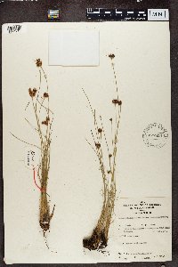 577859[1374710]Mat. Alcool II.8281959-10-10 Rwanda, Region du Mutara, enviorn de Mimuli, reserve IRSAC, colline Karukawanzi |
MIN:Plants | 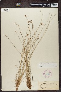 267129[1374711]T. Dawodu 16 Nigeria |
MIN:Plants | 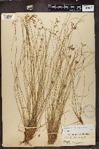 221614[1374712]Dawodu, T. 161971-00-00 Nigeria, Lagos |
1
Page 1, records 1-35 of 35
Google Map
Google Maps is a web mapping service provided by Google that features a map that users can pan (by dragging the mouse) and zoom (by using the mouse wheel). Collection points are displayed as colored markers that when clicked on, displays the full information for that collection. When multiple species are queried (separated by semi-colons), different colored markers denote each individual species.