University of Minnesota
http://www.umn.edu/
612-625-5000
http://www.umn.edu/
612-625-5000
Minnesota Biodiversity Atlas
Bell Museum
Dataset: MIN-Plants
Taxa: Calophyllum
Search Criteria: excluding cultivated/captive occurrences
1
Page 1, records 1-12 of 12
Bell Museum plants | |
 MIN:Plants | 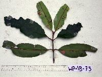 Calophyllum soulattri Burm.f. 912904[]Weiblen, G.D. & Binatang Research Center WP1B00752006-03-16 Papua New Guinea, Madang, Wanang Village, -5.2373 145.177183, 115m |
MIN:Plants | 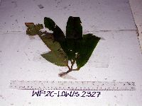 Calophyllum soulattri Burm.f. 912895[]Weiblen, G.D. & Binatang Research Center WP2C23272006-06-05 Papua New Guinea, Madang, Wanang Village, -5.2373 145.177183, 115m |
MIN:Plants | 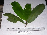 Calophyllum soulattri Burm.f. 912899[]Weiblen, G.D. & Binatang Research Center WP2D03772006-08-14 Papua New Guinea, Madang, Wanang Village, -5.2373 145.177183, 115m |
MIN:Plants | 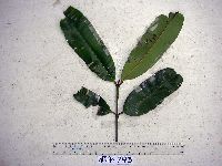 Calophyllum soulattri Burm.f. 912900[]Weiblen, G.D. & Binatang Research Center WP4D07932007-03-15 Papua New Guinea, Madang, Wanang Village, -5.2373 145.177183, 115m |
MIN:Plants | 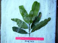 Calophyllum soulattri Burm.f. 912896[]Weiblen, G.D. & Binatang Research Center WP4E08222006-10-26 Papua New Guinea, Madang, Wanang Village, -5.2373 145.177183, 115m |
MIN:Plants | 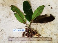 Calophyllum soulattri Burm.f. 923195[]Ctvrtecka, R. 35722008-12-03 Papua New Guinea, Madang, Wanang Village, -5.23088 145.182, 115m |
MIN:Plants | 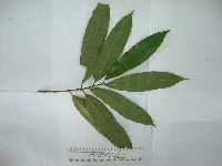 Calophyllum L. 903452[] GW23552005-03-28 Papua New Guinea, Madang, Morox village, near Yoro, Bogia, -4.266667 144.966667, 60m |
MIN:Plants | 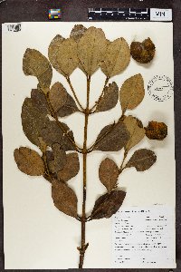 Calophyllum L. 488973[1370089]Sewall, B. J BJS1072002-03-11 Comoros, West Indian Ocean, Anjouan, Sangani, Mutsamudu River Watershed, Hapemba, -12.2 44.416667, 788m |
MIN:Plants | 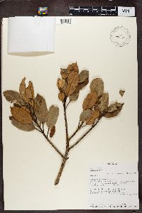 Calophyllum L. 492244[1370090]Beberonn Randriamampionona 4551993-06-12 Madagascar, Integrale reserve #11, Andohahela, Parcelle 1, Isaka Ivondro.; -24.666667 46.866667, -24.666667 46.866667, 100 - 500m |
MIN:Plants | 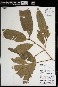 Calophyllum soulattri Burm.f. 969759[1371363]Weiblen, G. D. & Binatang Research Center NP1B00022014-03-17 Papua New Guinea, Madang, Numba, -5.7222 145.2714, 1200m |
MIN:Plants | 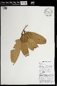 Calophyllum soulattri Burm.f. 969757[1371365]Weiblen, G. D. & Binatang Research Center NP1B00522014-06-12 Papua New Guinea, Madang, Numba, -5.7222 145.2714, 1200m |
MIN:Plants | 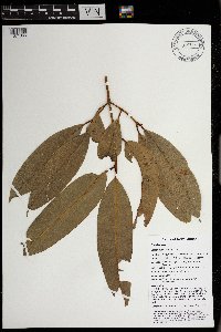 Calophyllum soulattri Burm.f. 969756[1371366]Weiblen, G. D. & Binatang Research Center NP1B00232014-03-18 Papua New Guinea, Madang, Numba, -5.7222 145.2714, 1200m |
1
Page 1, records 1-12 of 12
Google Map
Google Maps is a web mapping service provided by Google that features a map that users can pan (by dragging the mouse) and zoom (by using the mouse wheel). Collection points are displayed as colored markers that when clicked on, displays the full information for that collection. When multiple species are queried (separated by semi-colons), different colored markers denote each individual species.