University of Minnesota
http://www.umn.edu/
612-625-5000
http://www.umn.edu/
612-625-5000
Minnesota Biodiversity Atlas
Bell Museum
Dataset: MIN-Plants
Taxa: Castanea
Search Criteria: excluding cultivated/captive occurrences
1
Page 1, records 1-9 of 9
Bell Museum plants | |
 MIN:Plants | Castanea NULL 430192[]Anonymous s.n.1980-05-30 United States, Iowa, Des Moines, Des Moines Co. |
MIN:Plants | 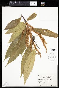 Castanea dentata (Marshall) Borkhausen 625258[1004644]Ahles, H. 757061972-07-15 United States, Massachusetts, Hampshire, Hampshire County ... railroad right-of-way, Hadley, at railroad corssing & Rt. 9;;;;, 42.34167 -72.58889 |
MIN:Plants | 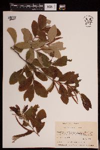 Castanea pumila (L.) Mill. 953274[1290822]Anderson, Loran C. 48711979-05-18 United States, Georgia, Decatur |
MIN:Plants | 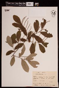 Castanea pumila (L.) Mill. 953273[1290823]Anderson, Loran C. 48211979-05-02 United States, Georgia, Decatur |
MIN:Plants | 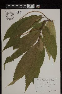 Castanea dentata (Marshall) Borkhausen 738754[1299176]Burnham, Charles United States, Minnesota, Carver |
MIN:Plants | 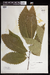 Castanea dentata (Marshall) Borkhausen 959624[1311976] 1924-08-00 United States, New York |
MIN:Plants | 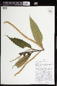 Castanea dentata (Marshall) Borkhausen 963459[1352010]Nee, M. 632042016-06-26 United States, Wisconsin, Sauk, 1.5km SSE of center of Spring Green; between Hwy. 23 and Old River Road; River Valley School Forest Spring Green Unit, 43.161389 -90.061389, 233m |
MIN:Plants | Castanea dentata (Marshall) Borkhausen []Timothy J. S. Whitfeld 32412022-06-16 United States, Minnesota, Washington, Crystal Spring Scientific and Natural Area, 0.4 miles northeast of the intersection of Scandia Trail North and Hwy 95, 45.258155 -92.764969, 271m |
MIN:Plants | Castanea dentata (Marshall) Borkhausen []Timothy J. S. Whitfeld 37262023-07-18 United States, Minnesota, Washington, Crystal Spring Scientific and Natural Area; 0.4 miles northeast of the intersection of Scandia Trail North and Hwy 95, 45.258155 -92.764969, 271m |
1
Page 1, records 1-9 of 9
Google Map
Google Maps is a web mapping service provided by Google that features a map that users can pan (by dragging the mouse) and zoom (by using the mouse wheel). Collection points are displayed as colored markers that when clicked on, displays the full information for that collection. When multiple species are queried (separated by semi-colons), different colored markers denote each individual species.