University of Minnesota
http://www.umn.edu/
612-625-5000
http://www.umn.edu/
612-625-5000
Minnesota Biodiversity Atlas
Bell Museum
Dataset: MIN-Plants
Taxa: Cyrtomium
Search Criteria: excluding cultivated/captive occurrences
1
Page 1, records 1-8 of 8
Bell Museum plants | |
 MIN:Plants | 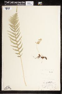 Cyrtomium falcatum (L. f.) C. Presl 53721[1321520]Conard, Henry 1071902-06-20 United States, Washington, Jefferson, Quiniault Valley;Olympic National Park;;;, 47.803236 -123.666112 |
MIN:Plants | 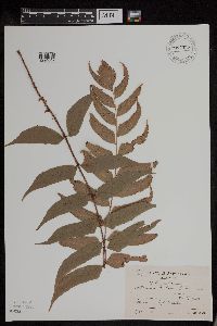 Cyrtomium fortunei J. Sm. 954335[1294649]Koyama, S. 147 Japan, Osaka Prefecture |
MIN:Plants | 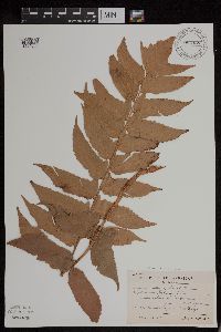 Cyrtomium fortunei var. clivicolum (Makino) Tagawa 954338[1294652]Koyama, S. 152 Japan, Hyogo Prefecture |
MIN:Plants | 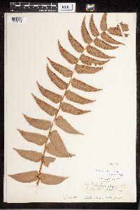 Cyrtomium C. Presl 52170[1321521]Stanford, Arthur W. 2571894-10-00 Japan, Kyoto |
MIN:Plants | 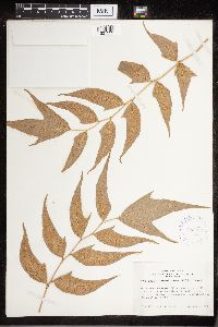 Cyrtomium caryotideum C.Presl 408904[1321523]Whitcomb, W.K. s1939-08-00 India, On road to cemetery falls, Mussoorie (hill station), Dehra Dun District. Himalaya Mts., 1829m |
MIN:Plants | 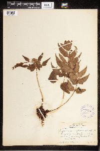 Cyrtomium caryotideum C.Presl 376130[1321524]Degener, O. 57091926-08-14 United States, Hawaii, Along road 17 miles from Kona toward Waimea |
MIN:Plants | 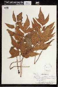 Cyrtomium caryotideum C.Presl 357773[1321525]Topping, D.L. 33551930-03-16 United States, Hawaii, Slopes of Puu Hapapa, Oahu, 21.4667 -158.1 |
MIN:Plants | 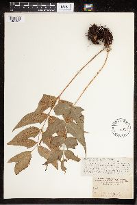 Cyrtomium caryotideum C.Presl 52083[1321526]Heller, A.A. 25441895-07-11 United States, Hawaii, Kauai, on the Hanapepe and Wahiawa Watershed, 21.972745 -159.543829 |
1
Page 1, records 1-8 of 8
Google Map
Google Maps is a web mapping service provided by Google that features a map that users can pan (by dragging the mouse) and zoom (by using the mouse wheel). Collection points are displayed as colored markers that when clicked on, displays the full information for that collection. When multiple species are queried (separated by semi-colons), different colored markers denote each individual species.