University of Minnesota
http://www.umn.edu/
612-625-5000
http://www.umn.edu/
612-625-5000
Minnesota Biodiversity Atlas
Bell Museum
Dataset: MIN-Plants
Taxa: Enemion
Search Criteria: excluding cultivated/captive occurrences
1
Page 1, records 1-95 of 95
Bell Museum plants | |
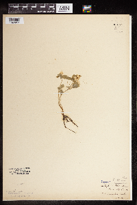
MIN:Plants | Enemion biternatum Rafinesque 476649[]Kaul, R. 67221990-05-01 United States, Minnesota, Steele, Steele Co.; along Straight River; Kaplan's Woods.;;107N;20W;, 44.05993 -93.237086 |
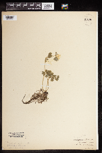
MIN:Plants | Enemion biternatum Rafinesque 476647[]Kaul, R.; et al. 51821986-05-09 United States, Minnesota, Steele, Steele County...along the Straight River, south edge of Owatonna.;;107N;20W;, 44.084579 -93.230139 |
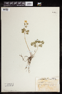
MIN:Plants | Enemion biternatum Rafinesque 920847[]Smith, Welby 222901993-06-03 United States, Minnesota, Sibley, Vale Wildlife Management Area. Sibley County ... Vale State Wildlife Management Area; in the valley of High Island Creek, about 2.5 miles southwest of its confluence with the Missesota River ... T113N R26W NE1/4 of SW1/4 of Sec 27. 113N 26W 27, 44.5625 -93.9427778 |
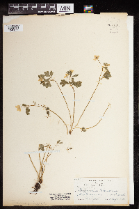
MIN:Plants | Enemion biternatum Rafinesque 454102[]Gellerman, Joanne 007 JLG1994-04-26 United States, Minnesota, Freeborn, Myre Big Island State Park. Myre Big Island State Park. Freeborn County; T: 102N R: 20W Sec: 19 Quarter Sec: NW; About 65 yards south of interpretive center by trail. 102N 20W 19, 43.624946 -93.289476 |
MIN:Plants | Enemion biternatum Rafinesque 919493[]Smith, Welby 220451993-05-07 United States, Minnesota, Nicollet, Seven Mile Creek County Park. Nicollet County...7-Mile Creek County Park, about 7 miles north of Mankato...7-mile Creek...T109N R27W NW1/4 of NE1/4 of Sec 11. 109N 27W 11, 44.2680556 -94.0344444 |
MIN:Plants | Enemion biternatum Rafinesque 492579[]Wheeler, Gerald 159951997-06-08 United States, Minnesota, Nicollet, Swan Lake Wildlife Management Area. Nicollet County ... Ca. 4 mi. SSW of Nicollet on Rte. 23; Swan Lake State WMA, North Star Unit ... NW1/4 NW1/4 NE1/4 Sec, 28 T109N R28W. 109N 28W 28, 44.217999 -94.200153 |
MIN:Plants | Enemion biternatum Rafinesque 499459[]McNaughton, Lynn 1002003-04-24 United States, Minnesota, Waseca, Maplewood Park: Waseca County ... NE1/4 of SW1/4 of Sect. 9, T107N, R22W.;Maplewood County Park;107N;22W;09, 44.087663 -93.476763 |
MIN:Plants | Enemion biternatum Rafinesque 498868[]Mortensen, Carol Estes; et al. LL1922B2003-06-00 United States, Minnesota, Cass, Chippewa National Forest / Leech Lake Indian Reservation. Leech Lake Reservation and Chippewa National Forest...Collected in Stony Point Campground on Leech Lake...T142N, R30W, NE10. 142N 30W 10, 47.13829 -94.45415 |
MIN:Plants | Enemion biternatum Rafinesque 112854[]Sandberg, John s.n.1891-05-00 United States, Minnesota, Hennepin, [no further data];;;;, 45 -93.47 |
MIN:Plants | Enemion biternatum Rafinesque 112855[]Butters, F.; et al. 31961916-05-05 United States, Minnesota, Goodhue, Cannon River Valley near Welch;Dorer Memorial Hardwood State Forest;;;, 44.585648 -92.557156 |
MIN:Plants | Enemion biternatum Rafinesque 112856[]Rosendahl, C. 20861919-05-17 United States, Minnesota, Snelling Reservation [old regional park spanning junction of Minnesota and Mississippi rivers];;028N;23W;, 44.90516 -93.16646 |
MIN:Plants | Enemion biternatum Rafinesque 112857[]Sheldon, Edmund s.n. United States, Minnesota, Ramsey, Ramsey Co.;;;;, 45.022812 -93.101184 |
MIN:Plants | Enemion biternatum Rafinesque 112858[]Moore, W. s.n.1907-05-18 United States, Minnesota, Ramsey, Groveland Park [St. Paul neighborhood between Highland and Summit aves.];;028N;23W;, 44.93059 -93.185623 |
MIN:Plants | Enemion biternatum Rafinesque 112859[]Hollinshead, C. 212000-05-05 United States, Minnesota, Ramsey, Groveland Park [St. Paul neighborhood between Highland and Summit aves.];;028N;23W;, 44.93059 -93.185623 |
MIN:Plants | Enemion biternatum Rafinesque 112860[]Sheldon, Edmund S1781891-06-00 United States, Minnesota, Blue Earth, Eagle Lake;;N;;, 44.189661 -93.896402 |
MIN:Plants | Enemion biternatum Rafinesque 112862[]Sandberg, John 431891-05-00 United States, Minnesota, Hennepin, Fort Snelling;Fort Snelling Military Reservation;N;;, 44.870583 -93.209602 |
MIN:Plants | Enemion biternatum Rafinesque 112863[]Sheldon, Edmund s.n.1895-04-00 United States, Minnesota, Ramsey, Ramsey Co.;;;;, 45.01456 -93.095004 |
MIN:Plants | Enemion biternatum Rafinesque 112864[]Kassube, J. s.n.1878-04-00 United States, Minnesota, Hennepin, Minneapolis;;N;;, 44.979965 -93.263836 |
MIN:Plants | Enemion biternatum Rafinesque 112865[]Thompson, R. s.n.1890-04-01 United States, Minnesota, Hennepin, near Shortline Bridge;;;, 44.956159 -93.212666 |
MIN:Plants | Enemion biternatum Rafinesque 112866[]Winchell, N. s.n.1876-05-24 United States, Minnesota, Hennepin, Nicollet Island;;N;;, 44.987465 -93.263558 |
MIN:Plants | Enemion biternatum Rafinesque 112867[]Ballard, A. AB211893-05-00 United States, Minnesota, Goodhue, Zumbrota;;N;;, 44.294132 -92.669081 |
MIN:Plants | Enemion biternatum Rafinesque 112868[]Holzinger, John s.n.1889-05-05 United States, Minnesota, Winona, Stockton;;;;, 44.027463 -91.769873 |
MIN:Plants | Enemion biternatum Rafinesque 112869[]Sandberg, John s.n.1886-05-00 United States, Minnesota, Goodhue, Red Wing;;113N;14W;, 44.55522 -92.49554 |
MIN:Plants | Enemion biternatum Rafinesque 112870[]Aiton, G. s.n.1891-05-00 United States, Minnesota, Hennepin, near Minneapolis;;N;;, 44.963488 -93.258331 |
MIN:Plants | Enemion biternatum Rafinesque 112871[]Sheldon, Edmund S1895-05-00 United States, Minnesota, Ramsey, Larson Island, Ramsey Co.;;;;, 45.018032 -93.092742 |
MIN:Plants | Enemion biternatum Rafinesque 112872[]Sandberg, John s.n.1891-05-00 United States, Minnesota, Hennepin, [no further data];;;;, 45 -93.47 |
MIN:Plants | Enemion biternatum Rafinesque 112873[]Sandberg, John s.n.1890-06-00 United States, Minnesota, Hennepin, [no further data];;;;, 45 -93.47 |
MIN:Plants | Enemion biternatum Rafinesque 208403[]Sandberg, John 2591891-06-00 United States, Minnesota, Hennepin, Minneapolis;;N;;, 44.979965 -93.263836 |
MIN:Plants | Enemion biternatum Rafinesque 262115[]Butters, F.; et al. 44111924-05-03 United States, Minnesota, Wabasha, Zumbro River, along Hwy No. 3;;;;, 44.249964 -91.954363 |
MIN:Plants | Enemion biternatum Rafinesque 264461[]Holzinger, John s.n.1894-04-00 United States, Minnesota, Winona, Bear Creek, Winona Co.;;N;;, 44.069785 -91.88447 |
MIN:Plants | Enemion biternatum Rafinesque 271232[]Miller, Lillian 241906-04-22 United States, Minnesota, Hennepin, Minnehaha Falls;Minnehaha Falls Park;028N;23W;17, 44.9118 -93.20343 |
MIN:Plants | Enemion biternatum Rafinesque 277749[]Roberts, Thomas s.n.1885-05-11 United States, Minnesota, Hennepin, Minneapolis;;N;;, 44.979965 -93.263836 |
MIN:Plants | Enemion biternatum Rafinesque 288098[]Sierney, D. s.n.1905-05-15 United States, Minnesota, Hennepin, Minneapolis;;N;;, 44.979965 -93.263836 |
MIN:Plants | Enemion biternatum Rafinesque 288209[]Cox, E. s.n.1905-05-10 United States, Minnesota, Hennepin, Mpls;;N;;, 45.001371 -93.266571 |
MIN:Plants | Enemion biternatum Rafinesque 288211[]Dickinson, G. s.n.1905-05-10 United States, Minnesota, Hennepin, Mpls;;N;;, 45.001371 -93.266571 |
MIN:Plants | Enemion biternatum Rafinesque 288234[]Anonymous 61914-05-10 United States, Minnesota, Ramsey, Groveland Park [St. Paul neighborhood between Highland and Summit aves.];;028N;23W;, 44.93059 -93.185623 |
MIN:Plants | Enemion biternatum Rafinesque 288388[]Cady, LeRoy s.n.1907-05-00 United States, Minnesota, Ramsey, St. Anthony Park [St. Paul neighborhood near U of M];;029N;23W;, 44.98382 -93.194806 |
MIN:Plants | Enemion biternatum Rafinesque 288447[]Johnson, Ruth s.n.1913-05-13 United States, Minnesota, Hennepin, Minnehaha Glen;;N;;, 44.914688 -93.209944 |
MIN:Plants | Enemion biternatum Rafinesque 288616[]Meck, Carlton s.n.1914-04-19 United States, Minnesota, Ramsey, Groveland Park [St. Paul neighborhood between Highland and Summit aves.];;028N;23W;, 44.93059 -93.185623 |
MIN:Plants | Enemion biternatum Rafinesque 336290[]Lehnert, W. s.n.1937-05-27 United States, Minnesota, Le Sueur, 2 mi E of Le Sueur;;N;;, 44.461346 -93.874659 |
MIN:Plants | Enemion biternatum Rafinesque 364457[]Beach, W. 331913-04-27 United States, Minnesota, Hennepin, Fort Snelling;Fort Snelling Military Reservation;N;;, 44.870583 -93.209602 |
MIN:Plants | Enemion biternatum Rafinesque 367195[]Koelnau, L. s.n.1938-05-14 United States, Minnesota, Washington, Washington Co.; N end Grey Cloud Island;;027N;22W;, 44.808304 -92.996579 |
MIN:Plants | Enemion biternatum Rafinesque 367623[]Moore, John; et al. 124271940-05-17 United States, Minnesota, Mower, Red Cedar River floodplain, SW1/4 S17, Lyle Twp. Mower Co.;;101N;18W;17, 43.547923 -93.013864 |
MIN:Plants | Enemion biternatum Rafinesque 369720[]Moore, John; et al. 139461941-05-11 United States, Minnesota, Fillmore, Fillmore Co.; Root River; 4 mi SW of Peterson;Dorer Memorial Hardwood State Forest;103N;09W;, 43.732298 -91.944067 |
MIN:Plants | Enemion biternatum Rafinesque 370330[]Moore, John; et al. 137491941-04-26 United States, Minnesota, Washington, North Grey Cloud Island, Washington County;;027N;22W;00, 44.804651 -92.998295 |
MIN:Plants | Enemion biternatum Rafinesque 374019[]Linnaean Club, U of M, 401939-05-21 United States, Minnesota, Rice, Nerstrand Woods. Rice Co.;Nerstrand Woods State Park;110N;19W;, 44.341172 -93.111247 |
MIN:Plants | Enemion biternatum Rafinesque 436668[]Smith, Welby 152231989-05-31 United States, Minnesota, Freeborn, Myre Big Island State Park. Freeborn County ... Helmer Myre State Park, about 2 miles southeast of Albert Lea. On 'Big Island' in Albert Lea Lake ... SW1/4 NW1/4 section 19, T 102N R 20W. 102N 20W 19, 43.625 -93.2874985 |
MIN:Plants | Enemion biternatum Rafinesque 440818[]Myhre, K. 36081993-05-19 United States, Minnesota, Pine, Pine Co. Located 1/2 mi NW of the Sandrock Cliff Campgroudn; T38N R19W SW1/4 of NW1/4 of Sec 7;Chengwatana State Forest;038N;19W;7, 45.799083 -92.770385 |
MIN:Plants | Enemion biternatum Rafinesque 440851[]Cholewa, A. 24791996-06-05 United States, Minnesota, Anoka, Anoka Co. Rice Creek Chain of Lakes Co. Park, Wargo Nature Center, approx. 1.25 mi N from Centerville, T31N R22W Sec 16;Rice Creek Chain of Lakes County Park;031N;22W;16, 45.174744 -93.091606 |
MIN:Plants | Enemion biternatum Rafinesque 442026[]Moore, John; Huff, N. 184371946-04-17 United States, Minnesota, Goodhue, 1 1/2 mi SW of Kenyon;;N;;, 44.256823 -93.006938 |
MIN:Plants | Enemion biternatum Rafinesque 447170[]Wheeler, Gerald 160591997-06-09 United States, Minnesota, Brown, Brown County...Ca. 1.2 mi. NW of Rte. 13, NW of New Ulm...1/2 SW1/4 NW1/4 Sec. 12 T110N R31W (Milford 12);;110N;31W;12, 44.349884 -94.50985 |
MIN:Plants | Enemion biternatum Rafinesque 447552[1312665]Lee, Michael MDL1041993-05-11 United States, Minnesota, Dakota, Dakota Co.; Hastings SNA; T 115N R 17W NW1/4 of NW1/4 of Sec 35;Hastings Scientific Natural Area;115N;17W;35, 44.729042 -92.830227 |
MIN:Plants | Enemion biternatum Rafinesque 515751[]Myhre, K. 34861993-04-26 United States, Minnesota, Pine, Pine Co.; located 3 miles west of the St. Croix River; small ravine; T 38N R 20W SE1/4 of SW1/4 of sEc 16;;038N;20W;16, 45.780703 -92.847557 |
MIN:Plants | Enemion biternatum Rafinesque 515808[]Husveth, J. 96-0051996-05-14 United States, Minnesota, Fillmore, Fillmore Co.; T104N R9W NW1/4 of the SE1/4 of S35; along Root River.;Dorer Memorial Hardwood State Forest;104N;09W;35, 43.766012 -91.87762 |
MIN:Plants | Enemion biternatum Rafinesque 552274[]Moyle, J. 42061946-05-02 United States, Minnesota, Winona, Whitewater River bottoms near Elba;;N;;, 44.058297 -92.058773 |
MIN:Plants | Enemion biternatum Rafinesque 566760[]Lang, H.; et al. 181878-04-19 United States, Minnesota, Ramsey, St. Paul;;;;, 44.960694 -93.076799 |
MIN:Plants | Enemion biternatum Rafinesque 574876[]Moore, John 244691959-05-08 United States, Minnesota, Blue Earth, 2 mi W of Mankato;;N;;, 44.16357 -94.03978 |
MIN:Plants | Enemion biternatum Rafinesque 576128[]Cotter, Shirley 18161951-05-30 United States, Minnesota, Rice, Nerstrand Woods, 5 mi E of Faribault;Nerstrand Woods State Park;110N;19W;, 44.294919 -93.167654 |
MIN:Plants | Enemion biternatum Rafinesque 585246[]Moore, John 258861962-05-08 United States, Minnesota, Houston, 1 mi E of Houston, along the Root River;;104N;06W;, 43.763298 -91.548421 |
MIN:Plants | Enemion biternatum Rafinesque 585378[]Moore, John 262771963-05-24 United States, Minnesota, Blue Earth, near top of N facing bluffs 1 1/2 mi W of Mankato;;N;;, 44.16233 -94.060637 |
MIN:Plants | Enemion biternatum Rafinesque 595432[]Vogel, A. 541965-05-16 United States, Minnesota, Brown, KC road, 3 mi N of New Ulm, Minn. R. valley;;N;;, 44.355912 -94.460529 |
MIN:Plants | Enemion biternatum Rafinesque 603688[]Moore, John; Moore, Marjorie 268531966-05-31 United States, Minnesota, Blue Earth, base of high bank, S shore of Lake Washington;;N;;, 44.243446 -93.872485 |
MIN:Plants | Enemion biternatum Rafinesque 607578[]Westkaemper, Remberta s.n.1967-05-00 United States, Minnesota, Stearns, Stearns Co. Richmond;;123N;30W;, 45.454111 -94.519989 |
MIN:Plants | Enemion biternatum Rafinesque 630426[]Johnson, Gary s.n.1973-05-23 United States, Minnesota, Mille Lacs, Izaty's Resort, S shore of Mille Lacs Lake;;N;;, 46.228105 -93.636954 |
MIN:Plants | Enemion biternatum Rafinesque 655188[]Gage Jr., Addison 91876-05-22 United States, Minnesota, Hennepin, Minneapolis;;N;;, 44.979965 -93.263836 |
MIN:Plants | Enemion biternatum Rafinesque 673590[]Borchard, Alma s.n.1941-04-27 United States, Minnesota, Goodhue, Kenyon;;N;;, 44.262012 -93.010543 |
MIN:Plants | Enemion biternatum Rafinesque 673610[]Borchard, Alma s.n.1938-05-07 United States, Minnesota, Rice, Nerstrand Woods;Nerstrand Woods State Park;110N;19W;, 44.341172 -93.111247 |
MIN:Plants | Enemion biternatum Rafinesque 686072[]Anonymous s.n.1900-04-29 United States, Minnesota, Stearns, St. Cloud;;N;;, 45.557693 -94.1603 |
MIN:Plants | Enemion biternatum Rafinesque 701518[]Johnson, Gary s.n.1976-04-17 United States, Minnesota, Mille Lacs, N and S of Co 27, SW1/4 S22 and NW1/4 S27, Eastside Twp;;043N;25W;, 46.097504 -93.606326 |
MIN:Plants | Enemion biternatum Rafinesque 721272[]Lustig, K. 2531979-05-16 United States, Minnesota, Sherburne, Clear Lake - Mississippi Scenic River and Recreational River SNA, 12 mi SE of St. Cloud, S14, 22, 23, T34N, R30W;Clear Lake Scientific Natural Area;034N;30W;, 45.428747 -94.042818 |
MIN:Plants | Enemion biternatum Rafinesque 727638[]Lustig, K. 3361979-05-31 United States, Minnesota, Sherburne, Mississippi River Islands Scientific Natural Area. Sherburne & Wright Cos. ...Mississippi Scenic and Recreational River Islands SNA: Mississippi RIver Islands between Monticello and Elk River, S2, 3, 4, T32N, R26, 27W; S7, 9, 18, T121N, R23, 24W. 032N 26W 3, 45.301026 -93.662501 |
MIN:Plants | Enemion biternatum Rafinesque 728513[]Lustig, K. 2411979-05-14 United States, Minnesota, Sherburne, Mississippi River Islands Scientific Natural Area. Sherburne & Wright Cos. ...Mississippi Scenic and Recreational River Islands SNA: Mississippi RIver Islands between Monticello and Elk River, S2, 3, 4, T32N, R26, 27W; S7, 9, 18, T121N, R23, 24W. 032N 26W 3, 45.301026 -93.662501 |
MIN:Plants | Enemion biternatum Rafinesque 729085[]Severson, M. 771980-05-15 United States, Minnesota, Chisago, Goose Creek Natural Area: 5 mi SE of Rush City, SE1/4 SE1/4 S12, T36N, R21W;Wild River State Park;036N;21W;12, 45.617688 -92.90171 |
MIN:Plants | Enemion biternatum Rafinesque 738649[]Galatowitsch, S. 151982-05-01 United States, Minnesota, Goodhue, Grace Nature Preserve: T109N, R18W parts of NW1/4 SW1/4 and SW1/4 SW1/4 of S8;Grace Nature Preserve, The Nature Conservancy;109N;18W;8, 44.262012 -93.010543 |
MIN:Plants | Enemion biternatum Rafinesque 738666[]Galatowitsch, S. 71982-04-26 United States, Minnesota, Rice, Rice Co. Trout Lily Preserve: T110N, R20W S1/2 NW1/4 SW1/4 S20; part of NE1/4 SE1/4 S19;Cannon River Trout Lily Scientific Natural Area;110N;20W;, 44.31962 -93.262308 |
MIN:Plants | Enemion biternatum Rafinesque 739446[]Sohmer, S. 110511977-05-06 United States, Minnesota, Rice, behind St. Mary's - St. James' campus in Faribault;;N;;, 44.294964 -93.268827 |
MIN:Plants | Enemion biternatum Rafinesque 770425[]Smith, Welby 76351983-05-05 United States, Minnesota, Mower, Lake Louise State Park, ca 1 mi NNW of Le Roy, banks of the Upper Iowa River, NW1/4 NE1/4 S28, T101N, R14W;Lake Louise State Park;101N;14W;28, 43.522099 -92.518958 |
MIN:Plants | Enemion biternatum Rafinesque 782451[]Bolin, Kathy KEB 191982-05-18 United States, Minnesota, Fillmore, Forestville State Park. Fillmore Co. T102N, R12W, S13 NW1/4 NW1/4 SE1/4;Forestville State Park;102N;12W;13, 43.637724 -92.219269 |
MIN:Plants | Enemion biternatum Rafinesque 787535[]Smith, Welby 100221985-04-20 United States, Minnesota, Olmsted, Olmsted Co. W side of the North Branch Root River; ca 2 mi S of Simpson; Se1/4 SE1/4 S17, T105N, R13W;Dorer Memorial Hardwood State Forest;105N;13W;17, 43.8844452 -92.4011078 |
MIN:Plants | Enemion biternatum Rafinesque 787710[]Smith, Welby 100281985-04-24 United States, Minnesota, Le Sueur, LeSueur Co. Richter Woods County Park, about 2 mi W of Montgomery, NW1/4 SE1/4 S8, T111N, R23W;Richter Woods County Park;111N;23W;8, 44.4333344 -93.6138916 |
MIN:Plants | Enemion biternatum Rafinesque 802850[]Smith, Welby 113761986-04-29 United States, Minnesota, Rice, Rice Co. ca 2 mi WNW of Nerstrand, SE1/4 SE1/4 S4, T110N, R19W;Prairie Creek Woods Scientific Natural Area;110N;19W;4, 44.3572235 -93.101944 |
MIN:Plants | Enemion biternatum Rafinesque 825729[]Sanford, J. s.n.1948-05-12 United States, Minnesota, Hennepin, Hennepin Co, Ft. Snelling region.;Fort Snelling Military Reservation;N;;, 44.870423 -93.208749 |
MIN:Plants | Enemion biternatum Rafinesque 829895[]Delaney, B. 910191991-05-21 United States, Minnesota, Morrison, Morrison Co.; along the Mississippi River; along fenceline and roadside; along S side of Co.Rd.26 on E side of river, 3 Morrison Co.; along the Mississippi River; along fenceline and roadside; along S side of Co.Rd.26 on E side of river, 3 mi W of Royalton. NW1/4 SE1/4 sec.34, T39N, R32W.. 039N 32W 34, 45.829738 -94.31442 |
MIN:Plants | Enemion biternatum Rafinesque 840437[]Smith, Welby 125951987-04-18 United States, Minnesota, Goodhue, Grace Nature Preserve, The Nature Conservancy. Goodhue County...Grace Nature Preserve, about 1 mi SW of Kenyon; S side of the Zumbro River; NW1/4 SW1/4 sec. 8, T109N R18W. 109N 18W 8, 44.2577778 -93.0180556 |
MIN:Plants | Enemion biternatum Rafinesque 499476[]Juhnke, C. 155 CMJ FRO1999-04-24 United States, Minnesota, Goodhue, Frontenac State Park. Goodhue County...Along trail...below campgrounds...T 112N R 13W NW NW NW 2;Frontenac State Park;112N;13W;02, 44.534004 -92.339261 |
MIN:Plants | Enemion biternatum Rafinesque 459866[]Kaul, R. 75161997-05-23 United States, Minnesota, Steele, Steele County ... Straight River at Kaplan's Woods [Owatonna];;107N;20W;, 44.084579 -93.230139 |
MIN:Plants | Enemion biternatum Rafinesque 919427[]Smith, Welby 220651993-05-07 United States, Minnesota, Redwood, Redwood County...Alexander Ramsey Municipal Park in Redwood Falls...Redwood River valley...T113N R36W NW1/4 of SE1/4 of Sec 36. 113N 36W 36, 44.5480556 -95.1244444 |
MIN:Plants | Enemion biternatum Rafinesque 499003[]Whitfeld, T.J.S. 3252002-05-15 United States, Minnesota, Kandiyohi, Kandiyohi County ... 8 miles southeast of Willmar. 3/4 mile west 120th St. SE; on peninsula separating Kasota Lake and Little Kandiyohi Lake ... T119N R34W SENW36. 119N 34W 36, 45.040802 -94.932514 |
MIN:Plants | Enemion biternatum Rafinesque 476650[]Kaul, R.; et al. 67331990-05-24 United States, Minnesota, Steele, Steele County...along the Straight River, south edge of Owatonna.;;107N;20W;, 44.084579 -93.230139 |
MIN:Plants | Enemion biternatum Rafinesque 435371[]Wheeler, Gerald 157391997-05-24 United States, Minnesota, Nicollet, Nicollet Co.; Near Fort Ridgely State Park, just E of the jct. of Rte. 4 and Rte. 5; SW1/4 NE1/4 SW1/4 Sec. 5 T111N R32W (Ridgely 5). 111N 32W 5, 44.449167 -94.715207 |
MIN:Plants | Enemion biternatum Rafinesque 936024[]Smith, Welby R. 323552011-05-20 United States, Minnesota, Waseca, about 4 miles south of Waseca. NW of NE of section;Courthouse County Park;106N;23W;01, 44.0197222 -93.5327778 |
MIN:Plants | Enemion biternatum Rafinesque 963178[1348053] United States, Iowa |
MIN:Plants | Enemion biternatum Rafinesque 963179[1348054] United States, Iowa |
MIN:Plants | Enemion biternatum Rafinesque 963181[1348055] United States, Indiana |
MIN:Plants | Enemion biternatum Rafinesque 963180[1348059]Putnam, Mary P. s. n.1902-05-05 United States, Minnesota, Fillmore |
1
Page 1, records 1-95 of 95
Google Map
Google Maps is a web mapping service provided by Google that features a map that users can pan (by dragging the mouse) and zoom (by using the mouse wheel). Collection points are displayed as colored markers that when clicked on, displays the full information for that collection. When multiple species are queried (separated by semi-colons), different colored markers denote each individual species.


