University of Minnesota
http://www.umn.edu/
612-625-5000
http://www.umn.edu/
612-625-5000
Minnesota Biodiversity Atlas
Bell Museum
Dataset: MIN-Plants
Taxa: Entada
Search Criteria: excluding cultivated/captive occurrences
1
Page 1, records 1-10 of 10
Bell Museum plants | |
 MIN:Plants | 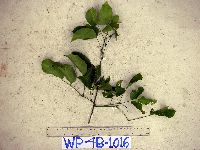 Entada phaseoloides (L.) Merr. 913822[]Weiblen, G.D. & Binatang Research Center WP4B10162007-08-31 Papua New Guinea, Madang, Wanang Village, -5.2373 145.177183, 115m |
MIN:Plants | 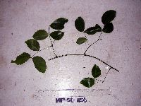 Entada phaseoloides (L.) Merr. 913442[]Weiblen, G.D. & Binatang Research Center WP5C11502007-06-20 Papua New Guinea, Madang, Wanang Village, -5.2373 145.177183, 115m |
MIN:Plants | 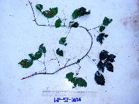 Entada phaseoloides (L.) Merr. 913434[]Weiblen, G.D. & Binatang Research Center WP5E30342007-04-26 Papua New Guinea, Madang, Wanang Village, -5.2373 145.177183, 115m |
MIN:Plants | 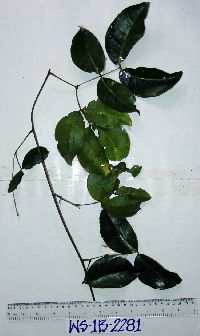 Entada phaseoloides (L.) Merr. 913431[]Weiblen, G.D. & Binatang Research Center WS1B22812006-07-21 Papua New Guinea, Madang, Wanang Village, -5.229583 145.178467, 115m |
MIN:Plants | 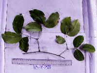 Entada phaseoloides (L.) Merr. 913432[]Weiblen, G.D. & Binatang Research Center WS2B23282006-08-29 Papua New Guinea, Madang, Wanang Village, -5.229583 145.178467, 115m |
MIN:Plants | 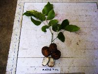 Entada phaseoloides (L.) Merr. 923030[]Ctvrtecka, R. 30322008-11-03 Papua New Guinea, Madang, Wanang Village, -5.23088 145.182, 115m |
MIN:Plants | Entada phaseoloides (L.) Merr. 897571[]Weiblen, G.D. TP4951996-07-31 Papua New Guinea, Simbu, O-Pio 1 ha plot, block 20, Crater Mountain Wildlife Management Area, -6.788611 145.036667, 550m |
MIN:Plants | 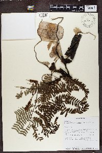 Entada chrysostachys (Benth.) Drake 491309[1374931]Birkinshaw, C. 6101999-12-15 Madagascar, 3km E of Andanomalaza Atsimo. Community Forest outside of Zahamena RNI, -17.653333 48.644167, 1200m |
MIN:Plants | 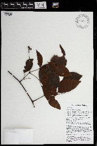 Entada phaseoloides (L.) Merr. 969945[1371507]Weiblen, G. D. & Binatang Research Center NP3B02202014-05-27 Papua New Guinea, Madang, Numba, -5.7222 145.2714, 1200m |
MIN:Plants | 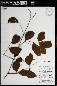 Entada phaseoloides (L.) Merr. 969937[1371515]Weiblen, G. D. & Binatang Research Center NP3B02352014-05-24 Papua New Guinea, Madang, Numba, -5.7222 145.2714, 1200m |
1
Page 1, records 1-10 of 10
Google Map
Google Maps is a web mapping service provided by Google that features a map that users can pan (by dragging the mouse) and zoom (by using the mouse wheel). Collection points are displayed as colored markers that when clicked on, displays the full information for that collection. When multiple species are queried (separated by semi-colons), different colored markers denote each individual species.