University of Minnesota
http://www.umn.edu/
612-625-5000
http://www.umn.edu/
612-625-5000
Minnesota Biodiversity Atlas
Bell Museum
Dataset: MIN-Plants
Taxa: Fagus
Search Criteria: excluding cultivated/captive occurrences
1
Page 1, records 1-14 of 14
Bell Museum plants | |
 MIN:Plants | Fagus grandifolia Ehrhart 473275[]US Nat. Arboretum staff 83-691983-00-00 United States, Maryland, Anne Arundel, [no further data] |
MIN:Plants | Fagus grandifolia Ehrhart 473274[]US Nat. Arboretum staff 831974-00-00 United States, District of Columbia, Washington |
MIN:Plants | 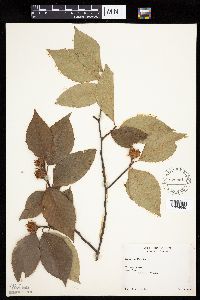 Fagus grandifolia Ehrhart 528851[1004645]Rolland-Germain, s.n.1946-07-26 Canada, Quebec, Saint-Jerome. Terrebonne County.;;;;, 45.76667 -74 |
MIN:Plants | 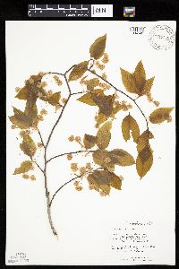 Fagus grandifolia Ehrhart 817359[1004646]Nelson, John; et al. 102111991-04-01 United States, South Carolina, Orangeburg, Orangeburg County ... N side of N fork of Edisto River, S of Proctorville;;;;, 33.53911 -80.961 |
MIN:Plants | 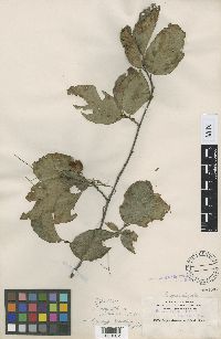 Fagus grandifolia f. mollis Fernald & Rehder 98189[1000002]Nash, G.V. 23391895-08-07 United States, Florida, Leon, Tallahassee |
MIN:Plants | 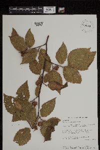 Fagus grandifolia Ehrhart 937508[1299175]Miller, James S. 8351 United States, North Carolina, Madison |
MIN:Plants | 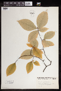 Fagus grandifolia Ehrhart 959627[1311959]Ray C. Friesner 95141935-10-19 United States, Indiana, Brown, 2 miles northeast Trevlac, 39.2861 -86.310459 |
MIN:Plants | 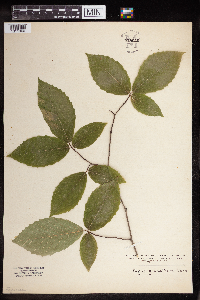 Fagus grandifolia Ehrhart 959626[1311960]Paul G. Wible 1928-07-28 United States, Indiana, Lawrence |
MIN:Plants | 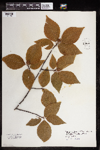 Fagus grandifolia Ehrhart 959625[1311961]Elizabeth Oliver 1930-07-00 United States, Michigan, Crystal Lake |
MIN:Plants | 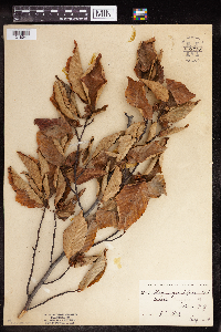 Fagus grandifolia Ehrhart 959737[1318041]Stork, H.E. 25981924-08-00 United States, New York |
MIN:Plants | 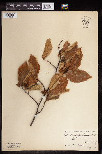 Fagus grandifolia Ehrhart 959736[1318040]Stork, H.E. 25721924-08-00 United States, New York |
MIN:Plants | 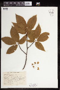 Fagus grandifolia Ehrhart 959735[1318039]Kruschke, E.P. 1941-05-24 United States, Wisconsin, 2 miles south west of Kiel;, 43.883525 -88.035652 |
MIN:Plants | 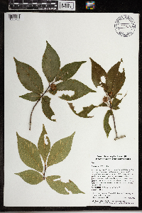 Fagus grandifolia Ehrhart 968176[1368786]Timothy J. S. Whitfeld 15762017-06-17 United States, Rhode Island, Kent, New England Botanical Club field trip, Arcardia Wildlife Management Area, Pine Top area, 0.7 miles north of intersection of Escoheag Hill Road and Falls River Road., 41.6172 -71.77369 |
MIN:Plants | 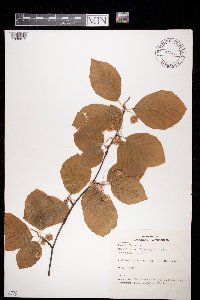 972466[1398015]Janssens, J. 1021974-05-09 Belgium, Den Brandt |
1
Page 1, records 1-14 of 14
Google Map
Google Maps is a web mapping service provided by Google that features a map that users can pan (by dragging the mouse) and zoom (by using the mouse wheel). Collection points are displayed as colored markers that when clicked on, displays the full information for that collection. When multiple species are queried (separated by semi-colons), different colored markers denote each individual species.