University of Minnesota
http://www.umn.edu/
612-625-5000
http://www.umn.edu/
612-625-5000
Minnesota Biodiversity Atlas
Bell Museum
Dataset: MIN-Plants
Taxa: Gilia
Search Criteria: excluding cultivated/captive occurrences
1
Page 1, records 1-15 of 15
Bell Museum plants | |
 MIN:Plants | Gilia latiflora subsp. davyi (Milliken) A.D. Grant & V.E. Grant 601046[]Munns, C. 4191966-03-21 United States, California, Kern, Collected on Calif. Hwy. 58, 5 miles west of Boron |
MIN:Plants | Gilia micromeria (A. Gray) J.M. Porter 680248[]Bright, R. 75-131975-06-09 United States, Idaho, Owyhee, Owyhee Co, 10 miles south of Bruneau, near Devil's Bathtub |
MIN:Plants | 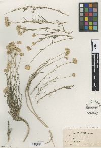 Gilia burleyana A. Nelson 175582[1001216]Nelson, A. 11261911-07-16 United States, Idaho, Elmore, King Hill, 786m |
MIN:Plants | 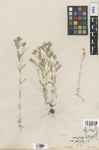 176165[1001217]Suksdorf, W.N. 15081892-05-27 United States, Washington, Klickitat, Falcon Valley |
MIN:Plants | 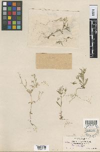 Gilia gracilis var. glabella Suksd. 176164[1001218]Suksdorf, W.N. 22061893-05-15 United States, Washington, Klickitat, Falcon Valley |
MIN:Plants | 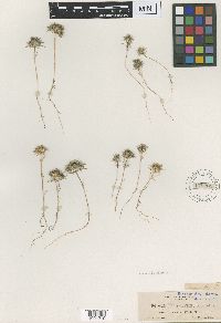 Gilia klickitatensis Suksd. 176262[1001219]Suksdorf, W.N. 9911890-05-27 United States, Washington, Klickitat, mouth of the Klickitat River |
MIN:Plants |  Gilia uncialis Brandegee 175990[1001220]Brandegee, T.S. s.n.1897-04-06 Mexico, Baja California, Cadros [sp?] Id. |
MIN:Plants | 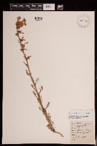 Gilia aggregata (Pursh) Spreng. 951946[1290357]Lawrence, D. B. 531930-07-02 United States, Colorado, Gunnison, Gothic. Rocky Mountain Biological Station. |
MIN:Plants | 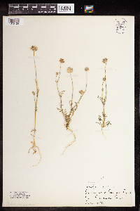 Gilia capitata Sims 964155[1375124] United States, California |
MIN:Plants | 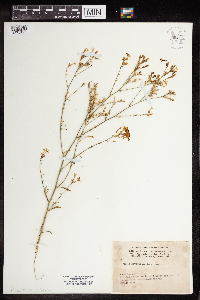 Gilia haydenii A. Gray 964156[1375125] United States, Colorado |
MIN:Plants | 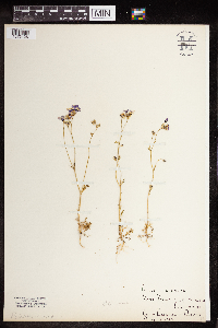 Gilia tricolor Benth. 964157[1375126] United States, California |
MIN:Plants | 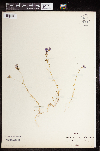 Gilia tricolor Benth. 964158[1375127] United States, California |
MIN:Plants | 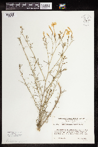 Gilia longiflora (Torr.) G. Don 964168[1375137] United States, New Mexico |
MIN:Plants | 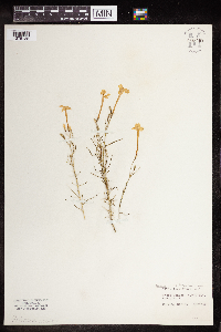 Gilia longiflora (Torr.) G. Don 964169[1375138] United States, New Mexico |
MIN:Plants | 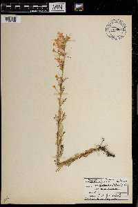 Gilia aggregata (Pursh) Spreng. 0968601[1391199]Bieberdorf, F.W. s.n.1940-00-00 United States, Yellowstone National Park |
1
Page 1, records 1-15 of 15
Google Map
Google Maps is a web mapping service provided by Google that features a map that users can pan (by dragging the mouse) and zoom (by using the mouse wheel). Collection points are displayed as colored markers that when clicked on, displays the full information for that collection. When multiple species are queried (separated by semi-colons), different colored markers denote each individual species.