University of Minnesota
http://www.umn.edu/
612-625-5000
http://www.umn.edu/
612-625-5000
Minnesota Biodiversity Atlas
Bell Museum
Dataset: MIN-Plants
Taxa: Gymnacranthera
Search Criteria: excluding cultivated/captive occurrences
1
Page 1, records 1-13 of 13
Bell Museum plants | |
 MIN:Plants | 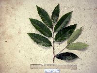 Gymnacranthera farquhariana var. zippeliana (Miq.) R.T.A.Schouten 916051[]Weiblen, G.D. & Binatang Research Center WP3A05132007-07-11 Papua New Guinea, Madang, Wanang Village, -5.2373 145.177183, 115m |
MIN:Plants | 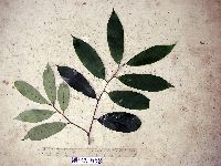 Gymnacranthera farquhariana var. zippeliana (Miq.) R.T.A.Schouten 916052[]Weiblen, G.D. & Binatang Research Center WP3A05582007-07-17 Papua New Guinea, Madang, Wanang Village, -5.2373 145.177183, 115m |
MIN:Plants | 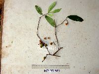 Gymnacranthera farquhariana var. zippeliana (Miq.) R.T.A.Schouten 916060[]Weiblen, G.D. & Binatang Research Center WP3B05832007-04-23 Papua New Guinea, Madang, Wanang Village, -5.2373 145.177183, 115m |
MIN:Plants | 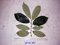 Gymnacranthera farquhariana var. zippeliana (Miq.) R.T.A.Schouten 916053[]Weiblen, G.D. & Binatang Research Center WP3B06052007-06-25 Papua New Guinea, Madang, Wanang Village, -5.2373 145.177183, 115m |
MIN:Plants | 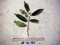 Gymnacranthera farquhariana var. zippeliana (Miq.) R.T.A.Schouten 916084[]Weiblen, G.D. & Binatang Research Center WP3B06092007-07-02 Papua New Guinea, Madang, Wanang Village, -5.2373 145.177183, 115m |
MIN:Plants | 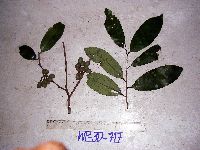 Gymnacranthera farquhariana var. zippeliana (Miq.) R.T.A.Schouten 916059[]Weiblen, G.D. & Binatang Research Center WP3D07172007-02-09 Papua New Guinea, Madang, Wanang Village, -5.2373 145.177183, 115m |
MIN:Plants | 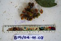 Gymnacranthera farquhariana var. zippeliana (Miq.) R.T.A.Schouten 922748[]Ctvrtecka, R. 30742008-11-04 Papua New Guinea, Madang, Baitabag Village, -5.13333 145.767, 50m |
MIN:Plants | Gymnacranthera farquhariana var. zippeliana (Miq.) R.T.A.Schouten 897311[]Weiblen, G.D. TP3051996-07-31 Papua New Guinea, Simbu, O-Pio 1 ha plot, block 13, Crater Mountain Wildlife Management Area, -6.788611 145.036667, 550m |
MIN:Plants | Gymnacranthera farquhariana var. zippeliana (Miq.) R.T.A.Schouten 897370[]Weiblen, G.D. TP1951996-07-31 Papua New Guinea, Simbu, O-Pio 1 ha plot, block 9, Crater Mountain Wildlife Management Area, -6.788611 145.036667, 550m |
MIN:Plants | Gymnacranthera farquhariana var. zippeliana (Miq.) R.T.A.Schouten 897602[]Weiblen, G.D. TP4861996-07-31 Papua New Guinea, Simbu, O-Pio 1 ha plot, block 20, Crater Mountain Wildlife Management Area, -6.788611 145.036667, 550m |
MIN:Plants | 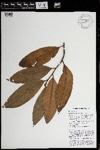 Gymnacranthera farquhariana var. zippeliana (Miq.) R.T.A.Schouten 969953[1371564]Weiblen, G. D. & Binatang Research Center NP1B00132014-03-21 Papua New Guinea, Madang, Numba, -5.7222 145.2714, 1200m |
MIN:Plants | 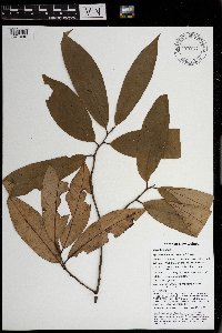 Gymnacranthera farquhariana var. zippeliana (Miq.) R.T.A.Schouten 970047[1371640]Weiblen, G. D. & Binatang Research Center NP1B00672014-03-19 Papua New Guinea, Madang, Numba, -5.7222 145.2714, 1200m |
MIN:Plants | 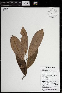 Gymnacranthera farquhariana var. zippeliana (Miq.) R.T.A.Schouten 969954[1371563]Weiblen, G. D. & Binatang Research Center NP4B02632014-05-10 Papua New Guinea, Madang, Numba, -5.7222 145.2714, 1200m |
1
Page 1, records 1-13 of 13
Google Map
Google Maps is a web mapping service provided by Google that features a map that users can pan (by dragging the mouse) and zoom (by using the mouse wheel). Collection points are displayed as colored markers that when clicked on, displays the full information for that collection. When multiple species are queried (separated by semi-colons), different colored markers denote each individual species.