University of Minnesota
http://www.umn.edu/
612-625-5000
http://www.umn.edu/
612-625-5000
Minnesota Biodiversity Atlas
Bell Museum
Dataset: MIN-Plants
Taxa: Hedysarum
Search Criteria: excluding cultivated/captive occurrences
1
Page 1, records 1-14 of 14
Bell Museum plants | |
 MIN:Plants | 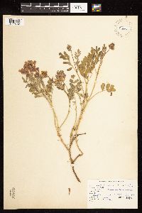 Hedysarum occidentale Greene 420101[1122702]Nash, A. 38961960-07-25 United States, Wyoming, Park, Old Tower Falls Road;Yellowstone National Park |
MIN:Plants | 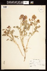 Hedysarum occidentale Greene 841326[1122701]Nash, A. 38971960-07-25 United States, Wyoming, Park, Old Tower Falls Road;Yellowstone National Park |
MIN:Plants | 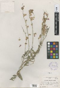 Hedysarum gremiale Rollins 361607[1001273]Rollins, R. 17331937-06-16 United States, Utah, Uintah, 14 miles west of Vernal, Uinta Basin, 40.455209 -109.795401, 1585m |
MIN:Plants | 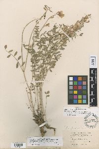 Hedysarum pabulare A. Nelson 137908[1001274]Baker, C.F. 831898-06-24 United States, Colorado, Montezuma, Mancos |
MIN:Plants | 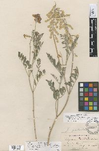 Hedysarum pabulare A. Nelson 137911[1001275]Nelson, A. 10871894-08-19 United States, Wyoming, Snake River |
MIN:Plants | 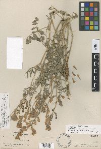 Hedysarum pabulare A. Nelson 254763[1001276]Gooding, L.N. 2011901-07-05 United States, Wyoming, Natrona, Bates Creek |
MIN:Plants | 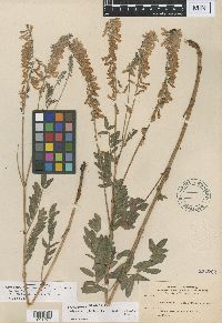 Hedysarum philoscia A. Nelson 254762[1001277]Nelson, A. 33671897-07-13 United States, Wyoming, Albany, Willow Creek |
MIN:Plants | 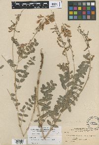 Hedysarum uintahense A. Nelson 254761[1001278]Nelson, A. 71981900-06-14 United States, Wyoming, Uinta, Evanston |
MIN:Plants | 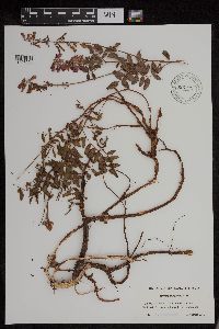 Hedysarum boreale Nutt. 956191[1296004]Lawrence, D. B. s.n.1949-08-12 United States, Alaska, Glacier Bay National Monument. Station 49-3. [Glacier Bay National Park], 58.797428 -136.838127 |
MIN:Plants | 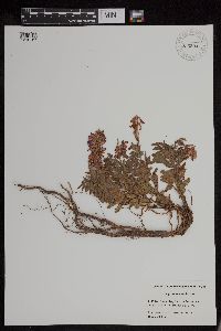 Hedysarum boreale Nutt. 956294[1296167]Schoenike, R. 55-1201955-08-16 United States, Alaska, Glacier Bay National Monument. Cooper Station 26 [Glacier Bay National Park], 58.797428 -136.838127, 5m |
MIN:Plants | 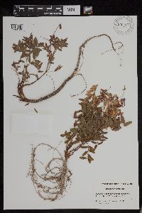 Hedysarum boreale Nutt. 956293[1296166]Schoenike, R. 55-1161955-08-16 United States, Alaska, Glacier Bay National Monument. Cooper Station 26 [Glacier Bay National Park], 58.797428 -136.838127, 6m |
MIN:Plants | 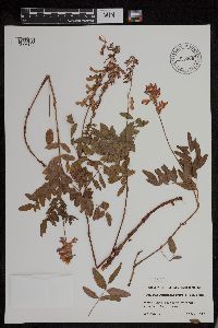 956306[1296120]Lawrence, D. B. s.n.1952-08-17 United States, Alaska, Glacier Bay National Monument. Sandy Cove. [Glacier Bay National Park], 58.797428 -136.838127 |
MIN:Plants | 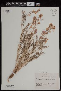 Hedysarum pabulare A. Nelson 954230[1295808]Anonymous 1021944-06-29 United States, Colorado |
MIN:Plants | 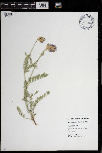 Hedysarum boreale Nutt. 0968678[1391261]Nalani McCutcheon s.n.1987-07-00 United States, Wyoming, Big Horn, Gallatin Rach |
1
Page 1, records 1-14 of 14
Google Map
Google Maps is a web mapping service provided by Google that features a map that users can pan (by dragging the mouse) and zoom (by using the mouse wheel). Collection points are displayed as colored markers that when clicked on, displays the full information for that collection. When multiple species are queried (separated by semi-colons), different colored markers denote each individual species.